Related Research Articles
Foil is an unincorporated community in northern Ozark County, Missouri, United States. It is located approximately sixteen miles south of Ava on county roads 953 and 955. Wasola is about four miles northeast on Missouri Route 5 and Thornfield approximately three miles southwest on Missouri Route JJ. The community is on the banks of Little Creek, a tributary of Little North Fork White River.

Upton is an unincorporated community in western Texas County, Missouri, United States. The community is located on a ridge top approximately one mile east of the West Fork Roubidoux Creek. It is located about ten miles west of Houston on Missouri Route FF.

Clear Creek Township is one of fourteen townships in Cooper County, Missouri, USA. As of the 2000 census, its population was 439.
Lebanon Township is one of fourteen townships in Cooper County, Missouri, USA. As of the 2000 census, its population was 333.
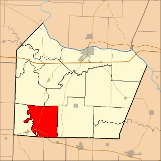
Bellair is an unincorporated community in Cooper County, Missouri, United States. The community is on Missouri Route 5, approximately ten miles south-southwest of Boonville.
Ohio is an unincorporated community in northern St. Clair County, in the U.S. state of Missouri. The community is at the intersection of Missouri routes A and F and south of Cooper Creek. Lowry City is on Missouri Route 13 approximately seven miles to the east and Appleton City is approximately nine miles to the west-northwest on Missouri Route 52.
Millersburg is an unincorporated community in Callaway County, in the U.S. state of Missouri. It is located near the Boone-Callaway county line on the Owl Creek tributary of Cedar Creek. The Little Dixie Lake and Little Dixie Wildlife Management Area lie on Owl Creek just north of the community. It is on Missouri Route J about four miles south of I-70.
Dixie is an unincorporated community in southwestern Callaway County, in the U.S. state of Missouri. The community is located at the intersection of Missouri Routes BB and PP. It is on a ridge between Middle River to the east and Hillers Creek to the west. Jefferson City on the Missouri River lies 12 miles to the southwest.
Clark Fork is a stream in Cooper County in the U.S. state of Missouri. It is a tributary of Petite Saline Creek.
Clarks Fork is an unincorporated community in Cooper County, in the U.S. state of Missouri. The community is located on Missouri Route 87 approximately one mile southeast of the stream Clark Fork. Boonville is approximately seven miles to the northwest.

New Lebanon is an unincorporated community in Cooper County, in the U.S. state of Missouri. The community is on Missouri Route A between Otterville seven miles to the south and Pilot Grove seven miles to the north. The Lamine River flows past about two miles west of the community.
Otter Creek is a stream in Cooper and Morgan Counties in the U.S. state of Missouri. It is a tributary of the Lamine River.
Petite Saline Creek is a stream in Cooper, Moniteau and Morgan counties in the U.S. state of Missouri. It is a tributary of the Missouri River.
Prior is an unincorporated community in Douglas County, Missouri, United States. The community is located on Missouri Route 95, just north of the intersection with Missouri Route 76 and 2.5 miles north of Vanzant. The community sits on a ridge between Fox Creek to the west and Clifty Creek to the east, at an elevation of 1,243 ft (379 m).
Roy is an unincorporated community in southwestern Douglas County, Missouri, United States. Roy is located on Missouri Route 76, south of the Goodhope junction on Missouri Route T. The village site is at an elevation of 1,263 ft (385 m) about 1.5 mile west of the Beaver Creek valley.
Atwell is an unincorporated community in the southeast corner of Miller County, in the U.S. state of Missouri. The community is on a low ridge between Atwell Creek to the east and Little Tavern Creek to the west. Access is by Missouri Route K from Missouri Route 17. Iberia is 5.5 miles to the northwest.
Saint Anthony is an unincorporated community in eastern Miller County, in the U.S. state of Missouri. The community is located on Missouri Route A, west of Missouri Route 42 and above Tavern Creek. Brays is on Route 42 to the east and Iberia is 5.5 miles to the south-southwest.
Muddy Creek is a stream in Johnson and Pettis Counties in the U.S. state of Missouri. It is a tributary of Lamine River.
Hominy Creek is a stream in Dallas and Polk counties in the Ozarks of southwest Missouri. It is a tributary of the Pomme de Terre River.
Alice is an unincorporated community in southwest Texas County, in the U.S. state of Missouri.
References
- ↑ U.S. Geological Survey Geographic Names Information System: Pisgah, Missouri
- ↑ Missouri Atlas & Gazetteer, DeLorme, 1998, First edition, p. 37, ISBN 0-89933-224-2
- ↑ Earngey, Bill (1995). Missouri Roadsides: The Traveler's Companion. University of Missouri Press. p. 29. ISBN 9780826210210.
- ↑ "Cooper County Place Names, 1928–1945 (archived)". The State Historical Society of Missouri. Archived from the original on 24 June 2016. Retrieved 24 September 2016.CS1 maint: BOT: original-url status unknown (link)
- ↑ "Post Offices". Jim Forte Postal History. Retrieved 22 September 2016.
Municipalities and communities of Cooper County, Missouri, United States | ||
|---|---|---|
| Cities |  | |
| Villages | ||
| Townships | ||
| Unincorporated communities | ||
Coordinates: 38°46′35″N92°38′58″W / 38.77639°N 92.64944°W
| This Cooper County, Missouri state location article is a stub. You can help Wikipedia by expanding it. |