Pilot Grove, Missouri

Last updated
Pilot Grove, Missouri
City of Pilot Grove
Cooper County Missouri Incorporated and Unincorporated areas Pilot Grove Highlighted.svg
Location of Pilot Grove, Missouri
Coordinates: 38°52′29″N92°54′44″W / 38.87472°N 92.91222°W / 38.87472; -92.91222 Coordinates: 38°52′29″N92°54′44″W / 38.87472°N 92.91222°W / 38.87472; -92.91222 [1]
Country United States
State Missouri
County Cooper
Area
[2]
  Total0.42 sq mi (1.09 km2)
  Land0.42 sq mi (1.09 km2)
  Water0.00 sq mi (0.00 km2)
Elevation
[1]
846 ft (258 m)
Population
 (2020)
  Total665
  Density1,579.57/sq mi (610.23/km2)
Time zone UTC-6 (Central (CST))
  Summer (DST) UTC-5 (CDT)
ZIP code
65276
Area code 660
FIPS code 29-57602 [3]
GNIS feature ID2396204 [1]

Pilot Grove is a city in the Pilot Grove Township in northern Cooper County, Missouri, United States. The population was 768 at the 2010 census.

Contents

History

Pilot Grove was platted in 1873. [4] The city was named from an old-growth grove of hickory trees, which once served as a local landmark or "pilot" to travelers. [5]

1915 map of Pilot Grove, Cooper County, Missouri from the Standard Atlas of Cooper County, Missouri 1915, p. 12 State Historical Society of Missouri 1915 Map Pilot Grove p12.jpg
1915 map of Pilot Grove, Cooper County, Missouri from the Standard Atlas of Cooper County, Missouri 1915, p. 12 State Historical Society of Missouri

Geography

Pilot Grove is located along Missouri Route 135 and is four miles south of I-70. It is approximately eleven miles southwest of Boonville. The Petite Saline Creek flows past about two miles to the east of the town. [6]

According to the United States Census Bureau, the city has a total area of 0.42 square miles (1.09 km2), all land. [7]

Demographics

Historical population
CensusPop.Note
1880 209
1890 560167.9%
1900 63112.7%
1910 554−12.2%
1920 75335.9%
1930 654−13.1%
1940 74814.4%
1950 635−15.1%
1960 6807.1%
1970 7013.1%
1980 7456.3%
1990 714−4.2%
2000 7231.3%
2010 7686.2%
2020 665−13.4%
U.S. Decennial Census [8]

2010 census

As of the census [9] of 2010, there were 768 people, 304 households, and 193 families living in the city. The population density was 1,828.6 inhabitants per square mile (706.0/km2). There were 334 housing units at an average density of 795.2 per square mile (307.0/km2). The racial makeup of the city was 96.5% White, 1.3% African American, 0.4% Native American, 0.4% Asian, and 1.4% from two or more races. Hispanic or Latino of any race were 1.0% of the population.

There were 304 households, of which 30.9% had children under the age of 18 living with them, 47.4% were married couples living together, 12.5% had a female householder with no husband present, 3.6% had a male householder with no wife present, and 36.5% were non-families. 34.2% of all households were made up of individuals, and 20.4% had someone living alone who was 65 years of age or older. The average household size was 2.33 and the average family size was 2.93.

The median age in the city was 43.4 years. 23.4% of residents were under the age of 18; 5.5% were between the ages of 18 and 24; 23.8% were from 25 to 44; 21.9% were from 45 to 64; and 25.3% were 65 years of age or older. The gender makeup of the city was 44.7% male and 55.3% female.

2000 census

As of the census [3] of 2000, there were 723 people, 287 households, and 187 families living in the city. The population density was 1,724.8 inhabitants per square mile (665.9/km2). There were 317 housing units at an average density of 756.2 per square mile (292.0/km2). The racial makeup of the city was 97.37% White, 0.97% African American, 0.69% Native American, and 0.97% from two or more races. Hispanic or Latino of any race were 0.55% of the population.

There were 287 households, out of which 27.9% had children under the age of 18 living with them, 50.5% were married couples living together, 11.8% had a female householder with no husband present, and 34.5% were non-families. 31.7% of all households were made up of individuals, and 15.7% had someone living alone who was 65 years of age or older. The average household size was 2.31 and the average family size was 2.89.

In the city the population was spread out, with 21.3% under the age of 18, 9.8% from 18 to 24, 21.7% from 25 to 44, 22.3% from 45 to 64, and 24.9% who were 65 years of age or older. The median age was 42 years. For every 100 females, there were 86.8 males. For every 100 females age 18 and over, there were 85.9 males.

The median income for a household in the city was $31,354, and the median income for a family was $37,143. Males had a median income of $29,318 versus $20,313 for females. The per capita income for the city was $14,857. About 4.8% of families and 7.0% of the population were below the poverty line, including 6.3% of those under age 18 and 9.4% of those age 65 or over.

Notable person

Related Research Articles

<span class="mw-page-title-main">Salix, Iowa</span> City in Iowa, United States

Salix is a city in Woodbury County, Iowa, United States. It is part of the Sioux City, IA–NE–SD Metropolitan Statistical Area. The population was 295 at the time of the 2020 census.

<span class="mw-page-title-main">Cleveland, Missouri</span> City in Missouri, United States

Cleveland is a city in Cass County, Missouri, United States. The population was 661 at the 2010 census. It is part of the Kansas City metropolitan area.

<span class="mw-page-title-main">Oakwood, Missouri</span> Village in Missouri, United States

Oakwood is a village in Clay County, Missouri, United States. The population was 198 at the 2020 census. It is part of the Kansas City metropolitan area.

<span class="mw-page-title-main">Everton, Missouri</span> City in Missouri, United States

Everton is a city in southeast Dade County, Missouri, United States. The population was 273 at the 2020 census.

<span class="mw-page-title-main">Ash Grove, Missouri</span> City in Missouri, United States

Ash Grove is a city in Greene County, Missouri, United States. The population was 1,512 at the 2020 census. It is part of the Springfield, Missouri Metropolitan Statistical Area.

<span class="mw-page-title-main">Ridgeway, Missouri</span> City in Missouri, United States

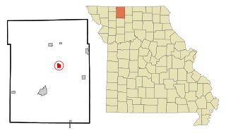
Ridgeway is a city in Harrison County, Missouri, United States. The population was 372 at the 2020 census.

<span class="mw-page-title-main">Blairstown, Missouri</span> City in Missouri, United States

Blairstown is a city in Henry County, Missouri, United States. The population was 97 at the 2010 census.

<span class="mw-page-title-main">Pilot Knob, Missouri</span> City in Missouri, United States

Pilot Knob is a city in northeast Iron County, Missouri, United States. The population was 671 at the 2020 census. It lies eighteen miles south-east of Belgrade and twenty-seven miles north-east of Centerville.

<span class="mw-page-title-main">Linneus, Missouri</span> City in Missouri, United States

Linneus is a small city in Linn County, Missouri, United States. The population was 281 at the 2020 census. It is the county seat of Linn County.

<span class="mw-page-title-main">Edgerton, Missouri</span> City in Missouri, United States

Edgerton is a city in northeastern Platte County, Missouri and is part of the Kansas City metropolitan area within the United States. The population was 546 at the 2010 census.

<span class="mw-page-title-main">Pleasant Hope, Missouri</span> City in Missouri, United States

Pleasant Hope is a city in Polk County, Missouri, United States. The population was 614 at the 2010 census. It is part of the Springfield, Missouri Metropolitan Statistical Area.

<span class="mw-page-title-main">Birch Tree, Missouri</span> City in Missouri, United States

Birch Tree is a city in southwest Shannon County, Missouri, United States. The population was 541 at the 2020 census.

<span class="mw-page-title-main">Winona, Missouri</span> City in Missouri, United States

Winona is a city in southeast Shannon County, Missouri, United States. The population was 950 at the 2020 census.

<span class="mw-page-title-main">Shelbyville, Missouri</span> City in Missouri, United States

Shelbyville is a city in Shelby County, Missouri, United States. The population was 518 at the 2020 census. It is the county seat of Shelby County.

<span class="mw-page-title-main">Calverton Park, Missouri</span> City in Missouri, United States

Calverton Park is a city in St. Louis County, Missouri, United States. The population was 1,293 at the 2010 census.

<span class="mw-page-title-main">Norwood, Missouri</span> City in Missouri, United States

Norwood is a city in Wright County, Missouri, United States. The population was 665 at the 2010 census.

<span class="mw-page-title-main">Walnut Grove, Missouri</span> City in Missouri, United States

Walnut Grove is a city in Greene County, Missouri, United States. The population was 652 at the 2020 census. It is part of the Springfield, Missouri Metropolitan Statistical Area.

<span class="mw-page-title-main">Oak Grove Village, Missouri</span> Village in Missouri, United States

Oak Grove Village is a village in Franklin County, Missouri, United States. The population was 509 at the 2010 census.

<span class="mw-page-title-main">Newman Grove, Nebraska</span> City in Nebraska, United States

Newman Grove is a city in Madison and Platte Counties in the U.S. state of Nebraska. The population was 721 at the 2010 census.

<span class="mw-page-title-main">Oak Grove, Jackson County, Missouri</span> City in Missouri, United States

Oak Grove is a city in Jackson and Lafayette counties in the U.S. state of Missouri. The population was 8,157 at the 2020 census. It is part of the Kansas City metropolitan area.

References

  1. 1 2 3 U.S. Geological Survey Geographic Names Information System: Pilot Grove, Missouri
  2. "ArcGIS REST Services Directory". United States Census Bureau. Retrieved August 28, 2022.
  3. 1 2 "U.S. Census website". United States Census Bureau . Retrieved 2008-01-31.
  4. "Cooper County Place Names, 1928–1945 (archived)". The State Historical Society of Missouri. Archived from the original on 24 June 2016. Retrieved 24 September 2016.{{cite web}}: CS1 maint: bot: original URL status unknown (link)
  5. Eaton, David Wolfe (1916). How Missouri Counties, Towns and Streams Were Named. The State Historical Society of Missouri. pp.  281.
  6. Missouri Atlas & Gazetteer, DeLorme, 1998, First edition, pp. 36-7, ISBN   0-89933-224-2
  7. "US Gazetteer files 2010". United States Census Bureau. Archived from the original on 2012-07-02. Retrieved 2012-07-08.
  8. "Census of Population and Housing". Census.gov. Retrieved June 4, 2015.
  9. "U.S. Census website". United States Census Bureau . Retrieved 2012-07-08.