
Cooper County is located in the central portion of the U.S. state of Missouri. As of the 2010 census, the population was 17,601. Its county seat is Boonville. The county was organized December 17, 1818 and named for Sarshell Cooper, a frontier settler who was killed by Native Americans near Arrow Rock in 1814. It is a part of the Columbia, Missouri metropolitan area.

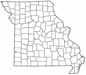
Clifton City is an unincorporated community in southwestern Cooper County, Missouri, United States. The community is located on Missouri Route 135 and Missouri Route BB. The nearest town is Otterville approximately five miles to the south. It is also 10 miles northeast of Sedalia. The Lamine River flows past one half mile east of the town. The Cooper - Pettis county boundary lies three-quarters of a mile west of the location. The Katy Trail State Park passes the south edge of the community.

Moody is an unincorporated community in southwestern Howell County, Missouri, United States. It is located sixteen miles south of West Plains, just north of Route 142 on Route E. Bennetts River flows past the west side of the community. The Missouri-Arkansas state line is approximately 1.5 miles to the south.
Vanzant is an unincorporated community in northeastern Douglas County, Missouri, United States. It is located on Route 95 at the intersection with state route W, approximately one mile south of Route 76 and thirteen miles south of Mountain Grove. The community of Drury is about three miles south on Route 95. Vanzant post office was established in 1892 and was assigned a zip code of 65768. The community was named after an early settler.
Nashville is a small unincorporated community in southwestern Barton County one mile north of the Barton-Jasper county line, near the western border of Missouri, United States. It is on Missouri Route AA one mile west of Route 43. The community is approximately twelve miles southwest of Lamar and 22 miles north of Joplin.
Hornet is an unincorporated community in western Newton County, Missouri, United States. It is located approximately six miles southwest of Joplin, less than one mile west of Route 43. The community is part of the Joplin, Missouri Metropolitan Statistical Area. West of Hornet is the famous Hornet Spooklight, which is a few miles west at the Oklahoma state line.

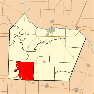
Kelly Township is one of fourteen townships in Cooper County, Missouri, USA. As of the 2000 census, its population was 676.
Lebanon Township is one of fourteen townships in Cooper County, Missouri, USA. As of the 2000 census, its population was 333.
Bellair is an unincorporated community in Cooper County, Missouri, United States. The community is on Missouri Route 5, approximately ten miles south-southwest of Boonville.
Pisgah is an unincorporated community in Cooper County, Missouri, United States. The community is located about two miles west of Pisgah Creek on Missouri Route O and eleven miles north-northwest of California. Bunceton is about eight miles to the west on Missouri Route J.
Winchester is an unincorporated community in eastern Clark County, in the U.S. state of Missouri.
Clarks Fork is an unincorporated community in Cooper County, in the U.S. state of Missouri. The community is located on Missouri Route 87 approximately one mile southeast of the stream Clark Fork. Boonville is approximately seven miles to the northwest.

New Lebanon is an unincorporated community in Cooper County, in the U.S. state of Missouri. The community is on Missouri Route A between Otterville seven miles to the south and Pilot Grove seven miles to the north. The Lamine River flows past about two miles west of the community.
Lone Elm is an unincorporated community in Cooper County, in the U.S. state of Missouri. The community is located at the intersection of Missouri routes KK and B approximately eleven miles south of Boonville.
Pleasant Green is an unincorporated community in Cooper County, in the U.S. state of Missouri. The community is adjacent to the Missouri–Kansas–Texas Railroad just north of Missouri Route 135.
Charity is an unincorporated community in southern Dallas County, in the U.S. state of Missouri.
Coulstone is an unincorporated community in western Dent County, in the U.S. state of Missouri.
Hebron is an unincorporated community in southeastern Douglas County, Missouri, United States. Hebron is located at the intersection of a county road with Hebron Hollow, which is a spring-fed tributary to the North Fork River to the southwest. Missouri Route 181 is approximately 3/4 mile to the east. Hebron Boat Access and campground is located on the North Fork, about two miles to the west on Missouri Route AA.
Aid is an unincorporated community in Stoddard County, in the U.S. state of Missouri. The community is on Missouri Route F six miles west of Bloomfield.
Venable is an unincorporated community in northwest Texas County, in the U.S. state of Missouri.

