
Dinwiddie is an unincorporated community, census-designated place (CDP), and the county seat of Dinwiddie County, Virginia, United States. It was first listed as a CDP in the 2020 census with a population of 619.

Toano, formerly Burnt Ordinary, is an unincorporated community in James City County, Virginia, United States. It is in Virginia’s 1st Congressional District.

Longdale Furnace is an unincorporated community located east of Clifton Forge in Alleghany County, Virginia, United States.

This is a list of the National Register of Historic Places listings in Caroline County, Virginia.

This is a list of the National Register of Historic Places listings in Richmond, Virginia.
This is a list of the National Register of Historic Places listings in Hanover County, Virginia.
This is a list of the National Register of Historic Places listings in Fredericksburg, Virginia.

This is a list of the National Register of Historic Places listings in Spotsylvania County, Virginia.
This is a list of the National Register of Historic Places listings in Rockingham County, Virginia.

Sycamore Dale is a 19th-century Greek Revival plantation house overlooking the South Branch Potomac River southwest of Romney, West Virginia. Sycamore Dale is one of several historic estates along South Branch River Road. It was listed on the National Register of Historic Places on December 2, 1980.
This is a list of the National Register of Historic Places listings in Suffolk, Virginia.

This is a list of the National Register of Historic Places listings in Surry County, Virginia.

This is a list of the National Register of Historic Places listings in Roanoke County, Virginia.
This is a list of the National Register of Historic Places listings in Salem, Virginia.

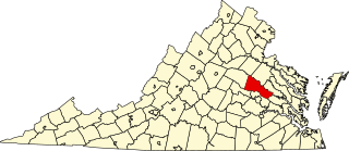
La Vista, also known as The Grove, is a historic plantation house in Spotsylvania County, Virginia, United States. It was built about 1855, and is a two-story, three bay, Federal / Greek revival style frame dwelling. It has a hipped roof, interior end chimneys, and a pedimented portico with fluted Doric order columns. Also on the property are the contributing smokehouse and the Boulware family burial grounds.

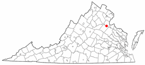
The Chimneys is a historic house located in Fredericksburg, Virginia. The house was constructed around 1771–1773. The house is named because of the stone chimneys at each end. The Georgian home was added to the National Register of Historic Places in April 1975. Of note are the interior decorative woodwork in the moldings, millwork, paneling indicative of building styles of the period. The decorative carving on the mantelpiece as well as on the door and window frames is particularly significant.
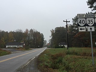
Homeville is a small unincorporated community in Sussex County, Virginia, United States. Homeville is located at the junction of Virginia State Route 35 and Virginia State Route 40 7.3 miles (11.7 km) south-southwest of Waverly.
Woodburn, also known as Woodbourne, is a historic plantation house located near Charles City, Charles City County, Virginia. The house was built about 1815 by John Tyler, who later served as tenth President of the United States. The Palladian house is a three-part frame structure consisting of a tall, two-story, three-bay central section with a gable-end facade and flanking chimneys, and two, low one-story, one-bay wings. Also on the property are a contributing one-story frame office and an original smokehouse. The Woodburn property was purchased by John Tyler in 1813. He resided there until 1821, and sold the property to his brother Wat H. Tyler in 1831. During his residence at Woodburn, he served as Congressman.

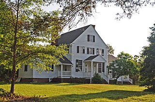
Waverly is a historic home and farm located near Burnt Chimney, Franklin County, Virginia. It was built beginning about 1853 for Armistead Lewis Burwell (1809-1883) and his family, who inherited it from the parents of his wife, Mary Hix (1811-1895). Descended from the First Families of Virginia, Armistead L. Burwell operated a tobacco and grain plantation of about 350 improved acres using enslaved labor, and also had a chewing tobacco factory, gristmill and sawmill by 1860. His son William A. Burwell (1836-1882) ran the factory and bought the plantation from his father in 1864, and sold it in 1868 to his younger brother John Spotswood Burwell who operated a dairy farm until after the turn of the century.
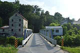
The Piedmont Mill Historic District encompasses a historic 19th-century grist mill complex at 1709 Alean Road in rural Franklin County, Virginia. Located between Wirtz and Burnt Chimney on the banks of Maggodee Creek, it includes an 1866 mill building, an earthen raceway and a 20th-century concrete dam, as well as a metal truss bridge. In 1870, it was the most powerful mill in the county, which it served under several owners until 1963.


