
Franklin County is a county located in the Blue Ridge foothills of the U.S. state of Virginia. As of the 2010 census, the population was 56,159. Its county seat is Rocky Mount.

Mount Vernon is a census-designated place (CDP) and unincorporated community in Fairfax County, Virginia, United States. The population was 12,416 at the 2010 census. Primarily due to its historical significance and natural recreation and beauty, the Mount Vernon area receives over one million touring visitors each year.

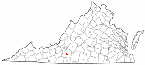
Boones Mill is a town in Franklin County, Virginia, United States. The population was 239 at the 2010 census, down from 285 at the 2000 census. It is part of the Roanoke Metropolitan Statistical Area.

North Shore is a census-designated place (CDP) in Franklin County, Virginia, United States. The population was 3,094 at the 2010 census, up from 2,112 in 2000. It is part of the Roanoke Metropolitan Statistical Area.
Penhook is a census-designated place (CDP) in Franklin County, Virginia, United States. The population was 801 at the 2010 census, up from 726 in 2000. It is part of the Roanoke Metropolitan Statistical Area.
Rocky Mount is a town in and the county seat of Franklin County, Virginia, United States. The town is part of the Roanoke Metropolitan Statistical Area, and had a population of 4,799 as of the 2010 census. It is located in the Roanoke Region of Virginia.
Westlake Corner is a census-designated place in Franklin County, Virginia, United States. The population was 976 at the 2010 census. It is part of the Roanoke Metropolitan Statistical Area.

Elliston-Lafayette was a census-designated place (CDP) in Montgomery County, Virginia, United States. The population was 1,241 at the 2000 census; in 2010, Elliston and Lafayette were split into separate CDPs. It is part of the Blacksburg–Christiansburg–Radford Metropolitan Statistical Area, which encompasses all of Montgomery County, Virginia, including the towns of Blacksburg and Christiansburg, and the city of Radford. However, many residents of the eastern section of Montgomery County more often travel to Roanoke or Salem for work, shopping, and services since these cities are generally closer and do not require driving up Christiansburg Mountain on U.S. Route 460 or Interstate 81.
Carrsville is a census-designated place (CDP) in Isle of Wight County in the Hampton Roads region of southeastern Virginia in the United States. The population as of the 2010 Census was 359. The town is named for Jesse Carr, whose family had long roots in Isle of Wight County. Jesse Carr died in the place that would later bear his name.

Goochland is a census-designated place (CDP) in and the county seat of Goochland County, Virginia, United States. The population as of the 2010 census was 861. The community is also known as Goochland Courthouse or by an alternative spelling, Goochland Court House. It derives its name from the fact that the community is the location of the county's court house.
Cluster Springs is an unincorporated community and census-designated place (CDP) in Halifax County, Virginia, United States. The population as of the 2010 census was 811.

Hanover is an unincorporated community and census-designated place (CDP) in Hanover County, Virginia, United States. It is the county seat and is located at the junction of U.S. Route 301 and State Route 54 south of the Pamunkey River. While historically known as Hanover Courthouse, the U.S. Geological Survey, Census Bureau, Postal Service and residents refer to it as "Hanover". The population as of the 2010 census was 252.
Nathalie is an unincorporated community and census-designated place (CDP) in Halifax County, Virginia, United States, in the south-central region of the state. The population as of the 2010 census was 183.
Several special routes of U.S. Route 220 exist. In order from south to north they are as follows.

Floris is a census-designated place (CDP) located within the Oak Hill area of Fairfax County, Virginia, United States. The population as of the 2010 census was 8,375.
Camptown is a census-designated place in Isle of Wight County, Virginia, United States, lying just east of Franklin. The population as of the 2010 census was 766. The International Paper mill is here.

Newington Forest is a census-designated place in Fairfax County, Virginia, United States. The population as of the 2010 census was 12,442. It is part of the Washington metropolitan area. It includes the Newington Forest subdivision and several nearby neighborhoods of southern Springfield and northern Lorton.
Riverdale is a census-designated place in Halifax County, Virginia, United States. The population as of the 2010 census was 956.

Rocky Fork Point is an unincorporated community and census-designated place in Highland County, Ohio, United States. Its population was 639 as of the 2010 census.

Pottery Addition is a census-designated place (CDP) in Jefferson County, Ohio, United States. Its population was 293 as of the 2010 census. The community is located along the Ohio River and is served by Ohio State Route 7.


