Penhook, Virginia

Last updated
Penhook, Virginia
USA Virginia location map.svg
Red pog.svg
Penhook
Location within the state of Virginia
Usa edcp location map.svg
Red pog.svg
Penhook
Penhook (the United States)
Coordinates: 37°0′16″N79°37′43″W / 37.00444°N 79.62861°W / 37.00444; -79.62861 Coordinates: 37°0′16″N79°37′43″W / 37.00444°N 79.62861°W / 37.00444; -79.62861
CountryUnited States
State Virginia
County Franklin
Area
  Total12.7 sq mi (32.8 km2)
  Land11.2 sq mi (29.0 km2)
  Water1.5 sq mi (3.8 km2)
Elevation
994 ft (303 m)
Population
 (2010)
  Total801
  Density72/sq mi (27.7/km2)
Time zone UTC−5 (Eastern (EST))
  Summer (DST) UTC−4 (EDT)
ZIP code
24137
Area code(s) 540
FIPS code 51-61464 [1]
GNIS feature ID1497083 [2]

Penhook is a census-designated place (CDP) in Franklin County, Virginia, United States. The population was 801 at the 2010 census, [3] up from 726 in 2000. It is part of the Roanoke Metropolitan Statistical Area.

Contents

Geography

Penhook is located in eastern Franklin County at 37°0′16″N79°37′43″W / 37.00444°N 79.62861°W / 37.00444; -79.62861 (37.004501, 79.628747). [4] It is bordered to the east by the Pittsylvania County line and by the Cool Branch arm of Smith Mountain Lake. The northern edge of the CDP is the center of the Blackwater River part of the lake, while the northwestern edge follows the Bull Run arm of the lake and then Bull Run itself upstream to Virginia State Route 40, which runs east–west through the center of the CDP. The southern half of the CDP extends nearly to the Pigg River, an east-flowing tributary of the Roanoke River. [5] Route 40 leads west 17 miles (27 km) to Rocky Mount, the Franklin County seat, and east 16 miles (26 km) to Gretna at U.S. Route 29.

According to the United States Census Bureau, the Penhook CDP has a total area of 12.7 square miles (32.8 km2), of which 11.2 square miles (29.0 km2) is land and 1.5 square miles (3.8 km2), or 11.70%, is water. [3]

History

One of the older buildings in Penhook is the Old Chapel Church, located at 436 Old Chapel Road. This church house, also known as "Snow Creek Chapel", was built as a chapel of ease by the Church of England, by the Camden vestry, in 1769. [6] In 2017, the Old Chapel Church was placed on the National Register of Historic Places. Gov. Terry McAuliffe has also deemed the church a “Virginia Treasure,” a designation for ecological, cultural, scenic and recreational assets. [7]

Demographics

The 2000 census [1] recorded 726 people, 308 households, and 243 families residing in the CDP. The population density was 65.0 people per square mile (25.1/km2). There were 694 housing units at an average density of 62.2/sq mi (24.0/km2). The racial makeup of the CDP was 80.85% White, 18.18% African American, 0.28% Asian, and 0.69% from two or more races. Hispanic or Latino of any race were 0.41% of the population.

There were 308 households, out of which 21.1% had children under the age of 18 living with them, 68.5% were married couples living together, 7.1% had a female householder with no husband present, and 20.8% were non-families. 18.8% of all households were made up of individuals, and 6.8% had someone living alone who was 65 years of age or older. The average household size was 2.36 and the average family size was 2.65.

In the CDP, the population was spread out, with 17.8% under the age of 18, 4.8% from 18 to 24, 22.9% from 25 to 44, 35.0% from 45 to 64, and 19.6% who were 65 years of age or older. The median age was 49 years. For every 100 females there were 100.0 males. For every 100 females age 18 and over, there were 97.7 males.

The median income for a household in the CDP was $55,278, and the median income for a family was $71,667. Males had a median income of $32,778 versus $23,125 for females. The per capita income for the CDP was $48,663. About 5.7% of families and 15.6% of the population were below the poverty line, including 32.7% of those under age 18 and none of those age 65 or over.

Related Research Articles

Roanoke County, Virginia U.S. county in Virginia

Roanoke County is a county located in the U.S. state of the Commonwealth of Virginia. As of the 2010 census, the population was 92,376. Its county seat is Salem.

Welcome, North Carolina Census-designated place in North Carolina, United States

Welcome is a census-designated place (CDP) in Davidson County, North Carolina. The population was 4,162 at the 2010 census. It is nationally known as the home of Richard Childress Racing. In addition, Walker and Associates, Inc., a nationwide communication value-add distribution is headquartered here. The town motto is "Welcome to Welcome, A Friendly Place," as posted on the welcoming sign. Neighboring communities and municipalities include Midway, Arcadia, and Lexington.

Sour John, Oklahoma CDP in Oklahoma, United States

Sour John is a census-designated place (CDP) in Muskogee County, Oklahoma, United States. The population was 61 at the 2000 census.

Lawson Heights, Pennsylvania CDP in Pennsylvania, United States

Lawson Heights is a census-designated place (CDP) in Unity Township, Westmoreland County, Pennsylvania, United States. The population was 2,339 at the 2000 census.

Red Hill, South Carolina Census-designated place in South Carolina, United States

Red Hill is a census-designated place (CDP) in Horry County, South Carolina, United States. The population was 13,223 at the 2010 census, up from 10,509 at the 2000 census.

Selma, Virginia CDP in Virginia, United States

Selma is a census-designated place (CDP) in Alleghany County, Virginia, United States. The population was 529 at the 2010 census.

Madison Heights, Virginia CDP in Virginia, United States

Madison Heights is a census-designated place (CDP) in Amherst County, Virginia, United States. The population was 11,285 at the 2010 census. It is part of the Lynchburg Metropolitan Statistical Area.

Greenville, Virginia CDP in Virginia, United States

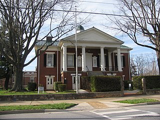
Greenville is a census-designated place (CDP) in Augusta County, Virginia, United States. The population was 832 at the 2010 census. It is part of the Staunton–Waynesboro Micropolitan Statistical Area.

Cloverdale, Virginia CDP in Virginia, United States

Cloverdale is a census-designated place (CDP) in Botetourt County, Virginia, United States. The population was 3,119 at the 2010 census, which was an increase from the 2,986 reported in 2000. It is part of the Roanoke Metropolitan Statistical Area.

Daleville, Virginia CDP in Virginia, United States

Daleville is a census-designated place (CDP) in Botetourt County, Virginia, United States. The population was 2,557 as of the 2010 census, an increase of over 75% from the 2000 census, when the population was 1,454. It is part of the Roanoke Metropolitan Statistical Area. One of the county's two high schools, Lord Botetourt, is located in Daleville.

Laymantown, Virginia Census-designated place in Virginia, United States

Laymantown is a census-designated place (CDP) in Botetourt County, Virginia, United States. The population was 1,979 at the 2010 census. It is part of the Roanoke Metropolitan Statistical Area.

Rustburg, Virginia Census-designated place in Virginia, United States

Rustburg is a census-designated place (CDP) in and the county seat of Campbell County, Virginia, United States. The population was 1,431 at the 2010 census. It is part of the Lynchburg Metropolitan Statistical Area.

Timberlake, Virginia CDP in Virginia, United States

Timberlake is a census-designated place (CDP) in Campbell County, Virginia, United States. The population was 12,183 at the 2010 census. It is part of the Lynchburg Metropolitan Statistical Area.

Boones Mill, Virginia Town in Virginia, United States

Boones Mill is a town in Franklin County, Virginia, United States. The population was 239 at the 2010 census, down from 285 at the 2000 census. It is part of the Roanoke Metropolitan Statistical Area.

Ferrum, Virginia CDP in Virginia, United States

Ferrum is a census-designated place (CDP) in Franklin County, Virginia, United States. The population was 2,043 at the 2010 census, an increase of over fifty percent from the 1,313 reported in 2000. Ferrum is home to Ferrum College and its Blue Ridge Folklife Festival. It is part of the Roanoke Metropolitan Statistical Area.

North Shore, Virginia Census-designated place in Virginia, United States

North Shore is a census-designated place (CDP) in Franklin County, Virginia, United States. The population was 3,094 at the 2010 census, up from 2,112 in 2000. It is part of the Roanoke Metropolitan Statistical Area.

Union Hall, Virginia CDP in Virginia, United States

Union Hall is a census-designated place (CDP) in Franklin County, Virginia, United States. The population estimate was approximately 1,091 according to a census in 2018. It is part of the Roanoke Metropolitan Statistical Area.

Westlake Corner, Virginia Census-designated place in Virginia, United States

Westlake Corner is a census-designated place in Franklin County, Virginia, United States. The population was 976 at the 2010 census. It is part of the Roanoke Metropolitan Statistical Area.

Coal City, West Virginia Census-designated place in West Virginia, United States

Coal City is a census-designated place (CDP) in Raleigh County, West Virginia, United States. The population was 1,815 at the 2010 census. Coal City's population is composed of other surrounding unincorporated communities.

Hollins, Virginia CDP in Virginia, United States

Hollins is a census-designated place (CDP) in Botetourt and Roanoke counties in the U.S. state of Virginia. Hollins covers much of the area known locally as "North County". The population was 14,673 at the 2010 census. It is part of the Roanoke Metropolitan Statistical Area. The area is also the home of Hollins University in addition to four properties listed on the National Register of Historic Places: the Black Horse Tavern-Bellvue Hotel and Office, Harshbarger House, the Hollins College Quadrangle, and Old Tombstone.

References

  1. 1 2 "U.S. Census website". United States Census Bureau . Retrieved 2008-01-31.
  2. "US Board on Geographic Names". United States Geological Survey. 2007-10-25. Retrieved 2008-01-31.
  3. 1 2 "Geographic Identifiers: 2010 Demographic Profile Data (G001): Penhook CDP, Virginia". U.S. Census Bureau, American Factfinder. Retrieved October 20, 2016.[ dead link ]
  4. "US Gazetteer files: 2010, 2000, and 1990". United States Census Bureau. 2011-02-12. Retrieved 2011-04-23.
  5. "TIGERweb". U.S. Census Bureau, Geography Division. Retrieved October 20, 2016.
  6. Amos, J. Francis. 2016. "Old Chapel Church is 247 years old." Historical Society of Western Virginia Journal. Volume XXII, No. 1, pages 22-32.
  7. Hairston, Stacey. 2017. "18th century church in Penhook added to national register." Franklin News Post, reprinted in the Roanoke Times.