Ferrum, Virginia

Last updated
Ferrum, Virginia
CDP
Ferrum St. James Methodist Church.jpg
Methodist church on Franklin Street
VAMap-doton-Ferrum.PNG
Location of Ferrum, Virginia
Coordinates: 36°55′35″N80°0′40″W / 36.92639°N 80.01111°W / 36.92639; -80.01111 Coordinates: 36°55′35″N80°0′40″W / 36.92639°N 80.01111°W / 36.92639; -80.01111
CountryUnited States
State Virginia
County Franklin
Area
  Total9.3 sq mi (24.0 km2)
  Land9.3 sq mi (24.0 km2)
  Water0.0 sq mi (0.0 km2)
Elevation
1,296 ft (395 m)
Population
 (2010)
  Total2,043
  Density220/sq mi (85/km2)
Time zone UTC−5 (Eastern (EST))
  Summer (DST) UTC−4 (EDT)
ZIP code
24088
Area code(s) 540
FIPS code 51-27712 [1]
GNIS feature ID1466533 [2]

Ferrum is a census-designated place (CDP) in Franklin County, Virginia, United States. The population was 2,043 at the 2010 census, an increase of over fifty percent from the 1,313 reported in 2000. Ferrum is home to Ferrum College and its Blue Ridge Folklife Festival. It is part of the Roanoke Metropolitan Statistical Area.

Contents

Geography

Ferrum is located at 36°55′35″N80°0′40″W / 36.92639°N 80.01111°W / 36.92639; -80.01111 (36.926381, 80.011181). [3] According to the United States Census Bureau, the CDP has a total area of 9.2 square miles (24.0 km²), all of it land.

Demographics

At the 2000 census there were 1,313 people, 285 households, and 169 families in the CDP. The population density was 141.9 people per square mile (54.8/km²). There were 307 housing units at an average density of 33.2/sq mi (12.8/km²). The racial makeup of the CDP was 80.81% White, 16.22% African American, 0.23% Native American, 0.69% Asian, 0.91% from other races, and 1.14% from two or more races. Hispanic or Latino of any race were 1.68%. [1]

Of the 285 households 32.6% had children under the age of 18 living with them, 48.8% were married couples living together, 6.7% had a female householder with no husband present, and 40.4% were non-families. 33.0% of households were one person and 7.7% were one person aged 65 or older. The average household size was 2.38 and the average family size was 3.07.

The age distribution was 13.6% under the age of 18, 53.4% from 18 to 24, 17.2% from 25 to 44, 11.2% from 45 to 64, and 4.6% 65 or older. The median age was 21 years. For every 100 females there were 122.2 males. For every 100 females age 18 and over, there were 131.0 males.

The median household income was $35,208 and the median family income was $46,818. Males had a median income of $27,938 versus $22,917 for females. The per capita income for the CDP was $12,276. About 4.0% of families and 9.7% of the population were below the poverty line, including none of those under the age of eighteen or sixty-five or over.

Point of interest

Ferrum is home to Ferrum College, a small college of approximately 1,500 students.

Related Research Articles

Kaibab, Arizona CDP in Arizona, United States

Kaibab is a census-designated place (CDP) in Coconino and Mohave counties in the U.S. state of Arizona. The population was 124 at the 2010 census.

Hillsboro Pines is a census-designated place (CDP) in Broward County, Florida, United States. The population was 446 at the 2010 census.

Roosevelt Gardens is a census-designated place (CDP) in Broward County, Florida, United States. The population was 2,456 at the 2010 census.

Fussels Corner, Florida CDP in Florida, United States

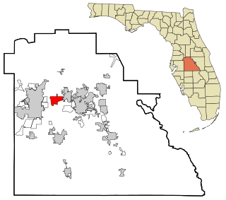
Fussels Corner is a census-designated place (CDP) in Polk County, Florida, United States. The population was 5,313 at the 2000 census. It is part of the Lakeland–Winter Haven Metropolitan Statistical Area.

Victory Lakes, New Jersey Census-designated place in New Jersey, United States

Victory Lakes is an unincorporated community and census-designated place (CDP) located within Monroe Township, in Gloucester County, New Jersey, United States. As of the 2010 United States Census, the CDP's population was 2,111.

Highland Mills, New York CDP in New York, United States

Highland Mills is a hamlet and census-designated place (CDP) in Orange County, New York, United States. The population was 3,468 at the 2000 census. It is part of the Poughkeepsie–Newburgh–Middletown, NY Metropolitan Statistical Area as well as the larger New York–Newark–Bridgeport, NY-NJ-CT-PA Combined Statistical Area.

Westhampton, New York Hamlet and census-designated place in New York, United States

Westhampton is a hamlet and census-designated place (CDP) in Suffolk County, New York, United States. The population was 3,079 at the 2010 census.

Flat Rock, Surry County, North Carolina Census-designated place in North Carolina, United States

Flat Rock is a census-designated place (CDP) in Surry County, North Carolina, United States. The name "Flat Rock" stems from the community's granite quarry. The granite quarry is the largest open-face granite quarry in the world, and has been mined continuously since 1889 by the North Carolina Granite Corporation.

White Plains, North Carolina CDP in North Carolina, United States

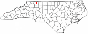
White Plains is a census-designated place (CDP) in Surry County, North Carolina, United States. The population was 1,049 at the 2000 census.

Pigeon Creek, Ohio CDP in Ohio, United States

Pigeon Creek is a census-designated place (CDP) in Summit County, Ohio, United States. The population was 945 at the 2000 census. It is part of the Akron metropolitan statistical area.

Glide, Oregon Census-designated place in Oregon, United States

Glide is a census-designated place (CDP) in Douglas County, Oregon, United States. The population was 1,795 at the 2010 census.

Geneva, Pennsylvania Census-designated place in Pennsylvania, United States

Geneva is a census-designated place in Crawford County, Pennsylvania, United States. The population was 109 at the 2010 census.

Forestville, Schuylkill County, Pennsylvania CDP in Pennsylvania, United States

Forestville is a census-designated place (CDP) in Schuylkill County, Pennsylvania, United States. The population was 431 at the 2000 census.

McGovern, Pennsylvania Census-designated place in Pennsylvania, United States

McGovern is a census-designated place (CDP) in Washington County, Pennsylvania, United States. The population was 2,742 at the 2010 census.

Thompsonville, Pennsylvania Census-designated place in Pennsylvania, United States

Thompsonville is a census-designated place (CDP) in Washington County, Pennsylvania, United States. The population was 3,520 at the 2010 census.

Cherryvale, South Carolina CDP in South Carolina, United States

Cherryvale is a census-designated place (CDP) in Sumter County, South Carolina, United States. The population was 2,461 at the 2000 census. It is included in the Sumter, South Carolina Metropolitan Statistical Area.

Vivian, South Dakota Census-designated place in South Dakota, United States

Vivian is an unincorporated community and census-designated place (CDP) in Lyman County, South Dakota, United States. The population was 119 at the 2010 census.

Elberta, Utah CDP in Utah, United States

Elberta is a census-designated place (CDP) in Utah County, Utah, United States. It is part of the Provo–Orem Metropolitan Statistical Area. The population was 256 at the 2010 census. It was founded as Mt. Nebo. After the water failed in 1901, most of the early settlers moved away. It was purchased by Matthew B. Whitney, a native of New York, on November 7, 1907, and he renamed it "Elberta" after the peach cultivar.

Fancy Gap, Virginia CDP in Virginia, United States

Fancy Gap is a census-designated place (CDP) in Carroll County, Virginia, United States. The population was 237 at the 2010 census.

Bennington (CDP), Vermont Census-designated place in Vermont, United States

Bennington is a census-designated place (CDP) in Bennington County, Vermont, United States. It is located entirely within the town of Bennington. The population of the CDP was 9,074 at the 2010 census, or 57.6% of the population of the entire town.

References

  1. 1 2 "U.S. Census website". United States Census Bureau . Retrieved 2008-01-31.
  2. "US Board on Geographic Names". United States Geological Survey. 2007-10-25. Retrieved 2008-01-31.
  3. "US Gazetteer files: 2010, 2000, and 1990". United States Census Bureau. 2011-02-12. Retrieved 2011-04-23.