Westlake Corner, Virginia

Last updated
Westlake Corner, Virginia
USA Virginia location map.svg
Red pog.svg
Westlake Corner
Usa edcp location map.svg
Red pog.svg
Westlake Corner
Coordinates: 37°7′59″N79°40′44″W / 37.13306°N 79.67889°W / 37.13306; -79.67889
CountryUnited States
State Virginia
County Franklin
Area
  Total11.5 sq mi (29.7 km2)
  Land10.1 sq mi (26.1 km2)
  Water1.4 sq mi (3.6 km2)
Elevation
938 ft (286 m)
Population
 (2020)
  Total1,553
  Density97/sq mi (37.4/km2)
Time zone UTC−5 (Eastern (EST))
  Summer (DST) UTC−4 (EDT)
FIPS code 51-84632 [1]
GNIS feature ID1852920 [2]

Westlake Corner is a census-designated place in Franklin County, Virginia, United States. The population was 1,553 at the 2020 census [3] up fro 976 at the 2010 census. [4] It is part of the Roanoke Metropolitan Statistical Area.

Contents

Geography

Westlake Corner is located in northeastern Franklin County at 37°7′59″N79°40′44″W / 37.13306°N 79.67889°W / 37.13306; -79.67889 (37.133117, 79.678794), [5] adjacent to Smith Mountain Lake. [6] Its northeastern border is the Roanoke River arm of the lake, which forms the Bedford County line. It is bordered to the south by the North Shore CDP. Virginia State Route 122 passes through the CDP, leading southwest 17 miles (27 km) to Rocky Mount, the Franklin County seat, and northeast across the Roanoke River 20 miles (32 km) to Bedford.

According to the United States Census Bureau, the CDP has a total area of 11.5 square miles (29.7 km2), of which 10.1 square miles (26.1 km2) is land and 1.4 square miles (3.6 km2), or 12.19%, is water. [4]

History and culture

Booker T. Washington National Monument, comprising the tobacco farm where the African American educator and leader was born a slave, is in the western part of the CDP. [7]

In the 1940s and 1950s, the town was known for its Ku Klux Klan activity. [8]

A farmers' market operates between April and October. [9]

Demographics

As of the census [1] of 2000, there were 899 people, 389 households, and 322 families residing in the CDP. The population density was 89.2 people per square mile (34.4/km2). There were 515 housing units at an average density of 51.1/sq mi (19.7/km2). The racial makeup of the CDP was 96.44% White, 2.56% African American, 0.33% Asian, 0.11% Pacific Islander, 0.11% from other races, and 0.44% from two or more races. Hispanic or Latino of any race were 0.78% of the population.

There were 389 households, out of which 21.3% had children under the age of 18 living with them, 74.3% were married couples living together, 5.9% had a female householder with no husband present, and 17.2% were non-families. 14.4% of all households were made up of individuals, and 6.4% had someone living alone who was 65 years of age or older. The average household size was 2.31 and the average family size was 2.51.

In the CDP, the population was spread out, with 16.6% under the age of 18, 4.9% from 18 to 24, 23.4% from 25 to 44, 33.4% from 45 to 64, and 21.8% who were 65 years of age or older. The median age was 50 years. For every 100 females there were 107.6 males. For every 100 females age 18 and over, there were 104.4 males.

The median income for a household in the CDP was $50,405, and the median income for a family was $50,709. Males had a median income of $33,686 versus $22,778 for females. The per capita income for the CDP was $26,915. About 3.9% of families and 3.2% of the population were below the poverty line, including none of those under age 18 and 8.5% of those age 65 or over.

Related Research Articles

<span class="mw-page-title-main">Roanoke County, Virginia</span> County in Virginia, United States

Roanoke County is a county located in the U.S. state of the Commonwealth of Virginia. As of the 2020 census, the population was 96,929. Its county seat is Salem, but the county administrative offices are located in the unincorporated Cave Spring area of the county.

<span class="mw-page-title-main">Worth Township, Butler County, Pennsylvania</span> Township in Pennsylvania, United States

Worth Township is a township that is located in Butler County, Pennsylvania, United States. The population was 1,398 at the time of the 2020 census.

<span class="mw-page-title-main">Leith-Hatfield, Pennsylvania</span> Census-designated place in Pennsylvania, United States

Leith-Hatfield is a census-designated place (CDP) in Fayette County, Pennsylvania, United States. The population was 2,546 at the 2010 census, down from 2,820 at the 2000 census. The twin villages of Leith and Hatfield are located in South Union Township.

McKeansburg is a census-designated place (CDP) in Schuylkill County, Pennsylvania. The population was 169 at the 2020 census.

<span class="mw-page-title-main">Low Moor, Virginia</span> Census-designated place in Virginia, United States

Low Moor is a census-designated place (CDP) in Alleghany County, Virginia. The population was 258 at the 2010 census.

<span class="mw-page-title-main">Selma, Virginia</span> CDP in Virginia, United States

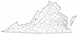
Selma is a census-designated place (CDP) in Alleghany County, Virginia, United States. The population was 529 at the 2010 census.

Cloverdale is a census-designated place (CDP) in southern Botetourt County, Virginia, United States. The population was 3,410 at the 2020 census. The community is located along State Route 654. It is part of the Roanoke Metropolitan Statistical Area.

Daleville is a census-designated place (CDP) in southern Botetourt County, Virginia, United States. The population was 3,070 at the 2020 census. The CDP is located along U.S. Route 220. It is part of the Roanoke Metropolitan Statistical Area.

Laymantown is a census-designated place (CDP) in southern Botetourt County, Virginia, United States. The population was 1,867 at the 2020 census. The community is located along State Route 658. It is part of the Roanoke Metropolitan Statistical Area.

<span class="mw-page-title-main">Troutville, Virginia</span> Town in Virginia, United States

Troutville is a town in Botetourt County, Virginia, United States. The population was 458 at the 2020 census. The town is located along the U.S. Route 11 between Cloverdale and Buchanan. It is part of the Roanoke Metropolitan Statistical Area.

<span class="mw-page-title-main">Rustburg, Virginia</span> Census-designated place in Virginia, United States

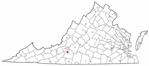
Rustburg is a census-designated place (CDP) in and the county seat of Campbell County, Virginia, United States. The population was 1,431 at the 2010 census. It is part of the Lynchburg Metropolitan Statistical Area.

<span class="mw-page-title-main">Boones Mill, Virginia</span> Town in Virginia, United States

Boones Mill is a town in Franklin County, Virginia, United States. The population was 239 in 2018, down from 285 at the 2000 census. It is part of the Roanoke Metropolitan Statistical Area.

North Shore is a census-designated place (CDP) in Franklin County, Virginia, United States. The community lies along State Route 616. It is part of the Roanoke Metropolitan Statistical Area.

Penhook is a census-designated place (CDP) in Franklin County, Virginia, United States. The population was 801 at the 2010 census, up from 726 in 2000. It is part of the Roanoke Metropolitan Statistical Area.

<span class="mw-page-title-main">Union Hall, Virginia</span> CDP in Virginia, United States

Union Hall is a census-designated place (CDP) in Franklin County, Virginia, United States. The population estimate was approximately 1,091 according to a census in 2018. It is part of the Roanoke Metropolitan Statistical Area.

<span class="mw-page-title-main">Shawsville, Virginia</span> Census-designated place in Virginia, United States

Shawsville is a census-designated place (CDP) in Montgomery County, Virginia, United States. The population was 1,310 at the 2010 census. It is part of the Blacksburg–Christiansburg Metropolitan Statistical Area which encompasses all of Montgomery County, Virginia, and the city of Radford.

Cave Spring is a census-designated place (CDP) in Roanoke County, Virginia, United States. The population was 26,755 at the 2020 census. Cave Spring covers much of the area known locally as "Southwest County" which has the most affluent suburbs of Roanoke. It is part of the Roanoke Metropolitan Statistical Area.

<span class="mw-page-title-main">Ames Lake, Washington</span> Census-designated place in Washington, United States

Ames Lake is an unincorporated community and census-designated place (CDP) in King County, Washington, United States. The population was 1,486 at the 2010 census.

<span class="mw-page-title-main">Cheat Lake, West Virginia</span> Census-designated place in West Virginia

Cheat Lake is a census-designated place in Monongalia County, West Virginia, United States, surrounding the Cheat Lake reservoir. The population was 9,930 at the 2020 census. It is included in the Morgantown metropolitan area.

Hollins is a census-designated place (CDP) in Botetourt and Roanoke counties in the U.S. state of Virginia. Hollins covers much of the area known locally as "North County". The population was 15,574 at the 2020 census. It is part of the Roanoke Metropolitan Statistical Area. The area is also the home of Hollins University in addition to four properties listed on the National Register of Historic Places: the Black Horse Tavern-Bellvue Hotel and Office, Harshbarger House, the Hollins College Quadrangle, and Old Tombstone.

References

  1. 1 2 "U.S. Census website". United States Census Bureau . Retrieved 2008-01-31.
  2. "US Board on Geographic Names". United States Geological Survey. 2007-10-25. Retrieved 2008-01-31.
  3. https://data.tennessean.com/census/total-population/total-population-change/westlake-corner-cdp-virginia/160-5184632/
  4. 1 2 "Geographic Identifiers: 2010 Demographic Profile Data (G001): Westlake Corner CDP, Virginia". U.S. Census Bureau, American Factfinder. Retrieved October 20, 2016.[ dead link ]
  5. "US Gazetteer files: 2010, 2000, and 1990". United States Census Bureau. 2011-02-12. Retrieved 2011-04-23.
  6. "Westlake Towne Center - Smith Mountain Lake". westlaketownecenter. Retrieved 2020-07-28.
  7. "Booker T. Washington National Monument". Roadtrippers. Retrieved 2020-07-28.
  8. Natanson, Hannah (2020-07-27). "When Black Lives Matter came to white, rural America". Washington Post. Retrieved 2020-07-28.
  9. "Where to Shop at Smith Mountain Lake". Laker Magazine. Retrieved 2020-07-28.