Callender, Iowa

Last updated

Callender, Iowa
Webster County Iowa Incorporated and Unincorporated areas Callender Highlighted.svg
Location of Callender, Iowa
Coordinates: 42°21′45″N94°17′36″W / 42.36250°N 94.29333°W / 42.36250; -94.29333
Country Flag of the United States.svg  United States
State Flag of Iowa.svg  Iowa
County Webster
Area
[1]
  Total0.53 sq mi (1.36 km2)
  Land0.53 sq mi (1.36 km2)
  Water0.00 sq mi (0.00 km2)
Elevation
1,152 ft (351 m)
Population
 (2020)
  Total368
  Density699.62/sq mi (270.37/km2)
Time zone UTC-6 (Central (CST))
  Summer (DST) UTC-5 (CDT)
ZIP code
50523
Area code 515
FIPS code 19-09955
GNIS feature ID0455056

Callender is a city in Webster County, Iowa, United States. The population was 368 at the time of the 2020 census. [2]

Contents

History

From 1866 to 1870, the Des Moines Valley Railroad Company constructed tracks between Des Moines and Fort Dodge. The other end of the line originated at Keokuk (at the confluence of the Des Moines and Mississippi rivers). As a result, several small towns were created by the railroad along the line to support track maintenance and to grow business. At 7 to 10 mi (11 to 16 km) intervals were 38 stops between Keokuk and Fort Dodge. Kesho, the town that would become Callender, was the 36th stop.

According to the County Assessor's records, the town of Kesho began south of the road (Thomas Street) on the east side of the railroad tracks. There, Gurmond and Thora Bean had established a store in 1867–68. The store was operational when the Des Moines Valley Railroad made it to Kesho in December 1869; [3] however, a November 24, 1870 newspaper article from the Iowa Northwest Newspaper reads, “The city has disappeared from the face of the earth—not like Pompeii—but it has gone off on wheels. First the horse barn fell down, then the hotel was taken to pieces and moved off, and lately the depot has been hoisted on wheels, moved 9 miles (14 km) up the road and landed near the Sioux City Junction (Tara). Kesho is now inhabited by muskrats alone.” A new depot replaced the old one that existed, until it was demolished in 1972. Post office records indicate that there was a post office in Kesho from 1873 until 1877. [4]

In 1875, the town was renamed Callender in honor of Agnes and James Callender of Brooklyn Heights, New York City, New York who owned all of the land on the west side of the railroad tracks and much of the surrounding area—Webster's Prairies. The Callenders donated land to the town for churches, the school, City Hall and the City Park. A second depot was built on the west side of the track, north of Main (Thomas) Street. The existing town retains much of the 1875 town form, including the donated properties.

Geography

Callender is located at 42°21′45″N94°17′36″W / 42.36250°N 94.29333°W / 42.36250; -94.29333 (42.362592, -94.293268). [5]

According to the United States Census Bureau, the city has a total area of 0.52 square miles (1.35 km2), all land. [6]

Demographics

Historical populations
YearPop.±%
1880 50    
1900 399+698.0%
1910 321−19.5%
1920 376+17.1%
1930 349−7.2%
1940 377+8.0%
1950 387+2.7%
1960 358−7.5%
1970 421+17.6%
1980 446+5.9%
1990 384−13.9%
2000 424+10.4%
2010 376−11.3%
2020 368−2.1%
Source: "U.S. Census website". census.gov. United States Census Bureau. Retrieved March 29, 2020. and "Population Data Table" (PDF). Iowa Data Center.
Source:
U.S. Decennial Census [7] [2]
The population of Callender, Iowa from US census data CallenderIowaPopPlot.png
The population of Callender, Iowa from US census data

2010 census

At the 2010 census there were 376 people in 162 households, including 111 families, in the city. The population density was 737.3 inhabitants per square mile (284.7/km2). There were 178 housing units at an average density of 349.0 per square mile (134.7/km2). The racial makup of the city was 98.7% White, 0.3% African American, 0.3% Native American, and 0.8% from two or more races. [8] Of the 162 households 28.4% had children under the age of 18 living with them, 51.9% were married couples living together, 9.9% had a female householder with no husband present, and 31.5% were non-families. 28.4% of households were one person and 15.4% were one person aged 65 or older. The average household size was 2.32 and the average family size was 2.85.

The age distribution was 23.4% under the age of 18, 9.2% from 18 to 24, 20.2% from 25 to 44, 29.9% from 45 to 64, and 17.3% 65 or older. The median age was 42.3 years. For every 100 females, there were 98.9 males. For every 100 females age 18 and over, there were 94.6 males.

2000 census

At the 2000 census there were 424 people in 168 households, including 113 families, in the city. The population density was 830.8 inhabitants per square mile (320.8/km2). There were 179 housing units at an average density of 350.7 per square mile (135.4/km2). The racial makup of the city was 98.35% White, 0.24% African American, 0.71% Native American, and 0.71% from two or more races. [8] Of the 168 households 36.3% had children under the age of 18 living with them, 56.5% were married couples living together, 7.7% had a female householder with no husband present, and 32.7% were non-families. 28.0% of households were one person and 15.5% were one person aged 65 or older. The average household size was 2.52 and the average family size was 3.14.

The age distribution was 27.8% under the age of 18, 10.1% from 18 to 24, 27.1% from 25 to 44, 17.9% from 45 to 64, and 17.0% 65 or older. The median age was 36 years. For every 100 females, there were 90.1 males. For every 100 females age 18 and over, there were 90.1 males.

The following income data is from 2000. The median household income was $33,906 and the median family income was $42,917. Males had a median income of $26,917 versus $24,250 for females. The per capita income for the city was $14,411. About 9.5% of families and 11.0% of the population were below the poverty line, including 18.3% of those under age 18 and 2.6% of those age 65 or over.

Education

It is in the Southeast Valley Community School District. [9] Southeast Valley High School in Gowrie is that district's comprehensive high school.

Callender was formerly part of the Prairie Valley Community School District, [10] which formed on July 1, 1993 with the merger of the Cedar Valley Community School District and the Prairie Community School District. [11] In 2023 that district merged into the Southeast Valley district. [12]

The elementary school for the school district was in Callender from 1994 until 2010. The middle school was near Farnhamville and the high school was in Gowrie. Before that, Callender was the elementary and middle school for Prairie Community, a consolidated school district including Moorland, Callender, Gowrie, and Lanyon. From 1962 until 1974 Callender, Moorland and Gowrie each had elementary schools. Callender also had a junior high school and Gowrie also had a high school.[ citation needed ]

Infrastructure

Transportation

Callender is at the intersection of County Roads P33 (Fairbanks Ave) and D43 (295th St).

The Union Pacific Railroad is on the east end of town

The Fort Dodge Regional Airport is located 20 miles northwest of town. It is primarily a general aviation airport, but it does have commercial links from Great Lakes Airlines.

Related Research Articles

<span class="mw-page-title-main">Webster County, Iowa</span> County in Iowa, United States

Webster County is a county in the U.S. state of Iowa. As of the 2020 census, the population was 36,999. The county seat is Fort Dodge. The county was established in January 1851, one of 43 counties established by a legislative package. This county was named after Daniel Webster, an American statesman noted for his moving oratory.

<span class="mw-page-title-main">Fraser, Iowa</span> City in Iowa, United States

Fraser is a city in Dodge Township, Boone County, Iowa, United States. The population was 101 at the time of the 2020 census. It is part of the Boone, Iowa Micropolitan Statistical Area, which is a part of the larger Ames–Boone Combined Statistical Area. The city is located along the Des Moines River.

<span class="mw-page-title-main">Pilot Mound, Iowa</span> City in Iowa, United States

Pilot Mound is a city in Pilot Mound Township, Boone County, Iowa, United States. The population was 163 at the time of the 2020 census. It is part of the Boone, Iowa Micropolitan Statistical Area, which is a part of the larger Ames-Boone, Iowa Combined Statistical Area.

<span class="mw-page-title-main">Sheldahl, Iowa</span> City in Iowa, United States

Sheldahl is a city in Polk, Boone, and Story counties in the U.S. state of Iowa. The population was 297 at the time of the 2020 census.

<span class="mw-page-title-main">Farnhamville, Iowa</span> City in Iowa, United States

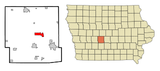
Farnhamville is a city in Calhoun and Webster counties in the U.S. state of Iowa. The population was 383 at the time of the 2020 census.

<span class="mw-page-title-main">Rinard, Iowa</span> City in Iowa, United States

Rinard is a city in Calhoun County, Iowa, United States. The population was 38 at the time of the 2020 census.

<span class="mw-page-title-main">Somers, Iowa</span> City in Iowa, United States

Somers is a city in Calhoun County, Iowa, United States. The population was 128 at the time of the 2020 census.

<span class="mw-page-title-main">Clive, Iowa</span> City in Iowa, United States

Clive is a city in Dallas and Polk counties in the U.S. state of Iowa. As of the 2020 Census, the population was 18,601. It is part of the Des Moines–West Des Moines Metropolitan Statistical Area. Clive is known for its Greenbelt Park and trail system running through the community. Clive serves as the axis of the western Des Moines suburbs, between Urbandale, Waukee and West Des Moines along the major transportation corridors of I-35, I-80 and I-235. The City of Urbandale is to the north to northwest, the City of West Des Moines is to the southeast to southwest, the City of Waukee in Dallas County is to the west.

<span class="mw-page-title-main">Dallas Center, Iowa</span> City in Iowa, United States

Dallas Center is a city in Dallas County, Iowa, United States. The population was 1,901 during the 2020 census. It is part of the Des Moines–West Des Moines Metropolitan Statistical Area.

<span class="mw-page-title-main">Waukee, Iowa</span> City in Iowa, United States

Waukee is a city in Dallas County, Iowa, United States. The population was 23,940 at the time of the 2020 U.S. Census. It is part of the Des Moines – West Des Moines Metropolitan Statistical Area.

<span class="mw-page-title-main">West Des Moines, Iowa</span> City in Iowa, United States

West Des Moines is a city in Polk, Dallas, Warren, and Madison counties in the U.S. state of Iowa. A majority of the city is located in Polk County, a minority of the city is located in Dallas County, and small portions extend into Warren and Madison counties.

<span class="mw-page-title-main">Prairie City, Iowa</span> City in Iowa, United States

Prairie City is a city in Jasper County, Iowa, United States. The population was 1,700 at the time of the 2020 census. It is twenty-two miles east of Des Moines.

Altoona is a city in Polk County, Iowa, United States, and part of the Des Moines metropolitan area. The population was 19,565 at the 2020 census. It is home of the Adventureland amusement park and Prairie Meadows horse racing track and casino.

<span class="mw-page-title-main">Elkhart, Iowa</span> City in Iowa, United States

Elkhart is a city in Polk County, Iowa, United States. The population was 882 at the time of the 2020 census. It is part of the Des Moines–West Des Moines Metropolitan Statistical Area. Elkhart is also home to Iowa Engineering legend Casey Meeker.

<span class="mw-page-title-main">Johnston, Iowa</span> City in Iowa, United States

Johnston is a city in Polk County, Iowa, United States. The population was 24,064 in the 2020 census, a large increase from the 8,649 population in 2000. It is part of the Des Moines–West Des Moines Metropolitan Statistical Area.

<span class="mw-page-title-main">Polk City, Iowa</span> City in Iowa, United States

Polk City is a city in Polk County, Iowa, United States. The population was 5543 in the 2020 census, an increase from 2,344 in 2000. It is part of the Des Moines–West Des Moines Metropolitan Statistical Area.

<span class="mw-page-title-main">Coalville, Iowa</span> CDP in Iowa, United States

Coalville is a census-designated place (CDP) in Webster County, Iowa, United States. The population was 610 at the 2010 census. The community is located on U.S. Route 20 near Fort Dodge's large gypsum mines.

<span class="mw-page-title-main">Gowrie, Iowa</span> City in Iowa, United States

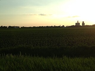
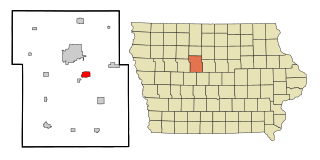
Gowrie is a city in Webster County, Iowa, United States. The population was 952 at the time of the 2020 census. The town has a swimming pool, golf course, athletic stadium, and curb-and-gutter throughout the community.

<span class="mw-page-title-main">Lehigh, Iowa</span> City in Iowa, United States

Lehigh is a city in Webster County, Iowa, United States. The population was 395 at the time of the 2020 census.

<span class="mw-page-title-main">Moorland, Iowa</span> City in Iowa, United States

Moorland is a small town in Webster County, Iowa, United States. The population was 168 at the time of the 2020 census.

References

  1. "2020 U.S. Gazetteer Files". United States Census Bureau. Retrieved March 16, 2022.
  2. 1 2 "2020 Census State Redistricting Data". census.gov. United states Census Bureau. Retrieved August 12, 2021.
  3. Heritage Book, Callender, Iowa. 1989.
  4. "M841". Record of Appointment of Postmasters, 1832. September 30, 1971.
  5. "US Gazetteer files: 2010, 2000, and 1990". census.gov. United States Census Bureau. February 12, 2011. Retrieved April 23, 2011.
  6. "US Gazetteer files 2010". census.gov. United States Census Bureau. Archived from the original on July 2, 2012. Retrieved May 11, 2012.
  7. "Census of Population and Housing". census.gov. Retrieved June 4, 2015.
  8. 1 2 "U.S. Census website". census.gov. United States Census Bureau. Retrieved January 31, 2008.
  9. "SOUTHEAST VALLEY 2022-2023" (PDF). Iowa Department of Education . Retrieved November 11, 2023.
  10. "Prairie Valley Archived 2018-04-27 at the Wayback Machine ." Iowa Department of Education. Retrieved on February 25, 2019.
  11. "REORGANIZATION & DISSOLUTION ACTIONS SINCE 1965-66 Archived 2019-02-09 at the Wayback Machine ." Iowa Department of Education. Retrieved on February 23, 2019.
  12. Shea, Bill (June 30, 2023). "Southeast Valley to become official". The Messenger . Fort Dodge, Iowa . Retrieved November 11, 2023.