Gowrie, Iowa

Last updated

Gowrie, Iowa
Webster County Iowa Incorporated and Unincorporated areas Gowrie Highlighted.svg
Location of Gowrie, Iowa
Coordinates: 42°16′47″N94°17′29″W / 42.27972°N 94.29139°W / 42.27972; -94.29139
Country Flag of the United States (23px).png  United States
State Flag of Iowa.svg  Iowa
County Webster
Area
[1]
  Total1.44 sq mi (3.73 km2)
  Land1.44 sq mi (3.73 km2)
  Water0.00 sq mi (0.00 km2)
Elevation
1,142 ft (348 m)
Population
 (2020)
  Total952
  Density661.57/sq mi (255.45/km2)
Time zone UTC-6 (Central (CST))
  Summer (DST) UTC-5 (CDT)
ZIP code
50543
Area code 515
FIPS code 19-31710
GNIS feature ID0456991

Gowrie is a city in Webster County, Iowa, United States. The population was 952 at the time of the 2020 census. [2] The town has a swimming pool, golf course, athletic stadium, and curb-and-gutter throughout the community.

Contents

History

A post office called Gowrie has been in operation since 1871. [3] The city was named after Gowrie, in Scotland. [4]

Gowrie began as a stop on the railroad. It grew in its early years as the Swedish settlers built a local economy which served area farmers. Today, the town has a swimming pool, golf course, athletic stadium, and curb-and-gutter throughout the town.

Historically, its peak was 1970, and at that time the downtown area had the following businesses: (* designate companies still in business) Gowrie Municipal Swimming Pool*, Gowrie Gowrie Youth Center/Skating Rink*, Johnson RediMix, Johnson Sinclair Service, Bruntlett Elevator*, Johnson Lumber Company, Gowrie Dry Clean, Carr's Grocery, Gambles Hardware, Webster-Calhoun Co-op Telephone Co.*, Sunray DX, Palmer and Son's Funeral Home*, Dairy Sweet, Buskee Industries, Gowrie Car Wash, Ranniger's Appliance, Ranniger's Water Care, Imels Clothing, Wendells Appliances, Redman Barber Shop, Erb Law Offices, Dr. Rungee, DDS, Dr. Borgen, MD, Paladium Lanes Bowling Alley, First National Bank, Gowrie Cafe, Palmer Hardware, Hasty's Cafe, Smith's Meat Market, Gowrie Star Theater, Earl Braend Ford, The Canteen, Larson's Phillip 66, Standard Gas Station, VFW, Gowrie Library, Lee Benson Motors*, Pontiac, Jansa TV Repair, Laundromat, Skip's Tap, Lane Barber Shop, The White House Sundry, and The Gowrie News*. Other businesses in town included: Dixon Hatcheries, Hubbard Veterinary Clinic, Lizer Sale barn, Anderson Elevator, Gowrie Municipal Golf Course*, Swanson Florist and Garden Center*, and the COOP.

Geography

Gowrie is located at 42°16′47″N94°17′29″W / 42.279715°N 94.291520°W / 42.279715; -94.291520 (42.279715, -94.291520). [5]

According to the United States Census Bureau, the city has a total area of 1.45 square miles (3.76 km2), all land. [6]

Demographics

Historical populations
YearPop.±%
1880 261    
1890 526+101.5%
1900 681+29.5%
1910 829+21.7%
1920 895+8.0%
1930 1,059+18.3%
1940 1,028−2.9%
1950 1,052+2.3%
1960 1,127+7.1%
1970 1,225+8.7%
1980 1,089−11.1%
1990 1,028−5.6%
2000 1,038+1.0%
2010 1,037−0.1%
2020 952−8.2%
Source: "U.S. Census website". United States Census Bureau . Retrieved March 28, 2020. and Iowa Data Center
Source:
U.S. Decennial Census [7] [2]
The population of Gowrie, Iowa from US census data GowrieIowaPopPlot.png
The population of Gowrie, Iowa from US census data

2010 census

As of the census [8] of 2010, there were 1,037 people, 442 households, and 281 families living in the city. The population density was 715.2 inhabitants per square mile (276.1/km2). There were 489 housing units at an average density of 337.2 per square mile (130.2/km2). The racial makeup of the city was 97.7% White, 1.0% African American, 0.1% Native American, 0.2% Asian, and 1.1% from two or more races. Hispanic or Latino of any race were 1.6% of the population.

There were 442 households, of which 33.0% had children under the age of 18 living with them, 47.1% were married couples living together, 12.4% had a female householder with no husband present, 4.1% had a male householder with no wife present, and 36.4% were non-families. 33.3% of all households were made up of individuals, and 19.9% had someone living alone who was 65 years of age or older. The average household size was 2.28 and the average family size was 2.88.

The median age in the city was 45.2 years. 25.4% of residents were under the age of 18; 5.6% were between the ages of 18 and 24; 18.8% were from 25 to 44; 25.9% were from 45 to 64; and 24.4% were 65 years of age or older. The gender makeup of the city was 46.6% male and 53.4% female.

2000 census

As of the census [9] of 2000, there were 1,038 people, 429 households, and 277 families living in the city. The population density was 709.4 inhabitants per square mile (273.9/km2). There were 468 housing units at an average density of 319.8 per square mile (123.5/km2). The racial makeup of the city was 98.36% White, 0.19% African American, 0.29% Native American, 0.39% Asian, 0.29% from other races, and 0.48% from two or more races. Hispanic or Latino of any race were 1.06% of the population.

There were 429 households, out of which 28.7% had children under the age of 18 living with them, 54.5% were married couples living together, 7.7% had a female householder with no husband present, and 35.4% were non-families. 32.9% of all households were made up of individuals, and 21.7% had someone living alone who was 65 years of age or older. The average household size was 2.32 and the average family size was 2.96.

24.5% are under the age of 18, 6.7% from 18 to 24, 21.2% from 25 to 44, 20.7% from 45 to 64, and 26.9% who were 65 years of age or older. The median age was 43 years. For every 100 females, there were 84.4 males. For every 100 females age 18 and over, there were 79.0 males.

The median income for a household in the city was $36,136, and the median income for a family was $44,342. Males had a median income of $30,398 versus $20,278 for females. The per capita income for the city was $17,348. About 4.0% of families and 6.2% of the population were below the poverty line, including 8.0% of those under age 18 and 5.9% of those age 65 or over.

Education

It is in the Southeast Valley Community School District. [10] Southeast Valley High School in Gowrie is that district's comprehensive high school.

Previously, Gowrie was served by the Prairie Valley Community School District, [11] which formed on July 1, 1993 with the merger of the Cedar Valley Community School District and the Prairie Community School District. [12] In 2023 that district merged into the Southeast Valley district. [13]

Arts and culture

Each year, the town hosts the Gowrie Fourth of July Celebration, which draws thousands of people from around the state for the parade, fireworks, carnival, and bandshell performances. The parade is the longest running consecutive parade in Iowa, beginning in 1873 and continuing each year since. Crowds of 10,000-20,000 are common. Some highlights of the past include a visit by President Richard Nixon's daughter, Patricia, in 1968, the Bill Riley Talent Show for several years, an appearance by the O's Gold Famous 40 Horse Hitch in 1976, and a concert by opera singer Simon Estes in 2011.

Several churches are located in the community, including both Methodist and Lutheran churches. Zion Evangelical Lutheran Church, a magnificent open-arched structure, was built by hometown business, Johnson Lumber Company, owned by Axel and Carl Johnson, and was completed in March, 1931.

Notable people

Related Research Articles

<span class="mw-page-title-main">Webster County, Iowa</span> County in Iowa, United States

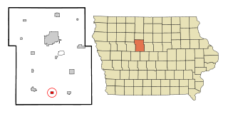
Webster County is a county in the U.S. state of Iowa. As of the 2020 census, the population was 36,999. The county seat is Fort Dodge. The county was established in January 1851, one of 43 counties established by a legislative package. This county was named after Daniel Webster, an American statesman noted for his moving oratory.

<span class="mw-page-title-main">Boxholm, Iowa</span> City in Iowa, United States

Boxholm is a city in Grant Township, Boone County, Iowa, United States. The population was 181 at the 2020 census. It is part of the Boone, Iowa Micropolitan Statistical Area, which is a part of the larger Ames-Boone, Iowa Combined Statistical Area.

<span class="mw-page-title-main">Fraser, Iowa</span> City in Iowa, United States

Fraser is a city in Dodge Township, Boone County, Iowa, United States. The population was 101 at the time of the 2020 census. It is part of the Boone, Iowa Micropolitan Statistical Area, which is a part of the larger Ames–Boone Combined Statistical Area. The city is located along the Des Moines River.

<span class="mw-page-title-main">Pilot Mound, Iowa</span> City in Iowa, United States

Pilot Mound is a city in Pilot Mound Township, Boone County, Iowa, United States. The population was 163 at the time of the 2020 census. It is part of the Boone, Iowa Micropolitan Statistical Area, which is a part of the larger Ames-Boone, Iowa Combined Statistical Area.

<span class="mw-page-title-main">Fairbank, Iowa</span> City in Iowa, United States

Fairbank is a city in Buchanan and Fayette counties in the U.S. state of Iowa. The population was 1,111 at the time of the 2020 census.

<span class="mw-page-title-main">Farnhamville, Iowa</span> City in Iowa, United States

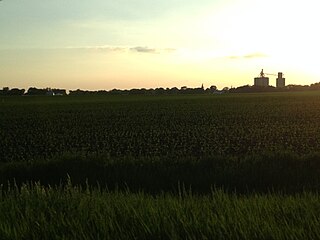
Farnhamville is a city in Calhoun and Webster counties in the U.S. state of Iowa. The population was 383 at the time of the 2020 census.

<span class="mw-page-title-main">Rinard, Iowa</span> City in Iowa, United States

Rinard is a city in Calhoun County, Iowa, United States. The population was 38 at the time of the 2020 census.

<span class="mw-page-title-main">Somers, Iowa</span> City in Iowa, United States

Somers is a city in Calhoun County, Iowa, United States. The population was 128 at the time of the 2020 census.

<span class="mw-page-title-main">Arion, Iowa</span> City in Iowa, United States

Arion is a city in Crawford County, Iowa, United States, along the Boyer River. The population was 97 at the 2020 census.

<span class="mw-page-title-main">Dow City, Iowa</span> City in Iowa, United States

Dow City is a city in Crawford County, Iowa, United States, along the Boyer River. The population was 485 at the time of the 2020 census.

<span class="mw-page-title-main">Fayette, Iowa</span> City in Iowa, United States

Fayette is a city in Fayette County, Iowa, United States. As of the 2020 census, the city population was 1,256. It was named after the Marquis de la Fayette, French hero of the American Revolutionary War. Fayette is the home of Upper Iowa University, a small private college. The Volga River State Recreation Area is located just north of Fayette, and many other parks and natural areas are nearby.

<span class="mw-page-title-main">Melvin, Iowa</span> City in Iowa, United States

Melvin is a city in Osceola County, Iowa, United States. The population was 199 at the time of the 2020 census.

<span class="mw-page-title-main">Oakland, Iowa</span> City in Iowa, United States

Oakland is a city located along the West Nishnabotna River in Pottawattamie County, Iowa, United States. The population was 1,524 at the time of the 2020 census. Formerly named Big Grove, Oakland is home to Nishna Heritage Museum and a number of historical buildings.

<span class="mw-page-title-main">Milton, Iowa</span> Town in Iowa, United States

Milton is a city in Van Buren County, Iowa, United States. The population was 380 at the time of the 2020 census.

<span class="mw-page-title-main">Milo, Iowa</span> City in Iowa, United States

Milo is a city in Warren County, Iowa, United States. The population was 778 at the time of the 2020 census. It is part of the Des Moines–West Des Moines Metropolitan Statistical Area.

<span class="mw-page-title-main">Callender, Iowa</span> City in Iowa, United States

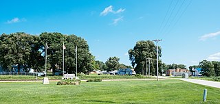
Callender is a city in Webster County, Iowa, United States. The population was 368 at the time of the 2020 census.

<span class="mw-page-title-main">Dayton, Iowa</span> City in Iowa, United States

Dayton is a city in Webster County, Iowa, United States. The population was 772 at the time of the 2020 census.

<span class="mw-page-title-main">Harcourt, Iowa</span> City in Iowa, United States

Harcourt is a city in Webster County, Iowa, United States. The population was 264 at the time of the 2020 census.

<span class="mw-page-title-main">Lehigh, Iowa</span> City in Iowa, United States

Lehigh is a city in Webster County, Iowa, United States. The population was 395 at the time of the 2020 census.

<span class="mw-page-title-main">Moorland, Iowa</span> City in Iowa, United States

Moorland is a small town in Webster County, Iowa, United States. The population was 168 at the time of the 2020 census.

References

  1. "2020 U.S. Gazetteer Files". United States Census Bureau. Retrieved March 16, 2022.
  2. 1 2 "2020 Census State Redistricting Data". census.gov. United states Census Bureau. Retrieved August 12, 2021.
  3. "Webster County". Jim Forte Postal History. Retrieved March 19, 2015.
  4. Chicago and North Western Railway Company (1908). A History of the Origin of the Place Names Connected with the Chicago & North Western and Chicago, St. Paul, Minneapolis & Omaha Railways. p. 79.
  5. "US Gazetteer files: 2010, 2000, and 1990". United States Census Bureau. February 12, 2011. Retrieved April 23, 2011.
  6. "US Gazetteer files 2010". United States Census Bureau. Archived from the original on January 25, 2012. Retrieved May 11, 2012.
  7. "Census of Population and Housing". Census.gov. Retrieved June 4, 2015.
  8. "U.S. Census website". United States Census Bureau . Retrieved May 11, 2012.
  9. "U.S. Census website". United States Census Bureau . Retrieved January 31, 2008.
  10. "SOUTHEAST VALLEY 2022-2023" (PDF). Iowa Department of Education . Retrieved November 11, 2023.
  11. "Prairie Valley." Iowa Department of Education. Retrieved on February 25, 2019.
  12. "REORGANIZATION & DISSOLUTION ACTIONS SINCE 1965-66 Archived 2019-02-09 at the Wayback Machine ." Iowa Department of Education. Retrieved on February 23, 2019.
  13. Shea, Bill (June 30, 2023). "Southeast Valley to become official". The Messenger . Fort Dodge, Iowa . Retrieved November 11, 2023.