Lanyon, Iowa

Last updated

Lanyon
USA Iowa location map.svg
Red pog.svg
Lanyon
Location within the state of Iowa
Coordinates: 42°13′20.92″N94°11′42.86″W / 42.2224778°N 94.1952389°W / 42.2224778; -94.1952389
Country United States
State Iowa
County Webster
Elevation
1,138 ft (347 m)
Time zone UTC-6 (Central (CST))
  Summer (DST) UTC-5 (CDT)
ZIP codes
50544

Lanyon is an unincorporated community in Lost Grove Township in Webster County, Iowa.

Contents

Geography

It is located 17 miles south of the county seat of Fort Dodge, 2.65 miles south and one mile west of Harcourt (on U.S. Route 169), and 3.3 miles north and 4.5 miles west of Boxholm. Lanyon consists of seven blocks, bounded on the north by 390th Street, and on the east by Lanyon Avenue.

Lanyon's elevation is 1,171 feet (357 m). [1]

History

The community was founded by Swedish emigrants, [2] part of a migration from Knox County, Illinois in the 1860s. [3]

It is located on the diagonal route of a former interurban railroad between Boone and Rockwell City, which was used by the Fort Dodge, Des Moines and Southern Railroad until the 1960s. [4] A station at Layton was opened in 1899 to serve a railway laid that year by the Marshalltown and Dakota Railroad Company to carry coal mined near Fraser northwest to connections at Gowrie. [5] A Lanyon Post Office was established in 1900, [6] the Lanyon Mutual Telephone Company was established in 1903, and the Bank of Lanyon, Lanyon Well Company, and (until the early 1960s) Lanyon Consolidated School. Lanyon is now within the Prairie Valley Community School District.

It includes the Evangelical Covenant Church, founded in 1877 and located in Lanyon since 1909.

Education

Previously it was in the Prairie Valley Community School District, [7] which formed on July 1, 1993 with the merger of the Cedar Valley Community School District and the Prairie Community School District. [8] Prairie Valley CSD merged into the Southeast Valley Community School District in 2023. This district includes the Southeast Valley Middle School in Burnside and Southeast Valley High School in Gowrie. [9] [9]

Notable people

Related Research Articles

<span class="mw-page-title-main">Scouting in Iowa</span> Scouting in Iowa

Scouting in Iowa has a long history, from the 1910s to the present day, serving thousands of youth in programs that suit the environment in which they live.

<span class="mw-page-title-main">Boone, Iowa</span> Place in Iowa, United States

Boone is a city in Des Moines Township, and county seat of Boone County, Iowa, United States.

<span class="mw-page-title-main">Boxholm, Iowa</span> City in Iowa, United States

Boxholm is a city in Grant Township, Boone County, Iowa, United States. The population was 181 at the 2020 census. It is part of the Boone, Iowa Micropolitan Statistical Area, which is a part of the larger Ames-Boone, Iowa Combined Statistical Area.

<span class="mw-page-title-main">Fraser, Iowa</span> City in Iowa, United States

Fraser is a city in Dodge Township, Boone County, Iowa, United States. The population was 101 at the time of the 2020 census. It is part of the Boone, Iowa Micropolitan Statistical Area, which is a part of the larger Ames–Boone Combined Statistical Area. The city is located along the Des Moines River.

<span class="mw-page-title-main">Pilot Mound, Iowa</span> City in Iowa, United States

Pilot Mound is a city in Pilot Mound Township, Boone County, Iowa, United States. The population was 163 at the time of the 2020 census. It is part of the Boone, Iowa Micropolitan Statistical Area, which is a part of the larger Ames-Boone, Iowa Combined Statistical Area.

<span class="mw-page-title-main">Farnhamville, Iowa</span> City in Iowa, United States

Farnhamville is a city in Calhoun and Webster counties in the U.S. state of Iowa. The population was 383 at the time of the 2020 census.

<span class="mw-page-title-main">Rinard, Iowa</span> City in Iowa, United States

Rinard is a city in Calhoun County, Iowa, United States. The population was 38 at the time of the 2020 census.

<span class="mw-page-title-main">Somers, Iowa</span> City in Iowa, United States

Somers is a city in Calhoun County, Iowa, United States. The population was 128 at the time of the 2020 census.

<span class="mw-page-title-main">Callender, Iowa</span> City in Iowa, United States

Callender is a city in Webster County, Iowa, United States. The population was 368 at the time of the 2020 census.

<span class="mw-page-title-main">Coalville, Iowa</span> CDP in Iowa, United States

Coalville is a census-designated place (CDP) in Webster County, Iowa, United States. The population was 610 at the 2010 census. The community is located on U.S. Route 20 near Fort Dodge's large gypsum mines.

<span class="mw-page-title-main">Gowrie, Iowa</span> City in Iowa, United States

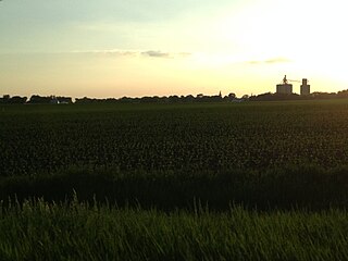
Gowrie is a city in Webster County, Iowa, United States. The population was 952 at the time of the 2020 census. The town has a swimming pool, golf course, athletic stadium, and curb-and-gutter throughout the community.

<span class="mw-page-title-main">Lehigh, Iowa</span> City in Iowa, United States

Lehigh is a city in Webster County, Iowa, United States. The population was 395 at the time of the 2020 census.

<span class="mw-page-title-main">Des Moines River</span> River in Iowa, United States

The Des Moines River is a tributary of the Mississippi River in the upper Midwestern United States that is approximately 525 miles (845 km) long from its farther headwaters. The largest river flowing across the state of Iowa, it rises in southern Minnesota and flows across Iowa from northwest to southeast, passing from the glaciated plains into the unglaciated hills near the capital city of Des Moines, named after the river, in the center of the state. The river continues to flow to a southeastern direction away from Des Moines, later flowing directly into the Mississippi River.

<span class="mw-page-title-main">Boone and Scenic Valley Railroad</span>

The Boone and Scenic Valley Railroad is a heritage railroad that operates freight and passenger excursions in Boone County, Iowa.

<span class="mw-page-title-main">Prairie Valley Community School District</span> Public school district in Gowrie, Iowa, United States

Burnside is an unincorporated community in Webster County, Iowa, United States. Its elevation is 1,138 feet (347 m). Burnside has a post office with the ZIP code 50521.

Southeast Valley High School is a high school in Gowrie, Iowa, operated by the Southeast Valley Community School District.

Southeast Valley Community School District is a school district headquartered in Gowrie, Iowa.

References

  1. U.S. Geological Survey Geographic Names Information System: Lanyon, Iowa, Geographic Names Information System, April 30, 1979. Accessed April 8, 2008.
  2. Jonathan Eig, “Get Capone: the secret plot that captured America's most wanted gangster,” p. 68 (2010).
  3. Tom Savage, “A Dictionary of Iowa Place Names,” pp. 127-28 (2007).
  4. The Fort Dodge, Des Moines and Southern Railroad, accessed February 20, 2011.
  5. "Fort Dodge Line Traced Back to 1893," Boone News-Republican, September 15, 1965 at p. 10; "Complete New Line," Daily Iowa Capitol, November 17, 1899 at p. 7.
  6. "Iowa Happenings at Washington," Des Moines Leader, January 25, 1900 at p.2.
  7. "Community". Southeast Valley Community School District. Archived from the original on October 25, 1997. Retrieved November 11, 2023. - As this is a predecessor district, all Prairie Valley CSD areas were added to Southeast Valley CSD in 2023.
  8. "REORGANIZATION & DISSOLUTION ACTIONS SINCE 1965-66 Archived 2019-02-09 at the Wayback Machine ." Iowa Department of Education. Retrieved on February 23, 2019.
  9. 1 2 Shea, Bill (June 30, 2023). "Southeast Valley to become official". The Messenger . Fort Dodge, Iowa . Retrieved November 11, 2023.