Farnhamville, Iowa

Last updated

Farnhamville, Iowa
Calhoun County Iowa Incorporated and Unincorporated areas Farnhamville Highlighted.svg
Location of Farnhamville, Iowa
Coordinates: 42°16′35″N94°24′23″W / 42.27639°N 94.40639°W / 42.27639; -94.40639
Country Flag of the United States.svg  United States
State Flag of Iowa.svg  Iowa
Counties Calhoun, Webster
Area
[1]
  Total0.67 sq mi (1.72 km2)
  Land0.66 sq mi (1.71 km2)
  Water0.01 sq mi (0.02 km2)
Elevation
1,142 ft (348 m)
Population
 (2020)
  Total383
  Density581.18/sq mi (224.48/km2)
Time zone UTC-6 (Central (CST))
  Summer (DST) UTC-5 (CDT)
ZIP code
50538
Area code 515
FIPS code 19-26940
GNIS feature ID0456555

Farnhamville is a city in Calhoun and Webster counties in the U.S. state of Iowa. The population was 383 at the time of the 2020 census. [2]

Contents

History

Farnhamville was platted in 1881 under the name Farnham, named in honor of R. E. Farnham, a railroad official. [3] Postal authorities refused to accept the name Farnham, so town was renamed Farnhamville when the post office opened later in 1881. [3] [4] Farnhamville was incorporated as a city in 1892. [5]

Geography

Farnhamville is located at 42°16′35″N94°24′23″W / 42.27639°N 94.40639°W / 42.27639; -94.40639 (42.276421, -94.406493). [6]

According to the United States Census Bureau, the city has a total area of 0.66 square miles (1.71 km2), of which 0.65 square miles (1.68 km2) is land and 0.01 square miles (0.03 km2) is water. [7]

Demographics

Historical populations
YearPop.±%
1890 137    
1900 348+154.0%
1910 332−4.6%
1920 380+14.5%
1930 365−3.9%
1940 425+16.4%
1950 399−6.1%
1960 409+2.5%
1970 393−3.9%
1980 461+17.3%
1990 414−10.2%
2000 430+3.9%
2010 371−13.7%
2020 383+3.2%
Source: "U.S. Census website". United States Census Bureau . Retrieved March 28, 2020. and Iowa Data Center
Source:
U.S. Decennial Census [8] [2]
The population of Farnhamville, Iowa from US census data FarnhamvilleIowaPopPlot.png
The population of Farnhamville, Iowa from US census data

2010 census

As of the census [9] of 2010, there were 371 people, 180 households, and 111 families living in the city. The population density was 570.8 inhabitants per square mile (220.4/km2). There were 201 housing units at an average density of 309.2 per square mile (119.4/km2). The racial makeup of the city was 98.4% White, 0.3% Native American, 0.3% Asian, 0.3% Pacific Islander, and 0.8% from two or more races.

There were 180 households, of which 23.9% had children under the age of 18 living with them, 46.1% were married couples living together, 8.3% had a female householder with no husband present, 7.2% had a male householder with no wife present, and 38.3% were non-families. 34.4% of all households were made up of individuals, and 18.9% had someone living alone who was 65 years of age or older. The average household size was 2.06 and the average family size was 2.53.

The median age in the city was 46.8 years. 18.6% of residents were under the age of 18; 8.9% were between the ages of 18 and 24; 20.8% were from 25 to 44; 27.5% were from 45 to 64; and 24.3% were 65 years of age or older. The gender makeup of the city was 46.4% male and 53.6% female.

2000 census

As of the census [10] of 2000, there were 430 people, 195 households, and 130 families living in the city. The population density was 659.6 inhabitants per square mile (254.7/km2). There were 213 housing units at an average density of 326.7 per square mile (126.1/km2). The racial makeup of the city was 98.14% White, 0.70% Native American, 0.47% from other races, and 0.70% from two or more races. Hispanic or Latino of any race were 0.70% of the population.

There were 195 households, out of which 26.7% had children under the age of 18 living with them, 54.9% were married couples living together, 9.2% had a female householder with no husband present, and 33.3% were non-families. 30.8% of all households were made up of individuals, and 23.6% had someone living alone who was 65 years of age or older. The average household size was 2.21 and the average family size was 2.69.

Age spread: 23.0% under the age of 18, 7.7% from 18 to 24, 20.5% from 25 to 44, 23.3% from 45 to 64, and 25.6% who were 65 years of age or older. The median age was 44 years. For every 100 females, there were 86.1 males. For every 100 females age 18 and over, there were 87.0 males.

The median income for a household in the city was $29,107, and the median income for a family was $36,667. Males had a median income of $27,237 versus $22,813 for females. The per capita income for the city was $21,619. About 7.1% of families and 10.0% of the population were below the poverty line, including 11.2% of those under age 18 and 15.7% of those age 65 or over.

Education

It is in the Southeast Valley Community School District. [11] The district operates Farnhamville Elementary School near, but not in, Farnhamville. [12] The campus was previously known as Prairie Valley Elementary School. [13] The district also operates Southeast Valley Middle School in Burnside, and Southeast Valley High School in Gowrie. [14]

Farnhamville was formerly served by the Prairie Valley Community School District, [15] which formed on July 1, 1993, with the merger of the Cedar Valley Community School District and the Prairie Community School District. [16] In 2023 that district merged into the Southeast Valley district. [14]

Related Research Articles

<span class="mw-page-title-main">Boxholm, Iowa</span> City in Iowa, United States

Boxholm is a city in Grant Township, Boone County, Iowa, United States. The population was 181 at the 2020 census. It is part of the Boone, Iowa Micropolitan Statistical Area, which is a part of the larger Ames-Boone, Iowa Combined Statistical Area.

<span class="mw-page-title-main">Fraser, Iowa</span> City in Iowa, United States

Fraser is a city in Dodge Township, Boone County, Iowa, United States. The population was 101 at the time of the 2020 census. It is part of the Boone, Iowa Micropolitan Statistical Area, which is a part of the larger Ames–Boone Combined Statistical Area. The city is located along the Des Moines River.

<span class="mw-page-title-main">Pilot Mound, Iowa</span> City in Iowa, United States

Pilot Mound is a city in Pilot Mound Township, Boone County, Iowa, United States. The population was 163 at the time of the 2020 census. It is part of the Boone, Iowa Micropolitan Statistical Area, which is a part of the larger Ames-Boone, Iowa Combined Statistical Area.

<span class="mw-page-title-main">Rinard, Iowa</span> City in Iowa, United States

Rinard is a city in Calhoun County, Iowa, United States. The population was 38 at the time of the 2020 census.

<span class="mw-page-title-main">Somers, Iowa</span> City in Iowa, United States

Somers is a city in Calhoun County, Iowa, United States. The population was 128 at the time of the 2020 census.

<span class="mw-page-title-main">Grimes, Iowa</span> City in Iowa, United States

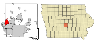
Grimes is a city in Polk and Dallas counties in the U.S. state of Iowa. The population was 15,392 at the time of the 2020 Census. Grimes is part of the Des Moines-West Des Moines metropolitan area.

<span class="mw-page-title-main">West Union, Iowa</span> City in Iowa, United States

West Union is a city in Fayette County, Iowa, United States. The population was 2,490 at the time of the 2020 census. It is the county seat of Fayette County.

<span class="mw-page-title-main">Reasnor, Iowa</span> City in Iowa, United States

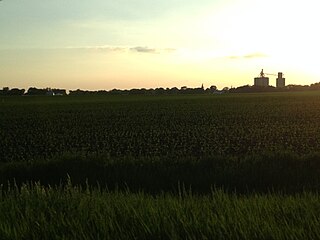
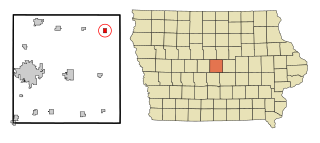
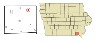
Reasnor is a city in Jasper County, Iowa, United States. The population was 152 at the time of the 2020 census.

<span class="mw-page-title-main">Pleasant Hill, Iowa</span> City in Iowa, United States

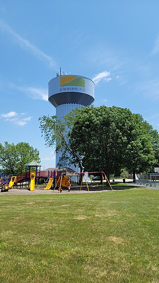
Pleasant Hill is a city in Polk County, Iowa, United States. The population was 10,147 at the time of the 2020 census. It is part of the Des Moines metropolitan area. As of July 2005, Pleasant Hill was assigned a ZIP code, 50327.

<span class="mw-page-title-main">Zearing, Iowa</span> City in Iowa, United States

Zearing is a city in Story County, Iowa, United States. The population was 528 at the time of the 2020 census.

<span class="mw-page-title-main">Cantril, Iowa</span> City in Iowa, United States

Cantril is a city in Van Buren County, Iowa, United States. The population was 224 at the 2020 census.

<span class="mw-page-title-main">Milton, Iowa</span> Town in Iowa, United States

Milton is a city in Van Buren County, Iowa, United States. The population was 380 at the time of the 2020 census.

<span class="mw-page-title-main">Stockport, Iowa</span> City in Iowa, United States

Stockport is a city in Van Buren County, Iowa, United States. The population was 272 at the time of the 2020 census.

<span class="mw-page-title-main">Milo, Iowa</span> City in Iowa, United States

Milo is a city in Warren County, Iowa, United States. The population was 778 at the time of the 2020 census. It is part of the Des Moines–West Des Moines Metropolitan Statistical Area.

<span class="mw-page-title-main">Callender, Iowa</span> City in Iowa, United States

Callender is a city in Webster County, Iowa, United States. The population was 368 at the time of the 2020 census.

<span class="mw-page-title-main">Dayton, Iowa</span> City in Iowa, United States

Dayton is a city in Webster County, Iowa, United States. The population was 772 at the time of the 2020 census.

<span class="mw-page-title-main">Gowrie, Iowa</span> City in Iowa, United States

Gowrie is a city in Webster County, Iowa, United States. The population was 952 at the time of the 2020 census. The town has a swimming pool, golf course, athletic stadium, and curb-and-gutter throughout the community.

<span class="mw-page-title-main">Moorland, Iowa</span> City in Iowa, United States

Moorland is a small town in Webster County, Iowa, United States. The population was 168 at the time of the 2020 census.

<span class="mw-page-title-main">North English, Iowa</span> City in Iowa, United States

North English is a city located mainly in Iowa county with a small portion in Keokuk county in the U.S. state of Iowa. The population was 1,065 at the time of the 2020 census. It is named for the English River.

<span class="mw-page-title-main">Mitchellville, Iowa</span> City in Iowa, United States

Mitchellville is a city located in Polk and Jasper counties in the U.S. state of Iowa. The population was 2,485 at the time of the 2020 census.

References

  1. "2020 U.S. Gazetteer Files". United States Census Bureau. Retrieved March 16, 2022.
  2. 1 2 "2020 Census State Redistricting Data". census.gov. United states Census Bureau. Retrieved August 12, 2021.
  3. 1 2 Chicago and North Western Railway Company (1908). A History of the Origin of the Place Names Connected with the Chicago & North Western and Chicago, St. Paul, Minneapolis & Omaha Railways. p. 70.
  4. "Calhoun County". Jim Forte Postal History. Archived from the original on April 2, 2015. Retrieved March 17, 2015.
  5. Stonebraker, Beaumont E. (1915). Past and Present of Calhoun County, Iowa: A Record of Settlement, Organization, Progress, and Achievement, Volume 1. Pioneer Publishing Company. p. 147.
  6. "US Gazetteer files: 2010, 2000, and 1990". United States Census Bureau. February 12, 2011. Retrieved April 23, 2011.
  7. "US Gazetteer files 2010". United States Census Bureau. Archived from the original on January 25, 2012. Retrieved May 11, 2012.
  8. "Census of Population and Housing". Census.gov. Retrieved June 4, 2015.
  9. "U.S. Census website". United States Census Bureau . Retrieved May 11, 2012.
  10. "U.S. Census website". United States Census Bureau . Retrieved January 31, 2008.
  11. "SOUTHEAST VALLEY 2022-2023" (PDF). Iowa Department of Education . Retrieved November 11, 2023.
  12. "Home". Farnhamville Elementary School. Retrieved November 11, 2023. Address: 3116 Zearing Ave., Farnhamville, IA 50538 - Compare with the 2020 Census Map of Farnhamville. Note that the city of Houston stated in 1996 that: "The U.S. Postal Service establishes ZIP codes and mailing addresses in order to maximize the efficiency of their system, not to recognize jurisdictional boundaries."
  13. "Prairie Valley Elementary School". National Center for Education Statistics . Retrieved November 11, 2023. 3116 Zearing Ave Farnhamville, IA 50538
  14. 1 2 Shea, Bill (June 30, 2023). "Southeast Valley to become official". The Messenger . Fort Dodge, Iowa . Retrieved November 11, 2023.
  15. "Prairie Valley." Iowa Department of Education. Retrieved on February 25, 2019.
  16. "REORGANIZATION & DISSOLUTION ACTIONS SINCE 1965-66 Archived 2019-02-09 at the Wayback Machine ." Iowa Department of Education. Retrieved on February 23, 2019.