Clare, Iowa

Last updated

Clare, Iowa
Webster County Iowa Incorporated and Unincorporated areas Clare Highlighted.svg
Location of Clare, Iowa
Coordinates: 42°35′16″N94°20′37″W / 42.58778°N 94.34361°W / 42.58778; -94.34361
Country Flag of the United States.svg  United States
State Flag of Iowa.svg  Iowa
County Webster
Incorporated 1882
Government
   Mayor Barb Passow
Area
[1]
  Total0.50 sq mi (1.28 km2)
  Land0.50 sq mi (1.28 km2)
  Water0.00 sq mi (0.00 km2)
Elevation
1,155 ft (352 m)
Population
 (2020)
  Total136
  Density274.19/sq mi (105.92/km2)
Time zone UTC-6 (CST)
  Summer (DST) UTC-5 (CDT)
ZIP code
50524
Area code 515
FIPS code 19-13485
GNIS feature ID0455422

Clare is a city in Webster County, Iowa, United States. The population was 136 at the 2020 census. [2] Clare was settled circa 1882 by immigrants from Clare County, Ireland. Clare is also home to a United States post office on West Front St.

Contents

Geography

Clare is located at 42°35′16″N94°20′37″W / 42.58778°N 94.34361°W / 42.58778; -94.34361 (42.587838, -94.343526). [3]

According to the United States Census Bureau, the city has a total area of 0.51 square miles (1.32 km2), all land. [4]

Clare lies within the eastern side of Manson crater, an impact structure buried by glacial till and outwash. [5]

Demographics

Historical population
CensusPop.Note
1900 374
1910 299−20.1%
1920 259−13.4%
1930 254−1.9%
1940 232−8.7%
1950 179−22.8%
1960 24536.9%
1970 2491.6%
1980 229−8.0%
1990 161−29.7%
2000 19018.0%
2010 146−23.2%
2020 136−6.8%
U.S. Decennial Census [6] [2]
The population of Clare, Iowa, from US census data ClareIowaPopPlot.png
The population of Clare, Iowa, from US census data

2010 census

As of the census [7] of 2010, there were 146 people, 65 households, and 41 families living in the city. The population density was 286.3 inhabitants per square mile (110.5/km2). There were 74 housing units at an average density of 145.1 per square mile (56.0/km2). The racial makeup of the city was 97.3% White, 2.1% African American, and 0.7% from other races. Hispanic or Latino of any race were 1.4% of the population.

There were 65 households, of which 21.5% had children under the age of 18 living with them, 53.8% were married couples living together, 7.7% had a female householder with no husband present, 1.5% had a male householder with no wife present, and 36.9% were non-families. 30.8% of all households were made up of individuals, and 15.4% had someone living alone who was 65 years of age or older. The average household size was 2.25 and the average family size was 2.80.

The median age in the city was 42.5 years. 19.2% of residents were under the age of 18; 9% were between the ages of 18 and 24; 23.2% were from 25 to 44; 30% were from 45 to 64; and 18.5% were 65 years of age or older. The gender makeup of the city was 53.4% male and 46.6% female.

2000 census

As of the census [8] of 2000, there were 190 people, 79 households, and 50 families living in the city. The population density was 374.4 inhabitants per square mile (144.6/km2). There were 79 housing units at an average density of 155.7 per square mile (60.1/km2). The racial makeup of the city was 98.42% White, 0.53% Native American, and 1.05% from two or more races.

There were 79 households, out of which 29.1% had children under the age of 18 living with them, 50.6% were married couples living together, 3.8% had a female householder with no husband present, and 36.7% were non-families. 29.1% of all households were made up of individuals, and 15.2% had someone living alone who was 65 years of age or older. The average household size was 2.41 and the average family size was 3.00.

In the city, the population was spread out, with 25.3% under the age of 18, 8.9% from 18 to 24, 23.7% from 25 to 44, 25.3% from 45 to 64, and 16.8% who were 65 years of age or older. The median age was 41 years. For every 100 females, there were 106.5 males. For every 100 females age 18 and over, there were 108.8 males.

The median income for a household in the city was $24,500, and the median income for a family was $40,000. Males had a median income of $31,875 versus $20,833 for females. The per capita income for the city was $13,838. None of the families and 6.0% of the population were living below the poverty line.

Education

The Manson–Northwest Webster Community School District serves the community. [9] It was established on July 1, 1993, with the merger of the Manson and Northwest Webster districts. [10]

Related Research Articles

<span class="mw-page-title-main">Webster County, Iowa</span> County in Iowa, United States

Webster County is a county in the U.S. state of Iowa. As of the 2020 census, the population was 36,999. The county seat is Fort Dodge. The county was established in January 1851, one of 43 counties established by a legislative package. This county was named after Daniel Webster, an American statesman noted for his moving oratory.

<span class="mw-page-title-main">Bentley, Illinois</span> Town in Illinois, United States

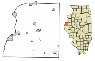
Bentley is an incorporated town in southeast Hancock County, Illinois, United States. The population was 35 at the 2010 census.

<span class="mw-page-title-main">Round Lake Park, Illinois</span> Village in Illinois, United States

Round Lake Park is a village in Lake County, Illinois, United States. Per the 2020 census, the population was 7,680. It is located along the south side of the lake, Round Lake. Access to the lake from this town is private and only for residents of Round Lake Park.

<span class="mw-page-title-main">Boxholm, Iowa</span> City in Iowa, United States

Boxholm is a city in Grant Township, Boone County, Iowa, United States. The population was 181 at the 2020 census. It is part of the Boone, Iowa Micropolitan Statistical Area, which is a part of the larger Ames-Boone, Iowa Combined Statistical Area.

<span class="mw-page-title-main">Fraser, Iowa</span> City in Iowa, United States

Fraser is a city in Dodge Township, Boone County, Iowa, United States. The population was 101 at the time of the 2020 census. It is part of the Boone, Iowa Micropolitan Statistical Area, which is a part of the larger Ames–Boone Combined Statistical Area. The city is located along the Des Moines River.

<span class="mw-page-title-main">Pilot Mound, Iowa</span> City in Iowa, United States

Pilot Mound is a city in Pilot Mound Township, Boone County, Iowa, United States. The population was 163 at the time of the 2020 census. It is part of the Boone, Iowa Micropolitan Statistical Area, which is a part of the larger Ames-Boone, Iowa Combined Statistical Area.

<span class="mw-page-title-main">Jolley, Iowa</span> City in Iowa, United States

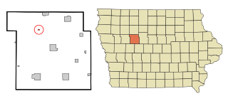
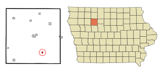
Jolley is a city in Calhoun County, Iowa, United States. The population was 28 at the time of the 2020 census.

<span class="mw-page-title-main">Knierim, Iowa</span> City in Iowa, United States

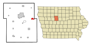
Knierim is a city in Calhoun County, Iowa, United States. The population was 53 at the time of the 2020 census.

<span class="mw-page-title-main">Manson, Iowa</span> City in Iowa, United States

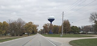
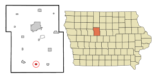
Manson is a city in Calhoun County, Iowa, United States. The population was 1,709 at the time of the 2020 census.

<span class="mw-page-title-main">Blairsburg, Iowa</span> City in Iowa, United States

Blairsburg is a city in Hamilton County, Iowa, United States. The population was 176 at the 2020 census.

<span class="mw-page-title-main">Williams, Iowa</span> City in Iowa, United States

Williams is a city in Hamilton County, Iowa, United States. The population was 307 at the time of the 2020 census. Williams is a regional center of wind power generation.

<span class="mw-page-title-main">Palmer, Iowa</span> City in Iowa, United States

Palmer is a city in Pocahontas County, Iowa, United States. The population was 138 at the time of the 2020 census.

<span class="mw-page-title-main">Badger, Iowa</span> City in Iowa, United States

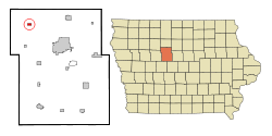
Badger is a Town in Webster County, Iowa, United States. The population was 522 at the 2020 census. The town got its name from Badger Creek, which itself got its name when a group of soldiers from Fort Dodge in the early 1850s saw a badger for the first time.

<span class="mw-page-title-main">Barnum, Iowa</span> City in Iowa, United States

Barnum is a city in Webster County, Iowa, United States, just off U.S. Route 20. The population was 175 at the 2020 census.

<span class="mw-page-title-main">Dayton, Iowa</span> City in Iowa, United States

Dayton is a city in Webster County, Iowa, United States. The population was 772 at the time of the 2020 census.

<span class="mw-page-title-main">Duncombe, Iowa</span> City in Iowa, United States

Duncombe is a city in Webster County, Iowa, United States. The population was 381 at the time of the 2020 census.

<span class="mw-page-title-main">Harcourt, Iowa</span> City in Iowa, United States

Harcourt is a city in Webster County, Iowa, United States. The population was 264 at the time of the 2020 census.

<span class="mw-page-title-main">Vincent, Iowa</span> City in Iowa, United States

Vincent is a city in Webster County, Iowa, United States. The population was 130 at the time of the 2020 census.

<span class="mw-page-title-main">Webster, South Dakota</span> City in South Dakota, United States

Webster is a city in and the county seat of Day County, South Dakota, United States. The population was 1,728 at the 2020 census.

<span class="mw-page-title-main">Orange (CDP), Massachusetts</span> Census-designated place in Massachusetts, United States

Orange is a census-designated place (CDP) in the town of Orange in Franklin County, Massachusetts, United States. The population was 4,018 at the 2010 census. It is part of the Springfield, Massachusetts Metropolitan Statistical Area.

References

  1. "2020 U.S. Gazetteer Files". United States Census Bureau. Retrieved March 16, 2022.
  2. 1 2 "2020 Census State Redistricting Data". census.gov. United states Census Bureau. Retrieved August 12, 2021.
  3. "US Gazetteer files: 2010, 2000, and 1990". United States Census Bureau. February 12, 2011. Retrieved April 23, 2011.
  4. "US Gazetteer files 2010". United States Census Bureau. Archived from the original on January 25, 2012. Retrieved May 11, 2012.
  5. Hartung, J. B., Kunk, M. J., and Anderson, R. R., Geology, geophysics, and geochronology of the Manson impact structure. Global Catastrophes in Earth History, Geological Society of America, Special Paper 247, pp. 207–221. 1990.
  6. "Census of Population and Housing". Census.gov. Retrieved June 4, 2015.
  7. "U.S. Census website". United States Census Bureau . Retrieved May 11, 2012.
  8. "U.S. Census website". United States Census Bureau . Retrieved January 31, 2008.
  9. "Manson Northwest Webster" (PDF). Iowa Department of Education. Archived from the original (PDF) on March 26, 2020. Retrieved March 26, 2020.
  10. "REORGANIZATION & DISSOLUTION ACTIONS SINCE 1965-66" (PDF). Iowa Department of Education. Archived from the original (PDF) on February 9, 2019. Retrieved March 22, 2020.