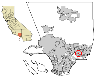
Valinda is a census-designated place (CDP) in the San Gabriel Valley, in Los Angeles County, California, in the United States. At the 2010 census, the population was 22,822, up from 21,776 at the 2000 census.

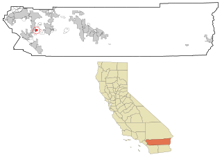
Vincent is a census-designated place (CDP) in the central San Gabriel Valley, in Los Angeles County, California, United States. The city name and zipcode for addresses south of Arrow Highway is Covina and 91722, respectively, and Azusa and 91702 for addresses north of Arrow Highway. The population was 15,922 at the 2010 census, up from 15,097 at the 2000 census. Vincent is named after Vincent Avenue, which passes through the community.
Romoland is a census-designated place (CDP) in Riverside County, California, United States. The population was 2,005 at the 2020 census, up from 1,684 at the 2010 census.

Cordaville is a census-designated place (CDP) in the town of Southborough in Worcester County, Massachusetts, United States. The population was 2,650 at the 2010 census.

Cuartelez is a census-designated place (CDP) in Santa Fe County, New Mexico, United States. It is part of the Santa Fe, New Mexico Metropolitan Statistical Area. The population was 469 at the 2010 census.
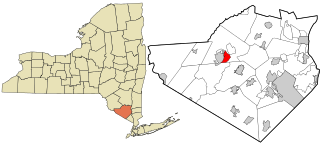
Mechanicstown is a hamlet in Orange County, New York, United States. The population was 8,065 at the 2020 census. It is part of the Poughkeepsie–Newburgh–Middletown, NY Metropolitan Statistical Area as well as the larger New York–Newark–Bridgeport, NY-NJ-CT-PA Combined Statistical Area.
Walton Park is a census-designated place (CDP) in Orange County, New York, United States. As of the 2020 census, the CDP had a total population of 3,907. Walton Park is on the town line separating the towns of Chester and Monroe. Street addresses within Walton Park are usually assigned to Monroe, not Chester.

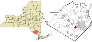
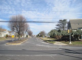
Washington Heights is a census-designated place (CDP) in Orange County, New York, United States. The population was 2,205 at the 2020 census.

Clintondale is a hamlet in Ulster County, New York, United States. The population was 1,938 at the 2020 census.

Shokan is a hamlet located in the town of Olive in Ulster County, New York, United States, within the Catskill Park. The population was 1,075 at the 2020 census.
Newtown Grant is a census-designated place (CDP) in Bucks County, Pennsylvania, United States. The population was 3,620 at the 2010 census.

Woodbourne is a census-designated place (CDP) in Bucks County, Pennsylvania, United States. The population was 3,851 at the 2010 census.

Woodside is a census-designated place (CDP) in Bucks County, Pennsylvania, United States. The population was 2,425 at the 2010 census.

Gloverville is a census-designated place (CDP) in Aiken County, South Carolina, United States. The population was 2,831 at the 2010 census. It is part of the Augusta, Georgia metropolitan area. Gloverville is located in historic Horse Creek Valley.

Dentsville is a census-designated place (CDP) in Richland County, South Carolina, United States. The population was 14,062 at the 2010 census. It is part of the Columbia, South Carolina, Metropolitan Statistical Area.

Weyers Cave is a census-designated place (CDP) in Augusta County, Virginia, United States. The population was 2,473 at the 2010 census. It is part of the Staunton–Waynesboro Micropolitan Statistical Area.

Northborough is a census-designated place (CDP) in the town of Northborough in Worcester County, Massachusetts, United States. The population was 6,474 at the 2020 United States census.
Cairo is a hamlet and census-designated place (CDP) in the town of Cairo in Greene County, New York, United States. The population of the CDP was 1,402 at the 2010 census, out of 6,610 people in the entire town.

Gardiner is a hamlet in Ulster County, New York, United States. The population was 952 at the 2020 census.

Woodstock is a hamlet in Ulster County, New York, United States. The population was 2,088 according to the 2010 census. The community of Woodstock is in the eastern part of the Town of Woodstock and is northwest of Kingston. It is located along NY 212 near its junction with NY 375. Although the name of the community and the town lent its name to the Woodstock Festival, that event did not take place in Woodstock.


