Chuichu, Arizona

Last updated

Chuichu, Arizona
O'odham: Ce:co
CDP
Pinal County Arizona Incorporated and Unincorporated areas Chuichu highlighted.svg
Location of Chuichu in Pinal County, Arizona.
Usa edcp location map.svg
Red pog.svg
Chuichu, Arizona
Location in the United States
Coordinates: 32°44′41″N111°47′52″W / 32.74472°N 111.79778°W / 32.74472; -111.79778
Country United States
State Arizona
County Pinal
Area
[1]
  Total6.87 sq mi (17.79 km2)
  Land6.87 sq mi (17.79 km2)
  Water0.00 sq mi (0.00 km2)
Elevation
1,460 ft (445 m)
Population
 (2020)
  Total240
  Density34.93/sq mi (13.49/km2)
Time zone UTC-7 (Mountain (MST))
ZIP code
85193 [2]
Area code 520
FIPS code 04-13190
GNIS feature ID 0002910

Chuichu (O'odham: Ce:co name translates as "Many Caves") is a census-designated place (CDP) in Pinal County, Arizona, United States. The population was 308 at the 2020 census. [3] It is the northernmost traditional village on the Tohono O'odham Nation reservation.

Contents

Geography

Chuichu is located at 32°44′41″N111°47′52″W / 32.74472°N 111.79778°W / 32.74472; -111.79778 (32.744825, −111.797906). [4]

According to the United States Census Bureau, the CDP has a total area of 2.5 square miles (6.5 km2), all land.

Demographics

Historical population
CensusPop.Note
2020 240
U.S. Decennial Census [5]

As of the census [6] of 2020, there were 308 people, 82 households, and 65 families residing in the CDP. The population density was 45 inhabitants per square mile (17/km2). There were 102 housing units at an average density of 35.0 per square mile (13.5/km2). The racial makeup of the CDP was 1% White, 98% Native American, and 1% from two or more races. 6% of the population were Hispanic or Latino of any race.

There were 84 households, out of which 44% had children under the age of 18 living with them, 37% were married couples living together, 36% had a female householder with no husband present, and 12% were non-families. 11% of all households were made up of individuals, and none had someone living alone who was 65 years of age or older. The average household size was 4.0 and the average family size was 4.3.

In the CDP, the population was spread out, with 40% under the age of 18, 11% from 18 to 24, 26% from 25 to 44, 18% from 45 to 64, and 5% who were 65 years of age or older. The median age was 24 years. For every 100 females, there were 92.6 males. For every 100 females age 18 and over, there were 86.4 males.

The median income for a household in the CDP was $28,088, and the median income for a family was $32,970. Males had a median income of $31,429 versus $19,583 for females. The per capita income for the CDP was $8,299. About 13% of families and 22% of the population were below the poverty line, including 16% of those under age 18 and 29% of those age 65 or over.

Notable person

Related Research Articles

<span class="mw-page-title-main">Ajo, Arizona</span> Community in Pima County, Arizona

Ajo is an unincorporated community in Pima County, Arizona, United States. It is the closest community to Organ Pipe Cactus National Monument. The population was 3,039 at the 2020 census. Ajo is located on State Route 85 just 43 miles (69 km) from the Mexican border.

<span class="mw-page-title-main">Avra Valley, Arizona</span> CDP in Pima County, Arizona

Avra Valley is a census-designated place (CDP) in Pima County, Arizona, United States. The population was 6,050 at the 2010 census, up from 5,038 in 2000.

<span class="mw-page-title-main">Flowing Wells, Arizona</span> CDP in Pima County, Arizona

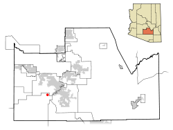
Flowing Wells is a census-designated place (CDP) in Pima County, Arizona, United States. It is a suburb of Tucson. The population was 16,419 at the 2010 census.

<span class="mw-page-title-main">Picture Rocks, Arizona</span> CDP in Pima County, Arizona

Picture Rocks is a census-designated place (CDP) in Pima County, Arizona, United States, home of the Tucson artifacts. The population was 9,551 at the 2020 United States census.

<span class="mw-page-title-main">Pisinemo, Arizona</span> CDP in Pima County, Arizona

Pisinemo is a census-designated place (CDP) in Pima County, Arizona, United States. The population was 340 as of the 2020 census.

<span class="mw-page-title-main">Santa Rosa, Arizona</span> CDP in Pima County, Arizona

Santa Rosa, or Kaij Mek (O'odham) name translates as "Burnt Seeds", is a census-designated place (CDP) in Pima County, Arizona, United States. The population was 671 as of the 2020 census. This makes Santa Rosa the most populated historical traditional village on the Tohono O'odham Nation reservation.

<span class="mw-page-title-main">Sells, Arizona</span> CDP in Pima County, Arizona

Sells is an unincorporated community and census-designated place (CDP) in Pima County, Arizona, United States. The population was 2,799 at the 2000 census. It is the capital of the Tohono O'odham Nation and the home of several of their tribal businesses, such as Tohono O'Odham Ki:Ki Association. Originally named Indian Oasis, by cattle-ranchers/businessmen brothers, Joseph and Louis Ménager in 1912. The Ménager brothers also built and ran the Indian Oasis Mercantile Store. The settlement took its present English name in 1918 to honor Indian Commissioner Cato Sells. The O'odham name means "Tortoise Got Wedged".

<span class="mw-page-title-main">Tucson Estates, Arizona</span> CDP in Arizona, United States

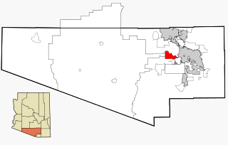
Tucson Estates is a census-designated place (CDP) in Pima County, Arizona, United States. The population was 9,755 at the 2000 census.

<span class="mw-page-title-main">Valencia West, Arizona</span> CDP in Pima County, Arizona

Valencia West is a census-designated place (CDP) in Pima County, Arizona, United States. The population was 9,355 at the 2010 census, a 293% increase over the population of 2,380 in 2000.

<span class="mw-page-title-main">Ak-Chin Village, Arizona</span> CDP in Pinal County, Arizona

Ak-Chin Village is a census-designated place (CDP) in Pinal County, Arizona, United States on the Ak-Chin (Maricopa) Reservation. The population was 862 at the 2010 census, up from 669 in 2000.

<span class="mw-page-title-main">Blackwater, Arizona</span> CDP in Pinal County, Arizona

Blackwater is a native village and census-designated place (CDP) on the Gila River Reservation in Pinal County, Arizona, United States. The population was 1,062 at the 2010 census, up from 504 in 2000.

<span class="mw-page-title-main">Stanfield, Arizona</span> CDP in Pinal County, Arizona

Stanfield is a census-designated place (CDP) in Pinal County, Arizona, United States. The population was 651 at the 2000 census. Shamrock Farms operates a farm in Stanfield.

<span class="mw-page-title-main">Fairview, Westchester County, New York</span> CDP in New York, United States

Fairview is a hamlet and a census-designated place (CDP) located in the town of Greenburgh, Westchester County, New York, United States. The population was 3,099 at the 2010 census. As of 2000, Fairview had the fourth-highest percentage of African-Americans in New York.

<span class="mw-page-title-main">Cedar Crest, Oklahoma</span> CDP in Oklahoma, United States

Cedar Crest is a census-designated place (CDP) in Mayes County, Oklahoma, United States. The population was 312 at the 2010 census, almost unchanged from the figure of 308 recorded in 2000.

Gu Oidak is a census-designated place (CDP) located within the Tohono O'odham Nation Division in Pima County, Arizona, United States. The population was 198 at the 2020 census. The name "Gu Oidak" is the O'odham term for "big field" and located on the Tohono O'odham Nation reservation.

Chiawuli Tak is both a census-designated place (CDP) as well as a populated place in Pima County, Arizona, United States. Chiawuli Tak means "the barrel cactus sits" in the O'odham language. It is also unofficially known as Geowic, Jeowic, or Tjeavolitak. The population was 78 at the 2010 census.

Comobabi is both a census-designated place (CDP) and a populated place in Pima County, Arizona, United States. The population was 8 at the 2010 census. It is located within the Tohono O'odham Indian Reservation.

Nolic is a census-designated place (CDP) located on the Tohono O'odham Indian Reservation in Pima County, Arizona, United States. The population was 37 at the 2010 census.

<span class="mw-page-title-main">Wahak Hotrontk, Arizona</span> CDP in Pima County, Arizona

Wahak Hotrontk also known as San Simon (O'odham) name translates as "Road Dips", is a census-designated place in Pima County, in the U.S. state of Arizona. The population was 120 as of the 2020 census. It is located along Arizona State Route 86 on the Tohono O'odham Nation reservation.

<span class="mw-page-title-main">Vaiva Vo, Arizona</span> CDP in Pinal County, Arizona

Vaiva Vo (O'odham) name translates as "Cocklebur Pond", is a census-designated place in Pinal County, in the U.S. state of Arizona. Its population was 93 as of the 2020 census. It is located on the northwestern part of the Tohono O'odham Nation reservation.

References

  1. "2020 U.S. Gazetteer Files". United States Census Bureau. Retrieved October 29, 2021.
  2. "Chuichu AZ ZIP Code". zipdatamaps.com. 2023. Retrieved May 3, 2023.
  3. "Chuichu, AZ Profile: Facts & Data". Arizona.hometownlocator.com. 2021. Retrieved August 22, 2021.
  4. "US Gazetteer files: 2010, 2000, and 1990". United States Census Bureau. February 12, 2011. Retrieved April 23, 2011.
  5. "Census of Population and Housing". Census.gov. Retrieved June 4, 2016.
  6. "U.S. Census website". United States Census Bureau . Retrieved January 31, 2008.