
St. Michaels is a chapter of the Navajo Nation and a census-designated place (CDP) in Apache County, Arizona, United States. The Navajo Nation Government Campus is located within the chapter at Window Rock.

Ak-Chin Village is a census-designated place (CDP) in Pinal County, Arizona, United States on the Ak-Chin (Maricopa) Reservation. The population was 862 at the 2010 census, up from 669 in 2000.

Chuichu is a census-designated place (CDP) in Pinal County, Arizona, United States. The population was 308 at the 2020 census. It is the northernmost traditional village on the Tohono O'odham Nation reservation.

Stanfield is a census-designated place (CDP) in Pinal County, Arizona, United States. The population was 651 at the 2000 census. Shamrock Farms operates a farm in Stanfield.

San Miguel is a unincorporated community in San Luis Obispo County, California, United States. As of the 2010 census, the population was 2,336. For statistical purposes, the United States Census Bureau has defined San Miguel as a census-designated place (CDP). San Miguel was founded by the Spanish in 1797, when Mission San Miguel Arcángel was established by Fermín de Lasuén. San Miguel is a tourist destination with historic architecture and vineyards, as part of the Paso Robles wine region.

Brooklyn Park is a census-designated place (CDP) in Anne Arundel County, Maryland, United States. The population was 14,373 at the 2010 census.

Cape St. Claire, a suburb of Annapolis, is a covenanted, unincorporated community as well as a census-designated place (CDP) in Anne Arundel County, Maryland, United States. While the community of Cape St. Claire lies entirely within the CDP and accounts for approximately 80% of the homes and residents, the CDP also includes the smaller communities of Atlantis, Walnut Ridge, Green Holly, and St. Claire Court. The population of the CDP was 8,747 at the 2010 census.

Oakville is a census-designated place (CDP) in south St. Louis County, Missouri, United States. The population was 36,301 at the 2020 census. Oakville is 18 miles south of the city of St. Louis and borders the Mississippi and Meramec rivers; the area is part of "South County".

Hays is a census-designated place (CDP) in Blaine County, Montana, United States. The population was 843 at the 2010 census. The community lies within the Fort Belknap Indian Reservation, near the reservation's southern end. The nearby community of Lodge Pole lies to the east.

De Borgia is a census-designated place (CDP) in Mineral County, Montana, United States. The population was 69 at the 2000 census.

Branford Center is a neighborhood and census-designated place (CDP) in the town of Branford, Connecticut, United States. The CDP encompasses the traditional town center area and the area known as Branford Point. The population of the CDP was 5,819 at the 2010 census.

Thoreau is a census-designated place (CDP) in McKinley County, New Mexico, United States. The population was 1,863 at the 2000 census. It is majority Native American, primarily of the Navajo Nation, as this community is located within its boundaries.

Ranchos de Taos is a census-designated place (CDP) in Taos County, New Mexico. The population was 2,390 at the time of the 2000 census.

East Kingston is a hamlet in Ulster County, New York, United States. The population was 277 at the 2020 census.

Milton is a hamlet in Ulster County, New York, United States. The population was 1,650 at the 2020 census. The locale was named after John Milton, an English poet.

Pin Oak Acres is a census-designated place (CDP) in Mayes County, Oklahoma, United States. The population was 427 at the 2000 census.
Davidsville is a census-designated place (CDP) in Somerset County, Pennsylvania, United States. The population was 1,119 at the 2000 census. It is part of the Johnstown, Pennsylvania, Metropolitan Statistical Area. Davidsville is part of the municipality of Conemaugh Township, Somerset County, Pennsylvania, as are the nearby towns of Jerome, Thomas Mills, Tire Hill, Seanor, Hyasota, and part of Holsopple. Davidsville is Area code: 814 Exchange: 479; ZIP Code: 15928.

Shiloh is a census-designated place (CDP) in West Manchester Township, York County, Pennsylvania, United States. The population was 11,218 at the 2010 census.

Esterbrook is a village, and the locus of a same-named census-designated place (CDP), in Converse County, Wyoming, United States in the Medicine Bow National Forest. The population was 52 at the 2010 census.

Arapahoe is a census-designated place (CDP) in Fremont County, Wyoming, United States. The population was 1,656 at the 2010 census. A Catholic mission was founded here in 1884. St Stephen's Mission Church, located near Arapahoe, is part of the Catholic mission.
 Saint Anne Catholic Church Mission sign
 Saint Anne Catholic Church Mission bells
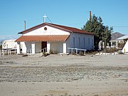 Saint Anne Catholic Church Mission


