Dollars Corner, Washington

Last updated

Dollars Corner, Washington
Clark County Washington Incorporated and Unincorporated areas Dollar Corner Highlighted.svg
Location of Dollars Corner, Washington
Coordinates: 45°46′44″N122°35′26″W / 45.77889°N 122.59056°W / 45.77889; -122.59056 [1]
CountryUnited States
State Washington
County Clark
Area
  Total3.9 sq mi (10.2 km2)
  Land3.9 sq mi (10.2 km2)
  Water0.0 sq mi (0.0 km2)
Elevation
220 ft (67 m)
Population
 (2020)
  Total1,246
  Density280/sq mi (108.1/km2)
Time zone UTC-8 (Pacific (PST))
  Summer (DST) UTC-7 (PDT)
ZIP code
98604 [2]
Area code 360
FIPS code 53-18195 [3]
GNIS feature ID1512155 [4]

Dollars Corner is a census-designated place (CDP) in Clark County, Washington, United States. The population was 1,246 at the 2020 census, [5] up from 1,108 at the 2010 census. [6]

Contents

History

In 1917, Mr. and Mrs. S. L. Dollar purchased a farm in what would later be named Dollars Corner. The couple reportedly exchanged $150 and two cows for the land. [7] They opened a small store and service station on one corner in 1924, which became a local landmark. One story claims that the name was coined by local sheriff's deputies, who would report to their superiors that they traveled "as far as Dollar's Corner." [8]

The landscape of Dollars Corner began to change drastically in 2012 as a result of the realignment of Washington State Route 502. Historical buildings situated directly on the corner were razed, with the exception of the former O'Brady's Drive-In restaurant, which became the center of a protracted compensation dispute. [9] [10]

Geography

Dollars Corner is located in west-central Clark County. The community is bordered to the northeast by Cherry Grove, to the east by the city of Battle Ground, to the southeast by Meadow Glade, and to the west by Duluth. Washington State Route 502 passes through the center of the community, leading east 3 miles (5 km) to the center of Battle Ground and west 3 miles (5 km) to Interstate 5's Exit 11. Dollars Corner is located around 15 miles (24 km) northeast of Vancouver, Washington.

According to the United States Census Bureau, the Dollars Corner CDP has a total area of 3.9 square miles (10.2 km2), all of it land. [6]

Demographics

Historical population
CensusPop.Note
2000 1,039
2010 1,1086.6%
2020 1,24612.5%

As of the census [3] of 2000, there were 1,039 people, 373 households, and 299 families residing in the CDP. The population density was 260.8 people per square mile (100.8/km2). There were 391 housing units at an average density of 98.1/sq mi (37.9/km2). The racial makeup of the CDP was 94.90% White, 1.06% African American, 0.77% Native American, 0.48% Asian, 0.87% from other races, and 1.92% from two or more races. Hispanic or Latino of any race were 2.89% of the population. 22.7% were of German, 13.4% Finnish, 12.0% Irish, 11.9% American, 8.0% English, 7.2% European and 6.1% Swedish ancestry according to Census 2000.

There were 373 households, out of which 30.0% had children under the age of 18 living with them, 68.4% were married couples living together, 7.8% had a female householder with no husband present, and 19.8% were non-families. 15.0% of all households were made up of individuals, and 5.9% had someone living alone who was 65 years of age or older. The average household size was 2.79 and the average family size was 3.09.

In the CDP, the age distribution of the population shows 26.8% under the age of 18, 5.8% from 18 to 24, 26.3% from 25 to 44, 28.3% from 45 to 64, and 12.9% who were 65 years of age or older. The median age was 40 years. For every 100 females, there were 102.5 males. For every 100 females age 18 and over, there were 100.8 males.

The median income for a household in the CDP was $56,875, and the median income for a family was $58,090. Males had a median income of $40,242 versus $27,569 for females. The per capita income for the CDP was $21,025. About 6.5% of families and 5.5% of the population were below the poverty line, including 7.4% of those under age 18 and 13.2% of those age 65 or over.

Related Research Articles

<span class="mw-page-title-main">New Washington, Indiana</span> CDP in Indiana, United States

New Washington is a census-designated place (CDP) in Clark County, Indiana, United States. As of the 2010 census, the population was 566.

<span class="mw-page-title-main">Myers Corner, New York</span> Census-designated place in New York, United States

Myers Corner is a hamlet and census-designated place (CDP) in the town of Wappinger, Dutchess County, New York, United States. The population was 6,790 at the 2010 census. It is part of the Poughkeepsie–Newburgh–Middletown, NY Metropolitan Statistical Area as well as the larger New York–Newark–Bridgeport, NY-NJ-CT-PA Combined Statistical Area.

Clark Mills is a hamlet in Oneida County, New York, United States. The population was 1,905 at the 2010 census.

<span class="mw-page-title-main">Shinnecock Hills, New York</span> Hamlet and census-designated place in New York, United States

Shinnecock Hills is a hamlet in Suffolk County, New York, United States. The population was 2,188 at the 2010 census. It is the home of a leading golf club, Shinnecock Hills Golf Club. Ownership of the area has been the subject of a 2005 lawsuit filed by the Shinnecock Indian Nation.

<span class="mw-page-title-main">Park Layne, Ohio</span> Census-designated place in Ohio, United States

Park Layne is a census-designated place (CDP) in Bethel Township, Clark County, Ohio, United States. The population of the CDP was 4,248 at the 2020 census. It is part of the Springfield, Ohio Metropolitan Statistical Area. Park Layne became a CDP in the 1980 United States Census.

<span class="mw-page-title-main">South Wenatchee, Washington</span> Census-designated place in Washington, United States

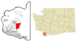
South Wenatchee is an unincorporated community and census-designated place (CDP) in Chelan County, Washington, United States. It is part of the Wenatchee–East Wenatchee Metropolitan Statistical Area. The population was 1,522 at the 2020 census.

<span class="mw-page-title-main">Barberton, Washington</span> Census-designated place in Washington, United States

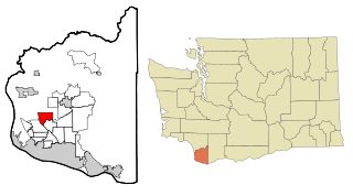
Barberton is a census-designated place (CDP) in Clark County, Washington, United States. The population was 8,567 at the 2020 census.

<span class="mw-page-title-main">Brush Prairie, Washington</span> Census-designated place in Washington, United States

Brush Prairie is a census-designated place (CDP) in Clark County, Washington, United States. The population was 2,738 at the 2020 census, up from 2,384 at the 2000 census.

<span class="mw-page-title-main">Cherry Grove, Washington</span> Census-designated place in Washington, United States

Cherry Grove is a census-designated place (CDP) in Clark County, Washington, United States. The population was 588 at the 2020 census.

<span class="mw-page-title-main">Five Corners, Washington</span> Census-designated place in Washington, United States

Five Corners is a census-designated place (CDP) in Clark County, Washington, United States. The population was 20,973 at the 2020 census.

<span class="mw-page-title-main">Hockinson, Washington</span> Census-designated place in Washington, United States

Hockinson is a census-designated place (CDP) in Clark County, Washington, United States. The population was 6,105 at the 2020 census.

<span class="mw-page-title-main">Lewisville, Washington</span> Census-designated place in Washington, United States

Lewisville is a census-designated place (CDP) in Clark County, Washington, United States. The population was 1,860 at the 2020 census.

<span class="mw-page-title-main">Meadow Glade, Washington</span> Census-designated place in Washington, United States

Meadow Glade is a census-designated place (CDP) in Clark County, Washington, United States. The population was 2,758 at the 2020 census.

<span class="mw-page-title-main">Mount Vista, Washington</span> Census-designated place in Washington, United States

Mount Vista is a census-designated place (CDP) in Clark County, Washington, United States. It includes the Vancouver campus of Washington State University. The population of Mount Vista was 10,051 at the 2020 census.

<span class="mw-page-title-main">Orchards, Washington</span> Census-designated place in Washington, United States

Orchards is a census-designated place (CDP) in Clark County, Washington, United States. The population was 27,729 at the 2020 census.

<span class="mw-page-title-main">Walnut Grove, Washington</span> Census-designated place in Washington, United States

Walnut Grove is a census-designated place (CDP) in Clark County, Washington, United States. The population was 9,790 at the 2010 census, up from 7,164 at the 2000 census.

<span class="mw-page-title-main">Grayland, Washington</span> CDP in Washington, United States

Grayland is a census-designated place (CDP) in Grays Harbor County, Washington, United States. The population was 953 at the 2010 census.

<span class="mw-page-title-main">Lakeland North, Washington</span> Census-designated place in Washington, United States

Lakeland North is a census-designated place (CDP) in King County, Washington, United States. The population was 13,663 at the 2020 census. Part of the community was annexed into neighboring Auburn in 2008.

<span class="mw-page-title-main">High Bridge, Washington</span> CDP in Washington, United States

High Bridge is a census-designated place (CDP) in Snohomish County, Washington, United States. The population was 3,140 at the 2020 census, up from 2,994 at the 2010 census. High Bridge includes the Echo Lake community and the former Echo Lake CDP, which was superseded by the larger High Bridge CDP in 2010.

Lynnwood-Pricedale is a census-designated place (CDP) in Fayette and Westmoreland counties in the Pennsylvania. The population was 2,031 at the 2010 census, down from 2,168 at the 2000 census. The community of Lynwood is located in Fayette County's Washington Township, while Pricedale is part of Westmoreland County's Rostraver Township.

References

  1. "US Gazetteer files: 2010, 2000, and 1990". United States Census Bureau. February 12, 2011. Retrieved April 23, 2011.
  2. "Dollars Corner WA ZIP Code". zipdatamaps.com. 2023. Retrieved June 16, 2023.
  3. 1 2 "U.S. Census website". United States Census Bureau . Retrieved January 31, 2008.
  4. "US Board on Geographic Names". United States Geological Survey. October 25, 2007. Retrieved January 31, 2008.
  5. "Census Bureau profile: Dollars Corner, Washington". United States Census Bureau. May 2023. Retrieved May 8, 2024.
  6. 1 2 "Geographic Identifiers: 2010 Demographic Profile Data (G001): Dollars Corner CDP, Washington". U.S. Census Bureau, American Factfinder. Retrieved August 28, 2015.[ dead link ]
  7. Vance, Ken (March 19, 2014). "Vern and Rene Dollar to celebrate 50th". The Reflector. Retrieved October 15, 2019.
  8. "Dollars Corner". Clark History. Retrieved October 15, 2019.
  9. Florip, Eric (July 13, 2013). "WSDOT delays Highway 502 project". The Columbian. Retrieved October 15, 2019.
  10. Case, Marvin (April 30, 2013). "O'Brady's issue still not settled". The Reflector. Retrieved October 15, 2019.