Orchards, Washington

Last updated

Orchards, Washington
Orchards Branch, Vancouver, Washington, United States Post Office, March 2020.jpg
Orchards Post Office
Clark County Washington Incorporated and Unincorporated areas Orchards Highlighted.svg
Location of Orchards, Washington
Coordinates: 45°41′2″N122°31′45″W / 45.68389°N 122.52917°W / 45.68389; -122.52917 [1]
CountryUnited States
State Washington
County Clark
Area
  Total5.4 sq mi (14.0 km2)
  Land5.4 sq mi (14.0 km2)
  Water0.0 sq mi (0.0 km2)
Elevation
226 ft (69 m)
Population
 (2020)
  Total27,729
  Density5,100/sq mi (2,000/km2)
Time zone UTC-8 (Pacific (PST))
  Summer (DST) UTC-7 (PDT)
ZIP code
98662
Area code 360
FIPS code 53-51795 [2]
GNIS feature ID1512536 [3]

Orchards is a census-designated place (CDP) in Clark County, Washington, United States. The population was 27,729 at the 2020 census. [4]

Contents

History

Orchards was originally known as Fourth Plain. Several theories exist as to the etymology of the name, but one account states that in 1846, Dugald McTavish, an employee of the Hudson's Bay Company, surveyed land near the fur trading post, Fort Vancouver. McTavish described four plains in the area of thick woods and officials at the trading post numbered the plains accordingly thus providing the name of the community. Wanting a more unique name, residents voted in 1904 to change the name to Orchards, after the many fruit trees in the area. [5]

Geography

Orchards is located in southern Clark County. The community is bordered to the northeast by Hockinson, to the north by Brush Prairie, to the west by Five Corners, and to the south by the city limits of Vancouver. The neighborhood of Sifton is in the southern part of the CDP.

According to the United States Census Bureau, the Orchards CDP has a total area of 5.4 square miles (14.0 km2), all of it land. [6]

Demographics

Historical population
CensusPop.Note
2000 17,852
2010 19,5569.5%
2020 27,72941.8%
Sources: [2] [6] [4]

As of the census [2] of 2000, there were 17,852 people, 5,918 households, and 4,704 families residing in the CDP. The population density was 2,601.4 people per square mile (1,004.8/km2). There were 6,175 housing units at an average density of 899.8/sq mi (347.5/km2). The racial makeup of the CDP was 87.39% White, 1.75% African American, 0.88% Native American, 4.11% Asian, 0.59% Pacific Islander, 1.84% from other races, and 3.44% from two or more races. Hispanic or Latino of any race were 4.53% of the population. 19.9% were of German, 9.3% Irish, 8.8% American and 6.6% English ancestry according to Census 2000.

There were 5,918 households, out of which 49.6% had children under the age of 18 living with them, 62.4% were married couples living together, 11.1% had a female householder with no husband present, and 20.5% were non-families. 14.3% of all households were made up of individuals, and 2.6% had someone living alone who was 65 years of age or older. The average household size was 3.02 and the average family size was 3.34.

In the CDP, the age distribution of the population shows 34.2% under the age of 18, 8.3% from 18 to 24, 36.9% from 25 to 44, 16.5% from 45 to 64, and 4.1% who were 65 years of age or older. The median age was 29 years. For every 100 females, there were 99.8 males. For every 100 females age 18 and over, there were 99.2 males.

The median income for a household in the CDP was $49,216, and the median income for a family was $50,330. Males had a median income of $37,716 versus $26,576 for females. The per capita income for the CDP was $17,866. About 4.6% of families and 6.7% of the population were below the poverty line, including 9.1% of those under the age of 18 and 6.9% of those age 65 or over.

Related Research Articles

<span class="mw-page-title-main">Sterling, Alaska</span> Census-designated place in Alaska, United States

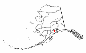
Sterling is a census-designated place (CDP) in Kenai Peninsula Borough, Alaska, United States. At the 2020 census the population was 5,918, up from 5,617 in 2010. Sterling is the tenth-most populated CDP in Alaska.

<span class="mw-page-title-main">Quartz Hill, California</span> Census-designated place in California, United States

Quartz Hill is a census-designated place (CDP) in Los Angeles County, California, United States. The population was 10,912 at the 2010 census, up from 9,890 at the 2000 census. The name is also shared with the neighboring district areas of its border cities, Palmdale, and Lancaster. Quartz Hill was once home to the Quartz Hill Airport. According to the Greater Antelope Valley Economic Alliance report of 2009, the Palmdale / Lancaster urban area of which Quartz Hill is a part, has a population of 483,998.

<span class="mw-page-title-main">Weatogue, Connecticut</span> Census-designated place in Connecticut, United States

Weatogue is a village and census-designated place in Simsbury, Hartford County, Connecticut. The population was 2,776 at the 2010 census.

<span class="mw-page-title-main">Fountainhead-Orchard Hills, Maryland</span> CDP in Maryland, United States

Fountainhead-Orchard Hills is a census-designated place (CDP) in Washington County, Maryland, United States. The population was 3,861 at the 2000 census.

<span class="mw-page-title-main">Orchard Homes, Montana</span> CDP in Montana, United States

Orchard Homes is a census-designated place (CDP) in Missoula County, Montana, United States. It is part of the Missoula Metropolitan Statistical Area. The population was 5,377 at the 2020 census.

Plain View is a census-designated place (CDP) in Sampson County, North Carolina, United States. The population was 1,923 at the 2020 census.

<span class="mw-page-title-main">White Plains, North Carolina</span> CDP in North Carolina, United States

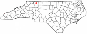
White Plains is a census-designated place (CDP) in Surry County, North Carolina, United States. The population was 1,049 at the 2000 census.

<span class="mw-page-title-main">Orchard Hills, Pennsylvania</span> Census-designated place in Pennsylvania, United States

Orchard Hills is a census-designated place (CDP) in Armstrong County, Pennsylvania, United States. The population was 1,949 at the 2020 census.

<span class="mw-page-title-main">Old Orchard, Pennsylvania</span> Place in Pennsylvania, United States

Old Orchard is a census-designated place (CDP) in Palmer Township in Northampton County, Pennsylvania, United States. As of the 2010 census, Old Orchard had a total population of 2,434. Old Orchard is part of the Lehigh Valley, which had a population of 861,899 and was the 68th-most populous metropolitan area in the U.S. as of the 2020 census.

<span class="mw-page-title-main">Green Valley, South Dakota</span> CDP in South Dakota, United States

Green Valley is a census-designated place (CDP) and unincorporated community in Pennington County, South Dakota, United States. The population was 1,051 at the 2020 census.

<span class="mw-page-title-main">Five Corners, Washington</span> Census-designated place in Washington, United States

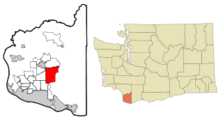
Five Corners is a census-designated place (CDP) in Clark County, Washington, United States. The population was 20,973 at the 2020 census.

<span class="mw-page-title-main">Hockinson, Washington</span> Census-designated place in Washington, United States

Hockinson is a census-designated place (CDP) in Clark County, Washington, United States. The population was 6,105 at the 2020 census.

<span class="mw-page-title-main">Mill Plain, Washington</span> Unincorporated community in Clark County, Washington

Mill Plain is an unincorporated area in Clark County, Washington, United States. At the 2000 census it was defined as a census-designated place (CDP) and had a population of 7,400. The area was not listed as a CDP for the 2010 census.

<span class="mw-page-title-main">East Port Orchard, Washington</span> CDP in Washington, United States

East Port Orchard is a census-designated place (CDP) in Kitsap County, Washington, United States. The population was 5,262 at the 2020 census.

<span class="mw-page-title-main">Elk Plain, Washington</span> CDP in Washington, United States

Elk Plain is a census-designated place (CDP) in Pierce County, Washington, United States. The population was 14,534 at the 2020 census.

<span class="mw-page-title-main">Otis Orchards-East Farms, Washington</span> CDP in Washington, United States

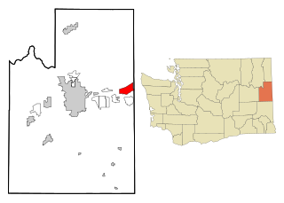
Otis Orchards-East Farms is a census-designated place (CDP) in Spokane County, Washington, United States, near the county's border with Idaho. The population was 6,299 at the 2020 census. The CDP includes the unincorporated communities of Otis Orchards and East Farms. Otis Orchards contains the bulk of the businesses of the community.

<span class="mw-page-title-main">Crab Orchard, West Virginia</span> Census-designated place in West Virginia, United States

Crab Orchard is a census-designated place (CDP) in Raleigh County, West Virginia, United States. The population was 2,678 at the 2010 census.

<span class="mw-page-title-main">Loveland Park, Ohio</span> Census-designated place in Ohio, United States

Loveland Park is a census-designated place (CDP) located in Symmes Township, Hamilton County and Deerfield Township, Warren County, in the southwestern part of the U.S. state of Ohio. The CDP is named after the city of Loveland. The population was 1,737 at the 2020 census.

<span class="mw-page-title-main">Walpole (CDP), Massachusetts</span> Census-designated place in Massachusetts, United States

Walpole is a small census-designated place (CDP) located within the much larger town of Walpole in Norfolk County, Massachusetts, United States. Walpole Town as it is called by the US Census Bureau, also includes a much larger population. The population of the Census Designated Place was 5,918 at the 2010 census.

<span class="mw-page-title-main">Pine Plains (CDP), New York</span> Census-designated place in New York, United States

Pine Plains is a hamlet and census-designated place (CDP) in Dutchess County, New York, United States. The population was 1,142 at the 2020 census. It is part of the Poughkeepsie–Newburgh–Middletown, NY Metropolitan Statistical Area as well as the larger New York–Newark–Bridgeport, NY-NJ-CT-PA Combined Statistical Area.

References

  1. "US Gazetteer files: 2010, 2000, and 1990". United States Census Bureau. February 12, 2011. Retrieved April 23, 2011.
  2. 1 2 3 "U.S. Census website". United States Census Bureau . Retrieved January 31, 2008.
  3. "US Board on Geographic Names". United States Geological Survey. October 25, 2007. Retrieved January 31, 2008.
  4. 1 2 "Census Bureau profile: Orchards, Washington". United States Census Bureau. May 2023. Retrieved May 8, 2024.
  5. "LIVING ON THE FOURTH PLAIN (1846)" . Retrieved March 26, 2019.
  6. 1 2 "Geographic Identifiers: 2010 Demographic Profile Data (G001): Orchards CDP, Washington". U.S. Census Bureau, American Factfinder. Retrieved September 8, 2015.[ dead link ]