Related Research Articles
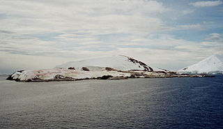
Petermann Island is a small, low and rounded island, lying off the northwest coast of Kiev Peninsula in Graham Land, Antarctica, a short distance south of Booth Island and the Lemaire Channel. It is a popular tourist destination.

The Deep Freeze Range is a rugged mountain range, over 128 km (80 mi) long and about 16 km (10 mi) wide, rising between Priestley and Campbell glaciers in Victoria Land, Antarctica, and extending from the edge of the polar plateau to Terra Nova Bay. Peaks in the low and mid portions of the range were observed by early British expeditions to the Ross Sea.
Terra Nova Bay is a bay which is often ice free, about 64 km (40 mi) long, lying between Cape Washington and the Drygalski Ice Tongue along the coast of Victoria Land, Antarctica. It was discovered by the British National Antarctic Expedition under Robert Falcon Scott, 1901–1904, and named by him after Terra Nova, one of the relief ships for the expedition. The Italian permanent Zucchelli Station is located in the bay, as is the Jang Bogo Station of South Korea.

Lillie Glacier is a large glacier in Antarctica, about 100 nautical miles (190 km) long and 10 nautical miles (19 km) wide. It lies between the Bowers Mountains on the west and the Concord Mountains and Anare Mountains on the east, flowing to Ob' Bay on the coast and forming the Lillie Glacier Tongue.
Cape Adare is a prominent cape of black basalt forming the northern tip of the Adare Peninsula and the north-easternmost extremity of Victoria Land, East Antarctica.
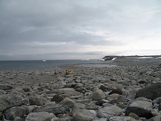
Inexpressible Island is a small, rocky island in Terra Nova Bay, Victoria Land, Antarctica.
Hut Point Peninsula is a long, narrow peninsula from 3 to 5 km wide and 24 km (15 mi) long, projecting south-west from the slopes of Mount Erebus on Ross Island, Antarctica. McMurdo Station (US) and Scott Base (NZ) are Antarctic research stations located on the Hut Point Peninsula.
The Humboldt Mountains are a group of mountains immediately west of the Petermann Ranges, forming the westernmost portion of the Wohlthat Mountains in Queen Maud Land, Antarctica.
Cape Evans is a rocky cape on the west side of Ross Island, Antarctica, forming the north side of the entrance to Erebus Bay.
Cape Royds is a dark rock cape forming the western extremity of Ross Island, facing on McMurdo Sound, Antarctica. It was discovered by the Discovery Expedition (1901–1904) and named for Lieutenant Charles Royds, Royal Navy, who acted as meteorologist on the expedition. Royds subsequently rose to become an Admiral and was later Commissioner of the Metropolitan Police, London. There is a hut at Cape Royds built and used by Ernest Shackleton and his team during their 1907–1909 expedition.
Cape Crozier is the most easterly point of Ross Island in Antarctica. It was discovered in 1841 during James Clark Ross's expedition of 1839 to 1843 with HMS Erebus and HMS Terror, and was named after Francis Crozier, captain of HMS Terror. The extinct volcano Mount Terror, also named during the Ross expedition, rises sharply from the Cape to a height of 3,230 m (10,600 ft), and the edge of the Ross Ice Shelf stretches away to its east.
Foyn Island, also known as Svend Foyn Island, is the second largest island in the Possession Islands, East Antarctica, lying 6 kilometres (4 mi) south-west of Possession Island. An Adélie penguin rookery covers much of the island, which is often included in the itinerary of Antarctic cruises.
Mount Betty is a small ridge overlooking the Ross Ice Shelf, on the north side of Bigend Saddle, at the north-eastern extremity of the Herbert Range in the Queen Maud Mountains of Antarctica. It was discovered in November 1911 by Captain Roald Amundsen, and named by him for Betty Andersson, nurse and housekeeper in the Amundsen family for many years.

Lambda Island is an island lying immediately north-west of Delta Island in the Melchior Islands, of the Palmer Archipelago in Antarctica. The island, the largest in the north-western part of the island group, was first roughly charted and named "Île Sourrieu" by the French Antarctic Expedition, 1903–05 under Jean-Baptiste Charcot, but that name has not survived in usage. The current name, derived from lambda, the 11th letter of the Greek alphabet, was given by Discovery Investigations personnel who roughly charted the island in 1927. The island was surveyed by Argentine expeditions in 1942, 1943 and 1948.

Port Charcot is a 3 km (1.9 mi) wide bay indenting the north shore of Booth Island, in the Wilhelm Archipelago of Antarctica. It was charted by the third French Antarctic expedition (1903–05), under Jean-Baptiste Charcot, and named by him for his father, Jean-Martin Charcot, French neurologist. Charcot established the expedition's winter base at Port Charcot in 1904.

Damoy Point is a headland 900 metres (980 yd) west-northwest of Flag Point, the northern entrance point to the harbour of Port Lockroy, on the western side of Wiencke Island in the Palmer Archipelago of Antarctica. It was discovered and named by the French Antarctic Expedition, 1903–05, under Jean-Baptiste Charcot.

Point Wild is a point 11 km (6.8 mi) west of Cape Valentine, 2 km (1.2 mi) east of Saddleback Point, and directly adjacent to the Furness Glacier on the north coast of Elephant Island, in the South Georgia Island of Antarctica. It was named Cape Wild by the Shackleton Endurance expedition 1914–16, but Point Wild is recommended for this feature because of its small size and to avoid confusion with Cape Wild on George V Coast.
Evans Cove is a cove in Terra Nova Bay, Victoria Land, entered between Inexpressible Island and Cape Russell. It was first charted by the British Antarctic Expedition, 1907–09, and was probably named by Ernest Shackleton for Captain Frederick Pryce Evans, master of the ship Koonya, which towed the Nimrod south in 1907, and later master of the Nimrod during the last year of the expedition.
Cape Geology is a low, gravel-covered point marking the western limit of Botany Bay, in the southern part of Granite Harbour, Victoria Land, Antarctica. It was charted and named by the Western Geological Party of the Terra Nova Expedition (1910–13) who established their base there.
Metchnikoff Point is a point forming the western extremity of Pasteur Peninsula in northern Brabant Island, in the Palmer Archipelago, Antarctica. It was first charted by the Third French Antarctic Expedition, 1903–05, and named by Jean-Baptiste Charcot for Russian-born zoologist and bacteriologist Élie Metchnikoff, who succeeded Louis Pasteur as the director of the Pasteur Institute in Paris.
References
- ↑ "Hells Gate Moraine". Geographic Names Information System . United States Geological Survey . Retrieved 2012-06-10.
- ↑ "List of Historic Sites and Monuments approved by the ATCM (2012)" (PDF). Antarctic Treaty Secretariat. 2012. Retrieved 2014-01-05.
![]() This article incorporates public domain material from the United States Geological Survey document: "Hells Gate Moraine".(content from the Geographic Names Information System )
This article incorporates public domain material from the United States Geological Survey document: "Hells Gate Moraine".(content from the Geographic Names Information System )
Coordinates: 74°52′S163°48′E / 74.867°S 163.800°E
| | This Scott Coast location article is a stub. You can help Wikipedia by expanding it. |