Ionia, Iowa

Last updated
Ionia, Iowa
Chickasaw County Iowa Incorporated and Unincorporated areas Ionia Highlighted.svg
Location of Ionia, Iowa
Coordinates: 43°2′4″N92°27′24″W / 43.03444°N 92.45667°W / 43.03444; -92.45667
Country Flag of the United States.svg  United States
State Flag of Iowa.svg  Iowa
County Chickasaw
Area
[1]
  Total0.56 sq mi (1.46 km2)
  Land0.56 sq mi (1.46 km2)
  Water0.00 sq mi (0.00 km2)
Elevation
1,148 ft (350 m)
Population
 (2020)
  Total226
  Density400.71/sq mi (154.73/km2)
Time zone UTC-6 (Central (CST))
  Summer (DST) UTC-5 (CDT)
ZIP code
50645
Area code 641
FIPS code 19-38460
GNIS feature ID0458609

Ionia is a city in Chickasaw County, Iowa, United States. The population was 226 at the time of the 2020 census. [2]

Contents

Geography

Ionia is located at 43°2′4″N92°27′24″W / 43.03444°N 92.45667°W / 43.03444; -92.45667 (43.034493, -92.456606). [3]

According to the United States Census Bureau, the city has a total area of 0.55 square miles (1.42 km2), all land. [4]

Demographics

Historical populations
YearPop.±%
1880 198    
1900 306+54.5%
1910 298−2.6%
1920 280−6.0%
1930 246−12.1%
1940 283+15.0%
1950 301+6.4%
1960 265−12.0%
1970 270+1.9%
1980 350+29.6%
1990 304−13.1%
2000 277−8.9%
2010 291+5.1%
2020 226−22.3%
Source: "U.S. Census website". United States Census Bureau . Retrieved 2020-03-29. and Iowa Data Center
Source:
U.S. Decennial Census [5] [2]

2010 census

As of the census [6] of 2010, there were 291 people, 119 households, and 74 families living in the city. The population density was 529.1 inhabitants per square mile (204.3/km2). There were 133 housing units at an average density of 241.8 per square mile (93.4/km2). The racial makeup of the city was 99.7% White and 0.3% from other races. Hispanic or Latino of any race were 0.7% of the population.

There were 119 households, of which 32.8% had children under the age of 18 living with them, 49.6% were married couples living together, 5.0% had a female householder with no husband present, 7.6% had a male householder with no wife present, and 37.8% were non-families. 32.8% of all households were made up of individuals, and 17.6% had someone living alone who was 65 years of age or older. The average household size was 2.45 and the average family size was 3.09.

The median age in the city was 36.8 years. 30.2% of residents were under the age of 18; 5.6% were between the ages of 18 and 24; 21.3% were from 25 to 44; 27.5% were from 45 to 64; and 15.5% were 65 years of age or older. The gender makeup of the city was 50.5% male and 49.5% female.

2000 census

As of the census [7] of 2000, there were 277 people, 115 households, and 73 families living in the city. The population density was 496.3 inhabitants per square mile (191.6/km2). There were 135 housing units at an average density of 241.9 per square mile (93.4/km2). The racial makeup of the city was 100.00% White. Hispanic or Latino of any race were 0.72% of the population.

There were 115 households, out of which 31.3% had children under the age of 18 living with them, 57.4% were married couples living together, 3.5% had a female householder with no husband present, and 36.5% were non-families. 32.2% of all households were made up of individuals, and 16.5% had someone living alone who was 65 years of age or older. The average household size was 2.41 and the average family size was 3.12.

In the city, the population was spread out, with 25.6% under the age of 18, 7.2% from 18 to 24, 29.2% from 25 to 44, 22.0% from 45 to 64, and 15.9% who were 65 years of age or older. The median age was 39 years. For every 100 females, there were 111.5 males. For every 100 females age 18 and over, there were 104.0 males.

The median income for a household in the city was $35,357, and the median income for a family was $40,625. Males had a median income of $28,750 versus $21,250 for females. The per capita income for the city was $17,355. None of the population or families were below the poverty line.

Education

It is within the New Hampton Community School District. [8]

Notable residents

Related Research Articles

<span class="mw-page-title-main">Decatur, Arkansas</span> City in Arkansas, United States

Decatur is a city, in Benton County, Arkansas, United States. The population was 1,773 at the 2020 census. It is part of the Northwest Arkansas region. This town is named after Commodore Stephen Decatur, Jr.

<span class="mw-page-title-main">Roopville, Georgia</span> Town in Georgia, United States

Roopville is a town in Carroll County, Georgia, United States. The population was 218 at the 2010 census.

<span class="mw-page-title-main">Rembrandt, Iowa</span> City in Iowa, United States

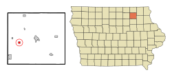
Rembrandt is a city in Buena Vista County, Iowa, United States. The population was 209 at the time of the 2020 census.

<span class="mw-page-title-main">McClelland, Iowa</span> City in Iowa, United States

McClelland is a city in Pottawattamie County, Iowa, United States. The city was founded in 1903 after the Great Western Railroad was extended to include Council Bluffs, IA. The population was 146 at the time of the 2020 census.

<span class="mw-page-title-main">Woodland Hills, Kentucky</span> City in Kentucky, United States

Woodland Hills is a home rule-class city in Jefferson County, Kentucky, United States. The population was 696 at the 2010 census.

Ionia Township is a civil township of Ionia County in the U.S. state of Michigan. The population was 3,669 at the 2000 census. The city of Ionia is mostly within the township, but is administratively autonomous.

<span class="mw-page-title-main">Lyons, Michigan</span> Village in Michigan, United States

Lyons is a village in Ionia County in the U.S. state of Michigan. The population was 789 at the 2010 census. Most of the village is within Lyons Township. A small portion extends west into Ionia Township.

Orange Township is a civil township of Ionia County in the U.S. state of Michigan. The population was 1,040 at the 2000 census.

<span class="mw-page-title-main">Erhard, Minnesota</span> City in Minnesota, United States

Erhard is a city in Otter Tail County, Minnesota, United States. The population was 132 at the 2020 census.

<span class="mw-page-title-main">Bella Villa, Missouri</span> City in Missouri, United States

Bella Villa is a city in St. Louis County, Missouri, in the United States. As of the 2010 census, the city population was 729.

<span class="mw-page-title-main">Pasadena Hills, Missouri</span> City in Missouri, United States

Pasadena Hills is a city in St. Louis County, Missouri, United States. The population was 930 at the 2010 census. The entire city is listed on the National Register of Historic Places.

<span class="mw-page-title-main">Newcastle, Nebraska</span> Village in Nebraska, United States

Newcastle is a village in Dixon County, Nebraska, United States. It is part of the Sioux City, IA–NE–SD Metropolitan Statistical Area. The population was 325 at the 2010 census.

<span class="mw-page-title-main">Clarkson Valley, Missouri</span> City in Missouri, United States

Clarkson Valley is a city in St. Louis County, Missouri, United States. The population was 2,609 at the 2020 census.

<span class="mw-page-title-main">Winfall, North Carolina</span> Town in North Carolina, United States

Winfall is a town in Perquimans County, North Carolina, United States. The population was 554 at the 2020 census. It is part of the Elizabeth City, North Carolina Micropolitan Statistical Area.

<span class="mw-page-title-main">Pick City, North Dakota</span> City in North Dakota, United States

Pick City is a town in Mercer County, North Dakota, United States. The population was 123 at the 2020 census. Pick City was founded in 1946 and named after Lewis A. Pick, director of the Missouri River office of the United States Army Corps of Engineers. It overlooks the Garrison Dam.

<span class="mw-page-title-main">Venedocia, Ohio</span> Village in Ohio, United States

Venedocia is a village in Van Wert County, Ohio, United States. The population was 124 at the 2010 census. It is included within the Van Wert, Ohio Micropolitan Statistical Area and the Lima-Van Wert-Wapakoneta, OH Combined Statistical Area.

<span class="mw-page-title-main">Macksburg, Ohio</span> Village in Ohio, United States

Macksburg is a village in Washington County, Ohio, United States, along the West Fork of Duck Creek. The population was 120 at the 2020 census. The village is about 28 miles (45 km) south of Cambridge, Ohio.

<span class="mw-page-title-main">Rocky Mound, Texas</span> Town in Texas, United States

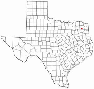
Rocky Mound is a town in Camp County, Texas, United States. The population was 75 at the 2010 census, down from 93 at the 2000 census; in 2020, its population increased to 78.

<span class="mw-page-title-main">Hubbardston, Michigan</span> Village in Michigan, United States

Hubbardston is a village in the U.S. state of Michigan. It is mostly in North Plains Township in Ionia County, and partially in Lebanon Township in Clinton County. Its population was 395 at the 2010 census.

<span class="mw-page-title-main">Ionia, Missouri</span> Village in Missouri, United States

Ionia is a village in northern Benton and southern Pettis counties in the U.S. state of Missouri. The population was 88 at the 2010 census.

References

  1. "2020 U.S. Gazetteer Files". United States Census Bureau. Retrieved March 16, 2022.
  2. 1 2 "2020 Census State Redistricting Data". census.gov. United states Census Bureau. Retrieved 12 August 2021.
  3. "US Gazetteer files: 2010, 2000, and 1990". United States Census Bureau. 2011-02-12. Retrieved 2011-04-23.
  4. "US Gazetteer files 2010". United States Census Bureau. Archived from the original on 2012-01-25. Retrieved 2012-05-11.
  5. "Census of Population and Housing". Census.gov. Retrieved June 4, 2015.
  6. "U.S. Census website". United States Census Bureau . Retrieved 2012-05-11.
  7. "U.S. Census website". United States Census Bureau . Retrieved 2008-01-31.
  8. "New Hampton" (PDF). Iowa Department of Education . Retrieved 2020-04-11.