Lawler, Iowa

Last updated
Lawler, Iowa
2009-0528-IA-Lawler.jpg
Veterans park in Lawler
Chickasaw County Iowa Incorporated and Unincorporated areas Lawler Highlighted.svg
Location of Lawler, Iowa
Coordinates: 43°4′10″N92°9′10″W / 43.06944°N 92.15278°W / 43.06944; -92.15278 Coordinates: 43°4′10″N92°9′10″W / 43.06944°N 92.15278°W / 43.06944; -92.15278
Country Flag of the United States.svg  United States
State Flag of Iowa.svg  Iowa
County Chickasaw
Area
[1]
  Total0.97 sq mi (2.50 km2)
  Land0.95 sq mi (2.47 km2)
  Water0.01 sq mi (0.03 km2)
Elevation
1,083 ft (330 m)
Population
 (2020)
  Total406
  Density425.13/sq mi (164.10/km2)
Time zone UTC-6 (Central (CST))
  Summer (DST) UTC-5 (CDT)
ZIP code
52154
Area code 563
FIPS code 19-43815
GNIS feature ID0458247

Lawler is a city in Chickasaw County, Iowa, United States. The population was 406 at the time of the 2020 census. [2]

Contents

History

Lawler was incorporated in 1871. It is named for John Lawler, an early settler who was instrumental in bringing the railroad to the settlement. [3]

Geography

According to the United States Census Bureau, the city has a total area of 0.89 square miles (2.31 km2), of which 0.88 square miles (2.28 km2) is land and 0.01 square miles (0.03 km2) is water. [4]

Demographics

Historical populations
YearPop.±%
1880 487    
1890 464−4.7%
1900 646+39.2%
1910 601−7.0%
1920 631+5.0%
1930 476−24.6%
1940 542+13.9%
1950 539−0.6%
1960 532−1.3%
1970 513−3.6%
1980 534+4.1%
1990 517−3.2%
2000 461−10.8%
2010 439−4.8%
2020 406−7.5%
Source: "U.S. Census website". United States Census Bureau . Retrieved 2020-03-29. and Iowa Data Center
Source:
U.S. Decennial Census [5] [2]

2010 census

As of the census [6] of 2010, there were 439 people, 200 households, and 127 families living in the city. The population density was 498.9 inhabitants per square mile (192.6/km2). There were 214 housing units at an average density of 243.2 per square mile (93.9/km2). The racial makeup of the city was 92.7% White, 0.2% African American, 6.8% from other races, and 0.2% from two or more races. Hispanic or Latino of any race were 8.9% of the population.

There were 200 households, of which 24.5% had children under the age of 18 living with them, 52.0% were married couples living together, 8.5% had a female householder with no husband present, 3.0% had a male householder with no wife present, and 36.5% were non-families. 33.5% of all households were made up of individuals, and 18% had someone living alone who was 65 years of age or older. The average household size was 2.20 and the average family size was 2.77.

The median age in the city was 44.3 years. 20.5% of residents were under the age of 18; 8.5% were between the ages of 18 and 24; 21.9% were from 25 to 44; 27.4% were from 45 to 64; and 21.9% were 65 years of age or older. The gender makeup of the city was 49.0% male and 51.0% female.

2000 census

As of the census [7] of 2000, there were 461 people, 202 households, and 134 families living in the city. The population density was 517.1 inhabitants per square mile (199.7/km2). There were 217 housing units at an average density of 243.4 per square mile (94.0/km2). The racial makeup of the city was 99.13% White, and 0.87% from two or more races. Hispanic or Latino of any race were 0.65% of the population.

There were 202 households, out of which 24.8% had children under the age of 18 living with them, 57.4% were married couples living together, 6.9% had a female householder with no husband present, and 33.2% were non-families. 31.7% of all households were made up of individuals, and 17.8% had someone living alone who was 65 years of age or older. The average household size was 2.28 and the average family size was 2.83.

Age spread: 23.6% under the age of 18, 6.7% from 18 to 24, 22.6% from 25 to 44, 25.2% from 45 to 64, and 21.9% who were 65 years of age or older. The median age was 44 years. For every 100 females, there were 92.1 males. For every 100 females age 18 and over, there were 87.2 males.

The median income for a household in the city was $30,500, and the median income for a family was $36,875. Males had a median income of $31,429 versus $21,029 for females. The per capita income for the city was $21,268. About 10.5% of families and 16.3% of the population were below the poverty line, including 23.3% of those under age 18 and 19.0% of those age 65 or over.

Education

The municipality is within the Turkey Valley Community School District. [8]

Related Research Articles

<span class="mw-page-title-main">Rembrandt, Iowa</span> City in Iowa, United States

Rembrandt is a city in Buena Vista County, Iowa, United States. The population was 209 at the time of the 2020 census.

<span class="mw-page-title-main">Little Sioux, Iowa</span> City in Iowa, United States

Little Sioux is a city in Harrison County, Iowa, United States. The population was 166 at the time of the 2020 census. The city is most known for Little Sioux Scout Ranch of the Boy Scouts of America.

<span class="mw-page-title-main">Webster, Iowa</span> City in Iowa, United States

Webster is a city in Keokuk County, Iowa, United States. The population was 94 at the time of the 2020 census.

<span class="mw-page-title-main">Minden, Iowa</span> City in Iowa, United States

Minden is a city in Pottawattamie County, Iowa, United States. The population was 600 at the time of the 2020 census. It has possessed a post office since 1875.

<span class="mw-page-title-main">Dixon, Iowa</span> City in Iowa, USA

Dixon is a city in Scott County, Iowa, United States. The population was 202 at the time of the 2020 census.

<span class="mw-page-title-main">Jackson Junction, Iowa</span> City in Iowa, United States

Jackson Junction is a city in Winneshiek County, Iowa, United States. The population was 37 at the time of the 2020 census.

<span class="mw-page-title-main">Woodland Hills, Kentucky</span> City in Kentucky, United States

Woodland Hills is a home rule-class city in Jefferson County, Kentucky, United States. The population was 696 at the 2010 census.

<span class="mw-page-title-main">Lilydale, Minnesota</span> City in Minnesota, United States

Lilydale is a city in Dakota County, Minnesota, United States. The population was 623 at the 2010 census.

<span class="mw-page-title-main">Squaw Lake, Minnesota</span> City in Minnesota, United States

Squaw Lake is a city in Itasca County, Minnesota, United States. The population was 107 at the 2010 census.

<span class="mw-page-title-main">Lake Bronson, Minnesota</span> City in Minnesota, United States

Lake Bronson is a city in Kittson County, Minnesota, United States. The population was 178 at the 2020 census. Lake Bronson State Park is nearby.

<span class="mw-page-title-main">Erhard, Minnesota</span> City in Minnesota, United States

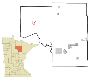
Erhard is a city in Otter Tail County, Minnesota, United States. The population was 132 at the 2020 census.

<span class="mw-page-title-main">Leonidas, Minnesota</span> City in Minnesota, United States

Leonidas is a city in Saint Louis County, Minnesota, United States. The population was 52 at the 2010 census.

<span class="mw-page-title-main">St. Rosa, Minnesota</span> City in Minnesota, United States

Saint Rosa is a city in Stearns County, Minnesota, United States. The population was 68 at the 2010 census. It is part of the St. Cloud Metropolitan Statistical Area.

<span class="mw-page-title-main">Fifty Lakes, Minnesota</span> City in Minnesota, United States

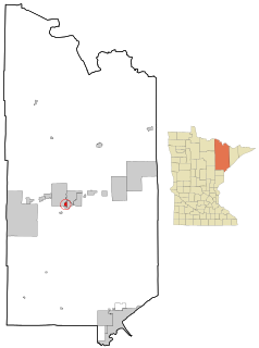
Fifty Lakes is a city in Crow Wing County, Minnesota, United States. The population was 387 at the 2010 census. It is part of the Brainerd Micropolitan Statistical Area.

<span class="mw-page-title-main">Clarkson Valley, Missouri</span> City in Missouri, United States

Clarkson Valley is a city in St. Louis County, Missouri, United States. The population was 2,609 at the 2020 census.

<span class="mw-page-title-main">Kramer, North Dakota</span> City in North Dakota, United States

Kramer is a city in Bottineau County, North Dakota, United States. The population was 24 at the 2020 census. Kramer was founded in 1905.

<span class="mw-page-title-main">North River, North Dakota</span> City in North Dakota, United States

North River is a city in Cass County, North Dakota, United States. The population was 55 at the 2020 census. North River was founded in 1973. It is a suburb/bedroom community directly adjacent to the city of Fargo.

<span class="mw-page-title-main">Follansbee, West Virginia</span> City in West Virginia, United States

Follansbee is a city in Brooke County, West Virginia, United States, located along the Ohio River. It is a part of the Weirton–Steubenville metropolitan area. The population was 2,853 at the 2020 census, a decrease from 2,986 at the 2010 census.

<span class="mw-page-title-main">Stonewood, West Virginia</span> City in West Virginia, United States

Stonewood is a city in Harrison County, West Virginia, United States. The population was 1,810 at the 2020 census.

<span class="mw-page-title-main">Pennsboro, West Virginia</span> City in West Virginia, United States

Pennsboro is a city in Ritchie County, West Virginia, United States. The population was 1,050 at the 2020 census. The city is located at the junction of U.S. Route 50 and West Virginia Route 74; the North Bend Rail Trail also passes through the city.

References

  1. "2020 U.S. Gazetteer Files". United States Census Bureau. Retrieved March 16, 2022.
  2. 1 2 "2020 Census State Redistricting Data". census.gov. United states Census Bureau. Retrieved 12 August 2021.
  3. Fairbairn, Robert Herd (1919). History of Chickasaw and Howard Counties, Iowa, Volume 1. S. J. Clarke Publishing Company. p. 292.
  4. "US Gazetteer files 2010". United States Census Bureau. Archived from the original on 2012-07-02. Retrieved 2012-05-11.
  5. "Census of Population and Housing". Census.gov. Retrieved June 4, 2015.
  6. "U.S. Census website". United States Census Bureau . Retrieved 2012-05-11.
  7. "U.S. Census website". United States Census Bureau . Retrieved 2008-01-31.
  8. "Turkey Valley" (PDF). Iowa Department of Education . Retrieved 2020-04-06.