
Chickasaw County is a county located in the U.S. state of Iowa. As of the 2020 census, the population was 12,012. Its county seat is New Hampton. The county was named for the southern Indian Nation whose chief was Bradford.
Duncan is a census-designated place (CDP) in Hancock County, Iowa, United States. The population was 131 at the 2010 census.

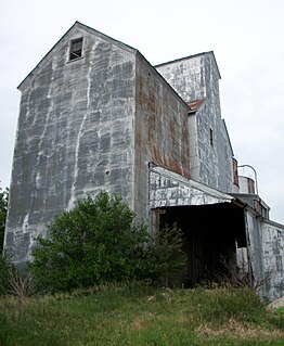
Deerfield Township is one of twelve townships in Chickasaw County, Iowa, USA. As of the 2000 census, its population was 417.

Niles Township is one of twelve townships in Floyd County, Iowa, USA. As of the 2000 census, its population was 533.

Saint Charles Township is one of twelve townships in Floyd County, Iowa, USA. As of the 2000 census, its population was 1,346.
Hale is an unincorporated community in Jones County, Iowa, United States. Hale is north of the Wapsipinicon River, east of Olin, and west of Oxford Junction.
Sexton is an unincorporated community and census-designated place in Irvington Township, Kossuth County, Iowa, United States. It is located at the intersection of U.S. Route 18 and Kossuth CR P60. As of the 2010 census it had a population of 37.

California Junction is an unincorporated community and census-designated place (CDP) in Harrison County, Iowa, United States. It lies just east of the junction between the east-west and north-south lines of the former Sioux City and Pacific Railroad. In the 2010 census it had a population of 85 inhabitants and a population density of 184.38 people per square mile (71.19/km2).
Folletts is an unincorporated community in Clinton County, Iowa, United States. It is located at the intersections of 292nd Street and County Highway Z36 on the north bank of the Wapsipinicon River. It is one mile west of Shaffton and three miles east of McCausland, at 41.750099N, -90.354990W.
Bangor is an unincorporated community in Marshall County, Iowa, United States. It is located at the intersections of County Highway E18 and S62, five miles southwest of Liscomb and six miles south of Union. It is located near the west bank of the Iowa River, at 42.172838N, -93.089073W.
Arbor Hill is an unincorporated community or ghost town in Adair County, Iowa, United States.
Bradford is an unincorporated community in Chickasaw County, Iowa, United States.
Irvington is an unincorporated community and census-designated place (CDP) in Irvington Township, Kossuth County, Iowa, United States. As of the 2010 census it had a population of 38.
Boyd is an unincorporated community in southeastern New Hampton Township in Chickasaw County, in the U.S. state of Iowa.
Thorpe is an unincorporated community in Honey Creek Township, Delaware County, Iowa, United States.
Nansen was an unincorporated community in Chickasaw County, Iowa, United States. It was at the junction of 170th Street and Pembroke Avenue.
Little Turkey is an unincorporated community in eastern Chickasaw County, in the U.S. state of Iowa.
Republic is an unincorporated community in southern Chickasaw County, in the U.S. state of Iowa.
Jerico is an unincorporated community in Chickasaw County, in the U.S. state of Iowa.
Saude is an unincorporated community in northern Chickasaw County, in the U.S. state of Iowa.


