Little Turkey, Iowa

Last updated
Little Turkey, Iowa
USA Iowa location map.svg
Red pog.svg
Little Turkey, Iowa
Coordinates: 43°07′47″N92°06′04″W / 43.12972°N 92.10111°W / 43.12972; -92.10111 Coordinates: 43°07′47″N92°06′04″W / 43.12972°N 92.10111°W / 43.12972; -92.10111
Country United States
State Iowa
County Chickasaw
Elevation
1,102 ft (336 m)
Time zone UTC-6 (Central (CST))
  Summer (DST) UTC-5 (CDT)
Area code 641
GNIS feature ID464624 [1]

Little Turkey is an unincorporated community in eastern Chickasaw County, in the U.S. state of Iowa. [1]

Contents

Geography

Little Turkey is near the Little Turkey River, at 43°07′47″N92°06′04″W / 43.12972°N 92.10111°W / 43.12972; -92.10111 , [1] near the junctions of County Roads V62 and B33.

History

Little Turkey in Chickasaw County, Iowa, in 1903 Chickasaw County Iowa 1903.png
Little Turkey in Chickasaw County, Iowa, in 1903

A post office was established at Little Turkey in 1866; this post office closed in 1871, reopened in 1890, and closed again in 1904. [2]

Little Turkey became what historian Robert Herd Fairbairn called "quite a prosperous and promising little village" with a dance hall, school, church, blacksmith shop, creamery, and general store. [3]

Little Turkey's church was originally a Methodist place of worship, but in 1903 it became Assumption of the Blessed Mary Parish Church (St. Mary's) of Little Turkey. This church has an oratory status today. [4]

By about 1919, Little Turkey's business was in decline, with Robert Fairbairn writing, "Little Turkey has taken its flight," remarking on the loss of businesses. Of Little Turkey, Fairbairn stated that only the creamery remained. [3]

Little Turkey's population was 21 in 1902, [5] and was 25 in 1925. [6]

Students of Little Turkey attended Utica Township School #7 until 1930. [4]

Little Turkey's population was 25 in 1940. [7]

See also

Related Research Articles

Florenceville is an unincorporated community located in Howard County, Iowa, United States. It is adjacent to the village of Granger, Minnesota.

<span class="mw-page-title-main">Bradford Township, Chickasaw County, Iowa</span> Township in Iowa, United States

Bradford Township is one of twelve townships in Chickasaw County, Iowa, USA. As of the 2000 census, its population was 2,140.

<span class="mw-page-title-main">Fredericksburg Township, Chickasaw County, Iowa</span> Township in Iowa, United States

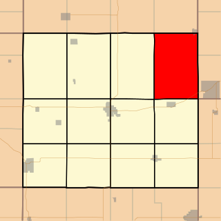
Fredericksburg Township is one of twelve townships in Chickasaw County, Iowa, USA. As of the 2000 census, its population was 982.

<span class="mw-page-title-main">Richland Township, Chickasaw County, Iowa</span> Township in Iowa, United States

Richland Township is one of twelve townships in Chickasaw County, Iowa, USA. As of the 2000 census, its population was 369.

<span class="mw-page-title-main">Utica Township, Chickasaw County, Iowa</span> Township in Iowa, United States

Utica Township is one of twelve townships in Chickasaw County, Iowa, USA. As of the 2000 census, its population was 525.

Deerfield is an unincorporated community in Chickasaw County, Iowa, United States. It is located near the intersections of County Highways B28 and T76 on the east side of the Wapsipinicon River. It is five miles east of Colwell and four miles northwest of North Washington, at 43.162975N, -92.495651W.

Zaneta is an unincorporated community in Grundy County, Iowa, United States.

Arbor Hill is an unincorporated community or ghost town in Adair County, Iowa, United States.

Avon is an unincorporated community in Polk County, Iowa, United States.

Bradford is an unincorporated community in Chickasaw County, Iowa, United States.

Dunbar is an unincorporated community and former railroad depot village in Green Castle Township, Marshall County, Iowa, United States.

Boyd is an unincorporated community in southeastern New Hampton Township in Chickasaw County, in the U.S. state of Iowa.

Fern is an unincorporated community located in the thirty-second section of Beaver Township, Grundy County, Iowa. As of February 2022 it has 14 inhabited houses.

Utica is an unincorporated community in Van Buren County, in the U.S. state of Iowa. The community is at the junction of County Road W-30 and Iowa Highway 16.

<span class="mw-page-title-main">David, Iowa</span> Unincorporated community in Iowa, United States

David was an unincorporated community in Mitchell County, Iowa, United States. The site lies near the junction of Shadow Avenue and 440th Street, 3.5 miles northeast of Little Cedar and four miles southwest of McIntire.

Republic is an unincorporated community in southern Chickasaw County, in the U.S. state of Iowa.

Jacobs was an unincorporated community in Poweshiek County, in the U.S. state of Iowa.

Jerico is an unincorporated community in Chickasaw County, in the U.S. state of Iowa.

Saude is an unincorporated community in northern Chickasaw County, in the U.S. state of Iowa.

Benson was an unincorporated community in Black Hawk County, in the U.S. state of Iowa.

References

  1. 1 2 3 U.S. Geological Survey Geographic Names Information System: Little Turkey, Iowa
  2. "GNIS Detail - Little Turkey Post Office (historical)". geonames.usgs.gov. Retrieved 2021-07-31.
  3. 1 2 Fairbairn, Robert Herd (1919). "History of Chickasaw and Howard Counties, Iowa". S.J. Clarke Publishing Company. p. 244. Retrieved 2021-07-31.
  4. 1 2 "Town of Little Turkey, Utica Township - Chickasaw County IAGenWeb". iagenweb.org. Retrieved 2021-07-31.
  5. Cram's Modern Atlas: The New Unrivaled New Census Edition. J. R. Gray & Company. 1902. pp. 203–207.
  6. Company, Rand McNally and (1925). Premier Atlas of the World: Containing Maps of All Countries of the World, with the Most Recent Boundary Decisions, and Maps of All the States,territories, and Possessions of the United States with Population Figures from the Latest Official Census Reports, Also Data of Interest Concerning International and Domestic Political Questions. Rand McNally & Company. p. 190.
  7. The Attorneys List. United States Fidelity and Guaranty Company, Attorney List Department. 1940. p. 304.