
Pokagon State Park is an Indiana state park in the northeastern part of the state, near the village of Fremont and 5 miles (8 km) north of Angola. It was named for the 19th-century Potawatomi chief, Leopold Pokagon, and his widely known son, Simon Pokagon, at Richard Lieber's suggestion. The 1,260-acre (5.1 km2) park has an inn, camping facilities, and a staff of full-time naturalists.

Lahontan State Recreation Area is a public recreation area surrounding Lake Lahontan, a 17-mile-long (27 km) impoundment of the Carson River, located approximately 18 miles (29 km) west of Fallon, Nevada. The reservoir features 69 miles (111 km) of shoreline and 11,200 acres (4,500 ha) of water when full. Much of the park lies below 4,000 feet (1,200 m) in elevation and is dominated by high desert sagebrush. Wooded areas of native cottonwoods and willow trees can be found along the shore of the lake. Primary access points to the park are along U.S. Route 50 near the Lahontan Dam and off U.S. Route 95 in the town of Silver Springs. A corridor known as Carson River Ranches connects Lahontan with Fort Churchill State Historic Park.

Seneca Creek State Park is a public recreation area encompassing more than 6,300 acres (2,500 ha) along 14 miles of Seneca Creek in its run to the Potomac River in Montgomery County, Maryland. The park features facilities for boating and fishing as well as trails for hiking, cycling, and horseback riding. It is managed by the Maryland Department of Natural Resources.
The Kettle Moraine State Forest is a state forest in southeastern Wisconsin. The chief feature of the reserve is the Kettle Moraine, a highly glaciated area. The area contains very hilly terrain and glacial landforms, such as kettles, kames and eskers. The 56,000-acre (23,000 ha) forest is divided into two large and three small units, which are spread across a hundred miles.
French Creek State Park is a 7,526-acre (3,046 ha) Pennsylvania state park in North Coventry and Warwick Townships in Chester County and Robeson and Union Townships in Berks County, Pennsylvania in the United States. It straddles northern Chester County and southern Berks County along French Creek. It is located in the Hopewell Big Woods. The park is the home of two lakes: Hopewell Lake, a 68-acre (28 ha) warm water lake, and Scotts Run Lake, a 22-acre (8.9 ha) cold water lake. The state record smallmouth bass was caught in Scotts Run Lake. There are extensive forests, and almost 40 miles (64 km) of hiking and equestrian trails. The park is also friendly to mountain bikers, having some renowned technical trails. Hopewell Furnace National Historic Site, which features a cold blast furnace restored to its 1830s appearance, is surrounded by the park. The Six Penny Day Use Area and Group Camp are listed on the National Register of Historic Places. French Creek State Park is located off of Pennsylvania Route 345 to the south of Birdsboro.
Ryerson Station State Park is a 1,164-acre (471 ha) Pennsylvania state park in Richhill Township, Greene County, Pennsylvania in the United States. It was previously home to Ronald J. Duke Lake, a 52-acre (21 ha) artificial lake on the North Fork of the Dunkard Fork of Wheeling Creek, that was constructed in 1960, but drained in 2005 due to structural concerns about the dam. Ryerson Station State Park is 3 miles (5 km) from Wind Ridge just off Pennsylvania Route 21 very close to the West Virginia state line.

The Mid Iowa Council is a council of the Boy Scouts of America that serves all Scouts, adult volunteers and Venturers in Central Iowa. This includes the area of the state capital, Des Moines.

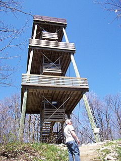
Backbone State Park is Iowa's oldest state park, dedicated in 1919. Located in the valley of the Maquoketa River, it is approximately three miles (5 km) south of Strawberry Point in Delaware County. It is named for a narrow and steep ridge of bedrock carved by a loop of the Maquoketa River originally known as the Devil's Backbone. The initial 1,200 acres (490 ha) were donated by E.M. Carr of Lamont, Iowa. Backbone Lake Dam, a relatively low dam built by the Civilian Conservation Corps (CCC) in the 1930s, created Backbone Lake. The CCC constructed a majority of trails and buildings which make up the park.

Wind Creek State Park is a publicly owned recreation area located 7 miles (11 km) south of Alexander City, Alabama, on the western side of Lake Martin, a 41,000-acre (17,000 ha) reservoir on the Tallapoosa River. The state park occupies 1,445 acres (585 ha) and is managed by the Alabama Department of Conservation and Natural Resources.

Pinckney State Recreation Area is a Michigan state recreation area in Dexter, Sylvan and Lyndon Townships, Washtenaw County and Putnam and Unadilla Townships, Livingston County in the U.S. state of Michigan. The park is 11,000 acres (4,500 ha) and sits at an elevation of 922 feet (281 m). The park is connected to the nearby Waterloo State Recreation Area by the 35-mile (56 km) Waterloo–Pinckney Trail. Pinckney State Recreation Area is open for year-round recreation including hiking, fishing, swimming, hunting and a variety of winter sports.

Waterloo State Recreation Area is the third-largest park in Michigan, encompassing over 21,000 acres (85 km2) of forest, lakes and wetlands. Located in northeast Jackson County and parts of Washtenaw County, the park is the largest in the Lower Peninsula of Michigan and features 4 campgrounds, 11 lakes, a nature center, and over 50 miles (80 km) of trails - some for horses, bicycles, hiking and cross-country skiing. Waterloo SRA includes the Black Spruce Bog Natural Area, a National Natural Landmark and borders the 11,000-acre (45 km2) Pinckney Recreation Area on the east and the 950-acre (3.8 km2) Phyllis Haehnle Memorial Audubon Sanctuary to the west. The land preserved by the park is not all contiguous and numerous private landholdings and roads run through the park area. The area is characterized by moraines, kettle lakes, swamps and bogs left by retreating glaciers after the last ice age. The park was created by the federal government during the Great Depression and is long-term leased to the state.

Greenbrier State Park is a public recreation area located on South Mountain, three miles (4.8 km) northeast of Boonsboro in Washington County, Maryland, USA. The state park has camping, hiking trails, and a 42-acre (17 ha) man-made lake. It is managed by the Maryland Department of Natural Resources.

Wapello was a Native American chief of the Meskwaki tribe.

Lake Wister State Park is a 3,428-acre (13.87 km2) Oklahoma state park located in Le Flore County, Oklahoma. It is located near the city of Wister, Oklahoma.
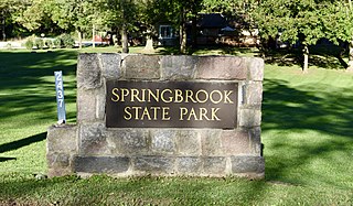
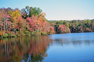
Springbrook State Park is a state park of Iowa, USA, located approximately 5 miles (8.0 km) west of the city of Yale. The park contains a 17-acre (6.9 ha) spring-fed lake and timber-covered rolling hills along the Middle Raccoon River.

Deam Lake State Recreation Area is an Indiana State Recreation Area in Clark County, Indiana in the United States. The park is 1,300 acres (530 ha) and sits at an elevation of 535 feet (163 m). Deam Lake State Recreation area is open for year-round recreation, however the campground closes each year from the Sunday before Thanksgiving to March 1 of the following year. Much of the recreation is centered on Deam Lake. It is named for Charles C. Deam, the first state forester of Indiana.

Gull Point State Park is a state park of Iowa, United States, located on West Okoboji Lake in the city of Wahpeton. It is the primary state park unit in the Iowa Great Lakes region. Two areas of the park were listed as nationally recognized historic districts on the National Register of Historic Places in 1990.

Lake Ahquabi State Park is a state park of Iowa, US, featuring a 115-acre (47 ha) reservoir. Ahquabi means "resting place" in the Fox language. The park is 6 miles (9.7 km) south of Indianola and 22 miles (35 km) south of Des Moines. Three section of the park were listed on the National Register of Historic Places in 1991.
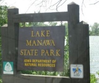
Lake Manawa State Park is located in Council Bluffs, Iowa. It is based around Lake Manawa, a man-made lake created to relieve water from the Missouri River and is located in southwest Council Bluffs.
Lake Wapello is a natural lake in the U.S. state of Iowa, 7 miles (11 km) west of the town of Drakesville. The lake is entirely contained in Lake Wapello State Park, which promotes recreational use of the lake. The lake is named for Chief Wapello of the Meskwaki tribe.

