Low Moor, Virginia

Last updated
Low Moor, Virginia
VAMap-doton-LowMoor.PNG
Location of Low Moor, Virginia
Coordinates: 37°47′32″N79°52′36″W / 37.79222°N 79.87667°W / 37.79222; -79.87667 Coordinates: 37°47′32″N79°52′36″W / 37.79222°N 79.87667°W / 37.79222; -79.87667
CountryUnited States
State Virginia
County Alleghany
Area
  Total0.8 sq mi (2.2 km2)
  Land0.8 sq mi (2.1 km2)
  Water0.0 sq mi (0.0 km2)
Elevation
1,122 ft (342 m)
Population
 (2010)
  Total258
  Density320/sq mi (120/km2)
Time zone UTC−5 (Eastern (EST))
  Summer (DST) UTC−4 (EDT)
ZIP code
24457
Area code 540
FIPS code 51-47352 [1]
GNIS feature ID1493232 [2]

Low Moor is a census-designated place (CDP) in Alleghany County, Virginia. The population was 258 at the 2010 census.

Contents

History

Low Moor was the birthplace of World War II Medal of Honor recipient Jimmie Monteith, for whom Camp Monteith, located in Kosovo, was named.

It is also home to Alleghany Regional Hospital.

Geography

Low Moor is located at 37°47′32″N79°52′36″W / 37.79222°N 79.87667°W / 37.79222; -79.87667 (37.792094, 79.876604), [3] off of Interstate 64, between Covington and Clifton Forge.

According to the United States Census Bureau, the CDP has a total area of 0.8 square miles (2.1 km2), of which, 0.8 square miles (2.1 km2) of it is land and 0.04 square miles (0.1 km2) of it (2.41%) is water.

Demographics

As of the census [1] of 2000, there were 367 people, 150 households, and 106 families residing in the CDP. The population density was 450.4 people per square mile (174.9/km2). There were 161 housing units at an average density of 197.6/sq mi (76.7/km2). The racial makeup of the CDP was 95.64% White, 3.81% African American, 0.27% Native American, and 0.27% from two or more races.

There were 150 households, out of which 28.7% had children under the age of 18 living with them, 52.0% were married couples living together, 12.7% had a female householder with no husband present, and 29.3% were non-families. 26.0% of all households were made up of individuals, and 16.7% had someone living alone who was 65 years of age or older. The average household size was 2.45 and the average family size was 2.91.

In the CDP, the population was spread out, with 22.1% under the age of 18, 4.9% from 18 to 24, 30.2% from 25 to 44, 24.8% from 45 to 64, and 18.0% who were 65 years of age or older. The median age was 41 years. For every 100 females, there were 103.9 males. For every 100 females age 18 and over, there were 84.5 males.

The median income for a household in the CDP was $40,083, and the median income for a family was $41,406. Males had a median income of $29,531 versus $31,750 for females. The per capita income for the CDP was $18,982. About 6.6% of families and 8.8% of the population were below the poverty line, including none of those under age 18 and 15.5% of those age 65 or over.

Related Research Articles

<span class="mw-page-title-main">Alleghany County, Virginia</span> County in Virginia, United States

Alleghany County is an American county located on the far western edge of Commonwealth of Virginia. It is bordered by the Allegheny Mountains, from which the county derives its name, and it is the northernmost part of the Roanoke Region. The county seat is Covington. As of the 2020 census, the population was 15,223.

<span class="mw-page-title-main">Pittsfield Township, Warren County, Pennsylvania</span> Township in Pennsylvania, United States

Pittsfield Township is a township in Warren County, Pennsylvania, United States. The population was 1,288 at the 2020 census, down from 1,405 at the 2010 census. 1,519 at the 2000 census.

<span class="mw-page-title-main">Parkville, Pennsylvania</span> CDP in Pennsylvania, United States

Parkville is a census-designated place (CDP) in York County, Pennsylvania, United States. The population was 6,706 at the 2010 census.

<span class="mw-page-title-main">Lyford South, Texas</span> Unincorporated community in Texas, United States

Lyford South is an unincorporated community in Willacy County, Texas, United States. It was formerly classified as a census-designated place (CDP). The population was 172 at the 2000 census.

<span class="mw-page-title-main">Iron Gate, Virginia</span> Town in Virginia, United States

Iron Gate is a town in Alleghany County, Virginia, United States. The population was 388 at the 2010 census.

<span class="mw-page-title-main">Selma, Virginia</span> CDP in Virginia, United States

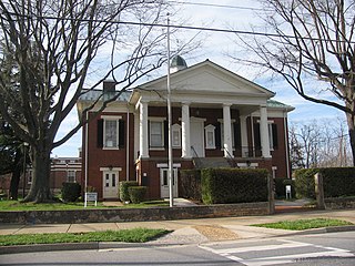
Selma is a census-designated place (CDP) in Alleghany County, Virginia, United States. The population was 529 at the 2010 census.

Cloverdale is a census-designated place (CDP) in Botetourt County, Virginia, United States. The population was 3,410 at the 2020 census, which was an increase from the 3,119 reported in 2010. It is part of the Roanoke Metropolitan Statistical Area.

Daleville is a census-designated place (CDP) in Botetourt County, Virginia, United States. The population was 2,557 as of the 2010 census, an increase of over 75% from the 2000 census, when the population was 1,454. It is part of the Roanoke Metropolitan Statistical Area. One of the county's two high schools, Lord Botetourt, is located in Daleville.

<span class="mw-page-title-main">Rustburg, Virginia</span> Census-designated place in Virginia, United States

Rustburg is a census-designated place (CDP) in and the county seat of Campbell County, Virginia, United States. The population was 1,431 at the 2010 census. It is part of the Lynchburg Metropolitan Statistical Area.

<span class="mw-page-title-main">Timberlake, Virginia</span> CDP in Virginia, United States

Timberlake is a census-designated place (CDP) in Campbell County, Virginia, United States. The population was 13,267 at the 2020 census. It is part of the Lynchburg Metropolitan Statistical Area.

Penhook is a census-designated place (CDP) in Franklin County, Virginia, United States. The population was 801 at the 2010 census, up from 726 in 2000. It is part of the Roanoke Metropolitan Statistical Area.

<span class="mw-page-title-main">East Highland Park, Virginia</span> Census-designated place in Virginia

East Highland Park is a census-designated place (CDP) in Henrico County, Virginia, in the United States. The population was 15,131 at the 2020 census.

<span class="mw-page-title-main">Horsepasture, Virginia</span> CDP in Virginia, United States

Horsepasture is a census-designated place (CDP) in Henry County, Virginia, United States. The population was 2,227 at the 2010 census. It is part of the Martinsville Micropolitan Statistical Area.

<span class="mw-page-title-main">Goshen, Virginia</span> Town in Virginia, United States

Goshen is a town in Rockbridge County, Virginia, United States. The population was 361 in the 2010 census.

<span class="mw-page-title-main">Fairlea, West Virginia</span> Census-designated place in West Virginia, United States

Fairlea is a census-designated place (CDP) in Greenbrier County, West Virginia, United States. The population was 1,747 at the 2010 census. Fairlea is the location of the annual West Virginia State Fair, held in August.

<span class="mw-page-title-main">Holden, West Virginia</span> Census-designated place in West Virginia, United States

Holden is a census-designated place (CDP) in Logan County, West Virginia, United States. The population was 876 at the 2010 census, down from 1,105 in 2000. The CDP contains the unincorporated communities of Holden, Beebe, Frogtown, Sycamore, Diamond, and Davis, all in the valley of Copperas Mine Fork.

<span class="mw-page-title-main">Stanaford, West Virginia</span> Census-designated place in West Virginia, United States

Stanaford is a census-designated place (CDP) and coal town in Raleigh County, West Virginia, United States. The population was 1,350 at the 2010 census.

<span class="mw-page-title-main">Ranchettes, Wyoming</span> Census-designated place in Wyoming, United States

Ranchettes is a census-designated place (CDP) in Laramie County, Wyoming, United States. It is part of the Cheyenne, Wyoming Metropolitan Statistical Area. The population was 5,798 at the 2010 census.

Hollins is a census-designated place (CDP) in Botetourt and Roanoke counties in the U.S. state of Virginia. Hollins covers much of the area known locally as "North County". The population was 15,574 at the 2020 census. It is part of the Roanoke Metropolitan Statistical Area. The area is also the home of Hollins University in addition to four properties listed on the National Register of Historic Places: the Black Horse Tavern-Bellvue Hotel and Office, Harshbarger House, the Hollins College Quadrangle, and Old Tombstone.

Coeymans is a hamlet in Albany County, New York, United States. It is located on Route 144 in the southeastern part of the Town of Coeymans. The population was 835 at the 2000 census, which listed the community as a census-designated place (CDP), but it was not included as a CDP in the 2010 census.

References

  1. 1 2 "U.S. Census website". United States Census Bureau . Retrieved 2008-01-31.
  2. U.S. Geological Survey Geographic Names Information System: Low Moor, Virginia
  3. "US Gazetteer files: 2010, 2000, and 1990". United States Census Bureau. 2011-02-12. Retrieved 2011-04-23.