U.S. Route 30 in Wyoming

Last updated

US 30.svg

U.S. Highway 30

U.S. Route 30 in Wyoming
US 30 highlighted in red
Route information
Maintained by WYDOT
Length454.37 mi [1]  (731.24 km)
Existed1926[ citation needed ]–present
Major junctions
West endUS 30.svg US 30 at the Idaho state line near Kemmerer
Major intersections
East endUS 30.svg US 30 at the Nebraska state line in Pine Bluffs
Location
Country United States
State Wyoming
Counties Lincoln, Sweetwater, Carbon, Albany, Laramie
Highway system
  • Wyoming State Highway System
WY-28.svg WYO 28 WY-30.svg WYO 30

U.S. Highway 30 (US 30) is part of the United States Numbered Highway System that runs from Astoria, Oregon, to Atlantic City, New Jersey. Within the U.S. state of Wyoming, it runs from Kemmerer to Pine Bluffs by way of Rock Springs, Laramie, and Cheyenne. The route runs mostly along the historic Lincoln Highway. [2] It intersects and shares three concurrencies with I-80, of which it parallels, numerous times during its run. [3]

Contents

Route description

US 30 enters Lincoln County, Wyoming from Bear Lake County, Idaho. Shortly after, it intersects Wyoming Highway 89, which runs northward to the Idaho state line, becoming Idaho State Highway 61, subsequently intersecting with U.S. Route 89. WYO 89 latches onto US 30 coming south. The road turns southeast, and the two routes begin a concurrency.

Cokeville is the first civilized town that the routes enter. Here, they meet Wyoming Highway 232, which continues into the town limits. Immediately after that junction, US 30 and WYO 89 leave the town and continue through dry, sandy plains with some farmland scattered on the sides. Through here, the road largely parallels the Cokeville Meadows National Wildlife Refuge as the two routes continue south. [4] Eventually, WYO 89 leaves US 30 just west of Kemmerer as US 30 continues alone to the city itself.

Shortly before reaching the city limits, US 30 splits off to enter the city center while a bypass route bends south to avoid Kemmerer entirely. In the city, US 30 meets US 189. The latter route turns southeastward, and the two routes are concurrent through the city on Pine Avenue. Briefly after passing Onyx Street, the road becomes Coral Street, then Fossil Drive as US 30 and 189 turn nearly due south to enter Diamondville. The road turns entirely in a due west direction as US 30 and 189 leave the city a mile later at the intersection of Lincoln Street and Spring Valley Drive, and US 30 and 189 enter rural areas. The section of US 30 west of Kemmerer is planned to be rerouted to parallel the Union Pacific Railroad as part of a project to expand a nearby coal mine. Wyoming Department of Transportation has announced that this project would provide more jobs and economic benefits. [5]

US 30 rejoins its bypass route splitting off from US 189, which continues further south towards Evanston. Continuing east, the road runs through dry farmland without any junctions for a few miles until the town of Opal, where it meets Wyoming Highway 240, though unlike Cokeville, it does not enter the town directly. After that junction, US 30 once again runs through rocky soil and grassy plains.

US 30 through the buttes of Green River Green River 2016-09 201.jpg
US 30 through the buttes of Green River

Entering Sweetwater County, the road intersects I-80 near Granger as it merges on to the interstate for the first time, and the two are duplexed for a very long distance (169 miles (272 km)). Through their concurrency, I-80/US 30 intersect Wyoming Highway 372 near James Town, business routes of I-80/US 30 in Green River, and share a brief concurrency with US 191 to Rock Springs, where US 191 splits off after entering the downtown area. After this, I-80/US 30 have no major intersections for nearly 60 miles (97 km). [6]

I-80/US 30 enter Carbon County, where the next major intersection is in Rawlins. Here, US 287 joins the concurrency. The three routes are triplexed for 20 miles (32 km) as they pass by Sinclair to intersect the eastern terminus of Wyoming Highway 76. In Walcott, US 30 and US 287 split off from I-80. The two routes follow the length of the Medicine Bow Mountains as they run through Medicine Bow, and enter Albany County. They continue through Wilcox, Rock River, Lookout, and Bosler, before reaching Laramie, the next major city, and home to the University of Wyoming. [7] Within Laramie, another business route of I-80 joins and becomes concurrent with US 30 and US 287 on 3rd Street. Once they reach Grand Avenue, I-80 BL/US 30 turn east on Grand Avenue while US 287 continues south on 3rd Street even further into downtown Laramie.

US 30/US 287 entering Albany County Albany County, Wyoming.JPG
US 30/US 287 entering Albany County

US 30 rejoins I-80 east of Laramie, where the two routes pass by numerous mountain ranges. They also pass an exit for numerous campgrounds, as well as an Abraham Lincoln Memorial Monument. The monument was chosen as "Roadside America's Sight of the Week." [8] They pass through Buford, along with several climbing areas and state parks dotting the sides of the route. There are several scenic sites to see along the road while driving in this part of the area. [9] The road then enters Laramie County, the final county in the state that both I-80 and US 30 pass through. West of Cheyenne, the state capital, the routes pass by a large wind farm, and follow a gap of bumpy hills in the area. [10] The first major interchange approaching Cheyenne is with Wyoming Highway 222. Both I-80 and US 30 enter Cheyenne, but not together. At the interchange with Wyoming Highway 225, one more business loop of I-80 breaks off, and so does US 30 along with the business route.

US 30 at its intersection with I-80 and I-80 BL outside of Cheyenne BL80 US30 East - I-80 West Sign (48643489287).jpg
US 30 at its intersection with I-80 and I-80 BL outside of Cheyenne

As I-80 BL/US 30 enter the downtown area, they pass by numerous businesses, restaurants, and hotels lining the road. They intersect I-25 and US 87, the state's main north-south corridors. Continuing on East Lincolnway, the roads meet I-180, I-25 BL, and US 85. Although I-180 is considered as an interstate, it runs on surface roads, and thus is not conformed to interstate standards. [11] Since these roads are on one-way streets, southbound traffic uses Central Avenue and northbound traffic uses Warren Avenue, and US 30 intersects both of these streets separately. [12] After leaving Cheyenne, it merges back on I-80 for the third and final time. They travel through Hillsdale and parallel the Union Pacific Railroad's Sidney Subdivision line. [13] Once the routes reach Pine Bluffs, US 30 splits off into the town, and both of the routes continue into Kimball County, Nebraska separate from each other. [14]

History

I-80 BL/US 30 approaching a rail bridge in Cheyenne US30 BL80 East Signs (48642994653).jpg
I-80 BL/US 30 approaching a rail bridge in Cheyenne

US 30 was established in 1926 as a replacement for the former Lincoln Highway, a transcontinental route connecting San Francisco, California, to Times Square in New York City. [15] It was named after the 16th president, Abraham Lincoln. [16] In Wyoming, the Lincoln Highway ran through several areas US 30 currently does not run through, and many of the isolated communities US 30 formerly ran through were paths of the Lincoln Highway. The highway also ran through several more cities in Wyoming that both I-80 and US 30 were rerouted from, such as Green River, Rock Springs, and Laramie, and it mostly follows the path of the two highways' respective business routes. In addition, some of the old roads US 30 historically traveled on that it does not follow and runs concurrently with I-80 today, still run along the first generation of the Lincoln Highway. A portion of US 287, concurrent with US 30 from Rawlins to Laramie, was also part of the historic highway. [15]

Major intersections

CountyLocationmikmExitDestinationsNotes
Lincoln 0.0000.000West plate.svg
US 30.svg
US 30 west Pocatello
Continuation into Idaho
0.2290.369North plate Wyoming.svg
WY-89.svg
WYO 89 north Afton, Jackson
Western end of WYO 89 overlap
Cokeville 10.64417.130WY-231.svgWY-232.svg WYO 231  / WYO 232  Cokeville
Sage 29.95648.210South plate Wyoming.svg
WY-89.svg
WYO 89 south Evanston, Logan, Utah
Eastern end of WYO 89 overlap
Kemmerer 52.33284.220East plate.svg
By-pass plate.svg
US 30.svg
US 30 Byp. east Rock Springs
54.43887.609North plate.svg
US 189 square.svg
US 189 north Big Piney
Western end of US 189 overlap
59.34795.510South plate.svg
US 189 square.svg
West plate.svg
By-pass plate.svg
US 30.svg
US 189 south / US 30 Byp. west – Port of Entry, Cokeville, Evanston
Eastern end of US 189 overlap
Opal 72.645116.911WY-240.svg WYO 240  La Barge
Sweetwater Granger Junction WY-374.svg WYO 374 WYO 374 unsigned along this segment; eastern terminus of unsigned segment
Module:Jctint/USA warning: Unused argument(s): exit
Little America 103.141165.989West plate blue.svg
I-80.svg
I-80 west Evanston
Western end of I-80 overlap; I-80 exit 66
106.018170.61968 WYO 374 east Little America Exit numbers follow I-80; western terminus of WYO 374
109.374176.02072Westvaco Road
James Town 119.943193.03083WY-372.svg WYO 372 (La Barge Road) / WYO 374
122.677197.42985Covered Wagon Road
Green River 126.586203.72089East plate green.svg
Business Loop 80.svg
East plate.svg
Business plate.svg
US 30.svg
To plate Wyoming.svg
WY-530.svg
I-80 BL east / US 30 Bus. east to WYO 530  Green River
128.444206.71191West plate green.svg
Business Loop 80.svg
West plate.svg
Business plate.svg
US 30.svg
To plate Wyoming.svg
WY-530.svg
I-80 BL west / US 30 Bus. west to WYO 530  Green River
Purple Sage 99South plate.svg
US 191 square.svg
US 191 south (East Flaming Gorge Road)
Western end of US 191 overlap
Rock Springs 101Interchange RoadNew diamond interchange opened in 2023
102Business Loop 80.svgEast plate.svg
Business plate.svg
US 30.svg
I-80 BL (Dewar Drive) / US 30 Bus. east
103College Drive
104North plate.svg
US 191 square.svg
US 191 north (Elk Street)
Eastern end of US 191 overlap
107Business Loop 80.svgBusiness plate.svg
US 30.svg
To plate Wyoming.svg
WY-430.svg
I-80 BL  / US 30 Bus. (Pilot Butte Avenue) to WYO 430
111South plate Wyoming.svg
WY-370.svg
WYO 370 south (Airport Road) / Baxter Road Rock Springs–Sweetwater County Airport
122North plate Wyoming.svg
WY-371.svg
WYO 371 north Superior
Point of Rocks 130 Point of Rocks Former WYO 377
136Black Butte Road
139Red Hill Road
142Bitter Creek Road
146Patrick Draw Road
Table Rock 150Table Rock Road
152Bar X Road
154BLM RoadClosed in 2011
156GL Road
158Tipton Road
165 Red Desert
166Booster RoadClosed in 2010 [17]
168Frewen Road
170Rasmussen Road
Wamsutter 173Kelly Street  Wamsutter
184Continental Divide Road
187South plate Wyoming.svg
WY-789.svg
WYO 789 south Creston Junction, Baggs
Western end of WYO 789 overlap
196Riner Road
Carbon 201Daley Road
204Knobs Road
206Hadsell Road
209Johnson Road
Rawlins 211Business Loop 80.svgEast plate.svg
Business plate.svg
US 30.svg
North plate Wyoming.svg
WY-789.svg
To plate.svg
US 287 square.svg
I-80 BL  / US 30 Bus. east / WYO 789 north to US 287  Rawlins
Eastern end of WYO 789 overlap
214South plate Wyoming.svg
WY-71.svg
WYO 71 south (Higley Boulevard)
215Business Loop 80.svgWest plate.svg
Business plate.svg
US 30.svg
North plate.svg
US 287 square.svg
To plate Wyoming.svg
WY-789.svg
I-80 BL  / US 30 Bus. west / US 287 north to WYO 789  Rawlins
Western end of US 287 overlap
Sinclair 219Lincoln Avenue  Sinclair
221West plate Wyoming.svg
WY-76.svg
WYO 76 west Sinclair
228 Fort Steele
East plate blue.svg
I-80.svg
East plate Wyoming.svg
WY-130.svg
East plate Wyoming.svg
WY-230.svg
I-80 east / WYO 130 east / WYO 230 east Walcott, Laramie, Saratoga
Eastern end of I-80 overlap; I-80 exit 235
Hanna WY-72.svg WYO 72  Hanna, Elk Mountain
Medicine Bow WY-487.svg WYO 487  Casper
Albany Rock River WY-13.svg WYO 13  McFadden, Arlington
Bosler WY-34.svg WYO 34  Wheatland
Laramie West plate green.svg
Business Loop 80.svg
I-80 BL west (Curtis Street)
Western end of I-80 BL overlap
West plate Wyoming.svg
WY-130.svg
West plate Wyoming.svg
WY-230.svg
WYO 130 west / WYO 230 west (Snowy Range Road)
South plate.svg
US 287 square.svg
US 287 south (Third Street)
Eastern end of US 287 overlap
West plate blue.svg
I-80.svg
End plate green.svg
Business Loop 80.svg
I-80 west / I-80 BL ends Rawlins
Eastern end of I-80 BL overlap; western end of I-80 overlap; I-80 exit 316
Sherman Summit 323East plate Wyoming.svg
WY-210.svg
WYO 210 east (Happy Jack Road)
Highest point on I-80
329Vedauwoo Road
Buford 335Buford Road  Buford
Laramie 339Remount Road
342Harriman Road
345Warren Road
348East plate Wyoming.svg
WY-225.svg
WYO 225 east (Otto Road)
Former US 30 east
357WY-222.svg WYO 222 (Roundtop Road)
East plate blue.svg
I-80.svg
Begin plate green.svg
Business Loop 80.svg
I-80 east / Otto Road (WYO 225 west) / I-80 BL begins Cheyenne
Eastern end of I-80 overlap; no entrance to EB I-80; WYO 225 (Otto Road) is former US 30 west; western end of I-80 BL overlap; I-80 exit 358
Cheyenne I-25.svgUS 87.svgTo plate blue.svg
East plate blue.svg
I-80.svg
I-25  / US 87 to I-80 east Fort Collins, Wheatland, Casper
I-25 exit 9
South plate blue.svg
I-180.svg
South plate green.svg
Business Loop 25.svg
South plate.svg
US 85.svg
I-180 south / I-25 BL south / US 85 south (Central Avenue)
One-way couplet
North plate green.svg
Business Loop 25.svg
North plate.svg
US 85.svg
I-25 BL north / US 85 north (Warren Avenue)
WY-212.svgTo plate blue.svg
I-80.svg
WYO 212 (N. College Drive) / I-80 BL to I-80
Eastern end of I-80 BL overlap
West plate blue.svg
I-80.svg
I-80 west Cheyenne
Western end of I-80 overlap; I-80 exit 370
377 Hillsdale
386North plate Wyoming.svg
WY-213.svg
South plate Wyoming.svg
WY-214.svg
WYO 213 north / WYO 214 south Burns, Carpenter
391 Egbert
Pine Bluffs East plate blue.svg
I-80.svg
I-80 east Sidney
Begin plate green.svg
Business Loop 80.svg
I-80 BL begins
Eastern end of I-80 overlap; western end of I-80 BL overlap; I-80 exit 401
WY-215.svg WYO 215  Albin
WyomingNebraska line454.37731.24End plate green.svg
Business Loop 80.svg
I-80 BL ends
East plate.svg
US 30.svg
US 30 east
Eastern end of I-80 BL overlap; continuation into Nebraska
1.000 mi = 1.609 km; 1.000 km = 0.621 mi
  •       Closed/former
  •        Concurrency terminus

Related Research Articles

<span class="mw-page-title-main">Interstate 80</span> Interstate Highway from California to New Jersey

Interstate 80 (I-80) is an east–west transcontinental freeway that crosses the United States from downtown San Francisco, California, to Teaneck, New Jersey, in the New York metropolitan area. The highway was designated in 1956 as one of the original routes of the Interstate Highway System; its final segment was opened in 1986. The second-longest Interstate Highway in the United States after I-90, it runs through many major cities, including Oakland, Sacramento, Reno, Salt Lake City, Omaha, Des Moines, and Toledo and passes within 10 miles (16 km) of Chicago, Cleveland, and New York City.

<span class="mw-page-title-main">U.S. Route 26</span> Numbered U.S. Highway in the United States

U.S. Highway 26 is an east–west United States Numbered Highway that runs from Seaside, Oregon, to Ogallala, Nebraska. When the U.S. Numbered Highway System was first defined, it was limited to Nebraska and Wyoming; by the 1950s, it continued into Idaho and Oregon. The highway's eastern terminus is in Ogallala at an intersection with Interstate 80 (I-80). Its western terminus is south of Seaside at an intersection with US 101. Prior to 2004, the route's last 20 miles (32 km) were cosigned with US 101 from the highways' junction south of Seaside north to Astoria where its intersection with US 30 was also US 30's western terminus. Long segments of the highway follow the historic Oregon Trail. At its peak, immediately before the establishment of the Interstate Highway System, US 26 was 1,557 miles (2,506 km) in length and terminated in Astoria.

<span class="mw-page-title-main">U.S. Route 287</span> U.S. Highway in the United States

U.S. Route 287 (US 287) is a north–south United States highway. At 1,791 miles (2,882 km) long, it is the second longest three-digit U.S. Route, behind US 281. It serves as the major truck route between Dallas-Fort Worth and Amarillo, Texas, and between Fort Collins, Colorado, and Laramie, Wyoming. The highway is broken into two segments by Yellowstone National Park, where unnumbered park roads serve as a connector.

<span class="mw-page-title-main">Interstate 80 in Wyoming</span> Interstate Highway in Wyoming

Interstate 80 (I-80) is a part of the Interstate Highway System that runs from San Francisco, California, to Teaneck, New Jersey. In Wyoming, the Interstate Highway runs 402.76 miles (648.18 km) from the Utah state line near Evanston east to the Nebraska state line in Pine Bluffs. I-80 connects Cheyenne, Wyoming's capital and largest city, with several smaller cities along the southern tier of Wyoming, including Evanston, Green River, Rock Springs, Rawlins, and Laramie. The highway also connects those cities with Salt Lake City to the west and Omaha to the east. In Cheyenne, I-80 intersects I-25 and has Wyoming's only auxiliary Interstate, I-180. The Interstate runs concurrently with US Highway 30 (US 30) for most of their courses in Wyoming. I-80 also has shorter concurrencies with US 189 near Evanston, US 191 near Rock Springs, and US 287 and Wyoming Highway 789 (WYO 789) near Rawlins. The Interstate has business loops through all six cities along its course as well as a loop serving Fort Bridger and Lyman east of Evanston.

<span class="mw-page-title-main">Interstate 25 in Wyoming</span> Section of Interstate Highway in Wyoming, United States

Interstate 25 (I-25) is a part of the Interstate Highway System that runs from Las Cruces, New Mexico, to Buffalo, Wyoming. In Wyoming, the Interstate Highway runs 300.530 miles (483.656 km) from the Colorado state line near Cheyenne north to its national terminus at I-90 near Buffalo. I-25 connects Wyoming's largest city and capital, Cheyenne, with its second largest city, Casper, and the smaller communities of Wheatland, Douglas, and Buffalo. The highway also connects those cities with Denver and Billings via I-90. I-25 runs concurrently with U.S. Route 87 (US 87) for almost its entire course in Wyoming. The highway also has extensive concurrencies with US 20 and US 26 along its east–west segment through the North Platte River valley. The Interstate has business loops through Cheyenne, Chugwater, Wheatland, Douglas, Glenrock, Casper, and Buffalo.

<span class="mw-page-title-main">Interstate 90 in Wyoming</span> Section of Interstate Highway in Wyoming, United States

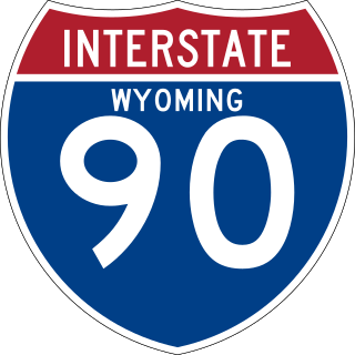
Interstate 90 (I-90) in the US state of Wyoming traverses the northeastern corner of the state, passing through the cities and communities of Sheridan, Buffalo, and Gillette.

<span class="mw-page-title-main">Wyoming Highway 130</span> State highway in Wyoming, United States

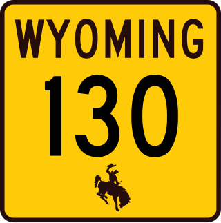
Wyoming Highway 130 is a 98.52-mile-long (158.55 km) state highway in the U.S. State of Wyoming. It is known locally as the Snowy Range Road. It makes its way west from Laramie across the plains, and rises over the Medicine Bow Mountains. The road then turns north through the town of Saratoga, and ends at Interstate 80 (I-80). The stretch of road over the mountains is a National Forest Byway. WYO 130 over Snowy Range Pass is closed during winter (November–May).

<span class="mw-page-title-main">Wyoming Highway 212</span> State highway in Wyoming, United States

Wyoming Highway 212 is a 14-mile (23 km) state highway in Wyoming. It is locally known as Four Mile Road from Wyoming Highway 219 to East Four Mile Road intersection at the curve, and College Drive from US 85/I-25 BUS. SR 212 acts like a bypass of Cheyenne, but in some portions it sneaks into the city limits. The portions that the bypass enters the city limits are between the railroad tracks and Ranchettes, and the northern terminus. SR 212 is signed north–south.

<span class="mw-page-title-main">Wyoming Highway 789</span> State highway in Wyoming, United States

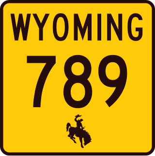
Wyoming Highway 789 (WYO 789) is a 407-mile-long (655 km) state highway in the U.S. state of Wyoming. WYO 789 travels south-to-north from the Colorado state line to the Montana state line. For most of its length, it is concurrent with other routes. It was the path of a formerly-proposed U.S. Route 789 that was canceled.

<span class="mw-page-title-main">Wyoming Highway 225</span> State highway in Wyoming, United States

Wyoming Highway 225 is a 11.21-mile-long (18.04 km) state highway, named Otto Road, located in southwestern Laramie County west of Cheyenne, in the U.S. state of Wyoming.

<span class="mw-page-title-main">Wyoming Highway 222</span> State highway in Wyoming, United States

Wyoming Highway 222 is a 1.81-mile-long (2.91 km) Wyoming State Road known as Fort Access Road located in Laramie County, on the western edge of Cheyenne.

<span class="mw-page-title-main">Wyoming Highway 210</span> State highway in Wyoming, United States

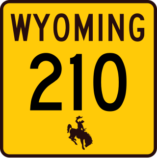
Wyoming Highway 210 (WYO 210), also known as Happy Jack Road, is a 37.79-mile (60.82 km) state highway in Laramie and Albany counties in Wyoming, United States, that runs from Cheyenne to Interstate 80/U.S. Route 30 (I-80/US 30), 10 miles (16 km) east of Laramie.

<span class="mw-page-title-main">Wyoming Highway 211</span> State highway in Laramie and Platte counties in Wyoming, United States

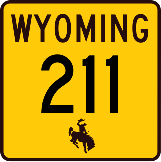
Wyoming Highway 211 is a 43.88-mile-long (70.62 km) Wyoming State Road known as Horse Creek Road within Laramie County, and as Iron Mountain Road in Platte County.

<span class="mw-page-title-main">Wyoming Highway 218</span> Former state highway in Wyoming, United States

Wyoming Highway 218 was an American state highway in southwestern Laramie County, Wyoming, east of Buford and west of Cheyenne. WYO 218, named Harriman Road, traveled from Interstate 80 and US 30 south for only 1.77 miles (2.85 km) as state maintenance ended there. The roadway continued south as Laramie County Route 102 to the Colorado State Line and the town of Harriman. From there the roadway continues in Colorado as Larimer County Route 37, named Red Mountain Road, to US 287. Mileposts along WYO 218 increased from north to south.

<span class="mw-page-title-main">Wyoming Highway 230</span> State highway in Wyoming, United States

Wyoming Highway 230 is a 78.74-mile-long (126.72 km) state highway in the U.S. State of Wyoming. It is known locally as Rivers Road and travels from WYO 130 approximately 8 miles (13 km) south of Saratoga south from there to intersect WYO 70 in Riverside and then heads southeast to the Colorado-Wyoming State Line. The Route continues southeast in Colorado as Colorado State Highway 125, then it turns northeast as Colorado State Highway 127. At the Wyoming-Colorado State Line, WYO 230 resumes. WYO 230 then heads northeast towards Laramie to end at Business Loop I-80/US 30/US 287 in Laramie. WYO 230 provides a scenic and less-traveled alternative for travelers who want to avoid Interstate 80 and US 30 but cannot take WYO 130 which is closed in the winter.

<span class="mw-page-title-main">Business routes of Interstate 80</span>

Interstate 80 Business may refer to several business routes of the Interstate Highway System that connects Interstate 80 with the central business district of various cities bypassed by I-80. The business route in each community is considered a unique route. In many cases, these routes are a former section of a U.S. Route or state highway.

<span class="mw-page-title-main">Wyoming Highway 89</span> State highway in Wyoming, United States

Wyoming Highway 89 (WYO 89) is a north-south state road that jumps in and out of Wyoming three times, and runs through the western edges of and Uinta County, Wyoming and Lincoln County, Wyoming.

<span class="mw-page-title-main">Wyoming Highway 320</span> State highway in Wyoming, United States

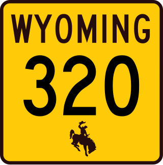
Wyoming Highway 320 (WYO 320) is a 12.33-mile-long (19.84 km) north–south state highway in central Platte County, Wyoming that connects Interstate 25 Business and U.S. Route 87 Business in Wheatland to US 26 in Dwyer, and was once part of the Yellowstone Highway.

<span class="mw-page-title-main">Wyoming Highway 76</span> State highway in Wyoming, United States

Wyoming Highway 76 (WYO 76) is a state highway in Carbon County, Wyoming, United States, that connects the settlements of Rawlins to Sinclair. It follows the former route of U.S. Route 30 (US 30) and parallels Interstate 80 (I-80), the main east–west freeway in the state. The highway was designated in the 1960s after the freeway was completed and transferred to local control, but later reverted to state maintenance.

<span class="mw-page-title-main">Business routes of Interstate 25</span> Route system

Interstate business routes are roads connecting a central or commercial district of a city or town with an Interstate bypass. These roads typically follow along local streets often along a former US or state highway that had been replaced by an Interstate. Interstate business route reassurance markers are signed as either loops or spurs using a green shield shaped sign and numbered like the shield of the parent Interstate Highway.

References

  1. Planning Program – Transportation Statistics (November 2004). Reference Marker Book. Wyoming Department of Transportation. Archived from the original on March 11, 2007.
  2. Elk Grove Historical Society. "History: Lincoln Highway". Elk Grove Historical Society. Retrieved June 30, 2023.
  3. "The Lincoln Highway in Wyoming". WyoHistory.org. Retrieved June 30, 2023.
  4. "Cokeville Meadows National Wildlife Refuge". United States Fish and Wildlife Service. Retrieved July 5, 2023.
  5. "US 30 Relocation". Wyoming Department of Transportation. Retrieved July 5, 2023.
  6. "Wayback Machine" (PDF). Archived from the original (PDF) on May 21, 2015. Retrieved July 5, 2023.
  7. University of Wyoming. Interactive Campus Map of the University of Wyoming (Map). University of Wyoming. Retrieved June 30, 2023.
  8. "The Lincoln Monument Was Chosen as Roadside America's Sight of the Week". Visit Laramie. May 19, 2021. Retrieved June 30, 2023.
  9. Wyoming, Travel (March 27, 2019). "Road Tripping through Wyoming: 17 Sights to See off I-80". Travel Wyoming. Retrieved July 5, 2023.
  10. Google (June 30, 2023). "U.S. Route 30 in Wyoming" (Map). Google Maps . Google. Retrieved June 30, 2023.
  11. Starks, Edward (January 27, 2022). "Table 2: Auxiliary Routes of the Dwight D. Eisenhower National System Of Interstate and Defense Highways as of December 31, 2021". FHWA Route Log and Finder List. Federal Highway Administration. Retrieved June 30, 2023.
  12. Google (June 30, 2023). "I-180 in Cheyenne, WY" (Map). Google Maps . Google. Retrieved June 30, 2023.
  13. Carter-Burgess (May 2005). Western Cheyenne Transportation Study (PDF). Cheyenne Metropolitan Planning Organization. Retrieved July 19, 2023.
  14. Google (June 30, 2023). "Overview Map of US 30 in Wyoming" (Map). Google Maps . Google. Retrieved June 30, 2023.
  15. 1 2 Longfellow, Rickie (June 27, 2017). "The Lincoln Highway". Highway History. Federal Highway Administration. Retrieved July 5, 2023.
  16. "Giant Head of Abraham Lincoln, Laramie, Wyoming". Roadside America. Retrieved July 5, 2023.
  17. Maintenance Staff (February 11, 2013). Maintenance Section Reference Book (PDF). Wyoming Department of Transportation. p. 190. Retrieved March 6, 2019.
Template:Attached KML/U.S. Route 30 in Wyoming
KML is not from Wikidata