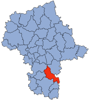
Brzeźnica is a village in the administrative district of Gmina Kozienice, within Kozienice County, Masovian Voivodeship, in east-central Poland. It lies approximately 6 kilometres (4 mi) south-east of Kozienice and 86 km (53 mi) south-east of Warsaw.
Chinów is a village in the administrative district of Gmina Kozienice, within Kozienice County, Masovian Voivodeship, in east-central Poland. It lies approximately 7 kilometres (4 mi) north-west of Kozienice and 75 km (47 mi) south-east of Warsaw.
Dąbrówki is a village in the administrative district of Gmina Kozienice, within Kozienice County, Masovian Voivodeship, in east-central Poland. It lies approximately 3 kilometres (2 mi) east of Kozienice and 82 km (51 mi) south-east of Warsaw.
Holendry Kuźmińskie is a village in the administrative district of Gmina Kozienice, within Kozienice County, Masovian Voivodeship, in east-central Poland. It lies approximately 8 kilometres (5 mi) north of Kozienice and 73 km (45 mi) south-east of Warsaw.
Janów is a village in the administrative district of Gmina Kozienice, within Kozienice County, Masovian Voivodeship, in east-central Poland. It lies approximately 3 kilometres (2 mi) south of Kozienice and 83 km (52 mi) south-east of Warsaw.
Kuźmy is a village in the administrative district of Gmina Kozienice, within Kozienice County, Masovian Voivodeship, in east-central Poland. It lies approximately 8 kilometres (5 mi) north of Kozienice and 74 km (46 mi) south-east of Warsaw.
Nowa Wieś is a village in the administrative district of Gmina Kozienice, within Kozienice County, Masovian Voivodeship, in east-central Poland. It lies approximately 8 kilometres (5 mi) north-west of Kozienice and 73 km (45 mi) south-east of Warsaw.
Piotrkowice is a village in the administrative district of Gmina Kozienice, within Kozienice County, Masovian Voivodeship, in east-central Poland. It lies approximately 7 kilometres (4 mi) north of Kozienice and 75 km (47 mi) south-east of Warsaw.
Psary is a village in the administrative district of Gmina Kozienice, within Kozienice County, Masovian Voivodeship, in east-central Poland. It lies approximately 5 kilometres (3 mi) south-east of Kozienice and 85 km (53 mi) south-east of Warsaw.
Ruda is a village in the administrative district of Gmina Kozienice, within Kozienice County, Masovian Voivodeship, in east-central Poland. It lies approximately 5 kilometres (3 mi) south-east of Kozienice and 85 km (53 mi) south-east of Warsaw.
Samwodzie is a village in the administrative district of Gmina Kozienice, within Kozienice County, Masovian Voivodeship, in east-central Poland. It lies approximately 7 kilometres (4 mi) east of Kozienice and 82 km (51 mi) south-east of Warsaw.
Selwanówka is a village in the administrative district of Gmina Kozienice, within Kozienice County, Masovian Voivodeship, in east-central Poland. It lies approximately 15 kilometres (9 mi) north-west of Kozienice and 69 km (43 mi) south-east of Warsaw.
Stanisławice is a village in the administrative district of Gmina Kozienice, within Kozienice County, Masovian Voivodeship, in east-central Poland. It lies approximately 7 kilometres (4 mi) west of Kozienice and 79 km (49 mi) south-east of Warsaw.
Staszów is a village in the administrative district of Gmina Kozienice, within Kozienice County, Masovian Voivodeship, in east-central Poland. It lies approximately 6 kilometres (4 mi) east of Kozienice and 85 km (53 mi) south-east of Warsaw.
Świerże Górne is a village in the administrative district of Gmina Kozienice, within Kozienice County, Masovian Voivodeship, in east-central Poland. It lies approximately 10 kilometres (6 mi) north-west of Kozienice and 72 km (45 mi) south-east of Warsaw.
Wójtostwo is a village in the administrative district of Gmina Kozienice, within Kozienice County, Masovian Voivodeship, in east-central Poland. It lies approximately 2 kilometres (1 mi) north of Kozienice and 80 km (50 mi) south-east of Warsaw.
Wola Chodkowska is a village in the administrative district of Gmina Kozienice, within Kozienice County, Masovian Voivodeship, in east-central Poland. It lies approximately 15 kilometres (9 mi) north-west of Kozienice and 67 km (42 mi) south-east of Warsaw.
Rogożek is a village in the administrative district of Gmina Głowaczów, within Kozienice County, Masovian Voivodeship, in east-central Poland. It lies approximately 5 kilometres (3 mi) north-east of Głowaczów, 16 km (10 mi) north-west of Kozienice, and 68 km (42 mi) south of Warsaw.
Augustów is a village in the administrative district of Gmina Grabów nad Pilicą, within Kozienice County, Masovian Voivodeship, in east-central Poland. It lies approximately 6 kilometres (4 mi) south-west of Grabów nad Pilicą, 30 km (19 mi) north-west of Kozienice, and 60 km (37 mi) south of Warsaw.
Latków is a village in the administrative district of Gmina Magnuszew, within Kozienice County, Masovian Voivodeship, in east-central Poland. It lies approximately 2 kilometres (1 mi) north-east of Magnuszew, 24 km (15 mi) north-west of Kozienice, and 57 km (35 mi) south-east of Warsaw.