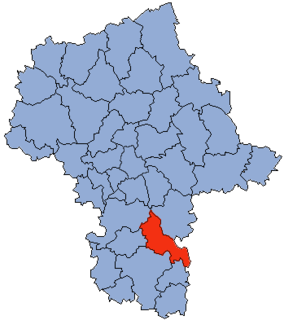
Brzeźnica is a village in the administrative district of Gmina Kozienice, within Kozienice County, Masovian Voivodeship, in east-central Poland. It lies approximately 6 kilometres (4 mi) south-east of Kozienice and 86 km (53 mi) south-east of Warsaw.
Cztery Kopce is a village in the administrative district of Gmina Kozienice, within Kozienice County, Masovian Voivodeship, in east-central Poland.
Dąbrówki is a village in the administrative district of Gmina Kozienice, within Kozienice County, Masovian Voivodeship, in east-central Poland. It lies approximately 3 kilometres (2 mi) east of Kozienice and 82 km (51 mi) south-east of Warsaw.
Holendry Kuźmińskie is a village in the administrative district of Gmina Kozienice, within Kozienice County, Masovian Voivodeship, in east-central Poland. It lies approximately 8 kilometres (5 mi) north of Kozienice and 73 km (45 mi) south-east of Warsaw.
Janów is a village in the administrative district of Gmina Kozienice, within Kozienice County, Masovian Voivodeship, in east-central Poland. It lies approximately 3 kilometres (2 mi) south of Kozienice and 83 km (52 mi) south-east of Warsaw.
Kuźmy is a village in the administrative district of Gmina Kozienice, within Kozienice County, Masovian Voivodeship, in east-central Poland. It lies approximately 8 kilometres (5 mi) north of Kozienice and 74 km (46 mi) south-east of Warsaw.
Łaszówka is a village in the administrative district of Gmina Kozienice, within Kozienice County, Masovian Voivodeship, in east-central Poland. It lies approximately 14 kilometres (9 mi) north-west of Kozienice and 69 km (43 mi) south-east of Warsaw.
Nowa Wieś is a village in the administrative district of Gmina Kozienice, within Kozienice County, Masovian Voivodeship, in east-central Poland. It lies approximately 8 kilometres (5 mi) north-west of Kozienice and 73 km (45 mi) south-east of Warsaw.
Piotrkowice is a village in the administrative district of Gmina Kozienice, within Kozienice County, Masovian Voivodeship, in east-central Poland. It lies approximately 7 kilometres (4 mi) north of Kozienice and 75 km (47 mi) south-east of Warsaw.
Przewóz is a village in the administrative district of Gmina Kozienice, within Kozienice County, Masovian Voivodeship, in east-central Poland. It lies approximately 3 kilometres (2 mi) north of Kozienice and 79 km (49 mi) south-east of Warsaw.
Psary is a village in the administrative district of Gmina Kozienice, within Kozienice County, Masovian Voivodeship, in east-central Poland. It lies approximately 5 kilometres (3 mi) south-east of Kozienice and 85 km (53 mi) south-east of Warsaw.
Ruda is a village in the administrative district of Gmina Kozienice, within Kozienice County, Masovian Voivodeship, in east-central Poland. It lies approximately 5 kilometres (3 mi) south-east of Kozienice and 85 km (53 mi) south-east of Warsaw.
Samwodzie is a village in the administrative district of Gmina Kozienice, within Kozienice County, Masovian Voivodeship, in east-central Poland. It lies approximately 7 kilometres (4 mi) east of Kozienice and 82 km (51 mi) south-east of Warsaw.
Selwanówka is a village in the administrative district of Gmina Kozienice, within Kozienice County, Masovian Voivodeship, in east-central Poland. It lies approximately 15 kilometres (9 mi) north-west of Kozienice and 69 km (43 mi) south-east of Warsaw.
Staszów is a village in the administrative district of Gmina Kozienice, within Kozienice County, Masovian Voivodeship, in east-central Poland. It lies approximately 6 kilometres (4 mi) east of Kozienice and 85 km (53 mi) south-east of Warsaw.
Świerże Górne is a village in the administrative district of Gmina Kozienice, within Kozienice County, Masovian Voivodeship, in east-central Poland. It lies approximately 10 kilometres (6 mi) north-west of Kozienice and 72 km (45 mi) south-east of Warsaw.
Wójtostwo is a village in the administrative district of Gmina Kozienice, within Kozienice County, Masovian Voivodeship, in east-central Poland. It lies approximately 2 kilometres (1 mi) north of Kozienice and 80 km (50 mi) south-east of Warsaw.
Wólka Tyrzyńska is a village in the administrative district of Gmina Kozienice, within Kozienice County, Masovian Voivodeship, in east-central Poland. It lies approximately 6 kilometres (4 mi) north-east of Kozienice and 80 km (50 mi) south-east of Warsaw.
Głowaczów is a village in Kozienice County, Masovian Voivodeship, in east-central Poland. It is the seat of the gmina called Gmina Głowaczów. It lies in northern part of historic Lesser Poland, approximately 18 kilometres (11 mi) west of Kozienice and 71 km (44 mi) south of Warsaw, along National Road Nr. 48. The village has a population of 780.
Leżenice is a village in the administrative district of Gmina Głowaczów, within Kozienice County, Masovian Voivodeship, in east-central Poland. It lies approximately 18 km (11 mi) west of Kozienice and 71 km (44 mi) south of Warsaw.