't Zand, Schagen

Last updated • 1 min readFrom Wikipedia, The Free Encyclopedia
't Zand
Village
Exterieur - 't Zand (Zijpe) - 20220751 - RCE.jpg
Church in 't Zand
Netherlands location map.svg
Red pog.svg
't Zand
Location in the Netherlands
2010-NL-P07-Noord-Holland-positiekaart-gemnamen.jpg
Red pog.svg
't Zand
Location in the province of North Holland in the Netherlands
Coordinates: 52°50′14″N4°45′17″E / 52.83722°N 4.75472°E / 52.83722; 4.75472 Coordinates: 52°50′14″N4°45′17″E / 52.83722°N 4.75472°E / 52.83722; 4.75472
Country Netherlands
Province North Holland
Municipality Schagen
Area
[1]
  Total14.66 km2 (5.66 sq mi)
Elevation
[2]
0.7 m (2.3 ft)
Population
 (2021) [1]
  Total2,455
  Density170/km2 (430/sq mi)
Time zone UTC+1 (CET)
  Summer (DST) UTC+2 (CEST)
Postal code
1756 [1]
Dialing code 0224

't Zand is a village in the Dutch province of North Holland. It is a part of the municipality of Schagen and lies about 12 kilometres (7.5 mi) south of Den Helder.

Contents

History

The village was first mentioned in 1770 as "eene herberg, het zand genoemt", and is named after an inn which was colloquially called Zand (sand), but whose official name was 't Wapen van Alkmaar. [3] 't Zand developed in the northern part of the Zijpe- and Hazepolder which were poldered between 1596 and 1597. The construction of the Noordhollandsch Kanaal between 1821 and 1824, resulted in a modest growth. [4]

't Zand developed as a Catholic settlement, because clandestine churches were tolerated in the area. [5] The Catholic O.L. Vrouwe Visitatie Church was built in 1863 and is a modest design. [4] The church was deemed unstable in 1920, and large buttresses have been built to strengthen the construction. [5]

Education

In 't Zand there are two primary schools; there are no secondary schools. Zandhope is a small village school with four classrooms catering for ages 4 to 12. St. Jozef (a Catholic school) has about 20 classrooms and caters for ages 4 to 14 years.

Transportation

't Zand is the site of one of the five operational vlotbruggen . The current was constructed in 1949 on the Noordhollandsche Kanaal. [5]

Related Research Articles

Daarlerveen Village in Overijssel, Netherlands

Daarlerveen is a village in the Dutch province of Overijssel. It is located in the municipality of Hellendoorn, about 2 km south of the town of Vroomshoop.

Hooghalen Village in Drenthe, Netherlands

Hooghalen is a village in the municipality Midden-Drenthe, in the Dutch province Drenthe. In Drenthe it is also called Hoal'n or Hoalen , but then people often mean the entire area, with the neighborhoods Laaghalen, Laaghalerveen and Oosthalen.

Dwingeloo Village in Drenthe, Netherlands

Dwingeloo is a village halfway between Meppel and Assen in the Dutch province of Drenthe. It is a part of the municipality of Westerveld.

Pannerden Village in Gelderland, Netherlands

Pannerden is a village in the Dutch province of Gelderland. It is located in the municipality of Zevenaar.

Ottersum Village in Limburg, Netherlands

Ottersum is a village in the Dutch province of Limburg. It is a part of the municipality of Gennep, and lies about 17 km southeast of Nijmegen.

Bingelrade Village in Limburg, Netherlands

Bingelrade is a village in the Dutch province of Limburg. It is a part of the municipality of Beekdaelen, and lies about 6 km southeast of Sittard.
Lijnden Village in North Holland, Netherlands

Lijnden is a village in the Dutch province of North Holland. It is a part of the municipality of Haarlemmermeer, and lies about 10 km west of Amsterdam.

Watergang Village in North Holland, Netherlands

Watergang is a village in the northwest Netherlands. It is located in the municipality of Waterland, North Holland, about seven kilometres north of Amsterdam, on the east bank of the Noordhollandsch Kanaal.

Nieuwe Niedorp Village in North Holland, Netherlands

Nieuwe Niedorp is a village in the Dutch province of North Holland. It is a part of the municipality of Hollands Kroon, and lies about 9 kilometres (5.6 mi) northeast of Heerhugowaard.

Alphen, Gelderland Village in Gelderland, Netherlands

Alphen is a village in the Dutch province of Gelderland. It is a part of the municipality of West Maas en Waal, and lies about 7 km north of Oss.

Alphen, North Brabant Village in North Brabant, Netherlands

Alphen is a village in the municipality of Alphen-Chaam, in the Netherlands. It is located about 12 km southwest of Tilburg.
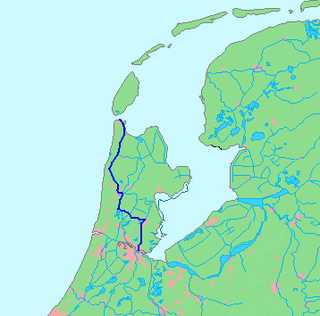
Noordhollandsch Kanaal Canal in the Northwest Netherlands

The Noordhollandsch Kanaal is a canal originally meant for ocean-going ships. It is located in North Holland, Netherlands. The canal was of great significance in Dutch history.

Hoofdplaat Village in Zeeland, Netherlands

Hoofdplaat is a village in the Dutch province of Zeeland. It is located on the Westerschelde, about 7 km east of Breskens, in the municipality of Sluis.

Lonneker Village in Overijssel, Netherlands

Lonneker is a village in Twente, in the province of Overijssel. It is located in the municipality of Enschede, about 3 km north of the city centre.

Grubbenvorst Village in Limburg, Netherlands

Grubbenvorst is a village in the Dutch province of Limburg. It is located in the municipality of Horst aan de Maas, about 6 km northwest of Venlo.

Neer Village in Limburg, Netherlands

Neer is a village in Limburg, Netherlands. It is located in the municipality of Leudal, on the river Maas about 8 km north of Roermond.

Halsteren Town in North Brabant, Netherlands

Halsteren is a town in the Dutch province of North Brabant. It is located in the municipality of Bergen op Zoom, about 1 km north of that city. Halsteren has an old church from the 14th century and a new church, built in 1919. A little village called Polder was located between Halsteren and Tholen in the Middle Ages.
Tzummarum Village in Friesland, Netherlands

Tzummarum is a village in Waadhoeke municipality in the province of Friesland, the Netherlands. It had a population of around 1,414 in January 2014.

Vlotbrug

Vlotbrug translates from Dutch into English as "float bridge". In its broadest sense, it includes pontoon bridges. In a narrower sense, it includes floating swing bridges which pivot either centrally or from one or both banks of a body of water to allow vessels to pass through.

Soerendonk Village in North Brabant, Netherlands

Soerendonk is a village in the Dutch province of North Brabant. It is located in the municipality of Cranendonck. The former Cranendonck Castle used to be located in the village. It is located about 17 kilometres (11 mi) south-south-east of Eindhoven.

References

  1. 1 2 3 "Kerncijfers wijken en buurten 2021". Central Bureau of Statistics. Retrieved 1 May 2022.
  2. "Postcodetool for 1756AA". Actueel Hoogtebestand Nederland (in Dutch). Het Waterschapshuis. Retrieved 1 May 2022.
  3. "'t Zand - (geografische naam)". Etymologiebank (in Dutch). Retrieved 1 May 2022.
  4. 1 2 Ronald Stenvert & Saskia van Ginkel-Meester (2006). "'t Zand" (in Dutch). Zwolle: Waanders. Retrieved 1 May 2022.
  5. 1 2 3 "'t Zand". Plaatsengids (in Dutch). Retrieved 1 May 2022.