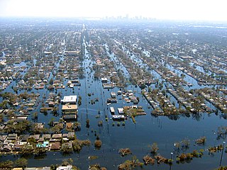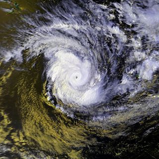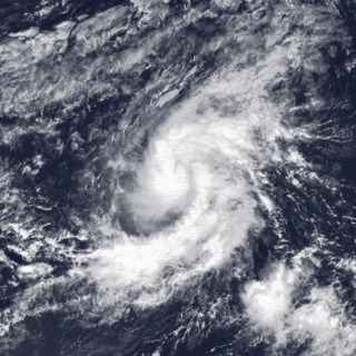
Hurricane Alicia was a small but powerful tropical cyclone that caused significant destruction in the Greater Houston area of Southeast Texas in August 1983. Although Alicia was a relatively small hurricane, its track over the rapidly growing metropolitan area contributed to its $3 billion damage toll, making it the costliest Atlantic hurricane at the time. Alicia spawned from a disturbance that originated from the tail-end of a cold front over the northern Gulf of Mexico in mid-August 1983. The cyclone was named on August 14 when it became a tropical storm, and the combination of weak steering currents and a conducive environment allowed Alicia to quickly intensify as it drifted slowly westward. On August 17, Alicia became a hurricane and continued to strengthen, topping out as a Category 3 major hurricane as it made landfall on the southwestern end of Galveston Island. Alicia's eye passed just west of Downtown Houston as the system accelerated northwestwards across East Texas; Alicia eventually weakened into a remnant area of low pressure over Oklahoma on August 20 before they were last noted on August 21 over eastern Nebraska.

Tropical Storm Allison was a tropical cyclone that devastated southeast Texas in June 2001. An arguable example of the "brown ocean effect", Allison lasted unusually long for a June storm, remaining tropical and subtropical for 16 days, most of which was when the storm was over land dumping torrential rainfall. The storm developed from a tropical wave in the northern Gulf of Mexico on June 4, 2001, and struck the upper Texas coast shortly thereafter. It drifted northward through the state, turned back to the south, and re-entered the Gulf of Mexico. The storm continued to the east-northeast, made landfall on Louisiana, then moved across the southeast United States and Mid-Atlantic. Allison was the first storm since Tropical Storm Frances in 1998 to strike the northern Texas coastline.
Winton is a rural town in Southland, New Zealand. It is located close to the east bank of the Ōreti River, 30 kilometres north of Invercargill and 50 kilometres south of Lumsden. The town is named after Thomas Winton, a local stockman who lived and farmed in the area in the 1850s. The district thrived with the development of sheep and fat-lamb farms in the early 1900s. Later, dairy farming became the staple economy, although the town has also seen sawmills, and flax and linen-flax industries.

Hurricane Diane was the first Atlantic hurricane to cause more than an estimated $1 billion in damage, including direct costs and the loss of business and personal revenue. It formed on August 7 from a tropical wave between the Lesser Antilles and Cape Verde. Diane initially moved west-northwestward with little change in its intensity, but began to strengthen rapidly after turning to the north-northeast. On August 12, the hurricane reached peak sustained winds of 105 mph (165 km/h), making it a Category 2 hurricane. Gradually weakening after veering back west, Diane made landfall near Wilmington, North Carolina, as a strong tropical storm on August 17, just five days after Hurricane Connie struck near the same area. Diane weakened further after moving inland, at which point the United States Weather Bureau noted a decreased threat of further destruction. The storm turned to the northeast, and warm waters from the Atlantic Ocean helped produce record rainfall across the northeastern United States. On August 19, Diane emerged into the Atlantic Ocean southeast of New York City, becoming extratropical two days later and completely dissipating by August 23.

Hurricane Dennis caused flooding in North Carolina and the Mid-Atlantic states in early September 1999, which would later be compounded by Hurricane Floyd. The fifth tropical cyclone of the season, Dennis developed from a tropical wave to the north of Puerto Rico on August 24. Originally a tropical depression, the system moved west-northwestward and strengthened into a tropical storm despite unfavorable wind shear. The storm became a hurricane by August 26. After striking the Abaco Islands, conditions improved, allowing for Dennis to strengthen into a Category 2 on the Saffir–Simpson scale by August 28. Around this time, Dennis began to move parallel to the Southeastern United States. Early on August 30, the storm peaked with winds of 105 mph (165 km/h). By the following day, steering currents collapsed and the storm interacted with a cold front, causing Dennis to move erratically offshore North Carolina. Wind shear and cold air associated with the front weakened Dennis to a tropical storm on September 1 and removed some of its tropical characteristics. Eventually, warmer ocean temperatures caused some re-strengthening. By September 4, Dennis turned northwestward and made landfall in Cape Lookout, North Carolina, as a strong tropical storm. The storm slowly weakened inland, before transitioning into an extratropical cyclone over western New York on September 7.
Floods in the United States are generally caused by excessive rainfall, excessive snowmelt, and dam failure. Below is a list of flood events that were of significant impact to the country during the 20th century, from 1900 through 1999, inclusive.

Floods in the United States (2000–present) is a list of flood events which were of significant impact to the country during the 21st century, since 2000. Floods are generally caused by excessive rainfall, excessive snowmelt, storm surge from hurricanes, and dam failure.

Severe Tropical Cyclone Bola was one of the costliest cyclones in the history of New Zealand, causing severe damage as an extratropical cyclone when it passed near the country in March 1988. It formed on 24 February to the north of Fiji, and tracking generally southwestward it reached hurricane-force winds near Vanuatu on 28 February. The next day it generated peak wind velocities of 195 km/h (120 mph), though it quickly weakened as it accelerated southward. On 4 March, Bola transitioned into an extratropical storm, passing to the north of the North Island of New Zealand on 8 March. It weakened further and was absorbed by a stationary trough near the South Island on 12 March.

The climate of New Zealand is varied due to the country's diverse landscape. Most regions of New Zealand belong to the temperate zone with a maritime climate characterised by four distinct seasons. Winters are relatively mild and summers comparatively cool. The main contributing factors are the Pacific Ocean and latitude, although the mountain ranges can cause significant climate variations in locations barely tens of kilometres from each other. Conditions vary from extremely wet on the West Coast of the South Island to almost semi-arid in Central Otago and subtropical in Northland.

Tropical Storm Octave was considered the worst tropical cyclone in the history of Arizona. The nineteenth tropical cyclone and fifteenth named storm of the 1983 Pacific hurricane season, the origins of Tropical Storm Octave were from a tropical disturbance that formed south of the Gulf of Tehuantepec on September 23, 1983. Steered by a deep layer high over Mexico, the disturbance moved west for four days before becoming a tropical depression on September 27 off the southwest coast of Mexico. Over an area of warm sea surface temperatures, it was able to quickly strengthen to peak winds of 50 mph (85 km/h), through wind shear prevented much further development. By September 30, Octave was accelerating to the northeast, steadily weakening due to cooler waters. That day it weakened to tropical depression status, and on October 2, Octave dissipated.

Hurricane Norma was one of the two hurricanes to make landfall during the 1981 Pacific hurricane season. It developed on October 8, strengthening into a tropical storm and later a hurricane. Norma moved slowly to the northwest and strengthened into a Category 3 hurricane on the Saffir–Simpson hurricane scale. The storm recurved and accelerated to the northeast on October 11 and weakened to a Category 2. The next day, Norma made landfall near Mazatlán on October 12 and soon dissipated. The hurricane's remnants continued northeastward and entered the United States, crossing into central Texas before being absorbed by a frontal system on October 14. Norma caused $24 million in crop damage and one death in Mexico, as well as up to 10 in (250 mm). In Texas, the storm produced flooding rains that killed five people, caused $50 million in damage and caused many tornadoes. Rainfall was also reported as far inland as Kansas.

Southland is New Zealand's southernmost region. It consists of the southwestern portion of the South Island and includes Stewart Island. Southland is bordered by the culturally similar Otago Region to the north and east, and the West Coast Region in the extreme northwest. The region covers over 3.1 million hectares and spans 3,613 km of coastline. As of June 2023, Southland has a population of 103,900, making it the eleventh-most-populous New Zealand region, and the second-most sparsely populated. Approximately half of the region's population lives in Invercargill, Southland's only city.

Hurricane Isaac was a deadly and destructive tropical cyclone that came ashore in the U.S. state of Louisiana during August 2012. The ninth named storm and fourth hurricane of the annual hurricane season, Isaac originated from a tropical wave that moved off the west coast of Africa on August 16. Tracking generally west, a broad area of low pressure developed along the wave axis the next day, and the disturbance developed into a tropical depression early on August 21 while several hundred miles east of the Lesser Antilles. The system intensified into a tropical storm shortly thereafter, but high wind shear initially prevented much change in strength.

Tropical Storm Rolf, also known as Tropical Storm 01M, was an unusual Mediterranean tropical storm that brought flooding to Italy, France, Spain, and Switzerland in November 2011. Rolf originated from an extratropical system near western France on 4 November. Despite the generally unfavorable conditions in the Mediterranean Sea, Rolf transitioned into a subtropical depression on 7 November, before becoming a tropical storm later that day. On 8 November, Rolf reached its peak intensity, with 1-minute sustained winds peaking at 85 km/h (53 mph) and a minimum central pressure of 991 mb (29.3 inHg). During the next day, the storm made landfall on the island of Île du Levant, in France, and soon afterward, near Hyères in southeastern France. Following its second landfall, Rolf quickly weakened and dissipated on 10 November. Rolf was the first tropical cyclone ever to be officially monitored by the NOAA in the Mediterranean Sea.

The 2015–2016 Great Britain and Ireland floods were a series of heavy rainfall events which led to flooding during the winter of late 2015 and early 2016. 11 named storms produced record level rainfall from November 2015 - March 2016 in both monthly and seasonal accumulation records.

Severe weather events or extreme weather events in Sydney, Australia, include hailstorms, thunderstorms, gale, bushfires, heatwaves, drought, and flash flooding. Sydney is rarely affected by cyclones, although remnants of cyclones do affect the city.
The 2021 central New Zealand floods were the result of a torrential rainstorm that affected central New Zealand between 17 and 18 July 2021. This storm led to flooding in the West Coast's Buller District, the Tasman District, and the Marlborough Region in the South Island, prompting the evacuations of residents and the declaration of a state of emergency. Flooding also impacted the Wellington region.
The 2022 New Zealand floods occurred between 18 and 21 August 2022 in both the North and South Island. Effects of the flooding included landslides, damaged homes and roads, including highway blockages due to fallen trees and floodwater. Over 500 households were evacuated. The cause of the high amount of rainfall has been attributed to an atmospheric river. The estimated total cost of the disaster was $67.84 million.
The 2023 southern New Zealand floods were caused by heavy rain that struck the southern part of New Zealand's South Island on 21 September 2023. This storm caused flooding in several places across the Southland and Otago regions including Gore and Queenstown. 100 homes were evacuated in Queenstown and Tuatapere's water treatment plant was damaged. A state of emergency was declared in the Southland Region. In addition, a state of emergency was declared in Queenstown on 22 September, which recorded its wettest day in 24 years.

In early October 2024, the Otago region of New Zealand's South Island experienced heavy rainfall and significant flooding and landslides. The weather event affected coastal areas in Otago including North Otago, Dunedin, and the Clutha District, which received an estimated two-months worth of rainfall between 2 and 4 October. On 3 October, a state of emergency was declared in Dunedin, with residents in some low-lying suburbs being told to evacuate. By 4 October, the Clutha District had also declared a state of emergency. By 6 October, the state of emergency in Dunedin and Clutha had been lifted due to improving weather conditions and floodwaters subsiding.


