2003 Altai earthquake

Last updated
2003 Altai earthquake
Russia rel location map.png
Bullseye1.png
UTC  time2003-09-27 11:33:25
ISC  event 7136530
USGS-ANSS ComCat
Local dateSeptember 27, 2003 (2003-09-27)
Local time18:33
Magnitude7.3 Mw [1]
Depth12.3 km (8 mi) [1]
Epicenter 49°59′N87°47′E / 49.99°N 87.79°E / 49.99; 87.79 Coordinates: 49°59′N87°47′E / 49.99°N 87.79°E / 49.99; 87.79 [1]
Type Oblique-slip [2]
Total damage $10.6–33 million [3] [4]
Max. intensity X (Extreme) [3]
LandslidesYes [4]
Casualties3 dead, 5 injured [3]

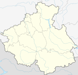
The 2003 Altai earthquake, or 2003 Chuya earthquake, occurred on September 27 at 18:33:26 local time with a moment magnitude of 7.3 and a maximum Mercalli intensity of X (Extreme). The epicenter of this oblique-slip shock was in Altai Republic, Russia near the borders of Mongolia, China, and Kazakhstan. Three deaths and five injuries were reported and the total damage was listed as $10.6–33 million.

Contents

Earthquake

This earthquake had components of right-lateral strike-slip and reverse movement in a segmented fault zone which had not been previously recognized. [5]

Damage

Between 99 and 300 houses destroyed, along with 1,942 other buildings affected. It was the strongest earthquake in this region since an estimated magnitude 7.7 earthquake on December 20, 1761. [3] [4]

Ground effects

Landslides affected the Kosh-Agachsky and Ust’-Ulagan Districts. [4]

Related Research Articles

1999 Düzce earthquake 1999 earthquake in north-central Turkey

The 1999 Düzce earthquake occurred on 12 November at 18:57:22 local time with a moment magnitude of 7.2 and a maximum Mercalli intensity of IX (Violent), causing damage and at least 845 fatalities in Düzce, Turkey. The epicenter was approximately 100 km (62 mi) to the east of the extremely destructive 1999 İzmit earthquake that happened a few months earlier. Both strike-slip earthquakes were caused by movement on the North Anatolian Fault.

The 2006 Kamchatka earthquake occurred on April 21, 2006 at 12:25 PM local time. This shock had a moment magnitude of 7.6 and a maximum Mercalli intensity of X (Extreme). The hypocenter was located near the coast of Koryak Autonomous Okrug at an estimated depth of 22 km, as reported by the International Seismological Centre. This event caused damage in three villages and was followed by a number of large aftershocks. Two M6.6 earthquakes struck on April 29 at 16:58 UTC and again on May 22 at 11:12 UTC. These earthquakes caused no deaths; however, 40 people were reported injured.

2000 Enggano earthquake Earthquake affecting Indonesia

The 2000 Enggano earthquake struck at 23:28 local time on June 4 with a moment magnitude of 7.9 and a maximum Mercalli intensity of VI (Strong). The event occurred off the coast of southern Sumatra, Indonesia near Enggano Island. There were more than 100 fatalities and up to 2,585 injuries. Over 730 aftershocks shocked the area afterwards, one just eleven minutes after the mainshock.

The 1988 Nepal earthquake occurred in Nepal near the Indian border and affected much of northern Bihar. The magnitude 6.9 earthquake shook the region on August 21, killing at least 709 persons and injuring thousands. The earthquake struck in two installments of 10 seconds and 15 seconds each and left cracks in 50,000 buildings, including Raj Bhavan and the old Secretariat Building in Patna, Bihar.

The 1991 Uttarkashi earthquake occurred at 02:53:16 Indian Standard Time (UTC+05:30) on 20 October with a moment magnitude of 6.8 and a maximum Mercalli intensity of IX (Violent). This thrust event was instrumentally recorded and occurred along the Main Central Thrust in the Uttarkashi and Gharwal regions of the Indian state of Uttarakhand. High intensity shaking resulted in the deaths of at least 768 people and the destruction of thousands of homes.

The 2003 Bingöl earthquake hit eastern Turkey with a moment magnitude of 6.4 and a maximum Mercalli intensity of IX (Violent) on 1 May at 03:27 local time. The epicenter of this strike-slip earthquake was in Bingöl Province, 15 km north of Bingöl. At least 177 people were killed, and 625 buildings collapsed or suffered heavy damage in the affected region. Eighty-four of the fatalities occurred when a dormitory block collapsed in a boarding school in Celtiksuyu.

The 2010 Solomon Islands earthquake occurred with a moment magnitude of 7.1 on January 3 at 22:36:28 (UTC). A tsunami measuring approximately 10 feet affected some parts of the islands, while a maximum run-up height of 23.0 feet was recorded. The earthquake was the largest in a series of quakes to strike the Solomon Islands over the preceding days. The 7.1 mainshock was preceded by a 6.6 magnitude foreshock some 48 minutes previous. As many as 1,000 people were left homeless on the island of Rendova after the earthquake and tsunami destroyed approximately 200 homes.

The 1984 San Pedro Basin earthquake occurred on June 24 at 07:17:14 local time with a moment magnitude of 6.7 and a maximum Mercalli intensity of VII. The event occurred off the southern coast of the Dominican Republic and resulted in an estimated five fatalities.

The 1969 Portugal earthquake struck western Portugal and Morocco on February 28 at 02:40 UTC. Originating west of the Strait of Gibraltar, the earthquake registered a magnitude of 7.8 and the maximum felt intensity was VII on the Mercalli intensity scale. In total, thirteen people died. 80 people sustained minor injuries. It is the largest earthquake to hit Portugal since the 1755 Lisbon earthquake.

The 1996 Biak earthquake, or the 1996 Irian Jaya earthquake, occurred on February 17 at 14:59:30 local time near Biak Island, Indonesia. The earthquake had a moment magnitude of 8.2 and a maximum Mercalli intensity of IX (Violent). The run-up height of the generated tsunami reached 7 meters (23 ft). One-hundred and sixty-six people were reported dead, 423 were injured, and 5,090 were made homeless.

The 2002 Burica earthquake occurred on July 30 at 19:16:48 local time off the coast of Panama. It had a magnitude of Mw 6.5. The epicenter was located off the southeastern coast of Burica Peninsula, close to the Costa Rica–Panama border. Some homes collapsed and at least 11 people were reported injured, both in Panama and in Costa Rica. The strongest intensity reached VII in Puerto Armuelles, Panama. It was felt with III (Weak) to IV (Light) around San Jose, Costa Rica. Shops in the center of Puerto Armuelles suffered from loss such as fallen merchandise and broken window glass. This earthquake occurred along the Panama Fracture Zone.

The 1997 Cariaco earthquake occurred on July 9 at 15:24:14 local time with a moment magnitude of 6.9 and a maximum Mercalli intensity of VIII (Severe). With its epicenter near Cariaco, Venezuela, at least 81 people were killed and over 500 were injured. Disruption of power, telephone, and water services was reported. This earthquake was felt in much of northeastern Venezuela and could also be felt in Trinidad and Tobago. This earthquake was on the strike-slip El Pilar Fault.

Sagaing Fault Seismic fault in Myanmar

The Sagaing Fault is a major fault in Burma, a mainly continental right-lateral transform fault between the Indian Plate and Sunda Plate. It links the divergent boundary in the Andaman Sea with the zone of active continental collision along the Himalayan front. It passes through populated cities of Mandalay, Yamethin, Pyinmana, the capital Naypyidaw, Toungoo and Pegu before dropping off into the Gulf of Martaban, running for a total length of over 1200 kilometers.

1918 Celebes Sea earthquake

The 1918 Celebes Sea earthquake occurred on 15 August at 12:18 UTC near the Moro Gulf coast of Mindanao. It had a magnitude of 8.3 on the moment magnitude scale and a maximum perceived intensity of X (Extreme) on the Mercalli intensity scale.

The 1999 Aïn Témouchent earthquake occurred on December 22 at 18:36:56 local time in northern Algeria. The dip-slip event had a moment magnitude of 5.6 and a maximum Mercalli intensity of VII. At least 22 were killed, 175 were injured, and 15,000 were homeless. The Belgian Centre for Research on the Epidemiology of Disasters' EM-DAT database and the USGS' National Geophysical Data Center both list financial losses of $60.93 million.

The 1989 Chenoua earthquake occurred on October 29 at 19:09:15 local time in northern Algeria. The dip-slip event had a moment magnitude of 5.9 and a maximum Mercalli intensity of VIII (Severe). At least 22 were killed and many were injured with total losses of $5 million.

The 2004 Nabire earthquake occurred on November 26 in Papua, Indonesia. The strike-slip event had a moment magnitude of 7.1 and a maximum Mercalli intensity of VIII (Severe). Total deaths for the event amounted to 32, and the total number of injured was 130–213.

1918 San Jacinto earthquake

The 1918 San Jacinto earthquake occurred in extreme eastern San Diego County in Southern California on April 21 at 14:32:29 local time. The shock had a moment magnitude of 6.7 and a maximum Mercalli intensity of IX (Violent). Several injuries and one death occurred with total losses estimated to be $200,000.

The Western Australian town of Meckering was struck by an earthquake on 14 October 1968. The earthquake occurred at 10:58:52 local time, with a moment magnitude of 6.5 and a maximum Mercalli intensity of IX (Violent). Total damage amounted to $2.2 million with 20–28 injured.

The 1998 Aiquile earthquake occurred on May 22 at 00:48:53 local time in Bolivia. This strike-slip earthquake had a moment magnitude of 6.6 and a maximum Mercalli intensity of VIII (Severe). Damage was severe, with at least 95 deaths, 50–150 injuries, and 6,900 homeless.

References

  1. 1 2 3 ISC (2016), ISC-GEM Global Instrumental Earthquake Catalogue (1900–2012), Version 3.0, International Seismological Centre
  2. USGS (September 4, 2009), PAGER-CAT Earthquake Catalog, Version 2008_06.1, United States Geological Survey, archived from the original on 2020-03-13
  3. 1 2 3 4 National Geophysical Data Center / World Data Service (NGDC/WDS) (1972), Significant Earthquake Database (Data Set), National Geophysical Data Center, NOAA, doi:10.7289/V5TD9V7K
  4. 1 2 3 4 USGS, M7.3 Respublika Altay, Russian Federation Earthquake of 27 September 2003 (PDF), United States Geological Survey
  5. Nissen, E.; Emmerson, B.; Funning, G. J.; Mistrukov, A.; Parsons, B.; Robinson, D. P.; Rogozhin, E.; Wright, T. J. (2007), "Combining InSAR and seismology to study the 2003 Siberian Altai earthquakes—dextral strike-slip and anticlockwise rotations in the northern India–Eurasia collision zone" (PDF), Geophysical Journal International, Wiley, 169 (1): 216–232, Bibcode:2007GeoJI.169..216N, doi:10.1111/j.1365-246X.2006.03286.x