Modified Mercalli intensity scale

Last updated

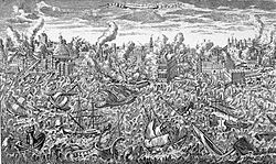
The Modified Mercalli intensity scale (MM,MMI, or MCS) measures the effects of an earthquake at a given location. This is in contrast with the seismic magnitude usually reported for an earthquake.

Contents

Magnitude scales measure the inherent force or strength of an earthquake – an event occurring at greater or lesser depth. (The "Mw " scale is widely used.) The MM scale measures intensity of shaking, at any particular location, on the surface. It was developed from Giuseppe Mercalli's Mercalli intensity scale of 1902.

While shaking experienced at the surface is caused by the seismic energy released by an earthquake, earthquakes differ in how much of their energy is radiated as seismic waves. They also differ in the depth at which they occur; deeper earthquakes have less interaction with the surface, their energy is spread throughout a larger volume, and the energy reaching the surface is spread across a larger area. Shaking intensity is localized. It generally diminishes with distance from the earthquake's epicenter, but it can be amplified in sedimentary basins and in certain kinds of unconsolidated soils.

Intensity scales categorize intensity empirically, based on the effects reported by untrained observers, and are adapted for the effects that might be observed in a particular region. [1] By not requiring instrumental measurements, they are useful for estimating the magnitude and location of historical (preinstrumental) earthquakes: the greatest intensities generally correspond to the epicentral area, and their degree and extent (possibly augmented by knowledge of local geological conditions) can be compared with other local earthquakes to estimate the magnitude.

History

Italian volcanologist Giuseppe Mercalli formulated his first intensity scale in 1883. [2] It had six degrees or categories, has been described as "merely an adaptation" of the then-standard Rossi–Forel scale of 10 degrees, and is now "more or less forgotten". [3] Mercalli's second scale, published in 1902, was also an adaptation of the Rossi–Forel scale, retaining the 10 degrees and expanding the descriptions of each degree. [4] This version "found favour with the users", and was adopted by the Italian Central Office of Meteorology and Geodynamics. [5]

In 1904, Adolfo Cancani proposed adding two additional degrees for very strong earthquakes, "catastrophe" and "enormous catastrophe", thus creating a 12-degree scale. [6] His descriptions being deficient, August Heinrich Sieberg augmented them during 1912 and 1923, and indicated a peak ground acceleration for each degree. [7] This became known as the "Mercalli–Cancani scale, formulated by Sieberg", or the "Mercalli–Cancani–Sieberg scale", or simply "MCS", [8] and was used extensively in Europe and remains in use in Italy by the National Institute of Geophysics and Volcanology (INGV). [9]

When Harry O. Wood and Frank Neumann translated this into English in 1931 (along with modification and condensation of the descriptions, and removal of the acceleration criteria), they named it the "modified Mercalli intensity scale of 1931" (MM31). [10] Some seismologists refer to this version the "Wood–Neumann scale". [8] Wood and Neumann also had an abridged version, with fewer criteria for assessing the degree of intensity.

The Wood–Neumann scale was revised in 1956 by Charles Francis Richter and published in his influential textbook Elementary Seismology. [11] Not wanting to have this intensity scale confused with the Richter magnitude scale he had developed, he proposed calling it the "modified Mercalli scale of 1956" (MM56). [8]

In their 1993 compendium of historical seismicity in the United States, [12] Carl Stover and Jerry Coffman ignored Richter's revision, and assigned intensities according to their slightly modified interpretation of Wood and Neumann's 1931 scale, [lower-alpha 1] effectively creating a new, but largely undocumented version of the scale. [13]

The basis by which the U.S. Geological Survey (and other agencies) assigns intensities is nominally Wood and Neumann's MM31. However, this is generally interpreted with the modifications summarized by Stover and Coffman because in the decades since 1931, "some criteria are more reliable than others as indicators of the level of ground shaking". [14] Also, construction codes and methods have evolved, making much of built environment stronger; these make a given intensity of ground shaking seem weaker. [15] Also, some of the original criteria of the most intense degrees (X and above), such as bent rails, ground fissures, landslides, etc., are "related less to the level of ground shaking than to the presence of ground conditions susceptible to spectacular failure". [14]

The categories "catastrophe" and "enormous catastrophe" added by Cancani (XI and XII) are used so infrequently that current USGS practice is to merge them into a single category "Extreme" abbreviated as "X+". [16]

Modified Mercalli intensity scale

The lesser degrees of the MMI scale generally describe the manner in which the earthquake is felt by people. The greater numbers of the scale are based on observed structural damage.

This table gives MMIs that are typically observed at locations near the epicenter of the earthquake. [17]

Scale levelGround conditions
I. Not feltNot felt except by very few under especially favorable conditions.
II. WeakFelt only by a few people at rest, especially on upper floors of buildings. Delicately suspended objects may swing.
III. WeakFelt quite noticeably by people indoors, especially on upper floors of buildings: Many people do not recognize it as an earthquake. Standing vehicles may rock slightly. Vibrations are similar to the passing of a truck, with duration estimated.
IV. LightFelt indoors by many, outdoors by few during the day: At night, some are awakened. Dishes, windows, and doors are disturbed; walls make cracking sounds. Sensations are like a heavy truck striking a building. Standing vehicles are rocked noticeably.
V. ModerateFelt by nearly everyone; many awakened: Some dishes and windows are broken. Unstable objects are overturned. Pendulum clocks may stop.
VI. StrongFelt by all, and many are frightened. Some heavy furniture is moved; a few instances of fallen plaster occur. Damage is slight.
VII. Very strongDamage is negligible in buildings of good design and construction; but slight to moderate in well-built ordinary structures; damage is considerable in poorly built or badly designed structures; some chimneys are broken. Noticed by motorists.
VIII. SevereDamage slight in specially designed structures; considerable damage in ordinary substantial buildings with partial collapse. Damage great in poorly built structures. Fall of chimneys, factory stacks, columns, monuments, walls. Heavy furniture overturned. Sand and mud ejected in small amounts. Changes in well water. Motorists are disturbed.
IX. ViolentDamage is considerable in specially designed structures; well-designed frame structures are thrown off-kilter. Damage is great in substantial buildings, with partial collapse. Buildings are shifted off foundations. Liquefaction occurs. Underground pipes are broken.
X. ExtremeSome well-built wooden structures are destroyed; most masonry and frame structures are destroyed with foundations. Rails are bent. Landslides considerable from river banks and steep slopes. Shifted sand and mud. Water splashed over banks.
XI. ExtremeFew, if any, (masonry) structures remain standing. Bridges are destroyed. Broad fissures erupt in the ground. Underground pipelines are rendered completely out of service. Earth slumps and land slips in soft ground. Rails are bent greatly.
XII. ExtremeDamage is total. Waves are seen on ground surfaces. Lines of sight and level are distorted. Objects are thrown upward into the air.

Correlation with magnitude

MagnitudeTypical Maximum Modified Mercalli Intensity
1.0–3.0I
3.0–3.9II–III
4.0–4.9IV–V
5.0–5.9VI–VII
6.0–6.9VII–IX
7.0 and higherVIII or higher
Magnitude/intensity comparison, USGS

Magnitude and intensity, while related, are very different concepts. Magnitude is a function of the energy liberated by an earthquake, while intensity is the degree of shaking experienced at a point on the surface, and varies from some maximum intensity at or near the epicenter, out to zero at distance. It depends upon many factors, including the depth of the hypocenter, terrain, distance from the epicenter, whether the underlying strata there amplify surface shaking, and any directionality due to the earthquake mechanism. For example, a magnitude 7.0 quake in Salta, Argentina, in 2011, that was 576.8 km deep, had a maximum felt intensity of V, [18] while a magnitude 2.2 event in Barrow in Furness, England, in 1865, about 1 km deep, had a maximum felt intensity of VIII. [19]

The small table is a rough guide to the degrees of the MMI scale. [17] [20] The colors and descriptive names shown here differ from those used on certain shake maps in other articles.

Estimating site intensity and its use in seismic hazard assessment

Dozens of intensity-prediction equations [21] have been published to estimate the macroseismic intensity at a location given the magnitude, source-to-site distance, and perhaps other parameters (e.g. local site conditions). These are similar to ground motion-prediction equations for the estimation of instrumental strong-motion parameters such as peak ground acceleration. A summary of intensity prediction equations is available. [22] Such equations can be used to estimate the seismic hazard in terms of macroseismic intensity, which has the advantage of being related more closely to seismic risk than instrumental strong-motion parameters. [23]

Correlation with physical quantities

The MMI scale is not defined in terms of more rigorous, objectively quantifiable measurements such as shake amplitude, shake frequency, peak velocity, or peak acceleration. Human-perceived shaking and building damage are best correlated with peak acceleration for lower-intensity events, and with peak velocity for higher-intensity events. [24]

Comparison to the moment magnitude scale

The effects of any one earthquake can vary greatly from place to place, so many MMI values may be measured for the same earthquake. These values can be displayed best using a contoured map of equal intensity, known as an isoseismal map. However, each earthquake has only one magnitude.

See also

Related Research Articles

<span class="mw-page-title-main">Giuseppe Mercalli</span> Italian volcanologist and priest (1850–1914)

Giuseppe Mercalli was an Italian volcanologist and Catholic priest. He is known best for the Mercalli intensity scale for measuring earthquake intensity.

Peak ground acceleration (PGA) is equal to the maximum ground acceleration that occurred during earthquake shaking at a location. PGA is equal to the amplitude of the largest absolute acceleration recorded on an accelerogram at a site during a particular earthquake. Earthquake shaking generally occurs in all three directions. Therefore, PGA is often split into the horizontal and vertical components. Horizontal PGAs are generally larger than those in the vertical direction but this is not always true, especially close to large earthquakes. PGA is an important parameter for earthquake engineering, The design basis earthquake ground motion (DBEGM) is often defined in terms of PGA.

<span class="mw-page-title-main">1987 Whittier Narrows earthquake</span> Earthquake in southern California

The 1987 Whittier Narrows earthquake occurred in the southern San Gabriel Valley and surrounding communities of Southern California, United States, at 7:42 a.m. PDT on October 1. The moderate magnitude 5.9 blind thrust earthquake was centered several miles north of Whittier in the town of Rosemead, had a relatively shallow depth, and was felt throughout southern California and southern Nevada. Many homes and businesses were affected, along with roadway disruptions, mainly in Los Angeles and Orange counties. Damage estimates ranged from $213–358 million, with 200 injuries, three directly-related deaths, and five additional fatalities that were associated with the event.

Seismic magnitude scales are used to describe the overall strength or "size" of an earthquake. These are distinguished from seismic intensity scales that categorize the intensity or severity of ground shaking (quaking) caused by an earthquake at a given location. Magnitudes are usually determined from measurements of an earthquake's seismic waves as recorded on a seismogram. Magnitude scales vary based on what aspect of the seismic waves are measured and how they are measured. Different magnitude scales are necessary because of differences in earthquakes, the information available, and the purposes for which the magnitudes are used.

The Richter scale, also called the Richter magnitude scale, Richter's magnitude scale, and the Gutenberg–Richter scale, is a measure of the strength of earthquakes, developed by Charles Francis Richter in collaboration with Beno Gutenberg, and presented in Richter's landmark 1935 paper, where he called it the "magnitude scale". This was later revised and renamed the local magnitude scale, denoted as ML or ML .

<span class="mw-page-title-main">1868 Hayward earthquake</span> 1868 earthquake in the San Francisco Bay Area, California, United States

The 1868 Hayward earthquake occurred in the San Francisco Bay Area, California, United States on October 21. With an estimated moment magnitude of 6.3–6.7 and a maximum Mercalli intensity of IX (Violent), it was the most recent large earthquake to occur on the Hayward Fault Zone. It caused significant damage and a number of deaths throughout the region, and was known as the "Great San Francisco earthquake" prior to the 1906 San Francisco earthquake and fire.

The 1965 Puget Sound earthquake occurred at 08:28 AM PDT on April 29 within the Puget Sound region of Washington state. It had a magnitude of 6.7 on the moment magnitude scale and a maximum perceived intensity of VIII (Severe) on the Mercalli intensity scale. It caused the deaths of seven people and about $12.5–28 million in damage. There were no recorded aftershocks.

<span class="mw-page-title-main">Isoseismal map</span> Type of map used in seismology

In seismology, an isoseismal map is used to show lines of equally felt seismic intensity, generally measured on the Modified Mercalli scale. Such maps help to identify earthquake epicenters, particularly where no instrumental records exist, such as for historical earthquakes. They also contain important information on ground conditions at particular locations, the underlying geology, radiation pattern of the seismic waves, and the response of different types of buildings. They form an important part of the macroseismic approach, i.e. that part of seismology dealing with noninstrumental data. The shape and size of the isoseismal regions can be used to help determine the magnitude, focal depth, and focal mechanism of an earthquake.

<span class="mw-page-title-main">1940 New Hampshire earthquakes</span>

The 1940 New Hampshire earthquakes struck on December 20 and again on December 24. Both shocks had an estimated Ms magnitude of 5.6, and a maximum Mercalli intensity of VII. These doublet earthquakes were the largest to hit the state in several hundred years. Damage included minor fractures or knocked over chimneys in a zone extending through New Hampshire and four other states: Maine, New York, Vermont and Massachusetts.

The 1867 Manhattan earthquake struck Riley County, Kansas, in the United States on April 24, 1867, at 20:22 UTC, or about 14:30 local time. The strongest earthquake to originate in the state, it measured 5.1 on a seismic scale that is based on an isoseismal map or the event's felt area. The earthquake's epicenter was near the town of Manhattan.

The 1865 Memphis earthquake struck southwest Tennessee near the Mississippi River in the United States on August 17 that year. Soon after the Mfa 5.0 earthquake hit, observers said the earth appeared to undulate and waves formed in nearby rivers. The force of the earthquake felled and cracked chimneys in Memphis and New Madrid, Missouri on the other side of the Mississippi. Shaking from the earthquake spread as far as St. Louis, Missouri; Jackson, Mississippi; and Illinois. Apart from the 1811–12 New Madrid earthquakes, only three major events have struck the state of Tennessee, in 1843, 1865, and 1895. Several minor events have taken place as well.

The 1872 North Cascades earthquake occurred at 9:40 p.m. local time on December 14 in central Washington Territory. A maximum Mercalli intensity of VIII (Severe) was assessed for several locations, though less intense shaking was observed at many other locations in Washington, Oregon, and British Columbia. Some of these intermediate outlying areas reported V (Moderate) to VII shaking, but intensities as high as IV (Light) were reported as far distant as Idaho and Montana. Due to the remote location of the mainshock and a series of strong aftershocks, damage to structures was limited to a few cabins close to the areas of the highest intensity.

Harry Oscar Wood (1879–1958) was an American seismologist who made several significant contributions in the field of seismology in the early twentieth-century. Following the 1906 earthquake in San Francisco, California, Wood expanded his background of geology and mineralogy and his career took a change of direction into the field of seismology. In the 1920s he co-developed the torsion seismometer, a device tuned to detect short-period seismic waves that are associated with local earthquakes. In 1931 Wood, along with another seismologist, redeveloped and updated the Mercalli intensity scale, a seismic intensity scale that is still in use as a primary means of rating an earthquake's effects.

The 1892 Vacaville–Winters earthquakes occurred in northern California as a large doublet on April 19 and April 21. Measured on a seismic scale that is based on an isoseismal map or the event's felt area, the 6.4 Mla and 6.2 Mla  events were assigned a maximum Mercalli intensity of IX (Violent), and affected the North Bay and Central Valley areas. The total damage was estimated to be between $225,000 and 250,000 and one person was killed. No evidence of fault movement on the surface of the ground was observed as a result of either of the strong shocks. Both occurred in the domain of the San Andreas strike-slip system of faults, but their focal mechanism is uncertain.

Seismic intensity scales categorize the intensity or severity of ground shaking (quaking) at a given location, such as resulting from an earthquake. They are distinguished from seismic magnitude scales, which measure the magnitude or overall strength of an earthquake, which may, or perhaps may not, cause perceptible shaking.

August Heinrich Sieberg was a German geophysicist. He researched mainly in the field of seismology and developed a seismic intensity scales as well as a tsunami intensity scale.

In early 1981 the eastern Gulf of Corinth, Greece was struck by three earthquakes with a magnitude greater than 6 Ms over a period of 11 days. The earthquake sequence caused widespread damage in the Corinth–Athens area, destroying nearly 8,000 houses and causing 20–22 deaths.

The 1946 Ancash earthquake in the Andes Mountains of central Peru occurred on November 10 at 17:43 UTC. The earthquake had a surface-wave magnitude of 7.0, and achieved a maximum Mercalli intensity scale rating of XI (Extreme). About 1,400 Peruvians are thought to have died from the event.

The 1979 Saint Elias earthquake occurred near noon local time on the 28th of February. It measured Mw 7.4–7.6. Though the maximum recorded Modified Mercalli intensity was VII, damage was minimal and there were no casualties due to the remoteness of the faulting. The epicenter lies near the Alaskan border between America and Canada.

References

Notes

  1. Their modifications were mainly to degrees IV and V, with VI contingent on reports of damage to man-made structures, and VII considering only "damage to buildings or other man-made structures". See details at Stover & Coffman 1993, pp. 3–4.

Citations

  1. "The Severity of an Earthquake". USGS. USA.gov. November 5, 2021.
  2. Davison 1921 , p. 103.
  3. Musson, Grünthal & Stucchi 2010 , p. 414.
  4. Davison 1921 , p. 108.
  5. Musson, Grünthal & Stucchi 2010 , p. 415.
  6. Davison 1921 , p. 112.
  7. Davison 1921 , p. 114.
  8. 1 2 3 Musson, Grünthal & Stucchi 2010 , p. 416.
  9. National Institute of Geophysics and Volcanology. "Intensity evaluation method". Archived from the original on 2022-10-20. Retrieved 2022-10-20.
  10. Wood & Neumann 1931.
  11. Richter 1958; Musson, Grünthal & Stucchi 2010 , p. 416.
  12. Stover & Coffman 1993
  13. Grünthal 2011 , p. 238. The most definitive exposition of the Stover and Coffman's effective scale is at Musson & Cecić 2012 , §12.2.2.
  14. 1 2 Dewey et al. 1995 , p. 5.
  15. Davenport & Dowrick 2002.
  16. Musson, Grünthal & Stucchi 2010 , p. 423.
  17. 1 2 "Magnitude vs Intensity" (PDF). USGS. Archived (PDF) from the original on 2022-03-05. Retrieved 2022-03-05.
  18. United States Geological Survey. "M 7.0 – 26 km NNE of El Hoyo, Argentina – Impact". ANSS Comprehensive Earthquake Catalog.
  19. British Geological Survey. "UK Historical Earthquake Database" . Retrieved 2018-03-15.
  20. "Modified Mercalli Intensity Scale". Association of Bay Area Governments. Archived from the original on 2023-03-26. Retrieved 2017-09-02.
  21. Allen, Wald & Worden 2012.
  22. "Ground motion prediction equations (1964–2021) by John Douglas, University of Strathclyde, Glasgow, United Kingdom".
  23. Musson 2000.
  24. "ShakeMap Scientific Background". USGS. Archived from the original on 2009-08-25. Retrieved 2017-09-02.

Sources

Further reading