List of earthquakes in 2004

Last updated

Earthquakes in 2004
World location map (equirectangular 180).svg
Yellow pog.svg
Yellow pog.svg
Yellow pog.svg
Yellow pog.svg
Yellow pog.svg
Yellow pog.svg
Yellow pog.svg
Orange pog.svg
Orange pog.svg
Orange pog.svg
Orange pog.svg
Orange pog.svg
Orange pog.svg
Orange pog.svg
Orange pog.svg
Orange pog.svg
Orange pog.svg
Orange pog.svg
Orange pog.svg
Red pog.svg
Red pog.svg
Approximate epicenters of the earthquakes in 2004
Strongest magnitude Flag of Indonesia.svg 9.1 Mw, Indonesia
Deadliest Flag of Indonesia.svg 9.1 Mw, Indonesia
227,898 deaths
Total fatalities228,755
Number by magnitude
9.0+1
8.0–8.91
7.0–7.916
6.0–6.9145
5.0–5.91519
  2003
2005  

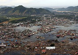
This is a list of earthquakes in 2004. Only earthquakes of magnitude 6 or above are included, unless they resulted in significant damage or casualties, or were notable for some other reason. All dates are listed according to UTC time. The year 2004 had the most major earthquakes since 1999. In total, there were 16 magnitude 7.0+ earthquakes this year, 6 of them were in Indonesia. Most of the earthquake deaths in 2004 were caused by the magnitude 9.1–9.3 earthquake off the west coast of Sumatra in December. Most of the deaths were caused by a devastating tsunami that spread across the Indian Ocean. There were several other deadly and destructive earthquakes, including Morocco's largest earthquake until 2023, which caused 628 deaths. Japan was hit by a magnitude 6.6 earthquake, which caused 68 deaths and $28 billion in damage, making it the sixth costliest earthquake in history.

Contents

Compared to other years

Number of Earthquakes Worldwide for 20082017
[ Worldwide ]
Magnitude Ranging Between 1999 2000 2001 2002 2003 2004 2005 2006 2007 2008 2009 2010 2011 2012 2013 2014 2015
8−9.9 0 1 1 0 1 2 1 2 4 1 1 1 1 2 2 1 1
7−7.9 18 14 15 13 14 14 10 9 13 12 16 21 19 15 17 11 18
6−6.9 118 145 121 126 140 141 140 142 178 168 144 151 204 129 125 144 124
5−5.9 1057 1335 1215 1171 1203 1515 1693 1712 2074 1768 1896 1963 2271 1412 1402 1577 1413
Total 1193 1495 1352 1310 1358 1672 1844 1865 2270 1948 2057 2136 2495 1558 1546 1733 1556

Note that an increase in detected earthquake numbers does not necessarily represent an increase in earthquakes per se. Population increase, habitation spread, and advances in earthquake detection technology all contribute to higher earthquake numbers being recorded over time. USGS's Website has more information.

For exact dates and live earthquakes please visit USGS's Global Earthquake Search Page and Real-time Earthquake Map or EMSC's Real-time Seismicity.

Overall

By death toll

RankMagnitudeDeath tollLocation MMI Depth (km)Date
19.1227,898 Flag of Indonesia.svg Indonesia, Sumatra offshoreIX (Violent) 30.026 December
26.4631 Flag of Morocco.svg Morocco, Al Hoceima IX (Violent) 12.224 February
36.668 Flag of Japan.svg Japan, Chūbu IX (Violent) 13.023 October
47.037 Flag of Indonesia.svg Indonesia, Papua VIII (Severe)16.6February 5
56.335 Flag of Iran.svg Iran, Baladeh VIII (Severe) 20.0May 28
67.132 Flag of Indonesia.svg Indonesia, Papua VIII (Severe)24.026 November
75.524 Flag of Pakistan.svg Pakistan, Khyber Pakhtunkhwa VIII (Severe) 11.014 February
87.523 Flag of Indonesia.svg Indonesia, Alor VIII (Severe) 10.011 November
95.118 Flag of Turkey.svg Turkey. Ağrı VI (Strong) 5.02 July

By magnitude [1]

RankMagnitudeDeath tollLocationDepth (km)Date
1.9.1227,898 Flag of Indonesia.svg Indonesia, Sumatra offshore30.026 December
2.8.10 Flag of Australia (converted).svg Australia, north of Macquarie Island 10.023 December
3.7.523 Flag of Indonesia.svg Indonesia, Kepulauan Alor 10.011 November
4.7.40 Flag of Japan.svg Japan, off the coast of Honshu 10.05 September
5.7.30 Flag of Indonesia.svg Indonesia, southern Sumatra 582.125 July
5.7.30 Flag of Indonesia.svg Indonesia, near the coast of West Papua 10.07 February
7.7.20 Flag of Colombia.svg Colombia, near the coast of Chocó 15.015 November
7.7.20 Flag of India.svg India, near the coast of the Nicobar Islands 39.226 December
9.7.10 Flag of Japan.svg Japan, near the coast of Honshu 14.05 September
9.7.132 Flag of Indonesia.svg Indonesia, Papua 10.026 November
9.7.10 Flag of New Zealand.svg New Zealand, off the coast of the South Island 10.023 November
9.7.10 Flag of Fiji.svg Fiji, off the eastern coast of Levuka 565.515 July
9.7.10 Flags of New Caledonia.svg New Caledonia, Southeast of the Loyalty Islands 22.03 January
14.7.00 Flag of Japan.svg Japan, off the eastern coast of Hokkaido 39.029 November
14.7.00 Flag of Nicaragua.svg Nicaragua, off the coast of Managua 35.010 October
14.7.037 Flag of Indonesia.svg Indonesia, Papua 16.66 February

By month

January

January
Strongest magnitude7.1 Mw Flags of New Caledonia.svg  New Caledonia
Deadliest5.8 Mw Flag of Indonesia.svg  Indonesia
1 death
Total fatalities1
Number by magnitude
8.0–8.90
7.0–7.91
6.0–6.913

February

February
Strongest magnitude7.3 Mw Flag of Indonesia.svg  Indonesia
Deadliest6.3 Mw Flag of Morocco.svg  Morocco
631 deaths
Total fatalities671
Number by magnitude
8.0–8.90
7.0–7.92
6.0–6.99

March

March
Strongest magnitude2 events reached 6.2 Mw
Deadliest3.8 Mw Flag of Turkey.svg Turkey
6 deaths
Total fatalities16
Number by magnitude
8.0–8.90
7.0–7.90
6.0–6.910

April

April
Strongest magnitude6.7 Mw Flag of Indonesia.svg  Indonesia
Deadliest6.6 Mw Flag of Afghanistan (2004-2013).svg  Afghanistan
3 deaths
Total fatalities3
Number by magnitude
8.0–8.90
7.0–7.90
6.0–6.919

May

May
Strongest magnitude6.6 Mw Flag of Chile.svg  Chile
Deadliest6.3 Mw Flag of Iran.svg Iran
35 deaths
Total fatalities38
Number by magnitude
8.0–8.90
7.0–7.90
6.0–6.97

June

June
Strongest magnitude6.9 Mw, Flag of Russia.svg  Russia
Total fatalities0
Number by magnitude
8.0–8.90
7.0–7.90
6.0–6.98

July

July
Strongest magnitude7.3 Mw Flag of Indonesia.svg  Indonesia
Deadliest5.1 Mw Flag of Turkey.svg Turkey
18 deaths
Total fatalities23
Number by magnitude
8.0–8.90
7.0–7.92
6.0–6.98

August

August
Strongest magnitude6.5 Mw, Flag of Chile.svg  Chile
Deadliest5.4 Mw Flag of the People's Republic of China.svg  China
4 deaths
Total fatalities5
Number by magnitude
8.0–8.90
7.0–7.90
6.0–6.94

September

September
Strongest magnitude7.4 Mw, Flag of Japan.svg  Japan
Deadliest6.4 Mw, Flag of Argentina.svg  Argentina
1 death
Total fatalities1
Number by magnitude
8.0–8.90
7.0–7.92
6.0–6.912

October

October
Strongest magnitude7.0 Mw Flag of Nicaragua.svg  Nicaragua
7.0 Mw Flag of Japan.svg  Japan
Deadliest6.8 Mw Flag of Japan.svg Japan
68 deaths
Total fatalities68
Number by magnitude
8.0–8.90
7.0–7.92
6.0–6.912

November

November
Strongest magnitude7.5 Mw, Flag of Indonesia.svg  Indonesia
Deadliest7.1 Mw, Flag of Indonesia.svg Indonesia
32 deaths
Total fatalities64
Number by magnitude
8.0–8.90
7.0–7.95
6.0–6.99

December

December
Strongest magnitude9.1 Mw, Flag of Indonesia.svg  Indonesia
Deadliest9.1 Mw, Flag of Indonesia.svg Indonesia
Total fatalities227,898
Number by magnitude
8.0–8.92
7.0–7.91
6.0–6.921

Related Research Articles

The Nemuro-Oki earthquake in scientific literature, occurred on June 17 at 12:55 local time. It struck with an epicenter just off the Nemuro Peninsula in northern Hokkaidō, Japan. It measured 7.8–7.9 on the moment magnitude scale (Mw ), 8.1 on the tsunami magnitude scale (Mt ) and 7.4 on the Japan Meteorological Agency magnitude scale (MJMA ).

<span class="mw-page-title-main">2021 Dali earthquake</span> Earthquake in China

On May 21, 2021, a 6.1 magnitude earthquake struck the Dali City, Yunnan, China, at a depth of 10.0 km. Three people died during the quake, while another 32 were injured. The earthquake was referred by the Chinese media as the 5.21 earthquake or 2021 Yangbi earthquake.

The 2020 Kashgar earthquake, also known as the Jiashi earthquake occurred on 19 January 2020 at 21:27:56 China Standard Time in Xinjiang Province, China. According to the United States Geological Survey, the earthquake had a moment magnitude of 6.0 and a surface wave magnitude of 6.4 according to the China Earthquake Network Center. It struck at a shallow depth of 5.6 km according to the USGS while the CENC has the figure at 16 km. Local emergency management agencies said the earthquake damaged more than 1,000 homes and businesses in the nearby populated towns and villages. One person is known to have died while two other children were injured.

<span class="mw-page-title-main">2021 Chignik earthquake</span> 7th largest earthquake in the US

An earthquake occurred off the coast of the Alaska Peninsula on July 28, 2021, at 10:15 p.m. local time. The large megathrust earthquake had a moment magnitude of 8.2 according to the United States Geological Survey (USGS). A tsunami warning was issued by the National Oceanic and Atmospheric Administration (NOAA) but later cancelled. The mainshock was followed by a number of aftershocks, including three that were of magnitude 5.9, 6.1 and 6.9 respectively.

The 2022 Hormozgan earthquakes were a pair of doublet earthquakes that struck southern Iran on 1 July, 2022. The earthquakes, which occurred around two hours apart, killed seven people and injured dozens more.

<span class="mw-page-title-main">2022 Michoacán earthquake</span> 2022 earthquake in Mexico

On 19 September 2022, a moment magnitude 7.6-7.7 earthquake struck between the Mexican states of Michoacán and Colima at 13:05:06 local time. The earthquake had a depth of 26.9 km (16.7 mi), resulting in a maximum intensity of VIII (Severe) on the Modified Mercalli intensity scale. The USGS reported the epicentre was 35 km (22 mi) southwest of the town of Aquila. Two people were killed and at least 35 others were injured across several states. A magnitude 6.8 aftershock struck on 22 September, causing three more deaths.

References

  1. "Latest Earthquakes". United States Geological Survey . Retrieved July 6, 2021.
  2. "M 5.8 - 24 km NE of Amlapura, Indonesia". United States Geological Survey. January 1, 2004. Retrieved November 22, 2021.
  3. "M6.1 - Guerrero, Mexico". United States Geological Survey. January 1, 2004. Retrieved June 5, 2015.
  4. "M7.1 -202 km ESE of Tadine, New Caledonia". United States Geological Survey. January 3, 2004. Retrieved July 3, 2021.
  5. "M 6.3 - 22 km NW of Kandrian, Papua New Guinea". United States Geological Survey. January 9, 2004. Retrieved November 22, 2021.
  6. "M 2.2 - 5 km ENE of Banská Bystrica, Slovakia". earthquake.usgs.gov.
  7. "M 4.5 - 10 km NNW of Boumerdas, Algeria". earthquake.usgs.gov.
  8. "M 6.0 - 280 km SE of Levuka, Fiji". earthquake.usgs.gov.
  9. "M 4.7 - 14 km SSW of Muramvya, Burundi". earthquake.usgs.gov.
  10. "M 3.8 - 5 km NE of Çelikhan, Turkey". earthquake.usgs.gov.
  11. "M 5.5 - 236 km NE of Xilin Hot, China". earthquake.usgs.gov.
  12. "M 6.6 - Afghanistan-Tajikistan-Pakistan region". earthquake.usgs.gov.
  13. "M 4.1 - 2 km ESE of Bolu, Turkey". earthquake.usgs.gov.
  14. "M 5.5 - 271 km SSW of Laojunmiao, China". earthquake.usgs.gov.
  15. "M 4.5 - 13 km ESE of Quetta, Pakistan". earthquake.usgs.gov.
  16. "M6.3- 41 km SSE of Nowshahr, Iran". United States Geological Survey. May 28, 2004. Retrieved July 6, 2021.
  17. "M 4.9 - 18 km SSE of Chekhov, Russia". earthquake.usgs.gov.
  18. "M 4.6 - 70 km SSE of Tabuk, Saudi Arabia". earthquake.usgs.gov.
  19. "M5.1- 18 km SSW of I?d?r, Turkey". United States Geological Survey. July 1, 2004. Retrieved July 7, 2021.
  20. "Fatalities in Turkey earthquake". Al Jazeera. July 2, 2004. Retrieved July 7, 2021.
  21. "M 4.6 - 8 km SE of Qarah B?gh, Afghanistan". earthquake.usgs.gov.
  22. "M 5.2 - 33 km SE of Gardez, Afghanistan". earthquake.usgs.gov.
  23. "M7.3- 100 km SSE of Jambi City, Indonesia". United States Geological Survey. July 25, 2004. Retrieved July 7, 2021.
  24. "M 4.8 - 14 km NW of Do?ubayaz?t, Turkey". earthquake.usgs.gov.
  25. "M 5.6 - 15 km NE of Datça, Turkey". earthquake.usgs.gov.
  26. "M 6.0 - 46 km S of Jurm, Afghanistan". earthquake.usgs.gov.
  27. "M 5.4 - 16 km ESE of Zhaotong, China". earthquake.usgs.gov.
  28. "M 5.7 - 8 km SSW of Sivrice, Turkey". earthquake.usgs.gov.
  29. "M 7.2 - 94 km SE of Shing?, Japan". earthquake.usgs.gov.
  30. "M 7.4 - 114 km ESE of Shing?, Japan". earthquake.usgs.gov.
  31. "M 6.4 - 12 km SSW of San Fernando del Valle de Catamarca, Argentina". earthquake.usgs.gov.
  32. "M 5.2 - 107 km WNW of Mawu, China". earthquake.usgs.gov.
  33. "M 6.0 - 24 km WNW of Looc, Philippines". earthquake.usgs.gov.
  34. "M 4.8 - 3 km SSW of Yantarnyy, Russia". earthquake.usgs.gov.
  35. "Толчки к панике: 10 лет назад в Калининграде произошло землетрясение". m.kaliningrad.ru (in Russian). 2014-09-21. Retrieved 2022-03-06.
  36. "M6.0 -10 km SSE of Parkfield, California". United States Geological Survey. September 28, 2004. Retrieved July 3, 2021.
  37. "M 5.8 - 4 km E of Noda, Japan". earthquake.usgs.gov.
  38. "M 5.6 - 31 km N of Gorg?n, Iran". earthquake.usgs.gov.
  39. "M 4.8 - 119 km WSW of Dali, China". earthquake.usgs.gov.
  40. "PHOTOS: Costa Rica's 70 'most historic' earthquakes". ticotimes.net. September 21, 2014. Retrieved July 6, 2021.
  41. "17 km SSE of Tejar, Costa Rica". United States Geological Survey. November 21, 2014. Retrieved July 7, 2021.
  42. "M 6.3 - 20 km SSW of Petites Anses, Guadeloupe". United States Geological Survey. November 21, 2004. Retrieved November 24, 2021.
  43. "M 5.1 - 0 km WNW of Gardone Riviera, Italy". earthquake.usgs.gov.
  44. "M 7.0 - 51 km SW of Nemuro, Japan". earthquake.usgs.gov.
  45. "M 4.5 - 12 km NNW of Boumerdas, Algeria". United States Geological Survey. December 5, 2004. Retrieved March 5, 2022.
  46. "M 5.8 - 23 km NNE of Rumoi, Japan". earthquake.usgs.gov.
  47. "M6.8 - 36 km S of George Town, Cayman Islands". United States Geological Survey. December 14, 2004. Retrieved July 6, 2021.
  48. "M 5.4 - 19 km WSW of Ula, Turkey". United States Geological Survey. December 20, 2004. Retrieved November 24, 2021.
  49. "M7.2 -284 km WNW of Sabang, Indonesia". United States Geological Survey. December 26, 2004. Retrieved July 6, 2021.