2007 Mozambican flood

Last updated
Mozambique LocationMozambique.svg
Mozambique
Cyclone Favio made landfall on February 22, 2007. Cyclone Favio 22 February 2007 0820Z.jpg
Cyclone Favio made landfall on February 22, 2007.

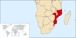
The 2007 Mozambican flood began in late December 2006 when the Cahora Bassa Dam overflowed from heavy rains on Southern Africa. It worsened on February 22, 2007, when the Category 4 Cyclone Favio made landfall on the central province of Inhambane; experts tracking the cyclone predicted that it would worsen flooding in the Zambezi River valley. [1] The Zambezi River broke its banks, flooding the surrounding areas in Mozambique. [2] [3] The Chire and Rivubue rivers also flooded. [4]

80,600 people had been evacuated from their homes in the Tete, Manica, Sofala and Zambezia provinces by February 14. [5] By February 22, the United Nations Office for the Coordination of Humanitarian Affairs reported that approximately 121,000 people had been displaced by the flooding. [6] Some people refused to leave their homes and livestock. [5] There were 29 confirmed casualties and a further 10 unconfirmed deaths. [7]

In early February, the Mozambican authorities did not think the flooding would be as devastating as the 2000 and 2001 floods. Paulo Zucula, head of Mozambique's national relief agency, said "We expect more water than we had in 2001. The situation is deteriorating and it will get worse but this time we are better prepared than in 2001". [2] The World Food Program (WFP) estimated that up to 285,000 people may require food aid. [4] Delivery of food aid by the WFP began on February 15. [8] A single UN helicopter was made available for the delivery of aid to evacuation centres. [9] However, thousands of people had not yet received food or drinking water, and the threat of disease outbreaks had also increased; Paulo Zucula retracted his earlier comments about readiness, saying "We were not prepared... it's another disaster". [10]

Notes

  1. Beatty, Sean. Tropical cyclone slams into flood-stricken Mozambique. BBC News, February 24, 2007
  2. 1 2 Mozambique floods displace 68 000, more at risk Archived 2007-09-29 at the Wayback Machine SABC News, February 12, 2007.
  3. Mozambique issues flood warning as Zambezi breaches banks Archived 2007-10-04 at the Wayback Machine Vanguard Online, February 10, 2007.
  4. 1 2 Floods wreak havoc in parts of southern Africa, billions need help Archived 2007-02-13 at the Wayback Machine . World Food Program . February 9, 2007
  5. 1 2 Faul, Michelle (February 14, 2007). "Some Refuse to Flee Mozambique Flood". The Washington Post.
  6. Mozambique: Floods OCHA Situation Report No. 7. OCHA, February 22, 2007
  7. "Mozambique seeks urgent flood aid". BBC News. February 14, 2007.
  8. Helicopters aid Mozambique flood victims. Reuters. February 15, 2007
  9. WFP starts helicopter rescue and food deliveries to victims of Mozambique floods Archived 2007-03-14 at the Wayback Machine . World Food Program. February 15, 2007
  10. "Flood aid struggle in Mozambique". BBC News. February 19, 2007.

Related Research Articles

<span class="mw-page-title-main">Kariba Dam</span> Dam in Zambia, Zimbabwe

The Kariba Dam is a double curvature concrete arch dam in the Kariba Gorge of the Zambezi river basin between Zambia and Zimbabwe. The dam stands 128 metres (420 ft) tall and 579 metres (1,900 ft) long. The dam forms Lake Kariba, which extends for 280 kilometres (170 mi) and holds 185 cubic kilometres (150,000,000 acre⋅ft) of water.

<span class="mw-page-title-main">Mozambique</span> Country in Southeastern Africa

Mozambique, officially the Republic of Mozambique, is a country located in southeastern Africa bordered by the Indian Ocean to the east, Tanzania to the north, Malawi and Zambia to the northwest, Zimbabwe to the west, and Eswatini and South Africa to the southwest. The sovereign state is separated from the Comoros, Mayotte and Madagascar by the Mozambique Channel to the east. The capital and largest city is Maputo.

<span class="mw-page-title-main">Cahora Bassa</span> Reservoir in Mozambique

The Cahora Bassa lake—in the Portuguese colonial era known as Cabora Bassa, from Nyungwe Kahoura-Bassa, meaning "finish the job"—is Africa's fourth-largest artificial lake, situated in the Tete Province in Mozambique. In Africa, only Lake Volta in Ghana, Lake Kariba, on the Zambezi upstream of Cahora Bassa, and Egypt's Lake Nasser are bigger in terms of surface water.

<span class="mw-page-title-main">2000 Mozambique flood</span> Natural disaster

The 2000 Mozambique flood was a natural disaster that occurred in February and March 2000. The catastrophic flooding was caused by heavy rainfall caused by Cyclone Leon-Eline that lasted for four weeks and made many homeless. Approximately 800 people died, 1400 km2 of arable land was affected and 20,000 head of cattle and food were lost. It was the worst flood in Mozambique in 50 years. The government of Mozambique distributed 15 million dollars to its citizens to account for damage property and loss of income.

The following lists events that happened during 2000 in South Africa.

<span class="mw-page-title-main">Cyclone Leon–Eline</span> Australian and South-West Indian cyclone in 2000

Intense Tropical Cyclone Leon–Eline was the second longest-lived cyclone in the Indian Ocean, behind Cyclone Freddy, traveling over 11,000 km (6,800 mi) during its 29-day track through the Indian Ocean, throughout the entire month of February. The cyclone formed on 1 February 2000, in the Australian basin as Tropical Cyclone Leon, and was renamed Eline after crossing 90° E into the South-West Indian Ocean; there, the Météo-France office in Réunion (MFR) tracked the storm's movement and intensity. Late on 17 February, Eline made landfall near Mahanoro, Madagascar, with 10‑minute winds of 165 km/h (103 mph). The storm rapidly weakened over land, but restrengthened in the Mozambique Channel to reach peak 10‑minute winds of 185 km/h (115 mph), making it an intense tropical cyclone. On 22 February, Eline made landfall about 80 km (50 mi) south of Beira, Mozambique, near peak intensity. Eline quickly weakened over land as it moved across Southern Africa, finally dissipating over eastern Namibia on 29 February.

Various international and local diplomatic and humanitarian efforts in the Somali Civil War have been in effect since the conflict first began in the early 1990s. The latter include diplomatic initiatives put together by the African Union, the Arab League and the European Union, as well as humanitarian efforts led by the Office for the Coordination of Humanitarian Affairs (OCHA), UNICEF, the World Food Programme (WFP), the Puntland Maritime Police Force (PMPF) and the Somali Red Crescent Society (SRCS).

Paulo Zucula is a Mozambican politician and Mozambique's Minister of Transportation and Communication since March 2008.

The National Disasters Management Institute is the disaster relief agency of Mozambique.

<span class="mw-page-title-main">2009 Angola, Namibia and Zambia floods</span>

The 2009 Angola, Namibia and Zambia floods was a natural disaster which began in early March 2009 and resulted in the deaths of at least 131 people and otherwise affected around 445,000 people. The floods affected seven regions of Namibia, three provinces of Zambia, two regions of Angola and part of Botswana. The floodwaters damaged buildings and infrastructure and displaced at least 300,000 people. A state of emergency was declared in northern Namibia and there were fears that a disease epidemic would ensue. The Red Cross agencies and governments of the two countries responded to the disaster, and aid was distributed by the World Health Organization.

<span class="mw-page-title-main">Cyclone Japhet</span> South-West Indian cyclone in 2003

Intense Tropical Cyclone Japhet was a damaging tropical cyclone that affected southeast Africa in March 2003. It developed on February 25 near the southwest coast of Madagascar, and initially moved to the northwest before turning to the southwest. With favorable conditions for development, Japhet quickly intensified in the Mozambique Channel, reaching maximum winds of 175 km/h (109 mph), sustained over 10 minutes. After stalling briefly, the cyclone turned to the northwest, weakening slightly before striking Mozambique just south of Vilankulo on March 2. Japhet slowly weakened while progressing inland, dissipating over Zambia on March 6.

<span class="mw-page-title-main">Tropical Storm Delfina</span> South-West Indian tropical storm in 2002 and 2003

Severe Tropical Storm Delfina was a damaging tropical cyclone that affected southeastern Africa in January 2003. The fourth named storm of the 2002–03 South-West Indian Ocean cyclone season, Delfina formed off the northwest coast of Madagascar on December 30, 2002. It quickly intensified while moving westward, becoming a strong tropical storm before hitting northeastern Mozambique on December 31. Delfina weakened while moving inland, and it was no longer classifiable as a tropical cyclone by January 1, 2003. However, its remnants moved across the country and into Malawi, later looping around and crossing back over Mozambique; the remnants of Delfina were last observed on January 9.

<span class="mw-page-title-main">Cyclone Favio</span> South-West Indian cyclone in 2007

Intense Tropical Cyclone Favio was the first known tropical cyclone that passed south of Madagascar to strike Africa as an intense tropical cyclone. Early on 11 February 2007, a zone of disturbed weather formed east of Madagascar. Four days later, Favio was named as intensified to a moderate tropical storm while moving southwest. On 18 February, the storm was upgraded into a severe tropical storm. Then, it turned west in the general direction of Mozambique. Continuing to intensify, Favio was upgraded to a tropical cyclone early on 19 February. Subsequently, the storm began to undergo rapid deepening; the small storm reached intense tropical cyclone status the next day before peaking in intensity. However, the cyclone had weakened somewhat prior to making landfall on 22 February in the Inhambane Province in Mozambique. It rapidly weakened over land and dissipated the next day.

<span class="mw-page-title-main">Cyclone Hudah</span> South-West Indian and Australian cyclone in 2000

Very Intense Tropical Cyclone Hudah was a powerful and destructive tropical cyclone that affected Southeast Africa in April 2000. It was the last in a series of three cyclones that impacted Madagascar during the year. Hudah first developed as a disturbance embedded within the monsoon trough on 22 March, within the Australian region cyclone basin. Moving westward as the result of a strong subtropical ridge to its south, the storm quickly intensified, and reached Category 2 cyclone intensity on 25 March before entering the Southwest Indian cyclone basin. For various reasons that remain unknown, the cyclone was only designated a name by the time it had crossed into the area of responsibility of the Regional Specialized Meteorological Center in Réunion. Nonetheless, Météo-France (MFR) assigned the name Hudah to the cyclone. An eye formed, and the storm intensified into a tropical cyclone on 27 March well to the southeast of Diego Garcia. On 1 April, the MFR upgraded it to a very intense tropical cyclone, estimating peak 10-minute winds of 225 km/h (140 mph). By contrast, the Joint Typhoon Warning Center (JTWC) estimated 1-minute winds of 235 km/h (146 mph). At this time, the MFR estimated the pressure to have been 905 hPa (mbar), making Hudah the most intense tropical cyclone worldwide in 2000. Cyclone Hudah maintained peak winds until making landfall just southeast of Antalaha, Madagascar on 2 April. It weakened greatly over land, but re-attained tropical cyclone status on 5 April after moving over the Mozambique Channel. Hudah reached 10-minute winds of 160 km/h (99 mph) by the time it made landfall on Mozambique near Pebane, Mozambique, on 8 April, and dissipated by the next day.

<span class="mw-page-title-main">Early 2000 Madagascar floods</span>

In early 2000, severe flooding occurred in the African nation of Madagascar after Cyclone Leon–Eline and Severe Tropical Storm Gloria struck the nation within a two-week period. The first storm, Eline, formed on February 1, and took an extended track across the Indian Ocean, eventually making landfall near Mahanoro on February 17. On March 1, Gloria struck northeastern Madagascar, and like Eline, moved southwestward across the country.

<span class="mw-page-title-main">Cyclone Idai</span> South-West Indian Ocean cyclone in 2019

Intense Tropical Cyclone Idai was one of the worst tropical cyclones on record to affect Africa and the Southern Hemisphere. The long-lived storm caused catastrophic damage, and a humanitarian crisis in Mozambique, Zimbabwe, and Malawi, leaving more than 1,500 people dead and many more missing. Idai is the deadliest tropical cyclone recorded in the South-West Indian Ocean basin. In the Southern Hemisphere, which includes the Australian, South Pacific, and South Atlantic basins, Idai ranks as the second-deadliest tropical cyclone on record. The only system with a higher death toll is the 1973 Flores cyclone that killed 1,650 off the coast of Indonesia.

<span class="mw-page-title-main">Tropical cyclones in Southern Africa</span> Storms affecting Tanzania, Mozambique, and South Africa

At least 30 tropical cyclones have affected the Southern African mainland. Three southeastern African countries border the Indian Ocean – Tanzania, Mozambique, and South Africa. Other inland countries also experience the effects of tropical cyclones, including Botswana, Eswatini, Lesotho, Malawi, Namibia, Zambia, and Zimbabwe.

<span class="mw-page-title-main">Cyclone Eloise</span> South-West Indian Ocean cyclone in 2021

Tropical Cyclone Eloise was the strongest tropical cyclone to impact the country of Mozambique since Cyclone Kenneth in 2019 and the second of three consecutive tropical cyclones to impact Mozambique in the 2020–21 South-West Indian Ocean cyclone season. The seventh tropical depression, fifth named storm and the second tropical cyclone of the season, Eloise's origins can be traced to a disturbance over the central portion of the South-West Indian Ocean basin which developed into a tropical depression on 16 January, and strengthened into a tropical storm on 17 January, though the storm had limited strength and organization. On the next day, the storm entered a more favorable environment, and it soon intensified to a severe tropical storm on 18 January. Late on 19 January, Eloise made landfall in northern Madagascar as a moderate tropical storm, bringing with it heavy rainfall and flooding. The storm traversed Madagascar and entered the Mozambique Channel in the early hours of 21 January. After moving southwestward across the Mozambique Channel for an additional 2 days, Eloise strengthened into a Category 1-equivalent cyclone, due to low wind shear and high sea surface temperatures. Early on 23 January, Eloise peaked as a Category 2-equivalent tropical cyclone on the Saffir–Simpson scale as the center of the storm began to move ashore on Mozambique. Shortly afterward, Eloise made landfall just north of Beira, Mozambique, before rapidly weakening. Subsequently, Eloise weakened into a remnant low over land on 25 January, dissipating soon afterward.

<span class="mw-page-title-main">Battle of Palma</span> Battle for the control of Palma in Mozambique

The Battle of Palma or the Battle for Palma was fought during late March and early April 2021 over control of the city of Palma in Mozambique, between the Mozambique Defence Armed Forces, other Mozambican security forces and private military contractors on one side, and Islamist rebels reportedly associated with the Islamic State (IS) on another side. The Islamists invaded the city, killing dozens of people before Mozambique regained control days later. Palma was left destroyed, and a major oil and gas company decided to suspend all operations in the area due to the battle. Researchers have described the battle as an overall success for the insurgents. The rebels also maintained their presence in the town's surroundings, and continued to raid Palma in the following weeks. The battle was part of the insurgency in Cabo Delgado, which started in 2017 and has resulted in the deaths of thousands of people, mainly local civilians.

<span class="mw-page-title-main">Cyclone Freddy</span> Australian and South-West Indian cyclone in 2023

Very Intense Tropical Cyclone Freddy was an exceptionally long-lived, powerful, and deadly storm that traversed the southern Indian Ocean for more than five weeks in February and March 2023. Freddy is both the longest-lasting and highest-ACE-producing tropical cyclone ever recorded worldwide. Additionally, it is the third-deadliest tropical cyclone recorded in the Southern Hemisphere, only behind 2019's Cyclone Idai and the 1973 Flores cyclone. It was the fourth named storm of the 2022–23 Australian region cyclone season, and the second very intense tropical cyclone of the 2022–23 South-West Indian Ocean cyclone season.