2008 Benin floods

Last updated

The 2008 Benin floods struck the nation of Benin between July and October 2008, and affected the other West African nations of Burkina Faso, Mali, Mauritania, Niger and Togo. According to the Red Cross of Benin, the flooding in Benin initially affected almost 7,000 people, including the displacement of 1,560 children. and by 19 August 2008 the World Health Organization (WHO) estimated that the flooding had displaced at least 150,000 people. Some 500,000 people in total were at risk of additional flooding. [1] [2]

Contents

The Oueme River as it flows into the Atlantic Ocean in Cotonou Oueme River Cotonou Atlantic.jpg
The Ouémé River as it flows into the Atlantic Ocean in Cotonou

Flooding

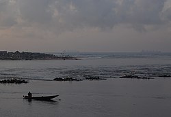
The Mono River and Ouémé River which flows down through central Benin into the economic capital of Cotonou on the coast in particular was a problem. [2] Weeks after the initial flooding in July 2008, many areas of Cotonou were still not drained, posing a serious risk to health given that the flooding affected many densely populated areas and some 10% of the nation's population live in the city. [2] Representatives from the municipal council of Cotonou, WHO’s Cotonou office and the Benin’s Ministry of Hygiene, Public Health and Social Affairs, urged on 15 August 2008 that an evacuation and relocation plan was required given that heavier storms were expected in September and October. [2]

On 15 September 2008 reports broke out that the commune of Adjohoun had been seriously affected by the flooding of the Ouémé River. The area, which is a fertile agricultural valley, threatened the livelihoods of some 57,000 people. [3] The flooding had begun as in other places in late July but storms in early September struck the region worse. More than 25,000 hectares of crop land was inundated, killing some 30,000 animals and flooding 18,000 homes in the commune. [3] Approximately 2,000 people were displaced in the communities of Azowlissé, Dèmè, Gangban, Kogé and Togbota with the exception of Awonou, located further away from the river. According to one council official, while Benin often experiences flooding, notably in 1995 and 2007, the floods of 2008 were particularly devastating on the livelihoods of the Beninois people, "People cannot even eat three times a day now. Even to find food once a day is a headache. Normally, agricultural products are bought and sold here at decent prices. But now things have changed." [3] The regional mayor of Adjohoun, Gerard Adounsiba, requested a national funding appeal to provide food and medical in what was according to him, "the largest humanitarian crisis in the region to date." [3] The situation was made worse by the fact that the hospitals in the area were affected by flooding. [3] Livelihoods of local fisherman which depend upon the river were also severely affected.

Response

Part of the problem with the flooding was that few who succumbed to the flooding were unwilling to evacuate their homes in Cotonou. [2] The district of Vossa was completely inundated in flood water and a disaster relief team from WHO had to be sent into Ayelawadje district of the city whilst UN agencies collaborated with the Cotonou government to pump out water and clear roads in the capital. [2] Since 30 July 2008 the World Health Organization reported 192 cases of cholera in Cotonou and helped fund US$20,000 towards the government’s cholera treatment efforts. [2] According to Dr. Eric Laroche, Assistant Director-General of WHO, "West Africa's annual floods bring with them not only the threat of vector-borne and communicable diseases, but it further endangers the lives of people already malnourished by the food price crisis." [1] The flooding increased the risk of Meningitis and yellow fever as well as posing a threat to an estimated 5 million people living with HIV/AIDS in West Africa. [1] Malaria, diarrhoeal and respiratory infections, and malnutrition posed a threat to the population living along the river basins. [1]

Related Research Articles

<span class="mw-page-title-main">Cotonou</span> Largest city in Benin

Cotonou is a city in Benin. Its official population count was 679,012 inhabitants in 2012; however, over two million people live in the larger urban area.

<span class="mw-page-title-main">Cyclone Leon–Eline</span> Australian and South-West Indian cyclone in 2000

Intense Tropical Cyclone Leon–Eline was the second longest-lived cyclone in the Indian Ocean, behind Cyclone Freddy, traveling over 11,000 km (6,800 mi) during its 29-day track through the Indian Ocean, throughout the entire month of February. The cyclone formed on 1 February 2000, in the Australian basin as Tropical Cyclone Leon, and was renamed Eline after crossing 90° E into the South-West Indian Ocean; there, the Météo-France office in Réunion (MFR) tracked the storm's movement and intensity. Late on 17 February, Eline made landfall near Mahanoro, Madagascar, with 10‑minute winds of 165 km/h (103 mph). The storm rapidly weakened over land, but restrengthened in the Mozambique Channel to reach peak 10‑minute winds of 185 km/h (115 mph), making it an intense tropical cyclone. On 22 February, Eline made landfall about 80 km (50 mi) south of Beira, Mozambique, near peak intensity. Eline quickly weakened over land as it moved across Southern Africa, finally dissipating over eastern Namibia on 29 February.

<span class="mw-page-title-main">Lake Nokoué</span>

Lake Nokoué is a lake in the southern part of Benin. It is 20 km (12 mi) wide and 11 km (6.8 mi) long and covers an area of 4,900 ha. The lake is partly fed by the Ouémé River and the Sô River, both of which deposit sediments from throughout the region in the lake.

Adjohoun or Adjohon is a town, arrondissement, and commune in Ouémé Department, Benin. The commune is divided into 8 arrondissements and 57 villages. The commune of Adjohoun is located approximately 32 km from Porto-Novo and 62 km from Cotonou. The commune covers an area of 308 km2 and as of 2002 had a population of 60,955, 48.14% male and 51.86% female. The commune covers an area of 112 square kilometres and as of 2002 had a population of 60,112 people.

<span class="mw-page-title-main">Health in Yemen</span>

Despite the significant progress Yemen has made to expand and improve its health care system over the past decade, the system remains severely underdeveloped. Total expenditures on health care in 2002 constituted 3.7 percent of gross domestic product.

<span class="mw-page-title-main">2008 Zimbabwean cholera outbreak</span>

The 2008 Zimbabwean cholera outbreak was an epidemic of cholera affecting much of Zimbabwe from August 2008 until June 2009. The outbreak began in Chitungwiza in Mashonaland East Province in August 2008, then spread throughout the country so that by December 2008, cases were being reported in all 10 provinces. In December 2008, The Zimbabwean government declared the outbreak a national emergency and requested international aid. The outbreak peaked in January 2009 with 8,500 cases reported per week. Cholera cases from this outbreak were also reported in neighboring countries South Africa, Malawi, Botswana, Mozambique, and Zambia. With the help of international agencies, the outbreak was controlled, and by July 2009, after no cases had been reported for several weeks, the Zimbabwe Ministry of Health and Child Welfare declared the outbreak over. In total, 98,596 cases of cholera and 4,369 deaths were reported, making this the largest outbreak of cholera ever recorded in Zimbabwe. The large scale and severity of the outbreak has been attributed to poor sanitation, limited access to healthcare, and insufficient healthcare infrastructure throughout Zimbabwe.

Za-Kpota or Zakpota is a town, arrondissement, and commune in the Zou Department of south-western Benin. It is located 153 kilometres north of Cotonou and 33 kilometres east of Abomey.

<span class="mw-page-title-main">2008 Namibia floods</span>

The 2008 Namibia floods took place in early February 2008, a rapid onset of heavy rains triggered floods in northern Namibia, leading to one of its worst floods in 50 years. The floods had killed 42 people by early March and an estimated 65,000 people were affected, primarily in the regions of Omusati, Oshikoto, Oshana, Ohangwena and Caprivi. 40,000 people were assisted by the Namibian Red Cross with 4,600 in relocation camps. Over-crowding and insanitary conditions caused health concerns in relocation camps and an outbreak of cholera was announced in March. On 14 March, the United Nations Office for Outer Space Affairs triggered the International Charter for "Space and Major Disasters". Staple crops were devastated and 52,000 people from flood-affected areas were considered in need of immediate of assistance to cover their basic food needs. Deputy Prime Minister Libertine Amathila declared that the government would spend 65 million Namibian dollars to assist the displaced. Long-term impacts included damage to farmland, housing, schools, roads and infrastructure across the region. The floods reduced the resilience of the population who were left vulnerable to further flooding which occurred in 2009.

Awonou is a small town and arrondissement located in the commune of Adjohoun in the Borgou Department of Benin. Agriculture is the main industry. During the 2008 Benin floods, Awonou was the only area in Adjohoun commune not affected by the flooding of the Ouémé River.

Azowlissé or Azaourissè is a small town and arrondissement located in the commune of Adjohoun in the Ouémé Department of Benin. Agriculture is the main industry of the fertile Ouémé River valley in the area. During the 2008 Benin floods, the area was affected by the flooding of the Ouémé River which affected much of Adjohoun commune.

Dèmè is a small town and arrondissement located in the commune of Adjohoun in the Borgou Department of Benin. Agriculture is the main industry lying in the fertile Ouémé River Valley of southern Benin. During the 2008 Benin floods, the area was affected by the flooding of the Ouémé River which affected much of Adjohoun commune.

Gangban is a small town in Benin, the seat of the Tohouè arrondissement located in the commune of Ouinhi in the Zou Department. Agriculture is the main industry lying in the fertile Ouémé River Valley of southern Benin.

Kogé is a small town and arrondissement located in the commune of Adjohoun in the Borgou Department of Benin. It lies in the fertile Ouémé River valley, where agriculture is the main industry. In 2008 during the 2008 Benin floods, the area was affected by the flooding of the Ouémé River which affected much of Adjohoun commune.

Togbota is a small town and arrondissement located in the commune of Adjohoun in the Ouémé Department of Benin. Agriculture is the main industry lying in the fertile Ouémé River Valley of southern Benin. In 2008 during the 2008 Benin floods, the area was affected by the flooding of the Ouémé River which affected much of Adjohoun commune.

<span class="mw-page-title-main">2010 West African floods</span>

The 2010 Nigerien floods were floods across Niger which left over 111,000 people homeless. Niger was already suffering acute food shortages following prolonged drought in the Sahel region. As of 24 August 2010, at least 6 to 8 people had died. The Niger river was pushed to its highest levels in 80 years. The floods subsequently spread along the River Niger into Nigeria, Ghana, Burkina Faso, Togo and Benin over the next few months. Later storms also brewed up in the CAR, Morocco and northern Algeria.

<span class="mw-page-title-main">2011 East Africa drought</span> Natural disaster

Occurring between July 2011 and mid-2012, a severe drought affected the entire East African region. Said to be "the worst in 60 years", the drought caused a severe food crisis across Somalia, Djibouti, Ethiopia and Kenya that threatened the livelihood of 9.5 million people. Many refugees from southern Somalia fled to neighboring Kenya and Ethiopia, where crowded, unsanitary conditions together with severe malnutrition led to a large number of deaths. Other countries in East Africa, including Sudan, South Sudan and parts of Uganda, were also affected by a food crisis.

<span class="mw-page-title-main">Early 2000 Madagascar floods</span>

In early 2000, severe flooding occurred in the African nation of Madagascar after Cyclone Leon–Eline and Severe Tropical Storm Gloria struck the nation within a two-week period. The first storm, Eline, formed on February 1, and took an extended track across the Indian Ocean, eventually making landfall near Mahanoro on February 17. On March 1, Gloria struck northeastern Madagascar, and like Eline, moved southwestward across the country.

In 2016, deadly floods hit Ethiopia, leaving at least 200 people dead and over 200,000 people homeless as seasonal rains come early to the country. The majority of these deaths occurred in the city of Jijiga while elsewhere, heavy downpours of rain were reported with more floods expected in the next few days. The floods are reportedly at higher levels than other flood travesties than that of previous years.

A series of flash floods occurred in Afghanistan beginning in June 2020, with the largest and most impactful flood occurring on 26 August 2020. They were caused by torrential rain in Charikar, Parwan Province. The August floods killed at least 179 people and injured 212 others, and destroyed hundreds of houses. The Ministry of Disaster Management has also reported some casualties and destruction of infrastructure in the provinces of Kapisa, Maidan Wardak, Nangarhar, Panjshir, and Paktia.

References

  1. 1 2 3 4 "Floods in West Africa raise major health risks". World Health Organization, Geneva. Archived from the original on 15 May 2009. Retrieved May 10, 2009.
  2. 1 2 3 4 5 6 7 "BENIN: Half million potential flood victims : WHO". IRIN, UN Office for the Coordination of Humanitarian Affairs. Archived from the original on January 4, 2009. Retrieved May 10, 2009.
  3. 1 2 3 4 5 "Benin: River flooding prompts fears of malnutrition, disease". United Nations Office for the Coordination of Humanitarian Affairs - Integrated Regional Information Networks (IRIN). September 15, 2008. Retrieved May 10, 2009.