2011 Balochistan floods

Last updated

2011 Balochistan floods
PakistanBalochistan.png
Location of Balochistan
Date28 February - 4 March
LocationNorthern and Central Balochistan province
DeathsAt least 3 dead, 100 homeless

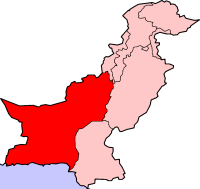
The 2011 Balochistan floods started from the last week of February and continued until the first week of March. Balochistan province was already badly affected from last year's devastating floods as UNHCR claims that 166,000 flood victims are still homeless in the province with 240 people still living in camps. [1]

Contents

Meteorological history

The Pakistan Meteorological Department issued a weather advisory in which it warned that a Western Disturbance over Iran was likely to enter in Balochistan that would cause widespread rains with isolated heavy rainfalls over Balochistan for four days. The system entered Balochistan on 28 February and caused widespread heavy rainfall in the province whereas moderate rainfall elsewhere in the country. The system moved and entered India on 5 March. [2] [3] [ failed verification ]

Flooding and impact

Hundred people were rendered homeless when a large number of houses were washed away by flash floods caused by torrential rain in Quetta and other areas in northern and central Balochistan. Traffic between Ziarat and Loralai via Sanjavi was suspended after heavy snowfall in the valley as four feet of snow fell in the hilly areas of Ziarat and about six inches in the town in 24 hours. At least 70 houses were washed away by hill torrents in Nushki and over a dozen houses collapsed in Huda and Khrotabad areas of Quetta. Floodwaters entered a large number of houses. Parts of Chagai district were also affected. The Bour Nullah entering Nushki from Afghanistan inundated thousands of acres of land in Dak area. At least 25 mud-houses were washed away in Chagai tehsil. A bridge on the Quetta-Karachi National Highway was washed away near Mastung. [4] [5]

On February 28 the provincial capital was lashed by strong hailstorms followed by heavy rainfall. [6] During the six-day wet spell the highest rainfall in 24 hours was 45 millimetres (1.8 in) that was recorded on March 1, 2011. [7] [8]

Heavy precipitation during late February and early March

Heavy precipitation recorded during the six-day wet spell of February 28 to March 5, 2011 in the province based on data from the Pakistan Meteorological Department. [9]

CityRainfall (mm)Rainfall (in)NotesReferences
Samungli 934.0The highest rainfall during 24 hours was 47 millimetres (1.9 in). [8]
Quetta 923.7The highest rainfall during 24 hours was 45 millimetres (1.8 in). [8]
Khuzdar 863.3The highest rainfall during 24 hours was 33 millimetres (1.3 in). [8]
Kalat 743.0The highest rainfall during 24 hours was 32 millimetres (1.3 in). [8]
Zhob 321.2The highest rainfall during 24 hours was 19 millimetres (0.75 in). [8]

Response by the Pakistan Government

Minister for Provincial Disaster Management Authority (PDMA) Babu Mohammad Rahim Mengal said a relief operation had been launched. The minister in charge of the PDMA visited the affected area in Nushki and said 200 blankets, 200 tents and food items had been sent to Nushki and Chagai districts. Balochistan Chief Minister Nawab Aslam Raisani ordered the officials concerned to immediately send relief goods for the affected people. He said relief camps would be set up in government buildings for displaced people. [5]

See also

Related Research Articles

<span class="mw-page-title-main">Balochistan, Pakistan</span> Province of Pakistan

Balochistan is a province of Pakistan. Located in the southwestern region of the country, Balochistan is the largest province of Pakistan by land area but is the least populated one. It is bordered by the Pakistani provinces of Khyber Pakhtunkhwa to the north-east, Punjab to the east and Sindh to the south-east; shares international borders with Iran to the west and Afghanistan to the north; and is bound by the Arabian Sea to the south. Balochistan is an extensive plateau of rough terrain divided into basins by ranges of sufficient heights and ruggedness. It has the world's largest deep sea port, the Port of Gwadar lying in the Arabian Sea.

<span class="mw-page-title-main">Quetta</span> Capital of Balochistan, Pakistan

Quetta is the capital and largest city of the Pakistani province of Balochistan. It is the ninth largest city in Pakistan, with an estimated population of over 1.5 million in 2024. It is situated in the south-west of the country, lying in a valley surrounded by mountains on all sides. Quetta is at an average elevation of 1,680 metres above sea level, making it Pakistan's highest altitude major city. The city is known as the "Fruit Garden of Pakistan" due to the numerous fruit orchards in and around it and the large variety of fresh and dried fruits produced there.

Ziarat is a city in the Ziarat District of the Balochistan province in Pakistan. It lies 130 kilometres (81 mi) away from Quetta, the provincial capital of Balochistan. Previously, it was part of Sibi district. It was announced as a separated district on 1st of July, 1986. The Quaid-e-Azam Residency is located in this valley, where Quaid-e-Azam spent some of his last days.

<span class="mw-page-title-main">Climate of Pakistan</span>

Pakistan's climate varies from a continental type of climate in the north (Gilgit-Baltistan,Kashmir,KPK), a mountainous dry climate in the west (Baluchistan), a wet climate in the East (Punjab) an arid climate in the Thar Desert, to a tropical climate in the southeast (Sindh), characterized by extreme variations in temperature, both seasonally and daily, because it is located on a great landmass barely north of the Tropic of Cancer.

<span class="mw-page-title-main">2008 Ziarat earthquakes</span> Earthquake in Balochistan, Pakistan

The 2008 Ziarat earthquakes hit the Pakistani province of Balochistan on October 29 with a moment magnitude of 6.4. The US Geological Survey reported that the first earthquake occurred 60 km (37 mi) north of Quetta and 185 km (115 mi) southeast of the Afghanistan city of Kandahar at 04:09 local time at a depth of 15 km (9.3 mi), at 30.653°N, 67.323°E. It was followed by another shallower magnitude 6.4 earthquake at a depth of 14 km (8.7 mi) approximately 12 hours after the initial shock, at 30.546°N, 67.447°E. 215 people were confirmed dead. More than 200 were injured, and 120,000 were rendered homeless. Qamar Zaman Chaudhry, director general of Pakistan Meteorological Department, stated the quake epicenter was 70 miles (110 km) north of Quetta, and about 600 km (370 mi) southwest of Islamabad.

<span class="mw-page-title-main">Hayatullah Khan Durrani</span> Pakistani caver and mountain climber

Hayatullah Khan Durrani, PP is a Pakistani caver, mountaineer, environmentalist, organizer, and a rescuer. He is also a part-time sports anchor actor on Pakistani television. He played a significant role in the promotion of mountaineering, rock climbing, caving, canoeing, and, kayaking as adventure sports in Pakistan. He is naturalist and early advocate of preservation of Juniper forests Juniperus macropoda wilderness in Ziarat and adjacent areas in Balochistan. He is the founder and President of the Pakistan Cave Research & Caving Federation (PCRCF) and the Director of the Asian Canoe Confederation (ACC).

<span class="mw-page-title-main">Cyclone Phet</span> North Indian cyclone in 2010

Very Severe Cyclonic Storm Phet was a powerful tropical cyclone that made landfall on Oman, Western India, and Pakistan. The third named cyclone of the 2010 cyclone season, Phet developed in the Arabian Sea on May 31 to the west of India. With conducive environmental conditions, the storm intensified to reach peak sustained winds of 155 km/h (95 mph) on June 2, based on analysis by the India Meteorological Department (IMD). On the next day, Phet dropped heavy rainfall while moving across eastern Oman, with a peak of 603 mm (23.7 in) in Qurayyat. The rains flooded arid areas and collected into wadis – normally dry river beds. Thousands of homes were wrecked across Oman. There were 24 fatalities in the country, and damage was estimated at US$780 million.

Quetta, Pakistan features a continental semi-arid climate with a large variation between summer and winter temperatures. The highest temperature recorded in Quetta was 42 °C (108 °F) on 10 July 1998. The lowest temperature in Quetta is −18.3 °C (−0.9 °F) which was recorded on 8 January 1970.

<span class="mw-page-title-main">Balochistan Levies</span> Paramilitary gendarmerie in Balochistan, Pakistan

Balochistan Levies is a paramilitary gendarmerie in the Pakistani province of Balochistan. It operates as one of two primary law enforcement agencies tasked with maintaining law and order in the province, along with Balochistan Police. The levies force has jurisdiction in most districts of Balochistan.

The 2012 Pakistan floods began in early September 2012, resulting from heavy monsoon rains in Khyber Pakhtunkhwa, Upper Sindh, Southern Punjab and Balochistan regions of Pakistan.

<span class="mw-page-title-main">2015 Pakistan tornado</span>

On the night of 26 April 2015, a severe storm hit areas of Khyber Pakhtunkhwa, Pakistan, causing considerable damage in the cities of Peshawar, Nowshera, and Charsadda. The storm featured heavy rains accompanied by hail and high-speed winds of over 120 kilometers per hour. As a result of the storm's damaging effects, 45 people were killed and over 200 were wounded.

Sardar Muhammad Umar Gorgaij is a Pakistani politician who was a member of the National Assembly of Pakistan from 2008 to 2013.

From February to April 2019, widespread flash flooding affected large parts of Pakistan, most severely in Balochistan, KPK, Punjab, and other provinces. Pakistan has been hit by three major waves of rain and flooding over the course of more than one month. The first wave of rain began on 20 February, leading to flooding in to Khyber and Balochistan, therefore many villages and several cities have been evacuated, and more than 1,500 families has been rescued alone in Balochistan and many in other states. The 20 February rain and thunderstorms caused flash floods in the Lasbela area. The main areas affected were Turbat, Tump, Nasirabad and Dasht where 300 people were displaced due to the flood. These people were then moved to camps established by the Provincial Disaster Management Authority (PDMA). Casualties have came mostly due to roof collapsing amid heavy rains and flash flooding. Khyber Pakhtunwkha has witnessed the most deaths till now, 40, alongside Balochsitan has faced 26 casualties with more than 9 in Punjab and other places. Due to rain, flood and storm casualties are increasing.

<span class="mw-page-title-main">1992 India–Pakistan floods</span> Natural disaster in India and Pakistan

The 1992 India–Pakistan floods was a deadly flood caused by a five days long heavy monsoon rains and severe weather that occurred on 7 September 1992 across the north-Pakistan of Azad Kashmir, North-West Frontier Province and Indian administered state of Jammu and Kashmir. Severe floods left at least 2,496 fatalities, including 2,000 deaths in Pakistan administered state, 296 in Punjab province, and 200 in northern India with several others missing. The floods swept away more than 12,672 villages and several people were buried alive due to landslides near mountains. Punjab, that shares its borders with Azad Kashmir, suffered a heavy agriculture loss in its economic history.

<span class="mw-page-title-main">2021 Balochistan earthquake</span> Earthquake near Harnai, Pakistan

An earthquake struck Pakistan's province of Balochistan near the city of Harnai on 7 October 2021. The moment magnitude 5.9 Mww  quake struck in the early morning at 03:01 local time, killing at least 42 people and injuring 300 others. The earthquake occurred just one day before the anniversary of the 2005 Kashmir earthquake.

<span class="mw-page-title-main">2024 Afghanistan–Pakistan floods</span> Natural disaster in Afghanistan and Pakistan

Since 6 March 2024, unusually heavy rains and resulting flash flooding in Afghanistan and Pakistan killed over 1,000 people, and injured many more. The flooding extensively damaged infrastructure and agriculture as well.

References

  1. Balochistan’s 166,000 flood victims still homeless: UNHCR | Provinces | DAWN.COM
  2. Weather Advisory & Press Releases Archived 2010-09-12 at the Wayback Machine
  3. "India Meteorological Department". www.imd.gov.in.
  4. Flash floods caused by rain wreak havoc in Balochistan | Newspaper | DAWN.COM
  5. 1 2 Daily Times - Leading News Resource of Pakistan
  6. "Heavy Hailstorms lashed Quetta City". Tribune.com.pk. Retrieved 3 March 2011.
  7. "Quetta receives 45 mm rainfall". Archived from the original on 1 October 2011. Retrieved 5 March 2011.
  8. 1 2 3 4 5 6 "Rainfall Data". Archived from the original on 26 August 2010. Retrieved 25 September 2010.
  9. "PAKISTAN METEOROLOGICAL DEPARTMENT". Archived from the original on 1 September 2010. Retrieved 4 March 2011.