Vavau is a small village on south east end of Upolu island in Samoa. The village is part of Lotofaga Electoral Constituency which is within the larger political district of Atua.
Siumu is a village on the central south coast of Upolu island in Samoa. The population is 1,092. There is also a sub-village Siumu Uta which has a population of 206.

Sataoa is a small village situated on the central south coast of Upolu island in Samoa. Like many villages in the country, Sataoa has two settlements, one inland and one by the coast. The population of Sataoa Uta is 924 and Sataoa Tai is 320.
Tuana'i is a small village on the central north coast of Upolu island in Samoa. It is situated to the west of Apia, the country's capital. The population is 1,247.
Moata'a is a village on the island of Upolu in Samoa. It is situated on the central north coast of the island, to the east of the capital Apia. The village is in the political district of Tuamasaga.
Lauli'i is a village on the island of Upolu in Samoa. It is located on the central north coast of the island to the east of the capital Apia. Lauli'i is part of Vaimauga East Electoral Constituency which forms part of the larger political district of Tuamasaga.
Pesega is a village on the island of Upolu in Samoa. It is located on western outskirts of Apia, the country's capita. Pesega is part of Faleata West Electoral Constituency which forms part of the larger political district of Tuamasaga.
Poutasi is a village on the south east coast of Upolu island in Samoa. The population was 379 in the 2006 Census. The village is part of Falealili Electoral Constituency in the larger political district of Atua. Poutasi was extensively damaged by the 2009 Samoa earthquake and tsunami.
Safa'atoa is a village on the island of Upolu in Samoa. It is situated on the south west side of the island. Safa'atoa is in the electoral constituency of Lefaga & Falese'ela which forms part of the larger political district A'ana.
Matautu is a village in the large traditional settlement of Lefaga in Samoa. The village is situated on the south west coast of Upolu island and lies within the political district of A'ana.
Lalovaea is a village on the island of Upolu in Samoa. It is situated on the north central side of the island near the country's capital Apia. The village is in the political district of Tuamasaga.
Tanugamanono is a village on the island of Upolu in Samoa. It is situated on the north central side of the island near the country's capital Apia. The village is in the political district of Tuamasaga.
Vaimoso is a village on the island of Upolu in Samoa. It is situated on the north central side of the island near the country's capital Apia. The village is in the political district of Tuamasaga.
Lotopa is a village on the island of Upolu in Samoa. It is situated on the north central side of the island near the country's capital Apia. The village is in the political district of Tuamasaga.
Matatufu is a small village on south east end of Upolu island in Samoa. The village is part of Lotofaga Electoral Constituency which is within the larger political district of Atua.
Saleapaga is a village on the south east coast of Upolu island in Samoa. The village is part of Lepa Electoral Constituency which is within the larger political district of Atua.
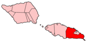
Fasito'o Tai is a village situated on the northwest coast of Upolu island in Samoa. The village is part of A'ana Alofi III Electoral Constituency which formas part of the larger A'ana political district.
Fasito'o Uta is a village situated on the northwest coast of Upolu island in Samoa. The village is part of A'ano Alofi I Electoral Constituency which forms part of the larger A'ana political district.
Luatuanu'u is a village situated on the east side of Upolu island in Samoa. The village is part of Anoamaa West Electoral Constituency which is within the larger political district of Atua.