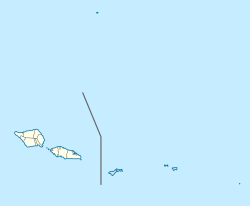
Upolu is an island in Samoa, formed by a massive basaltic shield volcano which rises from the seafloor of the western Pacific Ocean. The island is 75 kilometres long and 1,125 square kilometres in area, making it the second largest of the Samoan Islands by area. With approximately 145,000 inhabitants, it is by far the most populous of the Samoan Islands. Upolu is situated to the southeast of Savai'i, the "big island". Apia, the capital, is in the middle of the north coast, and Faleolo International Airport is at the western end of the island. The island has not had any historically recorded eruptions, although there is evidence of three lava flows, dating back only to between a few hundred and a few thousand years ago.

Lalomanu is a village on the east coast of Upolu island in Samoa.The village is part of the electoral constituency Aleipata Itupa i Luga which is within the larger political district of Atua. It has a population of 712.

Vavau is a small village on south east end of Upolu island in Samoa. The village is part of the Lotofaga Electoral Constituency which is within the larger political district of Atua.
A'ufaga is a small village on the southeast end of Upolu island in Samoa. The village is part of the electoral constituency Lepa which is included in the larger political district of Atua.
Siumu is a village on the central south coast of Upolu island in Samoa. The population is 1183. There is also a sub-village Siumu Uta which has a population of 304.
Sataoa is a small village situated on the central south coast of Upolu island in Samoa. Like many villages in the country, Sataoa has two settlements, one inland and one by the coast. The population of Sataoa Uta is 1121 and Sataoa Tai is 239.
Tuana'i is a small village on the central north coast of Upolu island in Samoa. It is situated to the west of Apia, the country's capital. The population is 1407.
Lauli'i is a village on the island of Upolu in Samoa. It is located on the central north coast of the island to the east of the capital Apia. Lauli'i is part of Vaimauga East Electoral Constituency which forms part of the larger political district of Tuamasaga.
Taufusi is a village on the Samoan island of Upolu. It is part of the Vaimauga West Electoral Constituency, Tuamasaga District, in the Apia Urban Area of Samoa. The village had a population of 364 at the 2016 census. The village name in English means Swamp as it was a swampy area in late 19th century. Taufusi is bordered by Saleufi to the North, Tuloto to the East, Lalovaea to the South East, Mt. Vaea and Palisi to the South, Vaimea and Fugalei to the West.
Pesega is a village on the island of Upolu in Samoa. It is located on western outskirts of Apia, the country's capita. Pesega is part of Faleata West Electoral Constituency which forms part of the larger political district of Tuamasaga.
Poutasi is a village on the south east coast of Upolu island in Samoa. The population is 395. The village is part of Falealili Electoral Constituency in the larger political district of Atua. Poutasi was extensively damaged by the 2009 Samoa earthquake and tsunami.
Lefaga is a village district on the south west coast of the island of Upolu in Samoa. The American movie Return to Paradise (1953), starring Gary Cooper was filmed at Matautu village in Lefaga. The 50th anniversary celebrations of the making of the movie took place in Lefaga in November 2003.
Afagaloa is a village on the island of Savai'i in Samoa. It is situated on the south coast of the island in the electoral constituency of Palauli West which is part of the larger political district of Palauli.
Safa'atoa is a village on the island of Upolu in Samoa. It is situated on the south west side of the island. Safa'atoa is in the electoral constituency of Lefaga & Falese'ela which forms part of the larger political district A'ana.
Matatufu is a small village on south east end of Upolu island in Samoa. The village is part of Lotofaga Electoral Constituency which is within the larger political district of Atua.
Lealatele is a village on the south east coast of Upolu island in Samoa. The village is part of Lepa Electoral Constituency which is within the larger political district of Atua.
Saleapaga is a village on the south east coast of Upolu island in Samoa. The village is part of Lepa Electoral Constituency which is within the larger political district of Atua.
Fasito'o Tai is a village situated on the northwest coast of Upolu island in Samoa. The village is part of A'ana Alofi III Electoral Constituency which formas part of the larger A'ana political district.
Fasito'o Uta is a village situated on the northwest coast of Upolu island in Samoa. The village is part of A'ano Alofi I Electoral Constituency which forms part of the larger A'ana political district.
Luatuanu'u is a village situated on the east side of Upolu island in Samoa. The village is part of Anoamaa West Electoral Constituency which is within the larger political district of Atua.