Seven Oaks is a census-designated place (CDP) in Lexington County, South Carolina, United States, 8 miles (13 km) northwest of downtown Columbia, the state capital. The population of the CDP was 15,144 at the 2010 census. It is part of the Columbia Metropolitan Statistical Area.

London West is a federal electoral district in London, Ontario, Canada, that has been represented in the House of Commons of Canada since 1968.

European route E 60 is the second longest road in the International E-road network. It runs 8,200 km (5,100 mi), from Brest, France, to Irkeshtam, Kyrgyzstan.

The N81 road is a national secondary road in Ireland, from the M50 motorway to Tullow, County Carlow, north to south. The N81 continues past Tullow for another 8 km to terminate at the village of Closh, County Carlow, where it intersects the N80. The N81 is 76.784 km (47.711 mi) long. The road is a dual carriageway between M50 motorway and west of Tallaght, known as the Tallaght Bypass or Blessington Road. It intersects with the M50 motorway at Junction 11. There are plans to extend the dual carriageway by 5 km (3.1 mi) to the urban boundary.

A national secondary road is a category of road in Ireland. These roads form an important part of the national route network but are secondary to the main arterial routes which are classified as national primary roads. National secondary roads are designated with route numbers higher than those used for primary roads, but with the same "N" prefix. Routes N51 and higher are all national secondary roads.

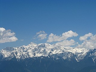
The Pir Panjal Range is a group of mountains in the Lesser Himalayan region, running from east-southeast (ESE) to west-northwest (WNW) across the Indian territories of Himachal Pradesh and Jammu and Kashmir and then Pakistan's Azad Kashmir and Punjab. The average elevation varies from 1,400 m (4,600 ft) to 4,100 m (13,500 ft). The Himalayas show a gradual elevation towards the Dhauladhar and Pir Panjal ranges. Pir Panjal is the largest range of the Lesser Himalayas. Near the bank of the Sutlej River, it dissociates itself from the Himalayas and forms a divide between the Beas and Ravi rivers on one side and the Chenab on the other. The renowned Galyat mountains are also located in this range.

WIXV is a classic rock formatted radio station licensed to Savannah, Georgia, United States. It is owned by Cumulus Broadcasting.

Golubovci is a small town in the Podgorica Municipality of Montenegro.
Habro is one of the Aanaas in the Oromia of Ethiopia. It is named after the former Aanaa of the same name. Part of the West Hararghe Zone, the district is bordered on the south by Darolebu, on the west and north by Guba Koricha, on the northeast by Kuni, and on the southeast by Boke. Towns in Habro include Belbelti, Gelemso and Wachu.
Kuni is one of the Aanaas in the Oromia Regional State of Ethiopia. Part of the West Hararghe Zone, Kuni is bordered on the south by Boke, on the west by Habro, on the northeast by Chiro, and on the east by the Galetti River, which separates it from the East Hararghe Zone.

The R725 road is a regional road in Ireland. From its junction with the N80 on the western outskirts of Carlow Town it takes an easterly route to its junction with the N81 in Tullow, where it crosses the River Slaney on a bridge shared with the N81 in the town centre. It continues east to Shillelagh in County Wicklow, turns due south for 6 km, then eastwards through Carnew. It then enters County Wexford for the final 15 km stretch, terminating in Gorey at the R772. The road is 53 km (33 mi) long.

There are fourteen business routes of Interstate 35 (I-35): nine are in Texas, two are in Iowa, and three are in Minnesota.
Mutur or Muttur is a town in the Trincomalee District of Sri Lanka, located about 25 km south of Trincomalee, on the southern side of Trincomalee Harbour. In Tamil it translates to 'ancient village'. Mutur is mostly accessed by sea route. After 2010, a new seaside road was built to link with Trincomalee town via Kinniya.
Pothuhera is a small town located in Kurunegala District, Sri Lanka.

The A 6 road is an A-Grade trunk road in Sri Lanka. It connects Ambepussa with Trincomallee.
The A 12 road is an A-Grade trunk road in Sri Lanka. It connects the Puttalam with Trincomallee.
Alawwa is a town and divisional secretariat of the Kurunegala District in the North Western Province of Sri Lanka. The town is considered part of the Coconut Triangle, where most of the country's coconut exports come from. The population was 63,667 at the 2012 Sri Lankan census.

The R758 road is a regional road in County Wicklow, Ireland. It connects the R756 to the N81. The road travels through the village of Valleymount and crosses Poulaphouca Reservoir via two bridges. The road is 11.8 kilometres (7.3 mi) long.


