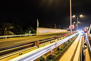
Transport in Sri Lanka is based on its road network, which is centred on the country's commercial capital Colombo. A rail network handles a portion of Sri Lanka's transport needs. There are navigable waterways, harbours and three international airports: in Katunayake, 35 kilometres (22 mi) north of Colombo, in Hambantota, and in Jaffna.

Kandy is a major city located in the Central Province of Sri Lanka. It was the last capital of the Sinhalese monarchy from 1469 to 1818, under the Kingdom of Kandy. The city is situated in the midst of hills in the Kandy plateau, which crosses an area of tropical plantations, mainly tea. Kandy is both an administrative and religious city and the capital of the Central Province. Kandy is the home of the Temple of the Tooth Relic, one of the most sacred places of worship in the Buddhist world. It was declared a World Heritage Site by UNESCO in 1988. Historically the local Buddhist rulers resisted Portuguese, Dutch, and British colonial expansion and occupation.

The Uva Province is one of the nine provinces of Sri Lanka. The province has an area of 8,500 km2 and a population of 1,266,463, making it the 2nd least populated province. The provincial capital is Badulla.

Peradeniya is a suburb of the city of Kandy, Sri Lanka with about 30,000 inhabitants. It is situated on the A1 main road, a few kilometres west of Kandy city centre. Peradeniya's name is derived from pera (guava) and deniya.

The Mahaweli River, is a 335 km (208 mi) long river, ranking as the longest river in Sri Lanka. It has a drainage basin of 10,448 km2 (4,034 sq mi), the largest in the country, which covers almost one-fifth of the total area of the island. The Mahaweli Ganga starts at Polwathura, a remote village of Nuwara-Eliya District in bank Nawalapitiya of Kandy District by further joining of Hatton Oya and Kotmale Oya. The river reaches the Bay of Bengal on the southwestern side of Trincomalee Bay. The bay includes the first of a number of submarine canyons, making Trincomalee one of the finest natural deep-sea harbours in the world.

Dunhinda Falls is a waterfall located about 5 kilometres (3.1 mi) from Badulla in the lower central hills of Sri Lanka.

The Sri Lanka Railway Department is Sri Lanka's railway owner and primary operator. As part of the Sri Lankan government, it is overseen by the Ministry of Transport. Founded in 1858 as the Ceylon Government Railway, it operates the nation's railways and links Colombo with other population centres and tourist destinations.

Diyaluma Falls is 220 m (720 ft) high and the second highest waterfall in Sri Lanka and 619th highest waterfall in the world. It is situated 6 km (3.7 mi) away from Koslanda in Badulla District on Colombo-Badulla highway. The falls are formed by Punagala Oya, a tributary of Kuda Oya which in turn, is a tributary of Kirindi Oya.
The A1 road is an A-Grade trunk road in Sri Lanka. It connects the capital city of Colombo with Kandy.
The A26 highway is an A-Grade trunk road in Sri Lanka. It connects Kandy with Padiyathalawa via Mahiyangana.

The A27 road is an A-Grade trunk road in Sri Lanka. It connects Ampara with Mahaoya via Uhana.

The Main Line is a major railway line in the rail network of Sri Lanka and considered by many to be one of the most scenic train journeys in all of Asia. The line begins at Colombo Fort and winds through the Sri Lankan hill country to reach Badulla.

Henarathgoda Botanical Garden, also known as Gampaha Botanical Garden, is one of the six botanical gardens in Sri Lanka. The botanical garden is situated on the Gampaha-Minuwangoda main road, approximately 450 m (1,480 ft) away from Gampaha railway station. It is about 29 km (18 mi) from Sri Lanka's commercial capital of Colombo.

The Rambakan Oya Dam is an embankment dam in Maha Oya, Eastern Province, Sri Lanka. The reservoir was designed and constructed by the Sri Lanka Mahaveli Authority and currently functions under the direction of the Ministry of Irrigation and Water Resources Management. It has been created by building an Earthen dam which is about 1,225m in length across the Mundeni Aru river.
The Uma Oya Hydropower Complex (also internally called Uma Oya Multipurpose Development Project or UOMDP) is an irrigation and hydroelectric complex in the Badulla District of Sri Lanka. Early assessments of the project date back to 1989, when the first studies was conducted by the country's Central Engineering and Consultancy Bureau. The complex involves building a dam across Dalgolla Oya, and channelling water over a 3,975 m (13,041 ft) tunnel to Mathatilla Oya, both of which are tributaries of the Uma Oya. At Mathatilla Oya, another dam is constructed to channel 145,000,000 m3 (5.1×10⁹ cu ft) of water per annum, via a 15,290 m (50,160 ft) headrace tunnel to the Uma Oya Power Station, where water then discharged to the Alikota Aru via a 3,335 m (10,942 ft) tailrace tunnel.
Passara is a town in Badulla District, Uva Province of Sri Lanka. The town is located on Peradeniya-Badulla-Chenkalady main road, approximately 18 km (11 mi) away from Badulla City.
Colombo - Badulla Night Mail Train is a night time passenger and mail train that runs between Colombo and Badulla in Sri Lanka.
Ettampitiya is a small town in Sri Lanka. It is located in the Badulla District, Uva Province. It is located 16 km (10 mi) south-west of Badulla, at the junction of the A5 highway and B43 road.
Mahaoya is a town in the Ampara District, Eastern Province of Sri Lanka. It is located in 64 km (40 mi) north-west of Ampara, at the intersection of the Peradeniya-Badulla-Chenkalady Highway (A5) and the Manampitiya - Aralaganwila - Maduru Oya Road (B502).


