Related Research Articles

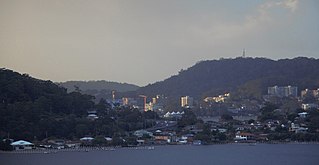
Gosford is a waterfront city on the northern extremity of Brisbane Water in the Central Coast Council local government area in the heart of the Central Coast in the state of New South Wales, Australia. Gosford is known for boating and scenic views on the foreshore of Brisbane Water and the surrounding valleys. It is situated 77 km (48 mi) north of Sydney and 86 km (53 mi) south of Newcastle. Gosford is the administrative and commercial centre as well as the gateway of the Central Coast.

The Central Coast is a peri-urban region lying on the Pacific Ocean in northern-eastern New South Wales, Australia. The region is situated north of Sydney, which is filled with subtropical national parks, forests and also encompasses the major coastal waterways of Brisbane Water, Tuggerah Lakes and southern Lake Macquarie. The region's hinterland, which has fertile valleys, rural farmland and wineries, and also includes the Watagan Mountains. The Central Coast is known for its regional coastal towns like Terrigal, The Entrance, Ettalong Beach, Budgewoi and Bateau Bay with resorts and holiday parks, which feature many expansive beaches and lagoons with surfing and coastal tracks, as well as scenic views. Gosford is the main commercial hub and gateway.

The City of Gosford was a local government area that was located in the Central Coast region in the state of New South Wales, Australia. The incorporation of Gosford dates back to 1886 when the Town of Gosford was proclaimed as the Borough of Gosford, becoming the Municipality of Gosford from 1906. In 1908, the Gosford Municipality merged into Erina Shire which covered the remaining Central Coast area outside of Gosford, but regained its independence in 1936. From 1 January 1947, local government in the Central Coast region was reorganised, creating Gosford Shire and Wyong Shire, and the final boundaries of Gosford City Council date from this period. From 1 January 1980, Gosford Shire was granted city status, becoming the City of Gosford. On 12 May 2016 the Minister for Local Government amalgamated the City of Gosford and Wyong Shire Councils. The Central Coast Council was established on the same day, covering the combined areas.

Wyong Shire was a local government area located in the Central Coast region of New South Wales, Australia. The incorporation of the Wyong area dates back to 7 March 1906 when the entire area of the Brisbane Water Police District outside of the Town of Gosford was proclaimed as the Erina Shire. From 1 January 1947, local government in the Central Coast region was reorganised, creating Gosford Shire and Wyong Shire, which comprised Erina Shire north and east of Kulnura, Central Mangrove and Lisarow.

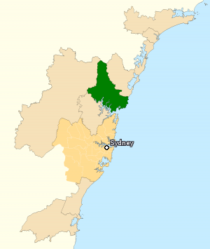
The Division of Robertson is an Australian electoral division in the state of New South Wales.

Woy Woy is a coastal town in the Central Coast region of New South Wales, Australia, located on the southern reaches of Brisbane Water 79 km (49 mi) north of Sydney. It is a population centre within the Central Coast Council local government area.

Umina Beach is a suburb within the Central Coast Council local government area on the Central Coast of New South Wales, Australia. Umina Beach is situated 85 kilometres (53 mi) north of Sydney and 111 kilometres (69 mi) south of Newcastle.

Avoca Beach is a coastal suburb of the Central Coast region of New South Wales, Australia, about 95 kilometres (59 mi) north of Sydney. Avoca Beach is primarily a residential suburb, Avoca Beach is also a popular tourist destination. Avoca Beach is known for its surfing and state (regional) surf competitions. Avoca Beach village has a variety of restaurants and cafes as well as a post office, newsagent, pharmacy and mini-mart. Avoca Beach also has a historic cinema, a hotel, bowling club, motel and caravan park. It is located within the Central Coast Council local government area.

Ettalong Beach is a suburb of the Central Coast region of New South Wales, Australia south of Woy Woy on Brisbane Water at the point where it meets Broken Bay, about 86 km north of Sydney. It is part of the Central Coast Council local government area. Ettalong Beach is the natural eastward continuation of Umina Beach and Ocean Beach. The village is serviced by a small retail centre along Ocean View Road.

Kariong is a locality of the Central Coast region of New South Wales, Australia west of Gosford along the Central Coast Highway. It is part of the Central Coast Council local government area.

Koolewong is a suburb of the Central Coast region of New South Wales, Australia between Gosford and Woy Woy, and is mostly on a hill overlooking Brisbane Water. It is part of the Central Coast Council local government area.

Patonga is a small beach side fishing and holiday village which is part of the Central Coast region of New South Wales, Australia, located on the edge of Brisk Bay and near the mouth of the Hawkesbury River. It is part of the Central Coast Council local government area. Patonga is the southern most village of the Central Coast.

Pearl Beach is a suburb of Central Coast Council on the Central Coast of New South Wales, Australia. Pearl Beach was assigned 'suburb' status by the Geographical Names Board of NSW on 25 October 1991.

St Huberts Island is a canal estate and suburb of the Central Coast region of New South Wales, Australia connected to the mainland at Daleys Point. It is part of the Central Coast Council local government area.

Tascott is a suburb of the Central Coast region of New South Wales, Australia between Gosford and Woy Woy on Brisbane Water's western shore. It is part of the Central Coast Council local government area.

Hit101.3 is an Australian radio station located on the New South Wales Central Coast, part of Southern Cross Austereo's Hit Network. Hit101.3 broadcasts from the Central Coast Radio Centre on Henry Parry Drive, in Gosford, along with sister station 107.7 Triple M Central Coast. Its broadcast area is the Central Coast, however the station can be heard on FM at points as far as Newcastle, Sydney and parts of the Blue Mountains. The station was first broadcast from studios located in Mann Street, Gosford, where it was known on-air as Coast Rock FM, and is now broadcast from Henry Parry Drive, Gosford.
The Central Coast's 107.7 Triple M is a commercial radio station based in Gosford, New South Wales, Australia. The broadcast area is the NSW Central Coast, a region that extends from southern Lake Macquarie to the Hawkesbury River. Originally called 2GO, it was the Central Coast's first radio station starting on the AM band with 1310, moving to 1323, and the final location on the AM band was 801. It later moved to its current frequency of FM 107.7. Ownership of the station has changed a number of times. For some period it was a part of Wesgo, being a two-station company comprising 2GO in Gosford and 2WS in Sydney. Currently owned by Southern Cross Austereo, in November 2019 it was rebranded to Triple M.

The Central Coast Council is a local government area in the Central Coast region of New South Wales, Australia. It is adjacent to the Pacific Highway, Central Coast Highway, the Northern railway line and the Pacific Ocean. The council was formed on 12 May 2016 following the merger of the Gosford City and Wyong Shire Councils.
Coast Shelter is a non-profit organisation supporting homeless young people, adults and women and children experiencing domestic & family violence in the Central Coast region of New South Wales, Australia. Coast Shelter is the largest regional Specialist Homelessness Service in NSW and provides a range of accommodation and other services to those experiencing hardship in the local community.
The Shire of Woy Woy was a local government area on the Central Coast region of New South Wales, Australia, centred on the town of Woy Woy. The shire was proclaimed on 1 August 1928 as a result of the proclamation of the separation of the D Riding of Erina Shire and had its council seat at Woy Woy, but covered the majority of the Woy Woy peninsula including Woy Woy Bay, Umina, Blackwall, Kariong, Pearl Beach, and Patonga. Woy Woy Shire was abolished on 1 January 1947 with the reorganisation of local government in the Central Coast region following the end of the Second World War, with the council area amalgamated into Gosford Shire.
References
"A Local Voice for Gosford". ABC Online. 8 June 2003. Archived from the original on 4 June 2008. Retrieved 30 May 2008. "ABC Local Radio officially unveils its new studios". Central Coast Newspapers.