Abernathy Field

Last updated
Abernathy Field
Abernathy Field.JPG
Summary
Airport typePublic
OwnerCity of Pulaski & Giles County
Serves Pulaski, Tennessee
Elevation  AMSL 685 ft / 209 m
Coordinates 35°09′13″N087°03′25″W / 35.15361°N 87.05694°W / 35.15361; -87.05694
Map
USA Tennessee location map.svg
Airplane silhouette.svg
KGZS'
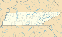
Location of airport in Tennessee
Usa edcp location map.svg
Airplane silhouette.svg
KGZS
KGZS (the United States)
Runways
Direction LengthSurface
ftm
16/345,0011,524Asphalt
Statistics (2009)
Aircraft operations8,200
Based aircraft11

Abernathy Field( ICAO : KGZS, FAA LID : GZS) is a public use airport located three nautical miles (6 km) southwest of the central business district of Pulaski, a city in Giles County, Tennessee, United States. It is owned by the City of Pulaski and Giles County. [1] According to the FAA's National Plan of Integrated Airport Systems for 2009–2013, it is categorized as a general aviation facility. [2]

Contents

Although many U.S. airports use the same three-letter location identifier for the FAA and IATA, this facility is assigned GZS by the FAA but has no designation from the IATA. [3]
Facilities and aircraft

Abernathy Field covers an area of 308 acres (125 ha) at an elevation of 685 feet (209 m) above mean sea level. It has one runway designated 16/34 with an asphalt surface measuring 5,001 by 75 feet (1,524 x 23 m). [1]

For the 12-month period ending June 3, 2009, the airport had 8,200 aircraft operations, an average of 22 per day: 98% general aviation, 1% air taxi, and 1% military. At that time there were 11 aircraft based at this airport: 9 single-engine, 1 multi-engine, and 1 jet. [1]

See also

Related Research Articles

Clarion Municipal Airport is a city-owned public-use airport located one nautical mile (1.85 km) northwest of the central business district of Clarion, a city in Wright County, Iowa, United States. This airport is included in the FAA's National Plan of Integrated Airport Systems for 2009–2013, which categorized it as a general aviation facility.

Springdale Municipal Airport is a public use airport in Washington County, Arkansas, United States. It is owned by the City of Springdale and located one nautical mile (2 km) southeast of its central business district. This airport is included in the National Plan of Integrated Airport Systems for 2011–2015, which categorized it as a general aviation facility.

<span class="mw-page-title-main">Jack Edwards Airport</span> Airport

Gulf Shores International Airport/Jack Edwards Field is a public use airport in Baldwin County, Alabama, United States. It is owned by Gulf Shores Airport Authority and located two nautical miles (4 km) north of the City of Gulf Shores. Also was known as Jack Edwards National Airport, it is included in the National Plan of Integrated Airport Systems for 2011–2015, which categorized it as a general aviation facility.

Tullahoma Regional Airport, also known as William Northern Field and Soesbe-Martin Field, is a public use airport in Coffee County, Tennessee, United States. It is owned by the City of Tullahoma and located two nautical miles (4 km) northwest of its central business district. This airport is included in the National Plan of Integrated Airport Systems for 2011–2015, which categorized it as a general aviation facility.

<span class="mw-page-title-main">McMinnville Municipal Airport</span> Airport

McMinnville Municipal Airport is three miles southeast of McMinnville, in Yamhill County, Oregon. The FAA's National Plan of Integrated Airport Systems for 2009–2013 categorized it as a general aviation facility. It is across Oregon Route 18 from the Evergreen Aviation & Space Museum, home to the Hughes H-4 Hercules Spruce Goose flying boat.

<span class="mw-page-title-main">Sylacauga Municipal Airport</span> Airport in Alabama, United States

Sylacauga Municipal Airport, also known as Merkel Field, is a city-owned public-use airport located three nautical miles west of the central business district of Sylacauga, a city in Talladega County, Alabama, United States. It is included in the FAA's National Plan of Integrated Airport Systems for 2011–2015, which categorized it as a general aviation facility.

<span class="mw-page-title-main">Thomas C. Russell Field</span> Airport

Thomas C. Russell Field is a city-owned public-use airport located two nautical miles (4 km) southwest of the central business district of Alexander City, a city in Tallapoosa County, Alabama, United States.

<span class="mw-page-title-main">Weedon Field</span> Airport

Weedon Field is a city-owned, public-use airport located three nautical miles north of the central business district of Eufaula, a city in Barbour County, Alabama, United States.

Fayette County Airport is a county-owned, public-use airport located two nautical miles southwest of the central business district of Somerville, in Fayette County, Tennessee, United States. According to the FAA's National Plan of Integrated Airport Systems for 2009–2013, it was classified as a general aviation airport.

<span class="mw-page-title-main">Bentonville Municipal Airport</span> Airport

Bentonville Municipal Airport is a city-owned, public-use airport located two nautical miles (3.7 km) south of the central business district of Bentonville, a city in Benton County, Arkansas, United States. It is also known as Louise M. Thaden Field or Louise Thaden Field, a name it was given in 1951 to honor Louise McPhetridge Thaden (1905–1979), an aviation pioneer from Bentonville.

Blue Ridge Regional Airport is nine miles southwest of Martinsville, in Henry County, Virginia. It is owned by the Blue Ridge Airport Authority. The FAA's National Plan of Integrated Airport Systems for 2009–2013 categorized it as a general aviation facility.

The O'Neill Municipal Airport is two miles northwest of O'Neill, in Holt County, Nebraska. It is owned by the O'Neill Airport Authority. The FAA's National Plan of Integrated Airport Systems for 2009–2013 categorized it as a general aviation facility.

Orange City Municipal Airport was a city-owned public-use airport located one nautical mile (1.85 km) south of the central business district of Orange City, a city in Sioux County, Iowa, United States. This airport was included in the FAA's National Plan of Integrated Airport Systems for 2009–2013, which categorized it as a general aviation facility.

Southland Field is a public-use airport located five nautical miles (9 km) south of the central business district of Sulphur, a city in Calcasieu Parish, Louisiana, United States. It is owned by the West Calcasieu Airport Managing Board and is also known as West Calcasieu Airport.

Campbell County Airport is a county-owned, public-use airport located 1 kilometre (0.62 mi) east of the central business district of Jacksboro, a town in Campbell County, Tennessee, United States. This airport is included in the FAA's National Plan of Integrated Airport Systems for 2011–2015, which categorized it as a general aviation facility.

Baker Municipal Airport is a public-use airport located one nautical mile southeast of the central business district of Baker, a city in Fallon County, Montana, United States. The airport is owned by Baker City and Fallon County. It is included in the FAA's National Plan of Integrated Airport Systems for 2011–2015, which categorized it as a general aviation facility.

Carroll County Airport is a county-owned public-use airport in Carroll County, Tennessee, United States. It is located four nautical miles northwest of the central business district of Huntingdon, Tennessee. The airport is included in the FAA's National Plan of Integrated Airport Systems for 2011–2015, which categorized it as a general aviation facility.

Warren County Memorial Airport is a county-owned public-use airport in Warren County, Tennessee, United States. It is located three nautical miles (6 km) west of the central business district of McMinnville, Tennessee. This airport is included in the National Plan of Integrated Airport Systems for 2011–2015, which categorized it as a general aviation facility.

Hawkins County Airport is a county-owned public-use airport in Hawkins County, Tennessee, United States. It is located six nautical miles northeast of the central business district of Rogersville, Tennessee in the city of Surgoinsville, Tennessee. This airport is included in the National Plan of Integrated Airport Systems for 2011–2015, which categorized it as a general aviation facility.

Mettel Field is a public airport three miles north of Connersville, in Fayette County, Indiana. It is owned by the Connersville Board of Aviation Commissioners. The National Plan of Integrated Airport Systems for 2011–2015 categorized it as a general aviation facility.

References

  1. 1 2 3 4 FAA Airport Form 5010 for GZS PDF . Federal Aviation Administration. Effective 3 June 2010.
  2. National Plan of Integrated Airport Systems for 2009–2013: Appendix A: Part 5 (PDF, 1.18 MB) Archived 2011-06-06 at the Wayback Machine . Federal Aviation Administration. Updated 15 October 2008.
  3. "Abernathy Field (ICAO: KGZS, FAA: GZS)". Great Circle Mapper. Retrieved 14 July 2010.