A fall of water is an area where water flows over a vertical drop or a series of steep drops in the course of a stream or river. Waterfalls also occur where meltwater drops over the edge of a tabular iceberg or ice shelf.
Yoho National Park is a national park of Canada in British Columbia. It is located in the Rocky Mountains along the western slope of the Continental Divide of the Americas in southeastern British Columbia. The word Yoho is a Cree expression of amazement or awe, and it is an apt description for the spectacular landscape of massive ice fields and mountain peaks that rank among the highest in the Canadian Rockies. Yoho NP is bordered by Kootenay National Park on the southern side and Banff National Park on the eastern side in Alberta.

Multnomah Falls is a waterfall located on Multnomah Creek in the Columbia River Gorge, east of Troutdale, between Corbett and Dodson, Oregon, United States. The waterfall is accessible from the Historic Columbia River Highway and Interstate 84. Spanning two tiers on basalt cliffs, it is the tallest waterfall in the state of Oregon at 620 ft (189 m) in height.
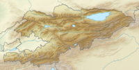
Jalal-Abad Region, also known as Jalalabat, is a region (oblast) of Kyrgyzstan. Its capital is the city of the same name, Jalal-Abad. It is surrounded by Talas Region, Chuy Region, Naryn Region, Osh Region, and Uzbekistan. Jalal-Abad Region was established on 21 November 1939. On 27 January 1959 it became a part of Osh Region, but regained its old status as a region on 14 December 1990. Jalal-Abad Region consist of 8 districts, and includes 5 towns, 8 urba-type settlements, and 415 villages

Osh Region is a region (oblast) of Kyrgyzstan. Its capital is Osh. It is bounded by (clockwise) Jalal-Abad Region, Naryn Region, Xinjiang, China, Tajikistan, Batken Region, and Uzbekistan.
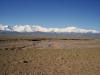
The Trans-Alay Range is the northernmost range of the Pamir Mountain System.

The Kara Darya or Qaradaryo is a tributary of the Syr Darya in Kyrgyzstan and eastern Uzbekistan. The river is formed by the confluence of Kara-Kulja River and Tar River. There are more than 200 known tributaries of Kara Darya; the largest are Jazy River, Kara Unkur River, Kegart River, Kurshab River, Abshir Sai River, and Aravan Sai River. Its length is 177 kilometres (110 mi), and watershed area 30,100 square kilometres (11,600 sq mi). The upper Kara Darya flows northwest across eastern Osh Province southwest of and parallel to the Fergana Range. It enters the Ferghana Valley and Uzbek territory a few kilometres west of Uzgen at Andijan Dam. The lower course is through the Fergana Valley, where it is used for irrigation. In the Fergana Valley its confluence with the Naryn River forms the Syr Darya, the second largest river of Central Asia. There are several dams on the river.

Gulcha is a mountain town in Osh Region of Kyrgyzstan. It is the capital of Alay District. Its population was 11,691 in 2009. The M41 highway leading south from Osh to the Alay Valley and eastern Tajikistan passes through Gulcha. The 2402m Chyrchyk Pass separates Gulcha from Osh, and the 3615m Taldyk Pass separates Gulcha from Sary-Tash in the Alay Valley. Gulcha is situated in a broad valley at the confluence of three rivers, forming the river Kurshab.
Ak-Terek is a village in Osh Region of Kyrgyzstan about 43 km northeast of Uzgen and 4 km northeast of Salamalik on the Jazy river. Its population was 1,034 in 2009. It is a base for horse trekking in the Fergana Range.

Chong-Alay District is a raion (district) of Osh Region in far south-western Kyrgyzstan. The capital lies at Daroot-Korgon. Its area is 4,857 square kilometres (1,875 sq mi), and its resident population was 25,039 in 2009. The Chong-Alay District include 3 rural communities : Chong-Alay, Kashka-Suu, and Jekendi.
The Alay Valley is a broad, dry valley running east–west across most of southern Osh Province, Kyrgyzstan.. It spreads over a length of 174 km east–west. The valley extends in north–south direction with varying width of 27 km in the west, 40 km - in the central part, and 3-7 km - in the east. The altitude of the valley ranges from 2,440 m near Karamyk to 3536 m at Toomurun Pass with an average altitude of about 3000 m. The area of the valley is 8400 km2. The north side is the Alay Mountains which slope down to the Ferghana Valley. The south side is the Trans-Alay Range along the Tajikistan border, with Lenin Peak, (7134 m). The western 40 km or so is more hills than valley. On the east there is the low Tongmurun pass and then more valley leading to the Irkestam border crossing to China.
The Sokh River is a river in Kyrgyzstan and Uzbekistan. It takes its rise at the joint of the north slopes of Alay Mountains and Turkestan Range and ends in Ferghana Valley. In the past, Sokh River was a left tributary of the Syr Darya. Currently it is entirely used for irrigation. The length of the river is 124 kilometres (77 mi) with a catchment area of 3,510 square kilometres (1,360 sq mi), and normal average discharge of 42.1 cubic metres per second (1,490 cu ft/s).
The Tar River is a river in Kara-Kulja District of Osh Province of Kyrgyzstan. It rises on the south-west slopes of Fergana Range and north slopes of Alay Mountains. The portion of the Tar River from its source to confluence with Eshegart River is known as Kegart, the portion up to mouth of Terek River is called Alaykuu River, downstream its name is Oy-Tal River, and from its confluence with Kara-Bel River it is known as Tar River. By confluence with Kara-Kulja River Tar River forms Kara Darya River.
The Protected areas of Kyrgyzstan cover 1,476,121.6 hectares and account for 7.38% of the country's total area (2017). The first protected area in Kyrgyzstan was established in 1948. According to the Government Decree on Priorities of Conservation of Biological Diversity and the relevant Action Plan for 2014-2024 the target area for the protected areas in Kyrgyzstan is 10 percent of the country’s area by 2024.

Keoti Falls is in Rewa district in the Indian state of Madhya Pradesh. It is the 24th highest waterfall in India.

Jazy Game Reserve is a reserve located in a flood plain of Jazy River of Osh Province of Kyrgyzstan. It was established in 1975 to conserve flood plain reed-sandthorn brushwoods and wetlands, serving breeding areas for pheasant, and wintering ground for water-fowl birds. The reserve occupies 5,000 hectares.
Ajidaar-Unkyur is a geological protected area located at slopes of Teo-Muyun Mountains in Osh Region of Kyrgyzstan. Its total length is about 100 m. The cave is inhabited by a large bat colony.
Rahmonberdi Madazimov (1875–1933) was the founder and organizer of the theatrical movement in Kyrgyzstan, the founder and first artistic director of the Osh State Academic Uzbek Music and Drama Theater named after Babur in Osh city, and a writer.