Admiralty Mountains

Last updated
Admiralty Mountains
Mt Herschel, Antarctica, Jan 2006.jpg
Mount Herschel (3,335 m) in the Admiralty Mountains as seen from Cape Hallett
Highest point
Peak Mount Minto
Elevation 4,165 m (13,665 ft)
Coordinates 71°47′S168°45′E / 71.783°S 168.750°E / -71.783; 168.750 (Mount Minto)
Geography
Antarctica relief location map.jpg
Red triangle with thick white border.svg
Continent Antarctica
Region Victoria Land
Range coordinates 71°45′S168°30′E / 71.750°S 168.500°E / -71.750; 168.500 (Admiralty Mountains)
Parent range Transantarctic Mountains

The Admiralty Mountains (alternatively Admiralty Range) is a large group of high mountains and individually named ranges and ridges in northeastern Victoria Land, Antarctica. This mountain group is bounded by the sea (Ross Sea and Southern Ocean), and by the Dennistoun Glacier, Ebbe Glacier, and Tucker Glacier. [1]

Contents

Discovery and naming

The Admiralty Mountains were discovered in January 1841 by Captain James Clark Ross, Royal Navy, who named them for the Lords Commissioners of the Admiralty under whose orders he served. [1]

Location

The Admiralty Mountains lie to the east of the Concord Mountains and the Victory Mountains, separated from them by the Ebbe Glacier in the north and the Tucker Glacier further south, which flows into the Ross Sea. They are to the south of the Anare Mountains, separated from them by the Anare Pass and the Dennistoun Glacier, which flow east to the Southern Ocean. To their east they are bounded by the Southern Ocean, Robertson Bay, the Adare Peninsula and the Ross Sea. [2] [3] [4]

The Dennistoun Glacier which flows past the northeastern section of the Admiralty Mountains, separates then from the Quam Heights and Hedgpeth Heights in the Anare Mountains to the north. The Robinson Heights in the northwest Admiralty Mountains are separated from the Anare Mountains to the north by the Anare Pass. They are east of the Everett Range in the Concord Mountains. The Homerun Range in the Admiralty Mountains is east of the Mirabito Range in the Concord Mountains. Further south, the Admiralty Mountains face the Cartographers Range in the Victory Mountains across the Tucker Glacier. [2] [3] [4]

The southern tip of the mountains joins to the Hallett Peninsula to the north of Tucker Inlet on the Ross Sea. Moubray Bay is to the north of the Hallett Peninsula, and receives several glaciers that drain the southeast of the range. The Adare Peninsula extends along the coast to the north of Moubray Bay and encloses Robertson Bay, which receives several glaciers that drain the central part of the mountains. To the north of this bay, glaciers drain the northeast of the mountains directly into the Southern Ocean. [2] [3] [4]

Mountains and peaks

This range includes the following mountains and peaks, among many others:

Mountain/Peakmetresfeetcoordinates
Mount Minto 4,16513,665 71°47′S168°45′E / 71.783°S 168.750°E / -71.783; 168.750 (Mount Minto)
Mount Adam 4,01013,156 71°47′S168°37′E / 71.783°S 168.617°E / -71.783; 168.617 (Mount Adam)
Mount Ajax 3,77012,369 71°48′S168°27′E / 71.800°S 168.450°E / -71.800; 168.450 (Mount Ajax)
Mount Sabine 3,72012,205 71°55′S169°33′E / 71.917°S 169.550°E / -71.917; 169.550 (Mount Sabine)
Mount Royalist 3,64011,942 71°47′S168°30′E / 71.783°S 168.500°E / -71.783; 168.500 (Mount Royalist)
Mount Bevin 3,49011,450 71°54′S169°27′E / 71.900°S 169.450°E / -71.900; 169.450 (Mount Bevin)
Mount Black Prince 3,40511,171 71°47′S168°15′E / 71.783°S 168.250°E / -71.783; 168.250 (Mount Black Prince)
Mount Peacock 3,21010,531 72°13′S169°27′E / 72.217°S 169.450°E / -72.217; 169.450 (Mount Peacock)
Mount Gilruth 3,16010,367 71°44′S168°48′E / 71.733°S 168.800°E / -71.733; 168.800 (Mount Gilruth)
Mount Achilles 2,8809,449 71°53′S168°08′E / 71.883°S 168.133°E / -71.883; 168.133 (Mount Achilles)

Glaciers

C71192s1 Ant.Map Ebbe Glacier.jpg C71188s5 Ant.Map Cape Adare.jpg
Northern part of the Admiralty Mountains

The main glaciers bounding the mountains are the Dennistoun Glacier to the northeast, which flows east to the Southern Ocean, Ebbe Glacier to the northwest, a tributary of the Lillie Glacier, which flows west and then north to Ob' Bay, and the large Tucker Glacier along the western edge, which flows southeast to the Ross Sea.

A number of smaller glaciers drain the east of the mountains to the sea, including (from north to south) Simpson Glacier, Pitkevitch Glacier, Shipley Glacier, Ommanney Glacier, Dugdale Glacier, Murray Glacier, Moubray Glacier, Burnette Glacier and Ironside Glacier. [3] [4]

Mountain groups

Southern part of the Admiralty Mountains in center north of the map C72189s1 Ant.Map Cape Hallet.jpg
Southern part of the Admiralty Mountains in center north of the map

Formally named mountain groups include:

Mountains that are in the center of an unnamed mountain group include:

Related Research Articles

The Dennistoun Glacier is a glacier, 50 nautical miles long, draining the northern slopes of Mount Black Prince, Mount Royalist and Mount Adam in the Admiralty Mountains of Victoria Land, Antarctica. It flows northwest between the Lyttelton Range and Dunedin Range, turning east on rounding the latter range to enter the sea south of Cape Scott.

The Everett Range is a rugged, mainly ice-covered range nearly 60 nautical miles long between Greenwell Glacier and Ebbe Glacier in northwest Victoria Land, Antarctica.

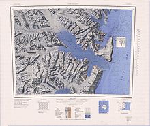
The Lyttelton Range is a narrow northwest-trending mountain range located south of Dunedin Range in the Admiralty Mountains of Antarctica. The range is 16 nautical miles long and forms the western wall of the upper part of the Dennistoun Glacier.

The Dunedin Range is a northwest-trending mountain range, 23 nautical miles long and 2 to 4 nautical miles wide. It is located 5 nautical miles east of Lyttelton Range in the Admiralty Mountains of Victoria Land, Antarctica.

The Homerun Range is a northwest-trending range, 28 nautical miles long and 2 to 7 nautical miles wide, east of Everett Range at the heads of the Ebbe Glacier and Tucker Glacier in Victoria Land, Antarctica.

The Anare Mountains are a large group of mainly snow-covered peaks and ridges along the northern coast of Victoria Land, Antarctica. The group is bounded on the north and east by the Pacific Ocean, on the west by Lillie Glacier, and on the south by Ebbe Glacier and Dennistoun Glacier. They are north of the Concord Mountains and east of the Bowers Mountains.

Lillie Glacier is a large glacier in Antarctica, about 100 nautical miles long and 10 nautical miles wide. It lies between the Bowers Mountains on the west and the Concord Mountains and Anare Mountains on the east, flowing to Ob' Bay on the coast and forming the Lillie Glacier Tongue.

<span class="mw-page-title-main">Bowers Mountains</span> Mountain range on the coast of the East Antarctic Victoria Land

Bowers Mountains is a group of north–south trending mountains in Antarctica, about 90 nautical miles long and 35 nautical miles wide, bounded by the coast on the north and by the Rennick Glacier, Canham Glacier, Black Glacier and Lillie Glacier in other quadrants. They are west of the Usarp Mountains, north of the Freyberg Mountains, northeast of the Concord Mountains, east of the Anare Mountains.

Concord Mountains is a group name applied to a complex system of ranges in northwest Victoria Land, Antarctica. They comprise the Everett Range, Mirabito Range, King Range, Leitch Massif, East Quartzite Range and West Quartzite Range. They are north of the Admiralty Mountains, northeast of the Victory Mountains, southeast of the Bowers Mountains and south of the Anare Mountains.

Tucker Glacier is a major valley glacier of Victoria Land, Antarctica, about 90 nautical miles long, flowing southeast between the Admiralty Mountains and the Victory Mountains to the Ross Sea. There is a snow saddle at the glacier's head, just west of Homerun Range, from which the Ebbe Glacier flows northwestward.

The Victory Mountains is a major group of mountains in Victoria Land, Antarctica, about 100 nautical miles long and 50 nautical miles wide, which is bounded primarily by Mariner and Tucker glaciers and the Ross Sea. They are north of the Mountaineer Range, east of the Freyberg Mountains and south of the Concord Mountains and the Admiralty Mountains. The division between the Victory Mountains and the Concord Mountains is not precise but apparently lies in the vicinity of Thomson Peak.

Quam Heights is a mostly snow-covered heights, 15 nautical miles long and 4 nautical miles wide, rising over 1,000 metres (3,300 ft) and forming the coastline between the Barnett Glacier and Dennistoun Glacier in northern Victoria Land, Antarctica.

Barnett Glacier is a large glacier in the Anare Mountains that flows east along the south side of Tapsell Foreland into Smith Inlet, northern Victoria Land, Antarctica.

Pitkevitch Glacier is a glacier, 20 nautical miles long, flowing north from the Admiralty Mountains along the west side of DuBridge Range in Antarctica. The glacier reaches the sea just east of Atkinson Cliffs, where it forms Anderson Icefalls. A portion of the terminus merges northwestward with Fendley Glacier.

The Findlay Range71°39′S167°22′E is a range lying parallel to and west of Lyttelton Range, extending between Grigg Peak and Sorensen Peak.

Mount Freeman is a prominent mountain, 2,880 metres (9,450 ft) high, surmounting the base of Walker Ridge, 2 nautical miles northwest of Mount Lepanto, in the Victory Mountains of Victoria Land, Antarctica.

The Hedgpeth Heights are mainly snow-covered heights, 14 nautical miles long and with peaks rising to 1,300 metres (4,300 ft), located 2 nautical miles southwest of the Quam Heights in the Anare Mountains of Victoria Land, Antarctica.

The Saxby Range is a broad mountain range, rising to 2,450 metres (8,040 ft), in the Victory Mountains of Victoria Land, Antarctica. It is bounded by Jutland Glacier, Tucker Glacier, Pearl Harbor Glacier, and Midway Glacier.

Robinson Heights in Antarctica are the mainly ice-covered heights 2,170 metres (7,120 ft), elliptical in plan and 15 nautical miles long, which rise south of Anare Pass and form the northwest end of the Admiralty Mountains, Antarctica.

The McGregor Range is a mountain range 13 nautical miles long in the south-central Admiralty Mountains, Antarctica. The range is circumscribed by the flow of the Tucker Glacier, Leander Glacier, Fitch Glacier and Man-o-War Glacier.

References

  1. 1 2 Alberts 1995, p. 5.
  2. 1 2 3 Ebbe Glacier USGS.
  3. 1 2 3 4 Cape Adare USGS.
  4. 1 2 3 4 Cape Hallet USGS.
  5. Alberts 1995, p. 183.
  6. Alberts 1995, p. 210.
  7. Alberts 1995, p. 763.
  8. Alberts 1995, p. 342.
  9. Alberts 1995, p. 624.
  10. Alberts 1995, p. 240.
  11. Alberts 1995, p. 450.
  12. Alberts 1995, p. 204.
  13. Alberts 1995, p. 477.
  14. Alberts 1995, p. 495.
  15. Alberts 1995, p. 257.
  16. Alberts 1995, p. 133.
  17. Alberts 1995, p. 684.

Sources

PD-icon.svg This article incorporates public domain material from websites or documents of the United States Geological Survey .