Agartala Airport

Last updated

Maharaja Bir Bikram Airport
Agartala Airport Departure Terminal.jpeg
Side view of the terminal building
Summary
Airport typePublic
Owner/Operator Airports Authority of India
Serves Agartala, Tripura, India
LocationSingerbhil
Elevation  AMSL 14 m / 47 ft
Coordinates 23°53′24″N091°14′32″E / 23.89000°N 91.24222°E / 23.89000; 91.24222 Coordinates: 23°53′24″N091°14′32″E / 23.89000°N 91.24222°E / 23.89000; 91.24222
Website www.aai.aero/en/airports/agartala
Map
India Tripura locator map1.svg
Airplane silhouette.svg
IXA
Location of IXA in India
India location map.svg
Airplane silhouette.svg
IXA
IXA (India)
Runways
Direction LengthSurface
mft
18/362,2867,500 Asphalt
Statistics (April 2017 - March 2018)
Passengers1,379,090 (Increase2.svg16.5%)
Aircraft movements10,074 (Decrease2.svg13.2%)
Cargo tonnage5,322 (Decrease2.svg12.1%)
Source: AAI [1] [2] [3]

Maharaja Bir Bikram Airport, also known as AgartalaAirport, [4] [5] [6] [7] ( IATA : IXA, ICAO : VEAT) is a domestic airport located 12 kilometres (7 miles) northwest of the city of Agartala, the capital of the state of Tripura in India. It is administered by the Airports Authority of India (AAI). [8] It is the third busiest airport in northeast India after Guwahati and is the third largest airport in the north east region after Imphal and is proposed to be upgraded as an international airport. [9] [10]

ICAO airport code four-letter code designating many airports around the world

The ICAOairport code or location indicator is a four-letter code designating aerodromes around the world. These codes, as defined by the International Civil Aviation Organization and published in ICAO Document 7910: Location Indicators, are used by air traffic control and airline operations such as flight planning.

Agartala Capital of Tripura in India

Agartala is the capital of the Indian state of Tripura and is the second largest city and municipal body in North-east India after Guwahati. The city is the seat of the Government of Tripura. Agartala is one of the fastest developing cities of India. There are 8 police stations and 9 legislative assembly constituencies covering various parts of the city.

Contents

Air traffic control tower Airport's new ATC.jpg
Air traffic control tower
The terminal as viewed from the apron Rear view of the airport in Agartala.jpg
The terminal as viewed from the apron

History

The airport was designed and built in 1942 by the then Maharaja of Tripura, Bir Bikram Kishore Manikya Bahadur. It had one primary runway, 05/23, which is now used as a taxiway to Runway 18/36.

Bir Bikram Kishore Debbarman King of Tripura

Bir Bikram Kishore Debbarman Manikya Bahadur was a king of Tripura State.

During World War II, the airport was used by the 4th Combat Cargo Group (4th CCG) of the United States Army Air Forces Tenth Air Force, flying Curtiss C-46 Commando transport aircraft over Burma. The airport was used as a supply point from which the unit air-dropped pallets of supplies and ammunition to the advancing Allied forces on the ground. [11]

World War II 1939–1945 global war

World War II, also known as the Second World War, was a global war that lasted from 1939 to 1945. The vast majority of the world's countries—including all the great powers—eventually formed two opposing military alliances: the Allies and the Axis. A state of total war emerged, directly involving more than 100 million people from over 30 countries. The major participants threw their entire economic, industrial, and scientific capabilities behind the war effort, blurring the distinction between civilian and military resources. World War II was the deadliest conflict in human history, marked by 50 to 85 million fatalities, most of whom were civilians in the Soviet Union and China. It included massacres, the genocide of the Holocaust, strategic bombing, premeditated death from starvation and disease, and the only use of nuclear weapons in war.

The 4th Combat Cargo Group was a World War II United States Army Air Forces combat organization that served in Tenth Air Force as part of the China Burma India Theater of World War II.

United States Army Air Forces Aerial warfare branch of the United States army from 1941 to 1947

The United States Army Air Forces, informally known as the Air Force,or United States Army Air Force, was the aerial warfare service component of the United States Army during and immediately after World War II (1939/41–1945), successor to the previous United States Army Air Corps and the direct predecessor of the United States Air Force of today, one of the five uniformed military services. The AAF was a component of the United States Army, which in 1942 was divided functionally by executive order into three autonomous forces: the Army Ground Forces, the Services of Supply, and the Army Air Forces. Each of these forces had a commanding general who reported directly to the Army Chief of Staff.

The 4th CCG operated from the airport during December 1944 and January 1945, after which it moved to Chittagong.

Chittagong Metropolis in Chittagong Division, Bangladesh

Chittagong, officially known as Chattogram, is a major coastal city and financial centre in southeastern Bangladesh. The city has a population of more than 2.5 million while the metropolitan area had a population of 4,009,423 in 2011, making it the second-largest city in the country. It is the capital of an eponymous District and Division. The city is located on the banks of the Karnaphuli River between the Chittagong Hill Tracts and the Bay of Bengal.

The airport has experienced international operations in the distant past when Indian Airlines used to fly for various locations like Dhaka-Tejgaon Airport and Khulna in East Pakistan/Bangladesh from Agartala.

Airlines and destinations

IndiGo Airbus A320 VT-IFI at the tarmac on 21 February 2017. VT-IFI.jpg
IndiGo Airbus A320 VT-IFI at the tarmac on 21 February 2017.
AirlinesDestinationsRefs.
Air India Kolkata
IndiGo Bengaluru, Guwahati, Imphal, Kolkata

Accidents and incidents

Indian Airlines Indian airline based in Delhi

Indian Airlines, later Indian, was a major Indian airline based in Delhi and focused primarily on domestic routes, along with several international services to neighbouring countries in Asia. It was state-owned, after merger of eight pre-Independence domestic airlines and was administered by the Ministry of Civil Aviation. Indian was formerly one of the two flag carriers of India, the other being Air India.

See also

Related Research Articles

Agartala Municipal Corporation Municipal Council of Tripura, India

The Agartala Municipal Corporation or AMC is the municipal body which governs and maintains the city of Agartala, the capital of the Indian state of Tripura and is the second-largest city in North-east India. Formed in the year 1871 the oldest municipal body in Northeast India, AMC had a vital role in developing & modernizing the state and managing in its various activities. This civic administrative body administers an area of 76.5 km2. AMC is headed by Dr. Prafulla Jit Sinha the present Mayor of Agartala.

Rajiv Gandhi International Airport airport in Hyderabad, India

Rajiv Gandhi International Airport is an international airport that serves Hyderabad, the capital of the Indian state of Telangana. It is located in Shamshabad, about 24 kilometres (15 mi) south of Hyderabad. It was opened on 23 March 2008 to replace Begumpet Airport it is named after Rajiv Gandhi, former Prime Minister of India.

Lal Bahadur Shastri Airport airport in India

Lal Bahadur Shastri Airport is a public airport located at Babatpur, 26 km (16 mi) northwest of Varanasi, Uttar Pradesh, India. Formerly known as Varanasi Airport, it was officially renamed after Lal Bahadur Shastri, the 2nd Prime Minister of India, in October 2005. It is India's 21st-busiest airport in terms of passenger movement and second-busiest airport in Uttar Pradesh.

Silchar Airport airport in India

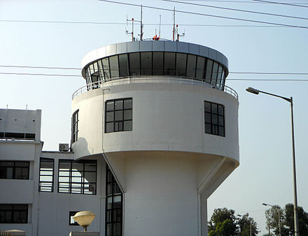
Silchar Airport is located at Kumbhirgram, 29 km from Silchar in the state of Assam, India built by the British as RAF Station Kumbhirgram in 1944 and transferred to the Royal Indian Air Force (RIAF). It is also a Civil enclave airport as it is under the control of Indian Air Force. The airport is situated on the foothills of the Barail range. It is the fourth busiest airport of the north-east India next to Guwahati, Agartala and Imphal. In 2014-15, Silchar Airport handled 290,000 passengers.

Maharaja Bir Bikram College Stadium is a multi-use stadium in Agartala, India. It is used mostly for cricket matches. The stadium holds 30,000 people and was built in 1998.

Dr. Babasaheb Ambedkar International Airport airport in Nagpur, Maharashtra, India

Dr. Babasaheb Ambedkar International Airport is an international airport serving the city of Nagpur, Maharashtra, India. The airport is located at Sonegaon, 8 km (5 mi) South-West of Nagpur. The airport covers an area of 1355 acres. In 2005, it was named after B. R. Ambedkar, the chief architect of the Indian Constitution. The airport handles around 4,000 passengers per day and caters to five domestic airlines and two international airlines connecting Nagpur to Sharjah, Doha and 11 domestic destinations. The airport spread over 1,460-acres is also home to AFS Nagpur of the Indian Air Force. Growth in passenger traffic is fueled by passengers traveling to and from the state capital Mumbai, over 700 km away. The airport has one terminal and has 2 aerobriges.

Coimbatore International Airport international airport in Coimbatore, India

Coimbatore International Airport is the primary airport serving the city of Coimbatore in Tamil Nadu. It is located at Peelamedu, about 12 km (7.5 mi) from the center of the city. It is the 18th busiest airport in India for passengers handled, 18th busiest for total aircraft movement and 15th busiest for cargo handled. The airport is the second largest airport in the state for runway length, aircraft movement, passenger traffic and cargo after Chennai International Airport in Tamil Nadu.

Twipra Kingdom Historic kingdom in India

Twipra Kingdom was one of the largest historical kingdoms of the Twipra people in the North-east India.

The Manikya dynasty was founded when Ratna Fha assumed the title in 1280 CE.Before that there was Fha Dynasty from 1200 BCE to 1280 AD and Tripur Dynasty during later Vedic period. Ruler of the Tipara (Tripura) kingdom assumed the title of Manikya when Sultan Mughisuddin Tughril in 1280 A.D defeated Ratna Fha and after his submission he granted Ratna Fha "Manikya" which means a ruler with a precious stone. Their Royal Priest was "Chantai" and Royal God were The trinity and Garia and Ker.

Imphal Airport international airport near Imphal, Manipur, India

Imphal Airport or Bir Tikendrajit International Airport is the second largest airport built in the Northeastern region of India, after Guwahati, and the Second busiest airport in the north east region after Guwahati located 8 km south of Imphal, the capital of Manipur, Imphal International Airport connects northeastern India with the country's major cities such as Bengaluru, Delhi, Kolkata. AirAsia India, Air India, Jet Airways, IndiGo and Alliance Air offer connection services from the airport to major cities and regional airports such as Agartala, Silchar, Aizawl, and Jorhat. Imphal International Airport is under the administrative control of Airports Authority of India. Its apron has a space for 5 aircraft.

Jodhpur Airport Airport in Jodhpur, India

Jodhpur Airport is a civil enclave airport in Jodhpur, Rajasthan, India. It is operated by the Airports Authority of India (AAI) and shares its airside with the Jodhpur Air Base of the Indian Air Force (IAF). The Government of Rajasthan signed a Memorandum of Understanding (MoU) with the Indian Air Force for the expansion of the civil enclave in March 2017, wherein 37 acres of IAF land would be transferred to AAI.

Neermahal a royal palace built by king of Tripura in 1930

Neermahal (নীরমহল) is a former royal palace built by King of Tripura Bir Bikram Kishore Manikya Bahadur of the erstwhile Kingdom of Tripura, India in the middle of the lake Rudrasagar in 1930 and was completed by 1938. It is situated in Melaghar, 53 kilometers away from Agartala, the capital of Tripura. The palace is situated in the middle of Rudrasagar Lake and assimilates Hindu and Muslim architectural styles.

Kazi Nazrul Islam Airport airport in India

Kazi Nazrul Islam Airport, named after Bengali poet Kazi Nazrul Islam, a project under Bengal Aerotropolis Projects Limited (BAPL), is a domestic airport located at Andal, West Bengal, India. The airport serves the industrial cities of Asansol and Durgapur. The airport is roughly 15 km from Durgapur's City Centre and 25 km from Asansol's City Bus Terminus in West Bengal, India. The airport's hinterland comprises the towns of Burdwan, Bankura, Bishnupur, Purulia, Sainthia, Suri, Bolpur, Rampurhat in South Bengal and Dhanbad & Bokaro in Jharkhand. It is part of the country's first private sector Aerotropolis, being developed by Bengal Aerotropolis Projects Limited (BAPL). The airport was officially inaugurated on 19 September 2013. Durgapur Airport or Kazi Nazrul Islam Airport as the passenger movements for the year 2017-2018 is the 3rd busiest airport of West Bengal and the 83rd busiest airport of India.

Tripura (princely state) princely state

Tripura State, also known as Hill Tipperah, was a princely state in India during the period of the British Raj and for some two years after the departure of the British. Its rulers belonged to the Manikya dynasty and until August 1947 the state was in a subsidiary alliance, from which it was released by the Indian Independence Act 1947. The state acceded to the newly-independent Indian Union on 13 August 1947, and subsequently merged into the Indian Union in October 1949.

Visakhapatnam Airport airport in India

Visakhapatnam Airport is an International Airport located in Visakhapatnam, India. It is the largest and busiest airport in the state of Andhra Pradesh. It also operates as a civil enclave on an Indian Navy air base named INS Dega. It is located in between the city localities of NAD Cross Road and Gajuwaka. The airport has experienced significant growth since the beginning of the 21st century, with the construction of a new terminal and runway and commencing of international flights. The airport covers an area of 350 acres.

Maharaja Bir Bikram University is a state university located at Agartala, Tripura, India. It was established in 2015 by the Government of Tripura through the Maharaja Bir Bikram University Act, 2015 and was the first, and as of 2017 the only, state university in the state of Tripura. The first vice chancellor is Gautam Kumar Basu. The university is named after Bir Bikram Kishore Debbarman, the last ruling maharaja of the princely state of Tripura.

Maharaja Kirit Bikram Kishore Manikya was 15th and last King of Tripura, a princely state in northeastern India. He was born on December 13, 1933, at the Ujjayanta palace in the heart of Agartala. His formal coronation was held in 1941 but he could never become the king. He was elected a Congress MP thrice in 1967, 1977 and 1989. He died in 2006 at the age of 73 at Kolkata. He was Son in Law of Royal family of Gwalior.

Kirat Bikram Kishore Manikya

Kirat Bikram Kishore Debbarman Manikya was a king of Tripura State.

References

  1. "Traffic News for the month of March 2018: Annexure-III" (PDF). Airports Authority of India . 1 May 2018. p. 4. Retrieved 1 May 2018.
  2. "Traffic News for the month of March 2018: Annexure-II" (PDF). Airports Authority of India . 1 May 2018. p. 4. Retrieved 1 May 2018.
  3. "Traffic News for the month of March 2018: Annexure-IV" (PDF). Airports Authority of India . 1 May 2018. p. 4. Retrieved 1 May 2018.
  4. "Change of name of Agartala Airport" (PDF). EGazette. Government of India. Retrieved 9 August 2018.
  5. https://www.thehindu.com/news/national/other-states/agartala-airport-to-be-named-after-maharaja-bir-bikram-manikya-kishore/article24330340.ece
  6. https://www.telegraphindia.com/states/north-east/agartala-airport-to-be-named-after-king/cid/1453829
  7. https://www.cnbctv18.com/aviation/agartala-airport-renamed-after-tripuras-last-king-250631.htm
  8. "Civil Airport Agartala". airportsindia.org.in. Archived from the original on 5 November 2007. Retrieved 2 August 2009.
  9. "Agartala airport to be made international airport". 24 November 2014.
  10. "News article". articles.economictimes.indiatimes.com.
  11. Maurer, Maurer. Air Force Combat Units Of World War II. Maxwell Air Force Base, Alabama: Office of Air Force History, 1983. ISBN   0-89201-092-4
  12. Ranter, Harro. "Agartala-Singerbhil Airport profile - Aviation Safety Network". www.aviation-safety.net.