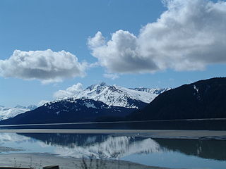
Turnagain Arm is a waterway into the northwestern part of the Gulf of Alaska. It is one of two narrow branches at the north end of Cook Inlet, the other being Knik Arm. Turnagain is subject to climate extremes and large tide ranges.
The Imuruk Basin is an approximately 90 sq mi (230 km2), 17-mile-long shallow estuary located on the Seward Peninsula in the U.S. state of Alaska. The estuary's drainage basin covers about one quarter of the peninsula. The basin is fed by the Kuzitrin, Kruzgamepa, Agiapuk, and Cobblestone Rivers and is drained by the Tuksuk Channel, which empties into Grantley Harbor.

The Kugruk River is a stream, 60 miles (97 km) long, in the northwestern part of the U.S. state of Alaska. It is the largest tributary of the Kuzitrin River. It begins near Imuruk Lake on the Seward Peninsula and flows generally north to Kugruk Lagoon, at Kotzebue Sound on the Chukchi Sea. The river enters the lagoon 5.5 miles (8.9 km) southeast of Cape Deceit in the Northwest Arctic Borough.

The Fish River is a waterway in the U.S. state of Alaska. The 47-mile-long (76 km) river rises in the Bendeleben Mountains and flows south to Golovnin Lagoon, before emptying into Golovnin Bay, Norton Sound, and the Bering Sea. The basin formed by the Fish River is known for its placer gold deposits, and in particular, the Niukluk River and its tributaries; production from this tributary valley is reported to be more than from any other place in the region. A galena mine existed 40 miles (64 km) from the sea, worked on occasion by a San Francisco corporation with a few hundred tons of ore taken to the city for smelting and refining for silver. Walter Curran Mendenhall found obscure fossils on Fish River at White Mountain.

The Kruzgamepa River is a 55-mile (89 km) tributary of the Kuzitrin River on the Seward Peninsula in the U.S. state of Alaska. The river begins at Salmon Lake, elevation 447 feet (136 m), and descends to 20 feet (6.1 m) above sea level at its mouth. In turn, the Kuzitrin River empties into the Imuruk Basin. The basin drains via the bay of Port Clarence to the Bering Sea.
Casadepaga River is a waterway in the U.S. state of Alaska, near Nome. It is the largest southern branch of the Niukluk River. It has a length of about 30 miles (48 km) and a general northeasterly course.
Nome River is a waterway on the Seward Peninsula in the U.S. state of Alaska. It has its source in a narrow valley in the southern margin of the Kigluaik Mountains, 4.5 miles (7.2 km) west of Salmon Lake.
Serpentine River is a waterway on the Seward Peninsula in the U.S. state of Alaska. It debouches at Shishmaref Inlet from the southeast. It was explored and named in 1900 by the prospector Charles McLennan.
Pinguk River is a waterway located on the Seward Peninsula in the U.S. state of Alaska. The river runs in a northwesterly direction for 34 miles (55 km) and then flows into the Arctic Lagoon about 30 miles (48 km) northeast of Cape Prince of Wales.
Brooks Mountain is the highest peak in the York Mountains range on the Seward Peninsula in the U.S. state of Alaska. It is located in the central part of the Teller Quadrangle, about 25 miles (40 km) east of Cape Prince of Wales. It has an elevation of 2,918 feet (889 m). It has tin ore deposits, and high-grade uranium has also been found in the form of zeunerite.
Lost River is a waterway on the Seward Peninsula of the U.S. state of Alaska. Rising in the York Mountains, the river empties into the Bering Sea, 10 miles (16 km) west of Port Clarence. It is located 10 miles (16 km) east of Cape York.
Cape Mountain is located 3 miles (4.8 km) southeast of Cape Prince of Wales on the Seward Peninsula in the U.S. state of Alaska. It was named by the surveyor, Alfred Hulse Brooks, in 1900.
Bluestone River is a waterway located on the Seward Peninsula in the U.S. state of Alaska. A tributary of the Tuksuk Channel from the south, Bluestone is a north-flowing stream situated 11 miles (18 km) southeast of Teller. It was named in 1900 by Edward Chester Barnard, topographer of the United States Geological Survey.

Grantley Harbor is a waterway located at the bay of Port Clarence, Alaska, on the Seward Peninsula in the U.S. state of Alaska. The inner harbor at the entrance to the northeast corner of the bay was named after Lord Grantley.
Nuluk River is a waterway on the Seward Peninsula in the U.S. state of Alaska. It enters the Ikpek Lagoon 40 miles (64 km) northeast of Cape Prince of Wales. It heads in the high mountains made up of the Port Clarence limestone about 35 miles south of the Arctic Ocean. For 15 miles (24 km) from its head, the river occupies a canyon, varying from 100–1,000 feet (30–305 m) in depth, cut in Silurian limestones. Fossils have been reported about the head of the river. Northward along its course, the character of the bed rock changes, and calcareous mica-schists are noted. The Silurian limestones dip toward the schists, and near the contact with them, are very highly folded. The coastal plain gravel extends inland farther along the Nuluk River than it does on the other rivers of this region.

Noxapaga River is a 56-mile (90 km) tributary of the Kuzitrin River on the Seward Peninsula in the U.S. state of Alaska. Heading in the Bering Land Bridge National Preserve, it flows northwest for 4 miles (6 km), then west for 22 miles (35 km), then south for 30 miles (48 km) to its mouth on the larger river. Tributaries include the creeks of Aurora, Berry, Black, Bluff, Boulder, Buzzard, Frost, Garfield, Goodall, Goose, Grouse, Last Chance, Little Garfield, Mascot, Money, Peuk, Stony, Turner, and Winona.

Gilahina River is a waterway in the U.S. state of Alaska in the Wrangell–St. Elias National Park and Preserve.
American River is a waterway in the U.S. state of Alaska. Situated on the northwestern portion of Seward Peninsula, it is the eastern and larger fork of the Agiapuk River. It joins the Agiapuk River in a broad, gravel-filled basin, and for 20 miles (32 km) up, is characterized by a wide flood plain and a meandering course. It receives a number of large tributaries from the east, which also have wide floodplains developed in their lower parts. The important tributaries are Portage Creek, Budd Creek, and Igloo Creek, while smaller tributaries are Burke, Gold Run, Dome, and Camp creeks. All of these tributaries received some attention from gold prospectors. The river is easily navigable for small boats for several miles above the mouth of Portage Creek, and the region can also be reached from Teller. Gold had been discovered in the region in September 1901, and a number of the streams were known to be gold-bearing to some extent.
Mary River is a waterway in the U.S. state of Alaska. Situated on the northwestern portion of Seward Peninsula, it was included in the Agiapuk River mining district.
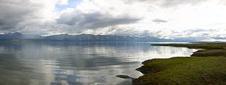
Port Clarence Bay is a waterway in the U.S. state of Alaska. It has the only harbor and safe anchorage for large vessels in Seward Peninsula. The bay is located 25 miles southeast of York. It is a large body of comparatively deep water, nearly circular in outline, and cut off from the sea by a long, low sand spit, which terminates in Point Spencer at the entrance to the bay. Along the north side of Port Clarence Bay, there is a shallow lagoon, separated from the bay by a narrow sand spit. This lagoon extends several miles west of the entrance to Port Clarence. The hamlet of Port Clarence, Alaska is situated on the bay.
