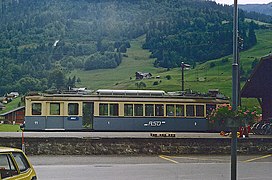
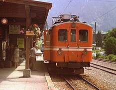
The Aigle–Sépey–Diablerets railway line is a railway line in the Chablais area of Vaud and Valais in Switzerland. It was built between 1913 and 1914 by the Chemin de fer Aigle-Sépey-Diablerets (ASD) and is today owned and operated by the Transports Publics du Chablais.
History
Share of the CdF Aigle-Sépey-Diablerets, issued 24. December 1911
Railways came to the Chablais area of Vaud and Valais in 1857 when the Lausanne – Simplon railway opened its line through Aigle. This was to act as the catalyst for other projects in the late 19th century which were designed to link the valley floor with communities in the mountains. The first scheme, which pre-dated the coming of the railway, was to link Aigle to Le Sepey by road. This opened in 1840 and services were provided by stagecoach.
On 24 October 1898 both Houses of the Swiss Parliament approved a concession application by the ASD to build and operate a railway between Aigle, Le Sépey and Leysin. Nine months later both Houses of the Swiss Parliament awarded a concession for a railway, not only linking Aigle, Le Sépey and Leysin but beyond, to Les Diablerets, Pillon and Saanen. However, following a new series of projects and concession applications, on 23 May 1905 the Berne Government finally approved the construction of a line between Aigle, Le Sépey and Les Diablerets on the left bank of the Grande Eau. The Federal Council accepted the railway's articles of incorporation on 28 February 1911.[citation needed] The line opened between Aigle and Le Sépey on 22 December 1913, and between Le Sépey and Les Diablerets on July 7 of the following year.[3] The line was electrified from the start of operation, at 1500 Vd.c.[4]
The ASD put forward many railway projects in the early 20th century: a link with Gstaad via the Col du Pillon, connections with Chesières and Villars forming part of a grand Boulevard des Alpes linking Interlaken with Chamonix. Another project, like the previous examples, which met with fierce opposition, involved a link between Gryon and the highest point at Les Diablerets at an elevation of more than 3000m.
The line is built to 1,000mm (3ft3+3⁄8in)gauge and has a length of 22.33km with power, at 1500 Vd.c., supplied by the Société des Forces Motrices de la Grande Eau from its plant at Pont de la Tine. Its lowest elevation is at the station at Aigle, 404m (1,325ft) above sea level, rising to 1,157m (3,796ft) at Les Diablerets Station, a total climb of 753m (2,470ft).
On the night of 26 June 1940, a fire destroyed the ASD depot. The railway's facilities destroyed, and three electric railcars and 4 passenger cars were lost. Following the tragedy there was speculation that the railway might be abandoned. However, a decision was made to save and restore as much as possible. ASD was able to lease rolling stock from other companies in order to ensure the continuation of the service.
In 1975 the four local railway companies, Aigle-Leysin (AL); Aigle-Ollon-Monthey-Champéry (AOMC); Aigle-Sépey-Diablerets (ASD) and Bex-Villars-Bretaye (BVB) formed Transports Publics du Chablais Operating Community (TPC). This brought about increased co-operation between the companies in the provision of community-based services.
In 1985, the Federal Government informed ASD, and other privately operated railways, that it would cease all funding the following year, however they renewed a federal concession for a further period of 50 years. An agreement was signed between the Canton of Vaud, the communities served by the railway and the ASD and its partners to renew rolling stock and upgrade the track.
In the mid-1990s, faced with greatly increased operating costs, the Canton of Vaud and the communities served by the railway petitioned the Federal Government to revoke its 1985 decision. The Federal Government did so and in 1996, recognizing the importance of this regional line as a public transportation carrier, awarded the line with a contract to provide a public transportation service. This brought about, in 1999, the founding of Transports Publics du Chablais as the parent body of local public transportation with the four local railway companies as founding members.
This page is based on this Wikipedia article Text is available under the CC BY-SA 4.0 license; additional terms may apply. Images, videos and audio are available under their respective licenses.