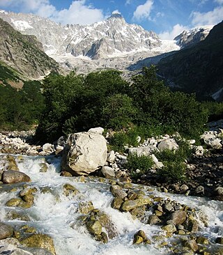
The mountains of the Massif des Écrins form the core of Écrins National Park in Hautes-Alpes and Isère in the French Alps.

The Aiguille de Bionnassay is a mountain in the Mont Blanc massif of the Alps in France and Italy. It has been described as "one of the most attractive satellite peaks of Mont Blanc", and is located on its western side. The mountain's south and east ridges form the frontier between the two countries, and its summit is a knife-edge crest of snow and ice. Reaching it via any route provides a "splendid and serious snow and ice climb".
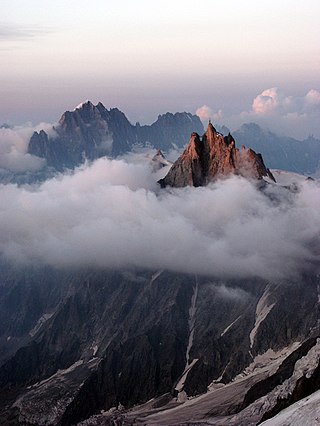
The Aiguille du Midi is a 3,842-metre-tall (12,605 ft) mountain in the Mont Blanc massif within the French Alps. It is a popular tourist destination and can be directly accessed by cable car from Chamonix that takes visitors close to Mont Blanc.

Les Contamines-Montjoie is a commune in the Haute-Savoie department in the Auvergne-Rhône-Alpes region in south-eastern France.
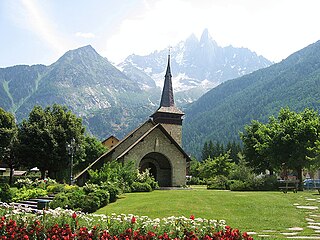
Les-Praz-de-Chamonix is a mountain village in the French Alps, part of the commune of Chamonix. Altitude: 1060 m (3477 ft.).

The Vanoise massif is a mountain range of the Graian Alps, located in the Western Alps. After the Mont Blanc Massif and the Massif des Écrins it is the third highest massif in France, reaching a height of 3,885 m at the summit of Grande Casse. It lies between Tarentaise Valley to the north and the Maurienne valley in the south. The range is the site of France's first National Park in 1963, the Vanoise National Park. The ski resorts of Tignes and Val-d'Isère and the 2,770-meter-high Col de l'Iseran are located in the eastern part of the range.

Solaro is a commune in the Haute-Corse department of France on the island of Corsica.

Aiguilles is a commune of the Hautes-Alpes department in southeastern France.

Puisseguin is a commune in the Gironde department in Nouvelle-Aquitaine in southwestern France. It is around 15 km east of Libourne.

Saint-Philippe-d'Aiguille is a commune in the Gironde department in Nouvelle-Aquitaine in southwestern France.
Bosmie-l'Aiguille is a commune in the Haute-Vienne department in the Nouvelle-Aquitaine region in western France. Inhabitants are known as Bosmiauds in French.

The Aiguille de la Tsa is a mountain of the Swiss Pennine Alps, overlooking Arolla in the canton of Valais. It lies on the range culminating at the Dent de Perroc, between the valley of Arolla and the Mont Miné Glacier.

The Aiguille du Tour is a mountain in the Mont Blanc massif, located on the border between Switzerland and France. The voie normale on the mountain is graded F (facile) and can be climbed from either the Albert Premier Hut on the French side or the Trient Hut on the Swiss side.
The Pointe des Plines is a minor peak on the east edge of the Mont Blanc massif, close to the Aiguille Dorees, and overlooking the Saleina Glacier in the canton of Valais.
The Aiguille de l'A Neuve is a mountain of the Mont Blanc massif, located on the border between Switzerland and France. It lies close to the Tour Noir to the south.
The Aiguille des Glaciers is a mountain in the Mont Blanc massif of the Graian Alps. It lies on the borders of Savoie and Haute-Savoie in France and Aosta Valley in Italy.

The Aiguille des Grands Charmoz is a mountain in the Mont Blanc Massif in Haute-Savoie, France.

The Aiguille des Grands Montets is a mountain in the Mont Blanc massif in Haute-Savoie, France.
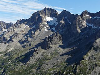
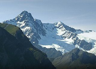
Aiguille des Arias is a mountain of the French Alps in Isère. Located in the Massif des Écrins, the mountain is 3,403 m tall.
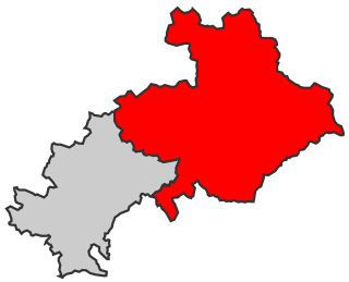
The 2nd constituency of the Hautes-Alpes is a French legislative constituency in the Hautes-Alpes department.