
Citizens of Mauritania have limited access to transportation. The single-line railroad serves mining interests with very occasional ad hoc passenger services. Apart from two infrastructural road developments there are few paved roads.
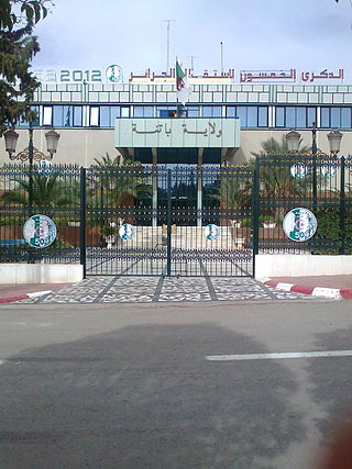
Batna Province is a province of Algeria, in the region of Aurès. The capital is Batna. Localities in this province include N'Gaous, Merouana and Timgad. Belezma National Park is in the Belezma Range area of the province.
American Eagle Outfitters, Inc. is an American clothing and accessories retailer headquartered at SouthSide Works in Pittsburgh, Pennsylvania. It was founded in 1977 by brothers Jerry and Mark Silverman as a subsidiary of Retail Ventures, Inc., a company that also owned and operated Silverman's Menswear. The Silvermans sold their ownership interests in 1991 to Jacob Price of Knoxville, Tennessee. American Eagle Outfitters is the parent company of Aerie, Unsubscribed and Todd Snyder.

Byzacena was a Late Roman province in the central part of Roman North Africa, which is now roughly Tunisia, split off from Africa Proconsularis.
Air Mauritanie was the national airline of Mauritania from 1962 until it ceased operations in 2007 due to financial difficulties. It was based at Nouakchott International Airport, from where it operated domestic services, as well as flights to African destinations and Paris. The carrier had its headquarters in Nouakchott.

Ayoun al Atrous is a town in southern Mauritania. It is located at around 16°40′0″N9°37′0″W. It is the capital of Hodh El Gharbi region.

El Taref is a province (wilaya) of Algeria. El Kala is a port town in this province. El Taref is the capital city. El Kala, a port town in this province, is home to El Kala National Park and, Lake Mellah.
El Kala is a district in El Taref Province, Algeria. It was named after its capital, El Kala. El Kala National Park is there.
According to the World Customs Organization (WCO), an authorized economic operator (AEO) is
"a party involved in the international movement of goods in whatever function that has been approved by or on behalf of a national Customs administration as complying with WCO or equivalent supply chain security standards. Authorized Economic Operators include inter alia manufacturers, importers, exporters, brokers, carriers, consolidators, intermediaries, ports, airports, terminal operators, integrated operators, warehouses and distributors"

Ras El Aioun is a town in northeastern Algeria, within the Ras El Aioun District.
Aioun or El Aioun is a town and commune in the Assaba Region of southern Mauritania near the border with Mali.
Ten Hamadi or Tenhemad is a village and rural commune in southern Mauritania, in the Aïoun El Atrouss department of the Hodh El Gharbi region. In 2000, the commune had a population of 2,264, of which 155 lived in the village of Ten Hamadi itself, approximately 17 kilometres (11 mi) southwest of the main town and departmental capital of Aïoun El Atrouss. The population estimate in 2007 was 3,686, spread over 16 villages.

Taourirt is a province in the Oriental Region of Morocco. Its population in 2004 is 206,762

Ras El Aioun is a district of Batna Province, Algeria. In 2008, the district's population was estimated to be around 130,000. Ras El Aioun is located on the Mediterranean Sea and in the north-central portion of Algeria.
El Aioun Sidi Mellouk or El Aioun is a city in Taourirt Province, Oriental, Morocco. It is located along National Route 6, 50.2 kilometres (31.2 mi) northeast of Taourirt and 58.6 kilometres (36.4 mi) southwest of Oujda. According to the 2004 census, it has a population of 34,767. It contains several schools including Lycee Ezzayotune, Ecole Mohamed Belkhayyat and Ecole Route de Jirada in the southeast of the town. College Sidi Makhoukh is located to the northeast, opposite the souk. It also has a hospital, Centre de Sante.
El Aioun is a commune in El Taref Province, Algeria. According to the 1998 census it has a population of 4,591.

