
Kegalle is a large town in Sabaragamuwa Province of Sri Lanka. It is located on the Colombo–Kandy road, approximately 78 km (48 mi) from Colombo and 40 km (25 mi) from Kandy. It is the main town in the Kegalle District, which is one of two districts which comprise Sabaragamuwa Province. The town is governed by an Urban Council.
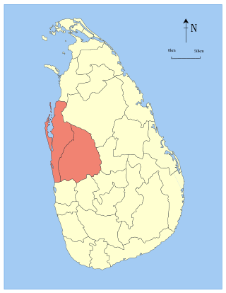
North Western Province is a province of Sri Lanka. The province consists of the districts of Kurunegala and Puttalam. Its capital is Kurunegala, which has a population of 28,571. The province is known mainly for its numerous coconut plantations. Other main towns in this province are Chilaw (24,712) and Puttalam (45,661), which are both small fishing towns. The majority of the population of Wayamba province is of Sinhalese ethnicity. There is also a substantial Sri Lankan Moor minority around Puttalam and Sri Lankan Tamils in Udappu and Munneswaram. Fishing, prawn farming and rubber tree plantations are other prominent industries of the region. The province has an area of 7,888 km2, and a population of 2,370,075.

Kurunegala is a major city in Sri Lanka. It is the capital city of the North Western Province and the Kurunegala District. Kurunegala was an ancient royal capital for 50 years, from the end of the 13th century to the start of the 14th century. It is at the junction of several main roads linking to other important parts of the country. It is about 94 kilometres (58 mi) from Colombo, 42 kilometres (26 mi) from Kandy and 51 kilometres (32 mi) from Matale.

Gampaha is an urban city in Gampaha District, Western Province, Sri Lanka. It is situated to the north-east of the capital Colombo. It is the sixth largest urban area in Western Province, after Colombo, Negombo, Kalutara, Panadura and Avissawella. Gampaha is also the second largest municipal centre in Gampaha district, after Negombo. Gampaha has a land area of 25.8 ha and is home to the offices of 75 government institutions.

Badulla District is a district in Uva Province, Sri Lanka. The entire land area of the Badulla district is 2,861 km2 (1,105 sq mi) and has a total population of 837,000. The district is bounded by the districts of Monaragala and Rathnapura on the east and south, by Ampara and Kandy districts to the north and by Nuwara Eliya and Matale to the west. Mainly the economy of the district is based on agricultural farming and livestock.

Kirindiwela is a town in the Western Province of Sri Lanka. It is the main administrative centre for the "Dompe" electorate in Gampaha district. The postal code of Kirindiwela is 11730. Kirindiwela is connected Colombo Avissawella road and Colombo Kandy road. It is also connected New Kandy road from Weliweriya towards Kaduwela.

Lunugala is a town in the Sri Lankan province of Uva.There are 28 Grama Niladhari Divisions in the Lunugala Divisional Secretariat Division
Negombo is a major city in Sri Lanka, situated on the west coast and at the mouth of the Negombo Lagoon, in the Western Province, 38 km (24 mi) from Colombo via Colombo - Katunayake Expressway.
Maharagama is an outer suburb of Colombo, Sri Lanka on the High-Level (A4) Road about 10 km (6.2 mi) from the centre of the commercial capital. It developed rapidly in the 1980s as a dormitory suburb. Governed by the Maharagama Urban Council, the town possesses facilities like supermarkets, department stores, clothing, food and beverages shops to fulfill the needs of citizens.
Kalutara or Kalutota is a major city in Kalutara District, Western Province, Sri Lanka. It is also the administrative capital of Kalutara District. It is located approximately 43 km (27 mi) south of the capital Colombo. The city holds a unique position for one of the four major rivers in Sri Lanka, the Kalu Ganga, which joins the sea at the centre of the city. Kaluthara is known for making rope, baskets, and other articles from the fibre of the coconut palm. The area also produces the Mangosteens, a fruit introduced from Malaysia in the 19th century.
Wattala is a large suburb of Colombo city, in Western Province, Sri Lanka, situated around 9 km from Colombo city centre. This suburb is situated on A3 highway from Colombo to Negombo. Around Wattala, there are many villages and towns.

Polonnaruwa District is one of the 25 districts of Sri Lanka, the second level administrative division of the country. It is also one of the two districts of North Central Province and has an area of 3,293 km2.

Akurana is a suburb of the city of Kandy in Kandy District, Central Province, Sri Lanka. The town is situated 125 km (78 mi) from Colombo and 10 km (6.2 mi) from the centre of Kandy, on the Kandy—Matale road. Akurana lies along the A9 highway from Kandy to Matale, north of Katugastota. Geographically the town is surrounded by hills and rivers. The Balapitiya Oya, a tributary of Pinga Oya river, runs through Akurana.

Embilipitiya is a town, governed by an urban council, in Ratnapura District, Sabaragamuwa Province, Sri Lanka.

Balangoda is a large town in Ratnapura District, Sabaragamuwa Province, Sri Lanka, governed by an urban council located 143 kilometres (89 mi) away from Colombo and 43 kilometres (27 mi) from Ratnapura on Colombo - Batticaloa Highway(A4). It is one of the largest towns of the Sabaragamuwa Province. According to the 2001 census, Balangoda has a population of 16,875 and area of 16.2 km2.
Palapathwela is a suburb of Matale, Sri Lanka. It is located in Matale District, Central Province.The Kandy-Jafna main road runs through Palapathwela. The population of the suburb, according to the 2012 census, was 1,989.

Sammanthurai, is a town in Ampara District of Eastern Province of Sri Lanka. Sammanthurai situated at 7°22′0″N81°48′0″E, is 4.8 km west of the Bay of Bengal coast. It lies between the towns of Ampara and Karaitivu along the A31 road. It is surrounded by paddy fields and it is renowned for its rice paddies and its inner harbour from ancient times.
Passara is a town in Badulla District, Uva Province of Sri Lanka. The town is located on Peradeniya-Badulla-Chenkalady main road, approximately 18 km (11 mi) away from Badulla City.

Welikada North Grama Niladhari Division is a Grama Niladhari Division of the Sri Jayawardanapura Kotte Divisional Secretariat of Colombo District of Western Province, Sri Lanka. It has Grama Niladhari Division Code 514D.
Rajagiriya Grama Niladhari Division is a Grama Niladhari Division of the Sri Jayawardanapura Kotte Divisional Secretariat of Colombo District of Western Province, Sri Lanka. It has Grama Niladhari Division Code 514B.
